 It’s now about mid-afternoon on the first day of my most recent Caliente field excursion, and after a quick lunch under a cottonwood tree on the side of the road, I decide that it’s time to continue my journey north on Highway 317 in Meadow Valley Wash. I’ve left Cottonwood Canyon, Elgin, and “the Narrows” behind. I have one more planned stop - despite the smoke and afternoon heat - before I head to the motel in Caliente: I want to find the road into our old mapping project near Boyd, so I can drive in and take a look around. In the meantime, one of the many trains that passes through the canyon has caught up with me.
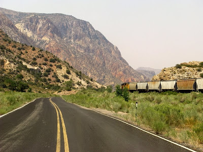
 The train keeps pace with me as I approach our 1978 camp area, which is just to the right of the highway in this photo. The train pulls through the bridge near camp and approaches the Boyd siding. Hard to say which vehicle is going faster, the locomotive or my truck – railway speed limits from Elgin to Caliente are mostly in the 30 to 40 mph range, and the highway speed limit is 35 mph or less, often marked 20, 25, or 30 mph because of curves and washouts.
What am I looking for exactly? Well, having not examined the old topo maps in detail, I’m looking for a place from memory, a place where we crossed over or under the train tracks. I think that place is just north of the Boyd siding, near the steep reddish cliffs we mapped, but I can’t really remember whether we drove over or under the tracks.
 Whoosh! Past the north end of the Boyd siding I go, and past one possible way under the tracks. I continue driving north with the train, rather than stopping. By now, it seems like I'm racing the train - but I'd better not do that, because of all the washouts and places where the pavement was undercut by the 2005 flood.
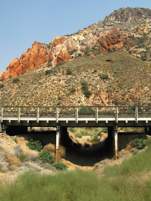
 I finally come to this little cement underpass, and although I'm north of the unnamed canyon central to the old project area, I decide to check it out - because it's there.
 With the train still moving north, I walk under the cement underpass to the east side. No, this is not the place – not the place we crossed the tracks to get to the mapping project back in 1978. Although scrape marks about truck high on the wall suggest that people have driven through, the road heads off to the north, away from the area I’m trying to reach.
 While driving north to the cement underpass, I’ve looked along this entire length of track for any approaches that might be possible places to cross over the tracks, and I really haven’t seen any. I take one last chance that there might be a place to drive over the tracks at this north Boyd marker - but as you can see, there isn't. Part of our former project area can be seen in the background: all those reddish, rhyolitic rocks, capped by what may be the Ox Valley Tuff.
At this point, I drive south, back towards the only other underpass I've seen, the only place that might provide access into the old project area.
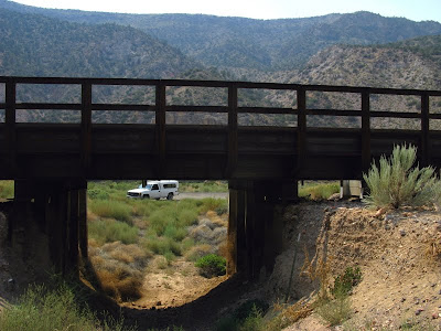
 Yes! This is the place! It even looks familiar! This underpass is here, just a little south of the northern Boyd marker (previous photo) and just a little north of the north end of the Boyd siding. This is the place we used to drive under the tracks to get to our map area. As you can see, it's chock full of green, rooted tumbleweeds (Russian thistle).
 The road went under the bridge, and then straight into those bushes on the far side before turning to the left to head up the unnamed dry wash north of the reddish cliffs.
 You can vaguely see where the old road would have gone into the bushes, although I really couldn’t follow it from there. The underpass is much higher and wider than the puny cement thing I walked under earlier. It doesn't, however, show any signs of recent use as a roadway!
 As I walked around on the east side of the bridge, I found this railroad-parallel, two-track road - also inaccessible. I was disappointed not to be able to spend the rest of the afternoon driving up the old canyon road - possibly with vehicular agression I could have gotten part way in before getting stuck - and with the thick smoke hanging over the canyon and the afternoon heat increasing, I decided against climbing the steep talus slopes of the old project area.
 So, I walked back to my truck...
 ...and drove north, bypassing the entrance to Kershaw-Ryan State Park on my way to Caliente.
But was I done for the day? No. I had it mind that I still had time to drive to the Ella Mountain Lookout, and from there into Pennsylvania Canyon from the east side, since I hadn't made it in from the west side at Elgin. That way, I would only have to stay in Caliente one more night. (Yay!) So I drove through Caliente and turned right onto the Clover Creek Road, took the dirt road past Tepee Rocks, and made it one hour into what turned out to be a four-hour-long, one-way journey to the lookout and into the canyon, before I realized that more than an afternoon's worth of driving was ahead of me if I continued on. I turned around.
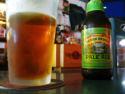
 Back in Caliente, I found a bar - but not the old Northern Lights that I remember from 1978. It closed about three or four years ago, according to some old-timers patronizing the Shamrock Pub, which is next door to what used to be the now-defunct bar.
 As I sat there, Classic Vinyl played "Do It Again" by Steely Dan. It seemed like my entire trip was an attempt to recreate the past or to somehow do it all over again.
You go back Jack do it again
Wheel turnin' 'round and 'round
You go back Jack do it again
5 comments:
Sure is beautiful country. You've done well returning to these landmarks, even if the old two-track is now impossible to drive. I'm hoping you went back the next day to the lookout and beyond.
Hopefully we'll find out soon! ;)
Thanks for posting the photos. Thee drive south of Caliente is definitely one of my favorites. That Sierra Nevada looks good after a long day in the field (or the truck), too!
Coconino, you've been everywhere!
Silver Fox - not quite, but trying. A long-standing family tradition of brutal-to-most driving vacations is well ingrained in my DNA. I've tried to travel as much as possible in my life. When I was younger, it was to far-off places. The last 15 years or so, it's been to the less-traveled, more remote spots in the west (used to be due to my ex's field work, but now just for myself). My daughter is well-traveled, as well; the travel gene showed up in her DNA, too. She can talk about AZ volcanoes near Flag and the Socal beaches in just about the same breath. Having an understanding of place and geography is very important.
Post a Comment