
Upon getting out of the truck at the north end of
the Monitor Valley playa, it became rapidly clear to me that it was very cold. (Later, the weather calendar for Eureka showed a max of 28°F and a min of-3°F for the day.) When I pulled off to the side of the road, possibly running over some spiky twigs from the roadside saltbushes, I hoped I wouldn't get a flat tire. I then immediately reassured myself that my fairly new tires still had good tread, and that *of course* I wouldn't get a flat.
By the time we got back to the truck after our excursion a relatively short distance out onto the playa, my fingers were freezing and my face was icy. I once again considered the chances of getting a flat from running over thorny bushes, so instead of turning around in the middle of the road, I drove a short way to a wider turnaround spot. I decided then that I wouldn't change a tire if one happened to go flat: it was just too damned cold. Instead, I figured I would immediately get into the back of the truck and climb into one of our -20°F sleeping bags. (Well, maybe I would have run the heater to warm my hands up first, but I wouldn't have wanted to use much gas. MOH, however, says we wouldn't have had a problem changing a flat, so maybe he wasn't as chilled!)
After getting back on the Monitor Valley Road, we proceeded north past
Diana's Punchbowl, a travertine hill with inset bowl or depression containing hot water that will presumably boil any living thing that falls into it (reported temperatures range from
138°F to
200°F), and drove on to
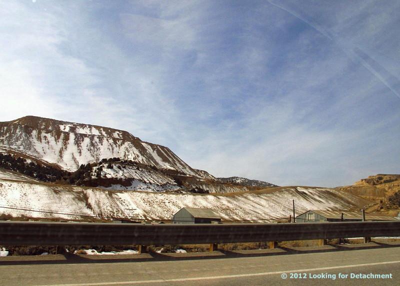
Potts Ranch Hot Springs, where we ultimately decided that the water was too cool for the outdoor temperature that I guessed was possibly as low as 5 or 10°F — or maybe it was 15°F with a wind of 7 mph, or 20°F with a wind of 10 mph. The average wind at the Eureka Airport was 7.4 mph that day, with gusts from the northwest, though we remember a breeze from the south.

At some point, either at the hot springs, or more likely as we were heading up the road past
The Geographic Center of Nevada, we had a brief discussion about the cold and what we would do if the truck broke down on this relatively desolated, but mostly good, graveled road.
What would we do if the truck broke down out here? Would we walk to the nearest occupied ranch? Well, no, we'd stay with the truck and probably get in our sleeping bags, which were in the back inside the metal
Caravan camper.
We had some food (and coffee), along with a Coleman stove for heating some of the water we had brought with us — water we had carefully preserved from freezing by placing in a large ice box. Although our food was really meant for two days and the second day was getting on toward dusk, we could stay with the truck awhile before getting too hungry or thirsty. The nearest active ranch that I knew of, the Monitor Valley ranch, was about 7 miles from Potts Ranch Hot Springs, about 11 miles SSW of the sign for the geographic center, and maybe about 14 or 15 miles back from the place where we started this conversation. Highway 50, at this point, was "only" 11 or 12 miles to the northeast. We had just passed a sign that said a ranch was off to the east up some side road, but I had no idea how far up the road the ranch might be, or whether the ranch was active.
So, had we broken down during the late afternoon or dusk of early evening, we would have stayed with the truck. We could try to spot ranch lights by dark, giving us a better idea of what we might to do by the light of the next day.
Would we activate one of our SPOTs to send a 911 message? Well, probably not right away.
I suspect that the Monitor Valley Road is fairly well traveled ordinarily, although I haven't been on it routinely for many, many years. I would expect at least one or two ranchers or other travelers to come by per day, even in the dead of winter. We would have, therefore, stayed in the truck hoping for someone to come by the next day instead of sending a SPOT 911 call right away and incurring possible search-and-rescue charges. Because we had really only packed food for two days, we might have been getting low on food by the end of the second, unless I still happened to have a stash of old canned food somewhere in the back of the truck, which I doubted.
If no one had come down the road by noon to mid-afternoon of the next day, we would have faced the same choice: walk, stay another night with our dwindling food and adequate water, or SPOT a 911 call. (There was no cell service, as far as I know.) I suspect that we might have stayed another night and then walked or sent a SPOT call for help on the third day, but we didn't end up having to make that choice.

I had been thinking about some of these possibilities since stopping at the north end of the Monitor Valley playa. There, we could have considered walking to the far side of Diana's Punchbowl, where warm or hot water flows in a creek coming from the eastern base of the spring mound. Reasons not to walk? I didn’t know the temperature of the water, our trek would have taken us farther off the main road than we already were, and we would have been going away from the shelter of the truck. (One can always burn tires for heat.) I suppose we could have carried food and some water along with our sleeping bags, but in my mind, no tent means no real shelter, and we didn’t have a tent to carry with us. Additionally, the warmth factor of the water, which I remembered as warm but not hot, was in question. (It turns out that the water was probably warm enough at about 110 to 120°F.) All in all, we would have faced similar circumstances and made similar choices as we might have made farther to the north: we were about 0.5 miles from the main road, about 4 miles from Diana's Punchbowl, and about 9 or 10 miles from the active Monitor Valley ranch.

Had we broken down at Potts Hot Springs, we would have stayed overnight, maybe getting warm in the springs before retiring to our sleeping bags (and maybe not, since the water was only around 100°F), leaving us to face the same choices the next day. Potts, however, is closer to the active Monitor Valley ranch — it's about 7 miles away — making it fairly likely that we would have walked the next day. Seven miles is still a fairly long hike over the repetitive ups and downs of the main road, which crosses alluvial fans coming off the east side of the Toquima Range, but 7 miles is feasible. We would have still been taking a chance by walking away from the shelter of the truck; but in this case, the truck was on a side road and probably not visible to the rest of the world, and we would have been walking down a main road, visible to anyone that might happen by.
An active ranch doesn’t necessarily have people present, but if no one is home, one can presumably break in if needed, make a phone call (if there is phone service), wait for people to come, or send a 911 call via SPOT while one waits indoors.
After all this consideration during the course of two hours or less, I realized that I really haven't done much field work out in the middle of nowhere in very low temperatures during the middle of winter. Also, when I did that sort of thing at all, other field partners were likely to have been waiting back at the motel, ready to go out looking if necessary. For this wintry trip, we had blithely traversed at least 90 miles of dirt roads by the time we had reached the geographic center of Nevada, and I hadn’t given the temperatures and our relative isolation a second thought until late afternoon: those roads and that area had become familiar to me over the years, although most of my familiarity dates back 20 to more than 30 years ago.
I think I'll at least take more food with me the next time I go out into the chilling cold.
 ...to the old mine.
 Hello, way off in the distance, to the new.

