A year ago, MOH and I were out on a two-day road trip that was designed to take us to the section of old Nevada S.R. 8A that has long been rumored to still be signed, though it is no longer shown on state road maps as 8A, nor has it been
since 1981. To accomplish our goal, we drove north out of Gerlach on old S.R. 34 (now Washoe County C.R. 34). It's about 85 miles from Gerlach to Vya, a small outpost consisting mostly of a Washoe County road department building or two and some private ranches.
Strangely enough, Google Maps won't let me make a connection from Gerlach to about 5 miles north of Gerlach on C.R. 34 without routing me either all the way over to Cedarville, CA, or taking me down an obscure and suspiciously narrow-looking dirt road.
The route above doesn't start in Gerlach, because it can't. The route below, starting in Gerlach, won't go exclusively on C.R. 34, because it won't.
After 3 hours of driving (driving and stopping, driving and stopping), we ended up at this junction with old 8A:
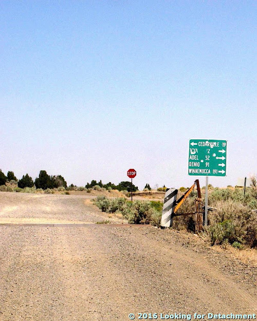 |
| The junction of old S.R. 34 and old S.R. 8A in northern Washoe County. |
At this point, we turned right to see what we might find.
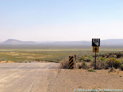
 |
| An 8A sign, up ahead! |
 |
| This is actually a "To 8A" sign! It's pretty well marked for a road that no longer exists, I'd say! |
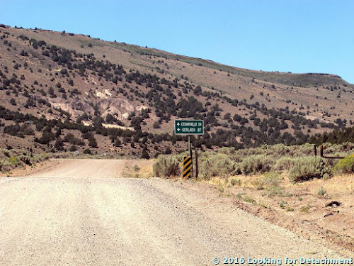
A little ways on, around a bend taking us back to the north, we came to another junction, one with several signs.
 |
| A small sign forest appears at the junction of conjoined 34+8A and 8A, which turns off to the east. |
 |
| Here's another "To 8A" sign. Turn east just ahead. |
 |
| Vya is now shown as being a mile to the north on continuing C.R. 34, and the sign says you will reach Denio or Winnemucca in many miles if you turn right. |
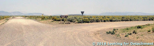 |
| The rest of the signs at the second junction are the back side of a yield sign, a BLM sign pointing to unreadable destinations, and a "To 34" sign beyond that. |
 |
| We turn right, of course, so we will be able to say we drove onto the northern leg of old Highway 8A. Now, what do those signs say? |
 |
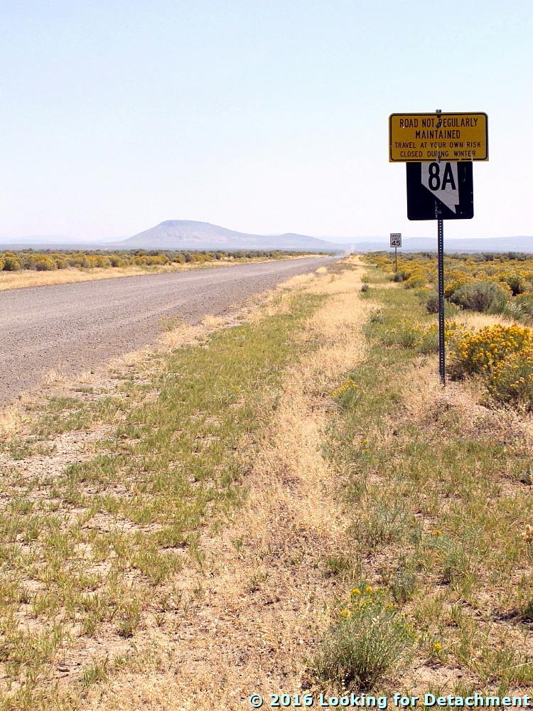
| This is 8A. It's signed. The sign doesn't say it's a county road. |
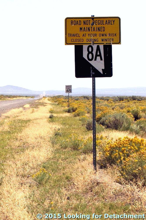 |
| "Road not regularly maintained. Travel at your own risk. Closed during winter." |
This warning sign was put in place sometime after the infamous Stolpa incident back in late 1992 – early 1993 (some links
here).
 |
| There's the jeep, barely on 8A, back at the junction with 34. Oh, and look: hoodoos! |
We drove north on C.R. 34 to the maintenance station at Vya. Apparently if we had driven a little farther north, we'd have been at the site of the old town of Vya,
now a ghost town.
 |
| There's a good batch of hoodoos in volcanic rock on the hillside behind the maintenance station. Don't ever plan on getting gas at Vya! There isn't any!! |
Having met our defined goal of reaching the northern portion of old Highway 8A, we turned back to the south. From the junction up ahead (the one we turned east on briefly), to the CA state line, we will be on old 8A, and for a short distance, also on old 34. Highway 34 wasn't even a marked road until sometime after 1939, whereas 8A was on maps as early as 1929 (a few maps and links
here).
 |
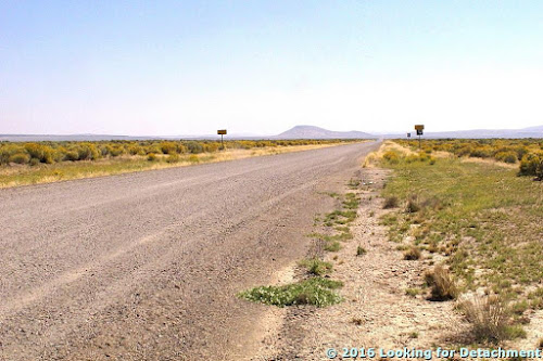
| We head south on 34, which will turn into unmarked 8A (combined with 34) at the junction just ahead. |
 |
| Now we've rounded that first bend and are back at our first junction. We'll head west on unmarked 8A. There may be hints of hoodoos on the far slope. |
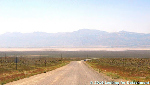 |
| Now we've crossed over an unnamed pass in the Hays Canyon Range, and are nearing the NV-CA border. |
 |
| There was a profusion of sign at the border, but no sign marking 8A going back into Nevada. |
We stopped at the stateline to see if
the sign that had marked 8A would still be there, but it wasn't. Gravel turned to pavement, old 8A became CA 299, and we drove on down into Surprise Valley, which wasn't looking very green a year ago today.


No comments:
Post a Comment