Getting back to
Lamoille Canyon, a place of
stunning cliffs and glacier carved valleys, I'm going to take us to an up-canyon viewpoint where we can see one of many hanging valleys. MOH and I initially came to this valley by way of the last stop on our second-day,
GBR field trip. The roadside pullout, compleat with descriptive sign, can be reached easily by paved road by driving about 1.5 miles past Thomas Canyon campground.
 |
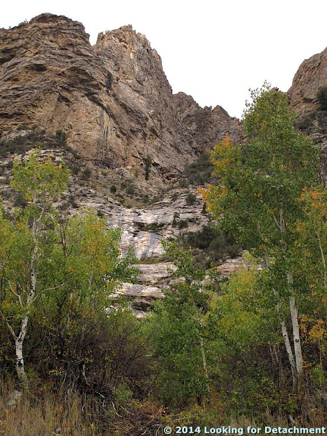
The hanging valley, as seen from a pullout along NF-650,
looking up (way up) and to the southwest. |
From the vantage point of the pullout, you can look straight up and see the hanging valley above a rocky, vegetated cliff. A narrow, V-shaped rill is curving it's way down the 450 feet of cliff below the U-shaped, glacially carved bowl above, which we can barely see from this vantage point. The triangular peak behind the dark green cleft in the cliff towers over us at just over 11,000 feet.
By
Yosemite standards, this cliff is really not that high above the valley floor, and there isn't a waterfall pouring out of our hanging valley, the way
Bridalveil Fall rushes over the cliffs near
Cathedral Rocks, but our little cleft is green with dense vegetation, indicating that the creek flows at least part-year (a feat in and of itself in Nevada) — and you can drive right to it. On pavement! (Pavement in Nevada is a real bonus.)
Before leaving the pullout, you can read
a sign about the hanging valley and the tributary glacier that created it, and if you have the time, you can take the
Hanging Valley nature trail through the aspens to Lamoille Creek and a beaver pond or two. Not sure if the trail continues uphill into the hanging valley — the cliff looks quite steep and brushy — but I suspect you can get to the valley via some other route.
Turning to look at the opposite canyon wall, you'll see a sheer cliff with a narrow chute carved into it. The slicked canyon rocks show where water has flowed persistently, probably with small casdcading waterfalls at some times of most years; those areas are now marked by black vertical lines where water has deposited dark minerals, often manganese oxides of some type, and where algae or lichen might get a toe hold.
 |
| Topo map of the area (USGS TNM 2.0 Viewer link), centered about on Thomas Creek, showing several hanging valleys around the area. |
 |
| "Our" hanging valley marked by a star. |
 |
| Topo map (TNM 2.0 Viewer link) centered on our valley, also showing most of two other hanging valleys to the northwest and southeast of it. |
 |
| Google Earth view approximating the view shown in the last topo map. |
The views all around from the hanging valley pullout are stunning, and a drive up Lamoille Canyon in the
Ruby Mountains is always well worth the time.


2 comments:
I have read about Lamoille Canyon and the Ruby Mountains - now I have to get there! Geology and beaver ponds - it doesn't get much better than that.
I'll have to post some pics of some of the beaver ponds -- the ponds are way cool!
Post a Comment