Showing posts with label gold. Show all posts

Tuesday, September 8, 2020

New Song Category: Gold or Mining Song | Seminole Wind

John Anderson: Seminole Wind (lyrics)
Album: Seminole Wind, 1992

I'm claiming a new song category: Gold Songs. And kind of like the Road Song category—songs that have to mention roads, streets, etcetera—gold songs are those that mention gold, gold mining, and possibly just mining in general. As a new category, at least on the blog, the definition has not yet been set in stone, so to speak. Another example of a "gold song" would be Heart of Gold by Neil Young.

This particular gold song, Seminole Wind, specifically mentions "days of old" and men digging for gold and silver, after which they "leave the empty holes," i.e. mine shafts, glory holes, or open pits. The song particularly emphasizes a couple negative aspects of gold and mining, though it really focuses on a hope that the Seminole Wind, and possibly the ghost of Osceola, will come and blow currently existing things to shit. (At least that's my interpretation.)

And so, when you happen to be gathering in places where the wind can blow ferociously—for example in Florida, in tornado country and the Midwest in general, in the Mojave Desert, and even in Nevada—watch out.

Tuesday, November 20, 2018

Winnemucca to Hwy 395 north of Susanville, Part 2

Well, it’s taken me awhile to get back to this road trip—for various reasons, including work schedules and personal things—but I’m going to give it a try again. Part 1 was the July 14th post, Winnemucca to Hwy 395 north of Susanville, Part 1. Part 2, as far as distance down the road goes, was actually an earlier post about Sulphur, Things You Find in the Field: Sulfur at Sulphur, on June 19th. Also see a little about the spot we ended last time, Pulpit Rock, though I don’t have much on the geology of that geographic landmark.

And I guess I should really pool some photos of mine taken of and near Hycroft’s gold mine sometime, but that would take a little more effort than I have time & energy for right this moment, so we’ll skirt past Hycroft, unless you’d like to stop at Sulphur briefly and look back, which we did on June 19th.
Looking east from Sulphur toward the barely active Hycroft gold mine.
Anyway, we’ll proceed westward. The road we’re on, the Jungo Road, would have been largely under water during the high stand of Lake Lahontan, which was in Sehoo time about 13,000 years ago. Consequently, there are several good spots along this stretch of road to see old Lake Lahontan shorelines, including the highest shoreline.
And here’s one such spot. The road goes just north of an elongate, somewhat oval hill with two rocky basalt knobs that would have been two small islands when the Sehoo lake was at it’s highest. The dark, rocky horizontal lines are some of the higher old shorelines.
Here’s a closer view. All of the upper, rocky portion of this knob was an island during the Lake Lahontan high stand. The break in slope, where the hill goes from bushy to rocky, is at about 1334 m (4377 ft). But wait, what do I see?
When I zoomed way in, I could see that the back side of this knob (the east side) is formed of the tops of columns! And the rubble or talus at the base of the knob consists of broken columns! Read more about columnar jointing here at Evelyn Mervine's blog, Georneys.
After crossing the spit coming northward off the elongate, dual-knobbed hill, we get a nice sideview of both knobs, looking south. The far knob, which has the highest elevation, and which we can call Hill 1362 because it's labeled as such on the USGS topo map (the hill is 1362 m high), exposes some nice basalt columns, slightly tilted. And shorelines. The entire hill is encircled by shorelines. The tops of both of these knobs stuck up out of the highest stand of Lake Lahontan, which was at about 1334 m (4377 ft) in this area.
Google Earth view of Hill 1362.
A USGS TNM Viewer map of approximately the same area.
Driving onward...
...here’s what the elongate hill of two knobs looks like looking back to the east from a little farther down the Jungo Road. Perhaps much of the talus is composed of chunks of basalt columns. Next time I’ll stop and check.

These photos of basalt and shorelines were taken on various trips I’ve taken on the Jungo Road. The first three are from 5/24/2017; the next, a browner, dryer picture, was taken 8/3/2012 in high summer; the last was taken 6/14/2006.
We'll continue farther, on our mid-June, 2018, journey. About 2½ miles closer to Gerlach, I stopped and grabbed this photo of the Black Rock Desert, the playa shining in the sun. The hills on the left of the photo are low hills belonging to Pahsupp Mountain; the mountains in the farest distance are the main part of the Granite Range, which runs northward out of Gerlach.

Numerous views can be had of the Black Rock Desert from Sulphur to Gerlach. Light and shadow change with the seasons and with the passing of clouds. Sometimes the playa is brightly lit, other times it’s in shadow, with the mountains around it glowing in sunlight. There are a few notable places to stop along the road, one being Trego Hot Springs and another being the Frog Pond (although it’s usually posted No Trespassing and the gate is usually locked).

On this trip, I hurried past those spots and others, and declined to drive out onto the playa, as it looked like it might still be a little muddy from winter. Nearer to Gerlach, I pulled off on the side of the road, mostly for a pit stop, and also to see if I could find some Prince’s Plume. Alas, it was past the best blooming date.
Not finding any Prince's Plume, I realized this was an excellent spot to take a photo looking more or less to the northeast, across the railroad tracks and across the desert toward the playa arm going up toward Soldier Meadow. The pinkish Calico Mountains are mostly in the sun just left of center, and the southern part of the Black Rock Range is mostly in shadow way over to the right.

After a moment, I noticed a nearby lizard, who kindly didn’t run off while I took this photo.
I’m a little surprised I saw it, camouflaged as it was amidst the patchy desert pavement.

It was already getting late by this time—well, it was 2:30 pm, anyway—and I had miles and miles to go, so I drove through Gerlach without stopping, but only after doing a gas mileage calculation to make sure I would get to the next gas station, which would be almost 91 miles down the road, across another desert, up a creek, over a mountain, and down the other side.
Nearly an hour later, after passing through Gerlach without stopping for ravioli or anything else, I made it to the northwest side of the Smoke Creek Desert and stopped to see if there was still any water in the playa. There had been quite a bit in the spring of 2017, just a little more than a year before this trek. Straining my eyes to see, I decided there wasn't any water, but I took this photo, thinking maybe I'd spot some water later. The desert does look little shiny near the center of the photo, in front of Pah-Rum Peak and a ridge of the Fox Range, but probably that’s just mirage. Toward the right of the photo, the playa is darkened by cloud shadows.

Not much farther down the west side of the Smoke Creek, I pulled over for a quick examination of some tufa.

To be continued...

Selected Reference:
Adams, K.D., Wesnousky, S.G., and Bills, B.G, 1999, Isostatic rebound, active faulting, and potential geomorphic effects in the Lake Lahontan basin, Nevada and California [link to access pdf]: GSA Bulletin, v. 111, no. 12, p. 1739-1756. https://doi.org/10.1130/0016-7606(1999)111<1739:IRAFAP>2.3.CO;2

Related Posts:
Winnemucca to Hwy 395 north of Susanville, Part 1
Blue Mountain (2012)
Pulpit Rock (2012)
Things You Find in the Field: Sulfur at Sulphur
Smoke in the Black Rock & Smoke Creek Deserts (2102)
Where in the West: Black Rock Desert (2008)
Where in the West - June: A Second Look (2008)
Where in the West - June (2008)
Name That Place (Gerlach, 2008)

Tuesday, July 24, 2018

Winnemucca to Hwy 395 north of Susanville, Part 1

We began our northern Nevada road trip about a month ago at this blog post about Sulphur, Nevada, a real ghost town located more or less a third of the way along our route. To continue with the trip, we’ll take a step back for a re-start in Winnemucca (The Griddle, above is a good place to stop for breakfast or lunch), though we could just as easily start somewhere to the east, say Elko, although the trip then would become longer. Our goal will be to make it, eventually, to the NV-CA state line west of the Smoke Creek Desert, and from there to U.S. Route 395 north of Susanville. We'll get to 395 by way of a fairly obscure dirt road that will take us from the Smoke Creek Desert in Nevada to a nearly non-place called Viewland, CA. See my Google Maps plot of this route, along with photo locations and other points of interest along the way. I'll add points to the map as our trip progresses.

The Jungo Road (Nevada S.R. 49 and 48) will be our gateway to the Black Rock Desert and points west, and to get on the Jungo Road we'll take U.S. Route 95 north out of the center of Winnemucca a very short distance, where we'll turn left onto the Jungo Road almost immediately after crossing the Humboldt River. Right at the Winnemucca convention center, essentially our starting point, you’ll note a sign stating that the road north (U.S. 95) is part of the Winnemucca-to-the-Sea Highway.

If you're inclined to travel northward instead of westward, have a look at my 2010 Oregon Trip Series, a series dedicated to road tripping over a portion of the Winnemucca-to-the-Sea Highway and other roads as well.
Lo and behond, the Jungo Road starts out paved as it leaves Winnemucca. That’s Blue Mountain nearly straight down the road.
At this point, just about 6 miles into our journey, we get a good view of Little Tabletop Mountain, which is a basalt-capped mesa south of the road. MOH and I used to call these hills “The Pancakes.” From the south side, they look a little like a tilted stack of pancakes.
"The Pancakes" from the south, as seen in Google Earth.

It’s difficult to get a photo of these hills when driving 80 mph on I-80, unless you happen to be sitting in the left passenger backseat, so I resorted to a G.E. view.
Before long, the paved portion of the Jungo Road ends; it becomes a magnesium-chloride treated road...a magged road. I figured the magged road condition would extend all the way out to the Hycroft gold mine, but I forgot that they are not operating with a large crew like they were a few years ago when the mine was active. Hycroft is still running their heap-leach operation while testing the feasibility of operating a sulfide leach pad, but the large crews are a thing of the past, at least for now (see Hycroft’s January 10th press release [pdf] for more about sulfide leach testing).
Here we are at the same locality as the previous photo, about 9 miles west of Winnemucca, looking back towards Winnemucca and the Sonoma Range.
The magged part of the Jungo Road currently ends at the turnoff to the Blue Mountain geothermal field, aka Blue Mountain Faulkner 1, which is just on the west side of Blue Mountain. Magging prevents dust, so the road is dusty to the west. One good thing about dust: you have a better chance of seeing that someone is heading toward you. A bad thing about dust: breathing it, of course. Magged roads have one particular disadvantage: they are very slippery when wet, almost like driving on greased snot!

Although the sign at the turnoff to the geothermal field says "NGP Blue Mountain 1 LLC," the power plant is now owned by AltaRock (or not - UPDATE 15June2019). The field was discovered during gold exploration conducted in the 1980s or 90s.
I often stop on a small-looking playa near Jungo—it seems to be a good spot for a pit stop, being about 1 coffee from Winnemucca, and when it’s hot, which it was on June 15th when these photos were taken, it’s definitely time for more hydration. It turns out that this playa is the southern part of the larger Desert Valley playa, which extends 46 miles north-northeast from about 6 miles south of Jungo, all the way to the Quinn River about half way between Winnemucca and Denio. Desert Valley is the 10-mile-wide basin between the Jackson Mountains on the west and the Slumbering Hills (a mountain range) on the east. The Sleeper gold mine was named for it's location in the Slumbering Hills (and also because it was a "sleeper?").
Here we are coming into Jungo, which is a railroad siding located at or near the junction of the Jungo Road with the Bottle Creek Road, which heads up toward the Bottle Creek mining district and the main part of Desert Valley. The well-bedded rocks in the hills ahead of us—a northward continuation of the Antelope Range or a southern part of the Jackson Mountains—are part of the Jungo Terrane, a thick pile of turbiditic shales with sandstone and limestone interbeds that were deposited in Late Triassic to Early or Middle Jurassic time (Luddington et al, 1996 and Crafford, 2007).
Not recognizing in the moment the exact location of Jungo, I took a photo of the junction with the dirt road that comes up with Imlay. If you happen to start this trek in Imlay, you'll cross the Humboldt River just above Rye Patch Reservoir, and you'll pass by Haystack Butte, a geographic marker that can be seen from the Applegate Trail.
I don’t do it often, but on this trip I went ahead and took a couple photos of two of the old mining cabins at Mandalay Spring. I’m not sure why these shacks are present (besides the spring) or what era they date from. I’ve been inside at least one of them—for some reason the entire enterprise struck me as depressing (maybe it was the peeling wallpaper or strings of disintegrating clothes; maybe it was just me).
This cabin is located a little closer to the spring and at about the same elevation; whereas the first cabin sits up above overlooking the spring.
I took this photo at one of the first spots to pull over and get a good look at the Black Rock Desert, which on this day was partly obscured by summer haze. Black Rock Point, for which the desert was named, is a small, dark hill just to the left of the road as it points off toward the vast playa; a closer view of the point can be seen here. The little hill in the foreground is part of a Pleistocene Lake Lahontan shoreline. There was another obvious shoreline just 200 m east of this smaller one.
We'll end this part of our trek at Pulpit Rock.
Google Maps location map.

Selected References:
Crafford, A.E.J., 2007, Geologic Map of Nevada: U.S. Geological Survey Data Series 249, 1 CD-ROM, 46 p., 1 plate.

Ludington, Steve, McKee, E.H., Cox, D.P., Moring, B.C., and Leonard, K.R., 1996, Pre-Tertiary geology of Nevada, Chapter 4 in Singer, D.A., ed., An analysis of Nevada's metal-bearing mineral resources: Nevada Bureau of Mines and Geology Open-File Report 96-2, p. 4.1-4.17, 1 sheet, scale 1:1,000,000.

Tuesday, July 10, 2018

Road Song: Stairway to Heaven

Led Zeppelin: Stairway to Heaven (lyrics)
Album: Led Zeppelin IV, 1971

I've don't often think of this song as a road song, but it does mention "the road" twice and "two paths" once, so is definitely a road song by any definition. It's also a gold song, for any of you miners out there.

Tuesday, March 28, 2017

Tales of the Mojave: A Dry Placer

And now, let us continue with my Tales of the Mojave series. In our last post, we had barely left town—town being Reno, NV, hundreds of miles to the north, and we being Allie and I, two young and fairly junior geologists: I was beginning my fourth full year as an exploration geologist; Allie was beginning her first. Besides the several recon targets I had generated while we were still in Reno, we also had a placer submittal to examine and evaluate.

A Dime a Dozen


Placer claims are a dime a dozen in the Mojave, and they are typically worthless—at least in my limited experience. (Actual placer miners might disagree with my assessment, but I'm using the mindset of large, hard-rock mining and exploration companies.) Unlike lode mining claims, placer claims can be increased in size if an association (group of more than one person) locates the claim: The usual 20 acres per lode claim or individual placer claim can be as large as 160 acres in an association placer when located by 8 or more claimants.[1] Association placers can, in other words, cover an entire quarter section, making it possible to cover a lot of ground with relatively few claims, something that was done widely across the lowlands of the Mojave Desert of California in the 1980s (and elsewhere, like Arizona, and elsewhen, perhaps even right now). Many of the placer submittals we received during the 80s were located not only for gold, but also for platinum, an element that is quite rare in the placer settings of the southwestern deserts.
“A degree of skepticism should also be reserved for ores said to contain uncommon metals or minerals. Because of their rarity, these substances may command a very high price and are therefore extremely attractive to the investor. The platinum-group metals including platinum, palladium, rhodium, ruthenium, iridium, and osmium, are the darlings of the swindler. Considering their high unit-value, even minute amounts of these metals appear to be a reasonably good bet to the innocent investor.”
–from Mining Scams, AZGS
In any case, I’m not sure why we were called upon to appraise these particular placer claims, nor do I remember their exact location or size.[2] I did already know a few things about placer deposits—a little—having looked at a number of placer submittals in the California foothills earlier that year. The Mojave placer, however, was different from those in the Mother Lode region of California, being “a dry placer” or “desert placer,” which means they were not located on or very close to any actively running water. Flash floods in usually dry washes, and sheet runoff across the fans during storms had formed the sand and gravel deposits that might (or might not) contain placer gold, but the nearest naturally running water was several miles to the southeast in the Colorado River. (Water in the nearby Colorado River Aqueduct was nearer by half, but was inaccessible to any would-be placer operators, including us.[3])

The Desert Sun


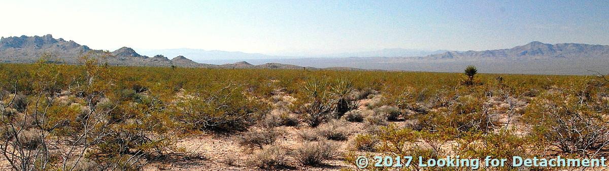
The desert sun glared through the windshield of the truck as if to threaten us with heat stroke or worse, and heat waves rose inexorably from broad alluvial fans and bajadas, countless meandering dry washes, and endless desert pavement. As we turned onto dirt somewhere between Vidal Junction, CA, and Parker, AZ, I wondered what we were getting ourselves into. It wasn’t just the question of evaluating a dry placer property located miles from running water, but also the larger question: What were we doing in the Mojave in June? We drove down the fan, over rocks and by countless jumping cholla, not knowing for sure where we'd end up, not having to meet with the prospector, as one does so often when checking out a submittal. It didn't take long, really, before we found the spot, nearly lost in low, decapitated hills and erratic dry washes south of the Whipple Mountains, buried under  a millennium’s worth of accumulated sand and dust. Dust covers entire mountain ranges in the western Mojave Desert, and it collects on pool tables in towns up and down the Colorado River in the eastern Mojave. Parker, Arizona, is one of those towns. Hopefully we'll stop in Parker some other time.
We had brought extra water with us in 5-gallon containers, including 1 or 2 basic upright cooler types and several clear, collapsible plastic types. The extra water was, at this point, for evaluation of the claims, not for our own hydration, but the extra containers would serve us well as our expedition unfolded. So far we hadn't noticed anything untoward in the flavor of the water, primarily because we had filled our containers north of the NV-CA line, probably in Reno. Desert water can taste absolutely awful.

As property reviewers, we would not only have to determine whether gold was present, but we would have to make some deliberation as to the feasibility of mining by a fairly sizable company. I could think of three scenarios for processing (mining) any placer deposit we found:[4] 1) haul water into the area from the Colorado River or from Lake Havasu to wet-separate the heavy gold from the lighter quartz and feldspar sand and gravel, 2) haul the gold-bearing sand and gravel to the water, presumably the Colorado River, for wet-separation offsite (no doubt requiring further land acquisition), or 3) dry wash the sand and gravels without water. Dry washing using the oldtimers' dry winnowing method is notoriously inefficient at gold recovery and can be totally worthless if not done with extreme care and diligence.
How we get gold in California: winnowing gold, near Chinese camp.
Original in Harper's Monthly, v. 20, 1860; source: Library of Congress (no known restrictions).
Of course there are more current methods of dry washing available than winnowing, if you happen to have some gold-bearing sands and gravels on your Mojave placer claims. I'd look into the Bedrock Dreams website (UPDATE 15Jun2019: no longer available) which used to show many possibilities and has a lot of info for the up-and-coming small-time gold miner (hard rock and placer).

The Dry Wash


At the dry wash, we camped in trenches dug by the claim holder. In the “cool” of the evening—when temperatures dropped somewhere between 70º and 85ºF by morning—we panned for gold using the precious water we had hauled in. Because the paved roads of Highways 95 and 62 and the desert-river town of Parker were not so far away, we went ahead and used a lot of our water for panning. We didn't have to save most of the water for drinking, which we would have done had we been camping four hours away—over hot, dusty roads—from anywhere of desert significance: any place with water, food, people, and, preferably, gas, spare parts, and tires (the latter preferences ruled out places like Goffs and Essex)

We were lucky, and our pans showed some color: a few, small flecks of gold almost too tiny to see. With repeated tries, we consistently got 2 to 4 colors in each pan. After we used up our extra water, which happened faster than we had envisioned, we took to dry panning. (It doesn't matter how close you are to town; it's ill-advised to use up all your water. You might need it during some unexpected, unplanned-for vehicle mishap or environmental disaster like a clogged fuel filter, a flat, a washed-out road, or a flash flood. See A Few Rules of the Desert.)

At some point, perhaps out of boredom, we gave up on classic dry panning, which looks a lot like regular panning but with tons of dust. One more time we filled the gold pan with the weakly gold-bearing alluvial sand and threw the material expectantly skyward. The evening breeze blew the lightweight fines toward Arizona—where all Mojave sand and dust aspires to reach—and the heavier material fell back toward the pan. We had reinvented dry winnowing! In theory, we should, after several skyward tosses of material, have been left with a few heavies, some black sand, and a few flecks of gold. We weren't, though; maybe our technique was subpar. Regular wet-wash gold panning requires some skill, but if there’s gold in the pan, even an unskilled person will usually find it—although I've seen newbies mistake golden-colored quartz, gold-flecked biotite, and that common mineral pyrite, AKA fool’s gold, for gold. All of these minerals might fool some of the people some of the time, though with practice or a good course in mineralogy, you should not get duped by any of them. Gold is the only mineral that will shine or look bright golden yellow in the shade. Pyrite pales next to gold, and put in the shade it won’t shine—it becomes just another mineral, barely tinted beyond pale brown, nowhere near the bright golden yellow of real gold. (The exact color of gold depends on its fineness and upon which of several other elements, notably Ag, Cu, Fe, Pt, Cd, might be contained within the gold. These factors will affect how bright yellow or golden the gold looks. And then there's chalcopyrite, not as common as pyrite, but often lying somewhere between pyrite and gold in it's yellow-gold sheen. So it is possible to be fooled. But don't be. A Niton™XL3t GOLDD+ xrf analyzer can be a friend.)

Dry panning and air winnowing hadn't done much besides create a lot of dust and two ravenous geologists. So we put the gold pans away and turned our thoughts toward dinner. The sun was fairly low over the Turtle Mountains to the northwest, and my time estimation method indicated we had about 1.5 hours to sunset. What should we eat? We went ahead and established our Mojave Desert, south-of-the-border-style cuisine of tacos or burritos, with avocado and as much hot salsa and jalapeño as we could stand. This type of food is not too heavy for the heat, and (I’ll swear to this—or ask any desert rat) the spicy burning of the peppers created a cooling effect, something we would really need as our time in the desert progressed. Besides, there’s enough vitamin C in the peppers to fight scurvy, a credible desert plague: Rapid melting of the ice will spoil many vegetables and a few fruits over the course of our stay.

Yeah, we had just arrived in the desert and were still greenhorns, not quite able to call ourselves Mojave Desert rats. Not yet.
A little fooling around with SunCalc produced this reproduction of sunrise and sunset at our campsite (approximate location and date).
As the sun sank behind the Mopah Peaks, I thought about the next day. We'd be moving upslope into the Whipple Mountains proper. We were done with the placer submittal and, back in Reno, would recommend “No Further Work.” Although we didn't really know how large the weakly gold-bearing sands are, we suspected that their likely flash-flood origin from upstream copper-gold diggings in the Whipples would make mapping out the gold bars and channels difficult at best.

To be continued...

Notes:


[1] (Read about basic claim location rules here.)

[2] In later years, when working for Former Mining Company, I rarely took on placer submittals; in fact I actively avoided them, especially after one particular submittal (a classic scam) led to a fabricated conflict between our lode claims and the association placer claims of the submitters.

[3] The Colorado River Aqueduct is a 242-mi (392 km) water conveyance in southern California. The aqueduct diverts water from the Colorado River at Lake Havasu (at Parker Dam north of Parker, AZ) on the California-Arizona border west across the Mojave Desert to the east side of the Santa Ana Mountains. The aqueduct is operated by the Metropolitan Water District of Southern California (MWD) as one of the primary sources of drinking water in southern California.

[4] A note about my usage of "found" and "deposit." We knew there were claims for placer gold. We didn't know for sure if any gold existed on the property or in the area. If there was gold in the dry washes, the claim owner had discovered it, not us. We, however, wouldn't think of any gold on the claims as an economic deposit until it had been tested, which usually involves drilling or—especially in the case of placers—small-scale test mining. It's not considered accurate to call a mineral occurrence a deposit until it meets economic parameters and passes mining feasibility studies. It is therefore correct for me to assert that the claim owner discovered the gold, but Northern Mining Company's representatives (us!) might discover a gold deposit.

Tuesday, December 13, 2016

Twelve Months of LFD (2016)

I'm doing the year-end meme wherein I compile the first sentence of the first post of every month. Meme rules are as follows, as per DrugMonkey:
Post the link and first sentence from the first blog entry for each month of the past year.
I also add the first photo from the same first post. Previous takes on this Twelve Month meme at LFD were posted for 2008, 2009, 20102012, 2014, and 2015.

Aaand...here's the year 2016 for LFD:

January:
I've gathered up a collection of rocks to see which ones will float and which ones will sink.

February:

After checking out the southern route to Mineral Ridge while on my 1976 thesis quest, I headed north out of Silver Peak on then Highway 47 (now S.R. 265), carefully measuring the miles to the left-hand turnoff.

March:
With Mineral Ridge in my rear-view mirror, I stopped briefly at the basalt cinder cone, The Crater, which is located right on the side of the road just a few miles north of Silver Peak.

April:
From the vantage point of the end of the last post, a little southwest of Luning, Nevada, I turned around and pointed my camera northeast across Soda Spring Valley ... and paused to think back to the late 1980s, when we in the Western District of Former Mining Company had finally taken over exploration of the Walker Lane, which until then had been a mostly unexplored part of the Nevada District.

May:
I'm not sure how I got started on checking different words and concepts on Google Books Ngram Viewer yesterday, although my "History" tab suggests to me that it might have been related to some reading I was doing on science fiction.


June:
I collected this hand sample from the Original Bullfrog mine, Nye County, Nevada, sometime back in the mid to late 1980s when doing recon in the area, then cut and polished it—probably with a company saw and grinding wheel.

July:
We're now about two thirds of the way up the hill toward Red Pass on the Titus Canyon road, a one-way road that runs approximately east to west from Nevada into California, starting not far south of the ghost town of Rhyolite.

August:
There I was, preparing a few photos for posting in the ongoing Death Valley Trip – Titus Canyon series, doing my usual thing of marking up photos in MS Paint (I'm too cheap to buy any real photo programs), when I figured that I must have something around the house that might work better than either dragging the cursor across the screen with my trackpad or dragging my finger across the computer's touch screen.

September:
Now we'll leave the parking area near the Leadfield sign and, as I promised last time, we’ll walk out to what I’ve been referring to as the “far west cabin," although maybe that should really be "far northwest cabin."

October:
At the end of our last post—the one about the non-fold—we came into Titus Canyon proper and were looking at this view, down the canyon and to the west

November:
Just a bit of stibnite for your #MineralMonday.

December:
When I drove to the area on the south side of the Whipple Mountains where I ended up camping amidst downpours and nearby lightning, I thought I'd grab a few photos of the Colorado River Aqueduct, which passes through just north of CA Highway 62 on its way to the greater L.A. area, but an RVer was camped just beyond the aqueduct overpass, so I blew it off until I left.

Monday, November 28, 2016

The Left-Lateral Strike-Slip Garlock Fault Near Highway 395

While out on the last road trip, I started taking pictures from places where roads crossed the Great Basin Divide. Unfortunately, I soon gave that up because freeways, which I traveled not exclusively but considerably, are lousy places from which to take pictures. But thinking about divides also made me think about the Garlock Fault, and how I'd be crossing it on 395 heading south into the Mojave. Here I've pulled over as I'm about to cross the fault.
I've drawn the Garlock fault with a thick blue line, and a secondary strand (air-photo linear) with a thinner blue line.
Besides the two fault strands, you can see the towns of Randsburg and Johannesburg, which were founded in 1896. The Yellow Aster open-pit gold mine was operated by Glamis Gold from about 1987 to 1997.

The haze was thick and the day overcast, and it looked like the photos I was taking would be fairly lousy, but MS Photos was surprisingly able to revive the dark, lackluster originals (I usually don't rely on the Photos app, but in this case it worked better than my other free programs).

After crossing the fault on 395, I took the road toward Goler Heights and Garlock. (Goler Gulch in the El Paso Mountains at Goler Heights is unrelated to Goler Wash in the Panamint Range at the edge of Death Valley National Park.)
Looking west along the southern range front of the El Paso Mountains toward Goler Heights.
The Garlock Fault is mostly behind low hills in this shot, and it runs to the right of us about three quarters of a mile to the north.
I've drawn in two (or three) apparent strands (or air-photo linears―my interpretation may not be precise in all cases) in dashed blue lines; where thin, the fault is behind hills or out of view.
We're now back near the junction of the Goler Road with Highway 395, looking to the northeast.
I took this photo thinking that we might be seeing part of the Garlock Fault, when in fact what we're seeing is a couple of fault strands parallel to the Garlock (air-photo linears).
The Garlock Fault proper is out of view beyond the low hills.
A little more than a mile to the NNE from the place I took that last photo (above), there's a great example of a shutter ridge and offset drainages.
Google Earth image with a blue line I added using the "Path" function.
The same image with more scribbles.
This marked up Google Earth image shows a small portion of the left-lateral Garlock Fault (long blue line). The fault line is basically the same as shown here (Roder, 2012). If you blur yours eyes a little (and even if you don't), you'll probably see several lines or linears that are running parallel to the main fault trace. I drew a few of these in with thinner dark blue lines. I can easily spot a few more.

The fault has offset two drainages in a left-lateral sense; that is, the south side of the fault, moving to the northeast (right) has brought in a ridge that has blocked the dry wash in the center of the image, forcing it to flow to the northeast to get around the ridge. That ridge is labeled "shutter ridge," which is the term for a ridge that blocks a drainage in this fashion along any strike-slip fault, whether it's right lateral, like the San Andreas, or left lateral like the Garlock. A second drainage way off in the upper right corner of the image has been blocked and offset in the same fashion. That drainage appears to have two shutter ridges, one that is north of the main trace of the fault, and another that looks like it's south of the main trace (at least the way the main trace has been drawn; we can see by drawing in just a few air-photo linears that there may be a few complications, and faults often meander around a bit).

I got back onto Highway 395 and continued south toward my destination, figuring that I could get a photo looking back toward the Garlock from somewhere up near the turn-off to Randsburg. I finally found a pullout on the east side of the highway; it offered me a four-wheeling opportunity to drive a very narrow, rocky road to the top of a small hill. The photos I took from there looked really lackluster, so I didn't spend a lot of time trying to get a really good panorama. Consequently, the two photos I've stitched together below do meet up on the horizon, but they are way off in the foreground, primarily because I ended up moving to keep the dirt road I was on out of the picture. We can, nevertheless see where the Garlock and a couple parallel strands or linears are located.
Stitched photo. The center of the photo is looking just west of north.
The same photo with a few labels.
And that's basically it for the Garlock Fault, but there's a location near Goler Heights that might be a good spot to look around the fault, and there are probably some good locations near Garlock.
Looking northeast from Goler Heights along the Garlock Fault.
UPDATE: Be sure to view Ron Schott's GigaPan of this portion of the Garlock Fault.