_1_1s.jpg) |
| Signs at the turn-off from westbound 140 to SRs 8A and 34A |
Well, I finally did it! I traveled the northern section of Nevada S.R. 8A, which runs from the NV-CA stateline east of Cedarville, CA, to Nevada S.R. 140, the Winnemucca-to-the-Sea Highway. I posted earlier about the west end of northern 8A
here,
here, and
here. The northeast end of northern 8A was covered briefly in
this post, which is part of
a series about Highway 140. The traverse described in this post was part of a larger loop trip from northern Nevada to northern California, the westbound portion of which is shown in
this map (also embedded at the bottom).
_1_1S.jpg) |
| Take the left fork to stay on 8A, or the right fork for 34A. |
_1_1s.jpg) |
| Looking southeast across Echo Creek at Gooch Table. |
_1_1s.jpg) |
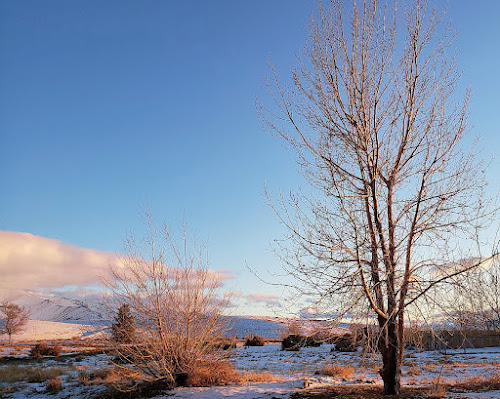
| Volcanic tableland in the foreground. The Pine Forest Range is on the right; the Pueblo Mountains near Denio are on the left. |
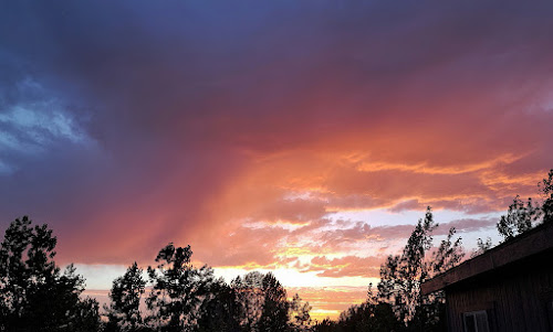
The sky was overcast for much of the trip, so the photos I got were not as good as they might have been on a bright summer day. Wildflowers were out—not a superbloom but quite persistent and with numerous species—and I saw three pronghorn in the west-central part of the
Sheldon National Wildlife Refuge.
_1_1s.jpg) |
| One pronghorn barely visible. The south end of Gooch Table is to the left; the hills beyond the pronghorn are northern slopes off Fish Creek Mountain. |
As the northern slopes of Fish Creek Mountain came into view, the area started looking familiar, and I wondered if I'd bushwhacked through the mountain mahogany on Fish Creek Mountain during a long-ago deer-hunting adventure. Also, I was now coming into the area where the
Stolpas got in trouble in the winter of '92-93. Beyond the pronghorn in the photo above, more or less just beyond the area between that dark volcanic flow and the mountain-mahogany-covered hills, the land slopes east into the upper drainage of Hell Creek, where Jim and Jennifer took refuge in a small cave
approximately two miles east of Blowout Mountain. Hell Creek drains into Virgin Creek, eventually into the area of the Virgin Valley opal mines, where they might have found people, had they been able to continue their long trek through the snow. Instead, Jim walked 40 miles or so to Vya, where he luckily found someone at or near the road maintenance station.
_1_1_1ss.jpg) |
| Two pronghorn. |
The road, 8A, is wide and graveled, quite smooth over most of its length, though it was decidedly dusty. At the north end, the gravel included oversize rocks that make for a rough ride in places. I had the AC on high and recirculate throughout the dirt portion of my trip (from NV 140 to CA 299) to keep the cabin pressurized; otherwise I was breathing in a lot of dust. Every time I'd stop, the dust would move over me from the rear, and I'd have to wait to take photos. The dust, in the mostly still air, was drafting along with the Jeep in lieu of any wind blowing it to one side or the other. By the way, it's always good to check your air filter after a trip through such volumes of dust, or even during if the silt is particularly nasty.
_1_1s.jpg) |
| Mesa at the south end of Fish Creek Table. |
And then, having passed from northwestern Humboldt County to northern Washoe County, and having also passed out of the Sheldon National Wildlife Refuge, I finally turned onto a side road for lunch. Lunch was accompanied by a short wildflower walkabout.
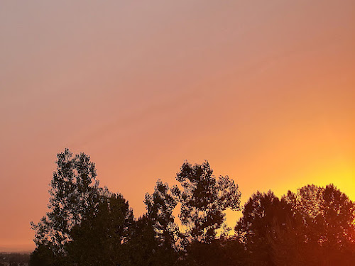
Moving on from lunch, I came to the fast, western section of road approaching Vya. Finally, the sun came out.
_3s.jpg) |
| Looking west toward Vya: The playas of Middle & West Lakes are in the center, with Massacre Lake behind the hill on the right. The dark knob on the left is Painted Point. |
The 8A portion of the larger trip, from its junction at the north end with Nevada S.R. 140 to the NV-CA stateline where the road becomes CA 299, took about two and a half hours, including several brief photo stops and a 20-minute lunch stop. Google has one traveling that route (63 miles) at an average speed of 18 mph, whereas my average speed including more than 20 minutes of down time, was 25 mph. Before leaving, I had calculated that Google was giving me a rate of 17 mph just for the 140 to Vya section, but apparently they think the entire 8A section is a drag. In winter, of course, one might not be able to traverse the road at all, what with all that volcanic-derived silt turning to sticky, slippery mud, or the plateau country becoming buried or drifted during any serious snowstorm.
_2_1s.jpg) |
| Wildflowers near the junction of 8A and 34 south of Vya. |
As mentioned earlier, I've been up in the Sheldon country before, most notably many years ago for black powder deer hunting. We were probably somewhere over in the Fish Creek Mountain – Blowout Mountain area, or perhaps a bit to the south down near Mahogany Mountain.
More about 8A at LFD:
Note: a few photos shown on the map didn't make it to this post.
_L+R(2)_bw.jpg)


_2s.jpg)
_1_1_1s.jpg)


_1_1s.jpg)
_1_1S.jpg)
_1_1s.jpg)
_1_1s.jpg)
_1_1s.jpg)
_1_1_1ss.jpg)
_1_1s.jpg)
_1_1s.jpg)
_1_1ss.jpg)
_1_1s.jpg)

_3s.jpg)
_2_1s.jpg)