Showing posts with label glacier. Show all posts

Monday, August 29, 2011

A Rainy Trip to Homer / No Augustine: AK2011 Day 8

The 8th day started out cloudy, and gradually turned rainy. Here we're heading down to Homer, having already passed Clam Gulch, and having just passed Ninilchik. As we drove by, I was thinking maybe we'd stop at Ninilchik or the beach on the way back, though we hadn't gotten an early start, and I didn't know how rainy the day would turn.
Not much farther on, we pulled over to look at the view across Cook Inlet (in the far distance in this wide angle shot) and to look at the lupines and cow parsnip, which were also blooming alongside fireweed.
It is at about this spot that one might hope for a view of Augustine looking south down and across Cook Inlet. Augustine is an island volcano that last erupted in 2006. Check out these much better images (ha!) at AVO. Augustine (sometimes called St. Augustine or Mount St. Augustine but shown as Augustine Volcano on topo maps) is officially a stratovolcano, one with a central dome and flow complex or cluster; it's part of the Aleutian volcanic arc, and it's the most active volcano in the Cook Inlet area (location map at AVO).
Ah, yes. We arrived at this famous sign, which doesn't mention Homer as a "quaint little drinking village with a small fishing problem," supposedly seen locally on bumper stickers.
Despite the fall-like weather (even for an Alaskan summer), we manage to get this view of the Kenai Mountains across Kachemak Bay. The glacier in the upper left is a small glacier coming out near the Doroshin Glacier (not visible farther left or in the clouds). It probably has a name, but not on topo maps available to me (MSRMaps location).
Before a late lunch, we stopped briefly at the Alaska Islands & Oceans Visitor Center, which has some interesting wildlife and ocean displays and a nice little gift shop, where I bought art notecards of two puffins and four ravens.
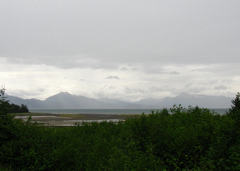
The Visitor Center parking lot overlooks a small mud flat just below Beluga Lake (MSRMaps location).
That's Grace Ridge, tucked behind Sadie Cove and in front of Tutka Bay, across the flats and across Kachemak Bay.
By the time we finally stopped for lunch, the rain had become a downpour. Sitting outside was out of the question, although at least one brave (or crazy?) soul was out in the weather.
I had to take a picture of this "Local Organic Wi-Fi" sign, which I noticed when we were leaving the organic lunch joint.

A Couple Augustine References:
Power, J.A., Coombs, M.L., and Freymueller, J.T., eds., 2010, The 2006 eruption of Augustine Volcano, Alaska: U.S. Geological Survey Professional Paper 1769, 667 p., 1 plate, scale 1:20,000, and data files.

AND (part of above) Section 2: The Geology of the 2006 Eruption.

Related Posts:
Wordless Wednesday: I Love the Color of the Water

Record Reds

Down to the Kenai: AK2011 Day 4

At the Cabin: AK2011 Day 4

Fishing for Reds and Other Miscellany (including a Volcano): AK2011 Days 5-7

Wordless Wednesday: Seen at Homer

Friday, December 10, 2010

Twelve Months of LFD (2010)

As per usual (see 2008 and 2009), I'm doing the year-end meme showing the first sentence of the first post of every month, along with - for LFD - the first photo if there happened to be one. Seen everywhere, especially at VWXYNot?, Dreams and hopes of a (former post doc) scientist, There and (hopefully) back again, and Thus Spake Zuska. The rules for this meme are simple, as explained by DrugMonkey: Post the link and first sentence from the first blog entry for each month of the past year.

January
It being the start of a new year (the year 2010 to be precise), I have a few deep-time links for all you deep-time lovers (or would that be lovers of Deep Time?):
February
Here, in non-chronological order, are a few of the geoblogospheric posts that have caught my eye recently.

March
The March, 2010, version of Where in the West (WITW) is really just an excuse to post a glacier picture or two.

April
Just a quick preview of a roadcut on Highway 36 near Susanville, CA, showing a basalt flow over some white [probably tuffaceous] lake sediments. The reddish baked zone may might include subaerial deposits.

May
Callan Bentley at Mountain Beltway has had a couple posts up recently about mud cracks.

June
Three years ago today, while driving between somewhere and somewhere else, I came upon this cool oasis in the greasewood zone below the sagebrush steppe on the northeast side of Honey Lake, CA.

July
waterI took a road trip last week, south into Big Smoky Valley (MSRMaps), in order to grab a few photos from areas I visited in 1976 while on my thesis hunt.

August
I just returned from a mega-trip with MOH into central Oregon, where I met with family at an annual reunion-type affair on a basalt-capped bluff overlooking a small Oregon town.

September
I've been working on a Highway 50 roadside geology series for quite a long time, and have managed to get a few posts in every now and then, but have many more to go before I really consider it complete (could it ever be complete?).

October
Where in the West, if you might remember, features some [unknown] location in the western part of the northern hemisphere.

November
Ophir and Out ... well, to Middlegate, anyway.

December
And so, following on from the post "What is a Road Song," here is the essence of one of the three road tapes I made in the late 1980s.

Everyone who blogs is tagged for this meme.

Thursday, March 11, 2010

A Glacier in Snow and through Trees

We did finally make it up to Matanuska Glacier this week, through heavy snow, and occasional near whiteout conditions. The view from the Long Rifle Lodge made the glacier look like a white cow in snow.
A close up view of the glacier, as seen through trees – probably black spruce.
And just in case you don't believe me, two nearly identical views taken on a sunny late February day in 2007.

Wednesday, March 3, 2010

Where in the West: Matanuska Glacier

The March 2010 version of WITW was won by Cannibal Panda, who blogs at Lift is like a rock - just lick it! She correctly identified the Matanuska Glacier, which heads in an ice field in the Chugach Mountains about 80 km (50 miles) east of Palmer, Alaska. This view, similar to the one shown a couple days ago, was taken in late February, 2007, from a pullout on Alaska S.R. 1, aka the Glenn Highway. The approximate pullout location is shown below on a Google Earth image.
The Matanuska Glacier is a fun one to visit. In winter or summer, you can stop and have lunch at the Long Rifle Lodge, which overlooks the glacier and should be considered, in and of itself, an Alaskan Experience. In summer, you can drive to a parking lot located about 0.4 km (0.25 miles) from the foot of the glacier, depending on current melting or retreating conditions. It's a very neat glacier – albeit a slippery one – on which to walk. If you find a used roll of Kodak print film from 2001, it's mine.


As for glacial features visible in these few photos I shot three years ago, you can see the lumpy and disorganized terminal morraine in the first photo, and a little bit of one lateral morraine in the last photo, just to the right of the glacier. The low hills behind the glacier in the last photo show the beginnings of Holocene river terraces that continue down canyon (west) all the way to Palmer. The terraces have formed on older till and outwash plain deposits.

References and Links:
Alaska Glaciers Case Study

R&M Consultants, 2005, Glennallen to Palmer Spur Line Soils Studies, Volume 1 of 2, Main Report: Alaska Natural Gas Development Authority (ANGDA). See Section 2.0 Regional Studies, p. 8-20.

Williams, J.R., and Ferrians, O.J., Jr., 1961, Late Wisconsin and Recent history of the Matanuska Glacier, Alaska: Arctic, v. 14, no. 2, p. 82–90.

Monday, March 1, 2010

Where in the West: March 2010

The March, 2010, version of Where in the West (WITW) is really just an excuse to post a glacier picture or two. You can tell me the location or name of this glacier in the comments, and identify any glacial features you might see. As per all WITW's, the location is somewhere in the western U.S.

Saturday, July 11, 2009

The Trail to 10,800 Feet

Before we began our July 1st trek up the Wheeler Peak Summit trail, we had fairly clear skies and nice views of the peak.
Aspen trees in the meadow of the Wheeler Peak campground, just downhill from our campsite, which was at about 9900 feet (MSRMaps map).
It took us a while to get out of camp, but we were finally underway by about 11:00 am. By 11:30 when we came to this great view of the rocky cliffs forming the east part of the Wheeler Peak cirque, we had passed through the morning thunderstorm, which lasted from about 10:30 to 11:30. These cliffs were barely visible during our June 10th hike.

If you want to summit, it's recommended that you start early in the morning, although at least two parties started an hour or more after we did.
A view looking east of the morning thunderstorm, which rained on us, then passed into Utah.
At 11:45 we turned off the Teresa-Stella Lakes Loop trail for the Wheeler Peak trail: 3.1 miles and 2704 feet to the top from here.
Aspen trees.
The trail at about 10,300 feet, as it aims toward Bald Mountain.
Wheeler Peak, as seen at noon from a broad meadow below Bald Mountain, just before the trail goes into some relatively dense and magnificently tall spruce trees.
Picea engelmannii Parry ex Engelm., commonly known as Engelmann spruce.
The morning thunderstorm as of 12:25 pm, now well into Utah.
This part of the trail is just wonderful: easy to walk on, great views, nice rocks, and only slightly uphill.
Aspen trees with bent trunks on a steep, rocky slope.
A view of Stella Lake and the cirque headwall above Teresa Lake (Teresa Lake cannot be seen in this view). The trail at this point has entered the steep cirque headwall above Stella Lake.
The rock pile above the trees and below the snow chutes is probably a terminal moraine, the most recent one in front of a now-melted glacier.
I love these talus chutes and piles!
As of about 12:30 pm and at about 10,800 feet, the trail goes on...

Wheeler Peak is inside Great Basin National Park

Friday, June 19, 2009

Friday Field Photos: Tarn It!

A tarn is a special kind of lake, and on our recent visit to Wheeler Peak in Great Basin National Monument, we hiked up to two of them: Teresa Lake and Stella Lake.


We came first to Teresa Lake, pictured in the above three photos, after hiking up from the Wheeler Peak campground. Teresa Lake is at about 10,280 feet in elevation, or somewhat just below 3150 meters.
Between Teresa Lake and Stella Lake, we hiked over snow patches...
...and across a lateral moraine separating the two lakes. While we hiked, it snowed lightly.
Ah, our first glimpse of Stella Lake, with probable Precambrian meta-pelite littering the ground. Stella Lake is at an elevation of about 10,400 feet, or somewhat just below 3200 meters.
Hike, hike, hike - now we're probably on a terminal moraine below Stella Lake.
We found a great view of Stella Lake here, looking about due south across one of the lateral moraines separating the two lakes, toward the cirque headwall above Teresa Lake.
Spring flowers on an outcrop of probable Precambrian quartzite along the shore of Stella Lake, during a light snow storm: Precambrian and Quaternary in one view. The quartzite might be the Stella Lake Quartztite of Misch, now considered part of the Precambrian McCoy Creek Group.

Reference:
Hose, R. K., Blake, M. C., and Smith, R. M., 1976, Geology and mineral resources of White Pine County, Nevada: Nevada Bur. Mines and Geol. Bulletin 85, 105 p.

Other references at these two Wheeler Peak posts.