Showing posts with label Badwater Rd. Show all posts

Tuesday, March 15, 2016

Death Valley Trip, Part 3: Northward, and over Daylight Pass

We're still on the road in Death Valley and have stopped between the turnoff to Natural Bridge and the southern entrance to the one-way Artist's Drive to look northeastward toward the Black Mountains.
Geology is everywhere in Death Valley, whether you look up or down, north or south, east or west. Consequently, although MOH and I were there mostly to see this year's "superbloom," the lion's share of the photos we took show a lot of geology, which I could only arm-wave or guess at when driving through. I've done a bit of research in these several days after getting back, read a few things, and looked at a map or two (see references below), thereby reacquainting myself with the general geology of the area. For this post, I'll mostly be using the geology, including formation abbreviations, from this USGS map and accompanying report.

So, what do we see in the first photo, besides a nice carpet of desert gold on the alluvial fan in the foreground? Well, I see a seemingly messy pile of white, buff, gray, and brown slope-forming rocks in front of reddish and brownish cliff-forming rocks, with the highest parts of the mountain topped by white, gray, pink, and brown layers. I suspected that the lower, rounded hills would correlated with the ashy layers occurring along Artist's Drive (the Miocene Artist Drive Formation), but I was wrong. Workman et al. (2002) mapped the lowers hills as Tvg: These are part of the 5.4 to 6.0 Ma Greenwater Volcanics, which consist of rhyodacite flows and ash-fall tuffs. The dark rocks in the cliffs behind the low hills are 8 to 12 Ma rhyolitic to andesitic flows and tuffs, mapped as Tar, with a couple thin, lighter-colored layers of what they map as Ts4: undifferentiated Pliocene to Miocene sedimentary rocks. Ts4 seemingly includes the Miocene Artist Drive Formation, although they don't specifically mention it in their report. The mountains are capped by the same ashy volcanic rocks that are in the low hills, possibly offset by faulting: The map shows two presumably normal (though not labeled) faults between the Tvg of the low hills and the Tvg capping the cliffy part of the Black Mountains.
Now, at the same location as in the first photo, we're looking north toward Artist's Drive, which is in the low area just left of center.
The low, dark hills in this second photo are composed of the Greenwater Volcanics (Tvg). Everything else is a jumble (or dog's breakfast) of lighter-colored  rocks mapped as Ts4 and brownish gray rocks mapped as Tb—i.e., a pile of faulted and interbedded (?) Artist Drive Formation (mapped as Ts4) and basalt (Tb).

Once again, MOH and I drove quickly through the Furnace Creek area without stopping, to continue northward. We finally came to the turnoff to the Daylight Pass cutoff at Beatty Junction. The next photo is from just after the turn onto the cutoff road.
Looking NE, with a  low part of the Grapevine Mountains in the background.
The low, dark brown hill beyond the desert-gold-carpeted alluvial fan is underlain by Ts4 (Artist Drive Formation?). The intricately dissected, crinkly hills just beyond, with numerous alluvial fans covered with desert gold, are underlain by what is mapped as QTa, or "oldest alluvium," thought to be middle Pleistocene to late Tertiary (Workman, et al., 2002a). The jagged-looking hills beyond, a low part of the Grapevine Mountains, are underlain by various Cambrian sedimentary formations.

As we drove a little farther up the road, the light was getting low.
Here we're looking southward toward the the 11,048-foot high (3367 m) Telescope Peak, barely visible behind closer ridges. Wildrose Peak is the rounded peak on the right; the peaks to the left include several unnamed ones along and above Colville Ridge.
Now we're standing on what looks like average desert pavement, with a little desert gold growing in a small rill.
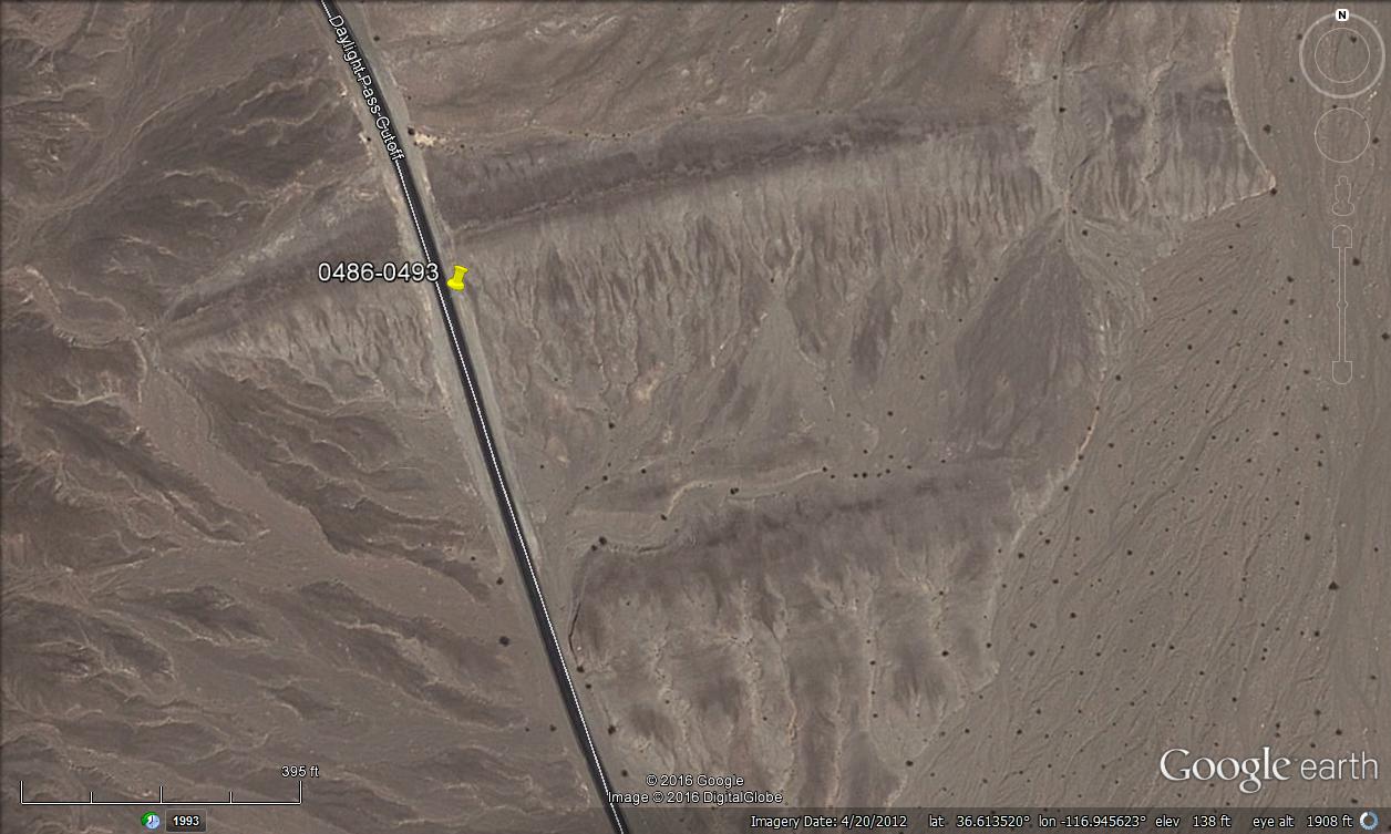
It turns out that this graveled hill is underlain by what has been mapped as Qlc, "old lacustrine deposits" (Workman, et al., 2002), which are late to middle Pleistocene in age. In fact, this is one of two linear ridges, as seen below in a Google Earth image. These might be old spits or bars, and they are marked by lines that might be shorelines.
Google Earth image showing two linear ridges (Google Maps link). The pin marks the approximate location of 3DV006-009 (the previous two photos and the next two).  
Bright desert gold (Geraea canescens) on brown, wrinkled hills of QTa (oldest alluvium). The dark hill on the right is part of the Death Valley Buttes, which is underlain by CZw, the Cambrian-Precambrian Wood Canyon Formation.
Desert gold along one of the rills running southward off the linear ridge.
The dark brownish, low hills beyond the lacustrine ridges and alluvial slopes are composed of more Ts4 (I'm not qualified to say it's Artist Drive Formation), and the high country beyond is part of the Funeral Mountains, largely underlain by late Precambrian and Cambrian rocks. The tilted rocks in a hill or mountain just right of center is shown as Cnbc on our map: the Cambrian Nopah, Bonanza King, and Carrarra Formations. In general, it's the lower far hills and the mountains to the left that are underlain by Precambrian rocks.

While we were stopped at the roadcut through the liner ridge, a photographer told us we should look out for a particular desert five-spot that he had put a rock ring around, which would be up ahead near Milepost 8. Apparently the five-spot is considered one of the more beautiful of the myriad desert flowers, and it is sometimes described as rare.

We drove north up the cutoff road, diligently looking for Milepost 8. Just when we had given up on seeing any mileposts (where were they? hidden? were we distracted by wildflowers and geology??), we found MP 6. From there we counted our way slowly, and pulled over right next to MP 8. Where was the rock ring?

It wasn't far uphill from MP 8, right alongside the road.
Desert five-spot (Eremalche rotundifolium) inside a circle of rocks.
A closeup of the same plant.
The location of this plant (and all the photos) can be seen in the embedded MyMaps map, below.

The sun was low, we were hungry, so onward and upward we rolled, turning back to take one last photo or two looking south toward the mostly shadowed Death Valley.
Looking south toward the Death Valley playa.
Once again, the low, dark brown hills are underlain by Ts4; the wrinkly hill of oldest alluvium that we saw earlier can be seen to the right of the dark hills. Telescope Peak is the faintest, snow-covered peak in the distant Panamint Range, on the right; the Badwater and Mormon Point Turtlebacks can be seen in silhouette on the left, far down the basin toward and beyond Badwater.

=========
This post ends the first day of our Death Valley wildflower trip, although I haven't yet posted about the Titus Canyon leg of this journey. Part 1 was here, Part 2 here. This is Part 3. There has been a geologic component to all of these posts, so far. How could there not be?

I will probably now move all the way back to the beginning of our trip, which began two days earlier and miles to the north under cloudy skies. I'll work my way south to Titus Canyon, which may take more than one post. (Titus Canyon is huge, for geology!)
Selected References:
Greene, R.C., and Fleck, R.J., 1997, Geology of the northern Black Mountains, Death Valley, California: U.S. Geological Survey Open-File Report 97-79, 110p.

Hunt, C.B., and Mabey, D.R., 1966, Stratigraphy and structure, Death Valley, California [pdf]: U.S. Geological Survey Professional Paper 494-A, , 162 p.

Lengner, K.E., 2009, A trip through Death Valley's geologic past: Deep Enough Press, 66 p.

Lengner, K., and Troxel, B.W., 2008, Death Valley's Titus Canyon & Leadfield ghost town: Deep Enough Press, 175 p.

Miller, M.G., and Pavlis, T.L, 2005, The Black Mountains turtlebacks: Rosetta stones of Death Valley Tectonics [pdf]: Earth Science Reviews, v.73, p. 115-138.

Troxel, B.W., and Wright, L.A., eds., 1976, Geologic features, Death Valley, California [pdf]: California Division of Mines and Geology Special Report 106 [several articles].

Troxel, B.W., and Wright, L.A., 1987, Tertiary extensional features, Death Valley region, eastern California [pdf]: in Hill, M.L., ed., DNAG Centennial Field Guide v. 1, Cordilleran Section: Geological Society of America, Boulder, p. 121-132.

Workman, J.B., Menges, C.M., Page, W.R., Taylor, E.M., Ekren, E. B., Rowley, P.D., Dixon, G.L., Thompson, RRA., and Wright, L.A., 2002, Geologic map of the Death Valley ground-water model area, Nevada and California: U.S. Geological Survey Miscellaneous Field Studies Map MF-2381-A, Pamphlet textSheet 1Sheet 2.

Wright, L.A., Otton, J.K., Troxel, B.W., 1974. Turtleback surfaces of Death Valley viewed as phenomena of extensional tectonics [abs.]: Geology v. 2, p. 53-54.

Bonus Photos:
The crinkly, wrinkled hills in a wider view.
A zoomed view of desert gold and the Panamint Range, with Telescope Peak a little more apparent than in the earlier, wide-angle view.
A wide-angle view from the linear ridge.

All photos in this post were taken on Leap Day, 29Feb2016.

Thursday, March 10, 2016

Death Valley Trip, Part 2: More of the Badwater Turtleback Fault

If you remember from a couple days ago, toward the end of the first of, hopefully, a few more posts about our trip to Death Valley and vicinity, we had walked up an alluvial fan down near Badwater and were looking at the Badwater Turtleback fault, which is essentially the entire range front above. Specifically, we were at the smooth, olive-brown surface on the far right edge of this first photo.

Not incidentally, these photos were all taken during the early days of this year's Death Valley "superbloom." We'll see some wildflowers in this post, but I'll be concentrating on the turtleback or detachment fault surface and not the flowers.
The Badwater Turtleback fault surface, looking north. Part, but not all, of the apparent curvature in this photo is from the 18mm wide-angle view (27mm in 35mm equivalent).
I was surprised to find what looked a lot like Quaternary or late Tertiary alluvium—alluvial fan, talus, or basin fill deposits—sitting in the upper plate of this fault, so I took quite a number of photos.
The apparent dip on the alluvial deposits is shallow, dipping slightly back to the east. This is only apparent dip, however.
I wondered if the older alluvium (older than the material on the active fans we had just hiked up) had been deposited right against the fault plane (the turtleback faults are often exposed, with hangingwall rocks having been stripped of by post-fault erosion), or if the deposits were, indeed, cut by the fault. If I could just get closer—close enough to touch the fault plane or the deposits—maybe it would be clear that this was a bunch of post-fault debris covering the fault. I couldn't, and it wasn't. The light brown, fairly poorly sorted material is definitely in the hangingwall of the fault: while there I could see visual evidence of shearing.
In this photo, you can see a more steeply dipping fault cutting the fan deposits in the hangingwall of the main shear zone. The slightly steeper hangingwall fault may flatten toward the main shears, but that's really unclear.
When checking out the literature after the trip, I found that, indeed, the hangingwall of the Badwater Turtleback fault or detachment does contain Pleistocene fanglomerate deposits (Miller and Pavlis, 2005).
Here we're looking up the plane of the fault surface, a kind of disorienting view.
The shadowy blob in the upper right (above) is part of the same shadowy surface seen in the next photo (below), and the light colored mass that looks like it's about to slide down on the photographer (me!) is another, larger mass of hangingwall fanglomerate.
This photo shows more older alluvium in the hangingwall of the turtleback fault surface, with the younger alluvium of a talus cone to the right. Notice the nice greenery with smallish flowers on the talus.
I scrambled upward near the base of the turtleback, but the terrain was a lot steeper than it looks in these photos, and the heat was getting to me some: although it was only 87° F (cool by Death Valley standards), it was a lot warmer than the 30s to 60s that I was accustomed to. Also, I had taken a scary tumble in Titus Canyon earlier that day, and wasn't comfortable with the steep slopes. I probably would have benefited from sturdier boots.
MOH looks up at the fault plane on the south side of the little drainage area or canyon near the base of the turtleback surface.
The same surface, perhaps a little closer.
Fault surface with wildflowers.
Because I couldn't get right up on the fault, I took these photos of a slickensided surface in float. Also, these tiny flowers—white with yellow centers like little daisies, tiny purple blooms, and others—were everywhere along the talus-ridden slopes.
The faint slickenlines are running across the photo here (same piece of float).
We walked back down the fan. It was easier going down, as it usually is, and I took a line more in tune with the recent rills and rocky, sandy washes, which no doubt ran last October when storms washed out numerous roads in the Death Valley area.
The turtleback fault plane is exposed in the shadows of a "slot" canyon just south from where we hiked up. Note the greenery with tiny wildflowers all across the fan.
And here's one of the tiny flowers. Does anyone know what this is?
(It's hard to Google "yellow wildflower death valley" right without coming up with just the desert gold.)
The Badwater Turtleback fault and a bit of desert gold.
We take one last look at the alluvial fan, the flowers, and the Badwater Turtleback. The flower show is dominated by yellow desert gold and purple notch-leaf phacelia.
Say goodbye to Badwater, before we head north.
    Location map:
Selected Reference:
Miller, M.G., and Pavlis, T.L, 2005, The Black Mountains turtlebacks: Rosetta stones of Death Valley Tectonics: Earth Science Reviews, v.73, p. 115-138.

All photos in this post taken on Leap Day, 29Feb2016.

Monday, March 7, 2016

Death Valley, "Super" Blooms, Turtlebacks, and Detachments

Looking southeast from the alluvial fan coming out of Titus Canyon.
When MOH and I came into Death Valley at Titus Canyon (and that's another story) on Leap Day, February 29th, we didn't see very many flowers right off, although it looked like Titus was poised to bloom heavily in a couple weeks or so (will we be back?). We had heard in Beatty that the best area was down near Badwater, so we headed that way, driving south on the paved Scotty's Castle Road (AKA North Highway or Bonnie Clare Road—Clare or Claire, whichever).

Approaching the junction of the Scotty's Castle Road with Highway 190, things started looking up. (By the way, Scotty's Castle Road was closed to the north while we were there, with no known opening date, as was a good portion of the Badwater Road, so be sure to check road conditions if you go!)
Looking southeast toward the Black Mountains, with the Badwater Turtleback coming into view beyond a carpet of gold.
The turtleback is the humped part of the mountain to the right of the varicolored volcanic and sedimentary rocks that sit in the hangingwall of the Badwater Turtleback fault near the Artist's Drive area.

Overall, things did get perceptibly better south of the junction with 190, where we turned on to the Badwater Road.
Our first view of the Death Valley playa, looking south toward Telescope Peak.
In the wash photo above, Telescope Peak is a faint bluish bump at the top of the Panamint Range in the distance on the right. A few footprints cut across the photo in the lower left, probably attesting to one of the many photographers and desert enthusiasts that were in the area during our short visit.

The vast majority of the color—a bright yellow gold—was from one plant, Geraea canescens, AKA desert sunflower, hairy desert sunflower, or desert gold. (I prefer the latter.)

I didn't take very many closeups of flowers, but I got a good one of the desert gold:
Desert gold, just north of Furnace Creek on March 1st.
Desert gold in a dry wash, with a bit of the Black Mountains in the background.
A view of low hills, looking south, from north of Furnace Creek.
We passed through Furnace Creek as quickly as possible, moving even farther south on the Badwater Road. Bicyclists cluttered the highway in places; I think a race or tour of some sort was in progress. We slowed constantly (unlike a few rude and dangerous drivers that I hereby excoriate) for photographers, road-crossers, bicyclists, and other miscellaneous travelers.

Turtlebacks and the salt flat came back into view.
The Badwater Turtleback and the Badwater Turtleback fault dominates this view of the Black Mountains range front.
A bit of the varicolored, Mio-Pliocene Artist Drive Formation is visible in the low hills to the far left, with reddish rocks to the right at least partly consisting of the late Tertiary Greenwater Volcanics in the upper plate of the turtleback fault. The greenish rocks forming the turtleback surface are mostly mylonites, gneisses and marble of the lower plate.
Turtleback and superbloom.
Desert gold (et al), the Death Valley salt flat, and the Panamint Range.
Looking south toward Badwater Basin, the lowest point in North America.
We drove past Badwater, where the parking lot was full, and turned around at a point just past the alluvial fan seen above.

We weren't seeing a lot of flowers at this point, although there was still quite a variety, so we turned around.
I grabbed a photo of this small alluvial fan. You can see some flowers if you look closely.
And I took this photo of a desert five-spot (Eremalche rotundifolia).
Driving north from Badwater, we decided that we had to stop and walk up to this fine exposure of the Badwater Turtleback fault, which is a detachment fault in my book, but may or may not be regional in scale, so may not technically qualify (Miller and Pavlis, 2005).
Detachment fault with superbloom flowers, one of at least two purple types.
Ah, it's only a little farther—and it's only 89 degrees! (That's the temperature in degrees Fahrenheit, not the dip on the fault. The dip was about 45 degrees.)
Fault plane with desert gold on the fan in front of it.
Turtleback fault with various flowers and greenery.
Yay! We're there! What's that in the hangingwall???
    Location map:
I've added a real location map here, because the "Location" feature offered by Blogger (below, where it says "Death Valley, CA, USA") is no longer as functional as it used to be. The default view for this map may change as I publish new blog posts, and I will add additional photos and possibly additional features as I go along. Right now the default view is centered over Death Valley. The purple pins are photo locations.

If anyone knows of a simple way to change Google's embed code to add a centered location and a height ("z" or "zoom") when embedding a MyMaps map, please let me know. I probably won't be able to use java or other fancy attributes here on this blog. The embed code looks like this:
[iframe height="500" src="https://www.google.com/maps/d/u/0/embed?mid=z5SoVdoeVNqI.kHrJd949dnkE" width="500"][/iframe]
Selected References:
Greene, R.C., and Fleck, R.J., 1997, Geology of the northern Black Mountains, Death Valley, California: U.S. Geological Survey Open-File Report 97-79, 110p.

Miller, M.G., and Pavlis, T.L, 2005, The Black Mountains turtlebacks: Rosetta stones of Death Valley Tectonics: Earth Science Reviews, v.73, p. 115-138.

Read more about the "superbloom" here (Geotripper), here (National Geographic), here (NPS), here (Death Valley NPS Facebook page), and here (U.S. News).