Showing posts with label AK1. Show all posts

Thursday, September 15, 2011

Back from the End of the Road: AK2011 Day 8 continued

As we were turning away from the Homer Spit, we spotted a group of cars pulled over, with people running out to take pictures of the large eagle's nest in the top of a dead tree.
The nest held one juvenile eagle — hard to call them babies when they are nearly fully grown and probably about to fledge — and the adult in the picture (Mom? Dad?). Whereas I did get to see the juvenile, I couldn't get a photo.
On the way back, in or just south of Ninilchik, we stopped at one of our favorite coffee places, The Buzz Café, one I've only been to once before which rapidly became a favorite because of its great coffee, convenient location, and colorful character.
The covered sitting area makes it possible to enjoy coffee outside anytime of the year — or at least during the rainy season, not so sure about sitting outside during the snowy season.

---

An Aside: Do you remember Alaska's seasons? There is more than one way of describing or counting these, but the six seasons I'm aware of are summer, fall, freezeup, winter, breakup, and spring. Summer ends with the fall of Termination Dust, which is followed, after a fairly short fall, by freezeup (sometimes called The End) and winter. Freezeup is either a very short season or a specific event, depending on your precision. Breakup can be considered a specific event or a whole season (sometimes a season between winter and spring, sometimes one between winter and summer, the latter arrangement leaving five rather than six seasons). As a season, breakup can seem to drag on and on because of refreezes after unexpected and unwanted mid or late winter melts, followed by refreezing, remelting, refreezing — come on, let's get it over with! Breakup is often considered the season of mud, and people wear special breakup boots. (Read more about breakup boots here and here.)

Breakup the event is marked by the "breakup" of ice in local rivers. In central Alaska, breakup may be defined at least semi-officially as the date, hour, and minute when the Tanana River ice breaks and starts to move downstream. Betting on the timing of this event takes place as part of the Nenana Ice Classic (Tanana, accent on the 1st syllable, is the river; Nenana, accent on the 2nd syllable, is the town.) Tanana River breakup dates through 2010 can be seen on the Ice Classic webpage; also see this NSIDC graph of breakup dates, which unfortunately only goes to about 2000.

---
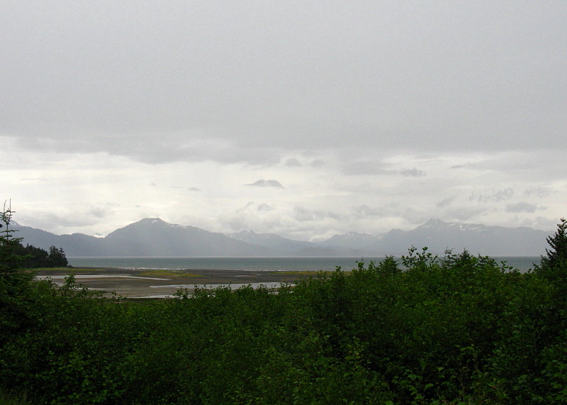
With our coffees still hot, we stopped briefly at the Russian Orthodox church on the bluff above Ninilchik Village, and I walked over to get this view of a muddy town and a cloudy Cook Inlet.
And so ended our trip back from the end of the road, although we still had time and distance to go, and we probably made at least one stop prior to returning to our favorite spot on the river.

(There is more, although my blogging attention span is being stretched here.)

Thursday, September 1, 2011

Homer Spit: Birds and Boats and Coal and Things (AK2011 Day 8)

The Homer Spit, with Coal Point at the end of the spit and Coal Bay near the beginning. From MSRMaps
After leaving the little lunch spot, we passed this (faux) lighthouse indicating that we were progressing on to Homer Spit, where Alaska Route 1, the Sterling Highway, comes to an end.
View of the Kenai Mountains across Kachemak Bay.

It was still rainy as we entered the spit, and powerfully windy. Here and there, we could see signs of campers on the west beach, their tents and gear tied down and heavily weighted against the wind.
Homer Spit is a bustling tourist stop, with places to eat, places sign up for and go out on halibut charters, places to buy touristy things, along with motels, hotels, condos, and B&Bs, not to mention at least a couple scattered bars and saloons. Over the many years of visits to Homer Spit, I've stopped here or there a couple times, mostly for suitable Alaskan lunches of halibut or such, but I haven't usually spent much time on the oft crowded boardwalks.
What I like to do is go directly to the end of the road and park overlooking the beach that wraps around the tip of the spit. (Google Street View of wet, potholed parking area.)

My mom and I were the only ones venturesome enough this time to walk down to the wet and windy beach.
After a storm, or almost anytime the wind isn't blowing as hard as it was, the beach is a great place to find shells and other things. Here I've found lots of rocks, mostly graywacke, and not so many shells. There is one black lump of a rock just above my foot, which might be coal. I'll get to that after a bit.
The beach is a good place to watch the waves, and to look at boats and birds.
Birds...
...and boats...
...and lots of birds, mostly gulls.
Down near the piers, you can sometimes find starfish frolicking in the waves or hanging out on the piers themselves. I've never seen this, but have found tiny living ones washed up onshore.
After not finding any starfish, I notice the coal once again.
Coal washes up on Homer Spit from a variety of sources, including some nearby seams of sub-bituminous coal to lignite found in bluffs cut into Tertiary sediments along the north side of Kachemak Bay. In fact, the Homer area was known for its coal resources long before the town was named in 1896 for con man Homer Pennock, who unsuccessfully promoted gold mining in the area for about a year before hightailing it off to the Klondike. Homer residents still come to the beaches after storms to collect coal to burn.

I leave the coal on the beach, and my mom and I retreat hastily to a drier environment: the car. We head back up the spit.
Here's a famous saloon I've never managed to stop in!
And we say goodbye to Homer Spit, Coal Bay, and Kachemak Bay. I wonder if the low, dark bluffs on the left expose low-grade coal beds.

Monday, August 29, 2011

A Rainy Trip to Homer / No Augustine: AK2011 Day 8

The 8th day started out cloudy, and gradually turned rainy. Here we're heading down to Homer, having already passed Clam Gulch, and having just passed Ninilchik. As we drove by, I was thinking maybe we'd stop at Ninilchik or the beach on the way back, though we hadn't gotten an early start, and I didn't know how rainy the day would turn.
Not much farther on, we pulled over to look at the view across Cook Inlet (in the far distance in this wide angle shot) and to look at the lupines and cow parsnip, which were also blooming alongside fireweed.
It is at about this spot that one might hope for a view of Augustine looking south down and across Cook Inlet. Augustine is an island volcano that last erupted in 2006. Check out these much better images (ha!) at AVO. Augustine (sometimes called St. Augustine or Mount St. Augustine but shown as Augustine Volcano on topo maps) is officially a stratovolcano, one with a central dome and flow complex or cluster; it's part of the Aleutian volcanic arc, and it's the most active volcano in the Cook Inlet area (location map at AVO).
Ah, yes. We arrived at this famous sign, which doesn't mention Homer as a "quaint little drinking village with a small fishing problem," supposedly seen locally on bumper stickers.
Despite the fall-like weather (even for an Alaskan summer), we manage to get this view of the Kenai Mountains across Kachemak Bay. The glacier in the upper left is a small glacier coming out near the Doroshin Glacier (not visible farther left or in the clouds). It probably has a name, but not on topo maps available to me (MSRMaps location).
Before a late lunch, we stopped briefly at the Alaska Islands & Oceans Visitor Center, which has some interesting wildlife and ocean displays and a nice little gift shop, where I bought art notecards of two puffins and four ravens.
The Visitor Center parking lot overlooks a small mud flat just below Beluga Lake (MSRMaps location).
That's Grace Ridge, tucked behind Sadie Cove and in front of Tutka Bay, across the flats and across Kachemak Bay.
By the time we finally stopped for lunch, the rain had become a downpour. Sitting outside was out of the question, although at least one brave (or crazy?) soul was out in the weather.
I had to take a picture of this "Local Organic Wi-Fi" sign, which I noticed when we were leaving the organic lunch joint.

A Couple Augustine References:
Power, J.A., Coombs, M.L., and Freymueller, J.T., eds., 2010, The 2006 eruption of Augustine Volcano, Alaska: U.S. Geological Survey Professional Paper 1769, 667 p., 1 plate, scale 1:20,000, and data files.

AND (part of above) Section 2: The Geology of the 2006 Eruption.

Related Posts:
Wordless Wednesday: I Love the Color of the Water

Record Reds

Down to the Kenai: AK2011 Day 4

At the Cabin: AK2011 Day 4

Fishing for Reds and Other Miscellany (including a Volcano): AK2011 Days 5-7

Wordless Wednesday: Seen at Homer

Monday, August 1, 2011

Down to the Kenai: AK2011 Day 4

Looking across the Turnagain Arm fjord at our general destination, the Kenai Penninsula, that flat area west of the edge of the Kenai Mountains.

It is in the usual order of things for us to make our way down to the cabin as soon as possible after arriving in Alaska, sometimes heading out as early as the first or second day. This time, we drove down on the fourth day.

It is also in the usual order of things for everyone to travel in one vehicle, but this time we took two: the truck needed to get to the cabin so it could be in a position to conduct cabiny things like putting the boat in the water.
Hard to tell for sure with the clouds, but this is most likely Mt. Spurr (MSRMaps), a volcano west of Anchorage and across Cook Inlet (AVO Webcam). It last erupted in 1992.

We made our way eastward down Turnagain Arm on AK State Route 1, the Seward Highway, without making the usual stops at Beluga Point to check the tides or at Girdwood to get coffee. We speculated about the tides, and whereas I thought the tide was possibly going out, the wind was very strong, creating huge easterly waves that obscurred the water motion. The tide books indicated that the tide was either almost all the way in, or just starting to go out, but I didn't try hard to parse the time differences between Kenai and Anchorage and then to translate those times to the arm.

I looked for Beluga whales, but it was early in the summer: they follow the fish, especially the silvers and humpies of August. It was only the late run of July reds that was just beginning to come up the arm; I looked for Belugas nonetheless.
The light on the water of the arm is always fascinating to me. Here it's flickering in thin patches just below the last major valley on the south side of the arm, Seattle Creek.
I seem to photograph the valley of Seattle Creek every time I pass through: it's a great example of a U-shaped valley carved by a glacier that once entered into the larger glacier that carved Turnagain Arm.
We passed the turnoff and viewing area for Portage Glacier near Portage and made the turn at the east end of Turnagain Arm. Crossing the second bridge across the Placer River — a river typical of anastomosing rivers and streams coming off ice fields and glaciers, in this case the Spencer Glacier and a small icefield northwest of the larger Sargent Icefield — I could look northward up the Placer into the valley of the Twentymile and Glacier Rivers (MSRMaps).
Welcome to the Kenai!
The fireweed was in relatively early bloom: when the flowers at the top are blooming it indicates that fall and Termination Dust are just around the corner. Here, only the lower flowers are blooming.

We skipped a usual stop at Summit Lake Lodge in favor of continuing onward to the Sterling Highway (still AK Route 1, but no longer the Seward Highway).
Near Cooper Landing we began to catch tantalizing glimpses of the Kenai River, a river we would soon fish.
We bypassed the cabin, needing to run to town to purchase fishing licenses, thereafter going directly to Buckets for dinner.
We both had the Sunken Island IPA by Kenai River Brewing.

Related Posts:
Getting There: AK2008 Day 1
Turnagain Arm: AK2008 Day 2
We Make the Turn: AK2008 Day 2
Summit Lake and Beyond: AK2008 Day 2
Fireweed in Alaska: Is it Fall?

Friday, March 19, 2010

The Lodge at Matanuska and Back Again

We were finally done with our afternoon lunch, so we walked out onto the front porch of the Long Rifle Lodge, ready to leave. The Open sign, hung in the window of the bar, still looked welcoming - especially when a quick survey of our outdoor surroundings showed limited visibility through snow.
A view of the hillside across the street from the lodge - yes, snow is still falling, though it's not falling sideways. Turn around and go back in? We didn't.
Gas is available here, one kind, one price (didn't check it).
A bear watches over our imminent departure from the roof ridgeline.
A sweet blue-eyed dog says goodbye.
The trip back down the Glenn Highway was nearly the same as the trip up - though it seemed faster - until we got to about Sutton and Granite Creek, where we started to see sunlight shining beneath clouds on the southwestern horizon. Here, the sun lights up part of the Talkeetna Range north of the highway.
The setting sun creates a yellow-orange glow to the south as we approach the confluence of the Matanuska and Knik Rivers.
While crossing the Knik, we had a distant view of Sleeping Lady to the west.

We drove past Eklutna, not stopping, and back to our starting point somewhere in Los Anchorage.

Wednesday, March 17, 2010

An Alaskan Lunch Overlooking the Glacier

After our long, seemingly endless drive up the Glenn Highway, we finally arrived the Long Rifle Lodge. We pulled in, parked right next to the entrance, and went inside - where we were welcomed by this testy character, who was thankfully behind a railing.
One great viewing spot for glacier watching is the windowed room beyond the shadowed bear. We were the only ones at the lodge when we arrived (besides our hosts), so we had our pick of tables. I was all for sitting at one of the far tables overlooking the snowed-out glacier, but others were chilly.
So we took a table right next to this fine wood stove.
I went outside. Down at the corner of this second-floor porch, you can see the glacier - on a clear day, not on this day.
Another porch corner has good viewing, and a telescope to boot. The Matanuska Glacier would be in plain view beyond the telescope and above the trees, were it not for all the snow and low clouds.
Back inside, we spent some time admiring this great ammonite fossil. This specimen could be from several local formations including the Cretaceous Matanuska Formation, which is known to contain ammonites and other marine fossils along with some plant fossils (Merritt, 1985, p. 45-46).
The inside of the lodge has its walls and empty floor spaces filled with Alaskan artwork, maps, historic paraphernalia, old rifles, and mounted animals.
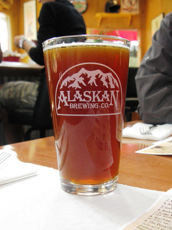
We got ready for lunch: some of us started with hot chocolate, some with Alaskan ale of one flavor or another.
After lunch, on the way out, I looked into the bar area and spotted this bear having a bottled beer.
What kind of beer? A Big Sky Brewing Moose Drool (from Montana, not Alaska). Wonder if the bear drinks anything else - will try to remember to check that out next time!
And because today is St. Patrick's Day, I've added a photo of a Northwest Coast art piece with a little green in it. I'm sorry I didn't get the artist's name or location.