Showing posts with label jeep. Show all posts

Tuesday, September 1, 2020

Northumberland via old Highway 8A

Before I get very far into this blog post, I have to say that the Blogger interface, with its recent "upgrade," now sucks due to sudden changes in the way the HTML works. First off, the code for each photo is different than it used to be, such that I have to go back to older posts to duplicate spacing at the top, bottom, and left margins. I mean, I guess if I was 100% prolific with HTML, I wouldn't have to do that, but every time they’ve done one of their upgrades, I’ve had to modify the way I enlarge the photos to the right size, and have to recreate or copy the HTML that controls the way my photos display—and quite frankly I do give a damn!

Back to our trip. As I mentioned earlier, it was hot, so I didn't stop very often on my trip down old Highway 8A (now S.R. 305) from Battle Mountain to Highway 50 near Austin, en route to the Northumberland caldera. I did, however, make a point to stop at an old stone house along the Reese River—possibly the original Walters Ranch, though the USGS map shows the ranch down in the green valley closer to the river.
The old place is holding together fairly well, though it looked a little more rundown than the last time I stopped.
A closer view of the entry area, with quite a bit of carved graffiti.
An old rusty stove sits in the ruins of the old stone house, below the caved-in roof and amidst the partly discombobulated walls (stove = dark patch in lower right of photo).
The roof has slumped more than the last time I stopped, which might have been as long ago as 2012. The meadow beyond—the valley of the Reese River between the Ravenswood mountain range on the west and low hills that lie more or less between the Shoshone and Toiyabe Ranges on the east—is often quite green; here it's looking a tad dried out.

At 12:29 pm, toward the end of my little stop, it was 96°F.
A little farther south I drove past the location where FMOH and I canoed meanders of the Reese River back in 2006. This time, the meanders were choked with dark green sedge and the river was too narrow for a canoe. 

My next stop was Austin, for gas. I prefer to be fully fueled when traveling the back roads of Nevada. After fueling up, it was up and over Austin Summit on Highway 50, then up to Bob Scott Summit, where I stopped briefly for a pit stop and to consider Bob Scott as a campsite. But no, I wanted to keep going. Scattered clouds hovered overhead, and a light sprinkle hit the windshield. At 1:20 pm the temp was 84°F.

Beyond Bob Scott, it was downhill to the turn off on old 8A (now S.R. 376) into Big Smoky Valley. I thought about the old camp on Bowman Creek as a possible camping location, but blew that off. I was shortly at the turnoff to Northumberland Canyon.
In this photo, taken just past the turnoff from pavement, Northumberland Canyon is almost 12 miles across Big Smoky Valley as the crow flies. The mountain range that we're looking at, on the east side of the valley, is the Toquima Range; the singular mountain to the right is Mount Jefferson, third most prominent peak in Nevada. I've been to about 11,400 ft near the North Summit. The South Summit reaches 11,941 ft.
I arrived at the western mouth to West Northumberland Canyon at about 2:30 pm and pulled off on a side road where I had a relatively elevated view of Big Smoky Valley and the Toiyabe Range beyond. A low area in the mountain range (just left of center in the photo above) marks the drainage basin of Kingston Creek. The tiny town of Kingston sits on Kingston Creek, right at the range front. Bunker Hill, the rounded peak right of the low spot, reaches 11,473 feet in elevation.

* * * * *

2:45pm: It's now 92°F. I just walked a short ways up the dirt road behind the Jeep, thinking I'd check the road to the range front, but I gave that up for the heat. Instead, I'm sitting next to the Jeep in a lawn chair, enjoying the view. A few clouds overhead look threatening—possible T-storms. I won't cross the flash-flood prone Northumberland Canyon dry wash until...well, hopefully the clouds will dissipate. The crossing right now would be perfectly fine, but if the canyon floods, I'd be stranded on the other side. A long time ago, there was a road across Big Smoky Valley going back to 8A north of Kingston, providing a possible escape route if stranded; I have no idea if that road exists anymore.

There was a huge wipe out of a flash flood in West and East Northumberland Canyons back in 1979. Heavy barite ore from the small mine on the west side of Northumberland Pass was washed down canyon, as was a USFS truck. Fortunately no one was inside the truck.

Back in 1978, in the reddish hills across the dry wash of West Northumberland Canyon (behind the Jeep in the photo above, or somewhere in the low part of the reddish hills in the photo below) I left a standard Estwing rock hammer leaned against an outcrop of tuff as scale for a photo. I've looked for the hammer a couple times, both before and after the mega flash flood of 1979. I suppose it's part of the drainage, downstream somewhere. But who knows? Maybe it's still there, leaning against the outcrop.
The reddish brown tuff of Hoodoo Canyon, 31.4 Ma, overlies whitish volcanic and volcaniclastic rocks that include Ts6, an air-fall tuff related to the tuff of Hoodoo Canyon, and Ts5, 4, and 3—and possibly Ts2 and 1—which are all intracaldera sediments deposited after the partial collapse of the ~32 Ma Northumberland caldera and before deposition of Ts6.

2:53 pm: I've frequented this valley, these parts, since before 1978. In fact, the first time I camped in the area was up on Pete's Summit in 1976, after seeing the Ordovician graptolites in the Vinini Formation while on a grad school field trip. It's my country, I feel, and if I had a house up here on this pediment, I'd sit outside and stare at the basin, the way I did back in 1979-81 when the company put me up in a small cabin above Kingston. There's usually no no one around for miles, for at least ten to fifteen miles. The view is awesome.

It's 4:27 pm now,
and I've crossed the wash and moved to the site we used to call the Hot Spot, so named for it's anomalous gamma radiation and U3O8 minerals. From the camp I've chosen, I can look northwest toward Kingston Canyon, east into Hoodoo Canyon, and south toward Northumberland Canyon. The wind is coming in from the northwest, and it's 91° F in my little camp. It's five hours to sunset according to the hand method, though at five hours away, the method is grossly inaccurate.

4:51 pm: I'm cracking an All Day IPA. Until the sun is lower, I won't set up camp more than I have already, which is only to remove the ice boxes, the water cooler, and folding chair. I'm somewhat low on ice, and the beer isn't the coldest beer in the world, but it's refreshing. And now the sun has come out from behind those formerly threatening clouds, so I've moved into the shade of the Jeep. A tree would be nice!

* * * * *
As the sun got lower, I drank my cool beers and had a minimalist dinner of chips and dip. The sun finally went behind the clouds hovering over the Toiyabe Range. I watched the sunset colors change, took many photos, marveled at the yellow-orange crepuscular rays, took more photos, and basked in the quietude of the area.
Virga and a cliff of Northumberland Tuff glow reddish orange.

I had another beer or two and took more photos. At some point, the sun went down, but with the Toiyabes in the way and no connection for my cell phone, I could only estimate the time of actual sunset, guessing it to be about 8:05 pm. According to SunCalc, the sun set at 8:10 pm at my campsite. The hand method referenced earlier gave a time of about 9:25 pm—off by almost an hour and a half! (It's more accurate within one to three hours of sunset, especially when there aren't any mountain ranges looming above the true horizon.)

By 8:43 pm, I had my headlamp on, using the red light setting. It was way warm for sleeping, but I didn't check the temperature by turning on the Jeep. Overall, it felt strange to be camped there in the middle of nowhere during the middle of a summer heat wave. And for some reason, I felt creeped out by a long ago memory of a lone mountain lion in the Toquimas, so I didn't want to sleep outside the Jeep, making for a night that was hotter than necessary. Eventually, I slept, albeit restlessly.

Tuesday, November 8, 2016

From the Road: Storms

I got kind of bogged down with traveling and went light on the posting. Part of this has to do with the nature of posting from the road. I decided not to try to post using a mobile connection, for various reasons, and so that meant that I needed a wifi connection at night. One night, that was unavailable. Additionally, my chosen destination had me so busy that I didn't hardly touch the computer, even though I had great wifi. While there, I had Other Priorities.
Jumping cholla fruit.
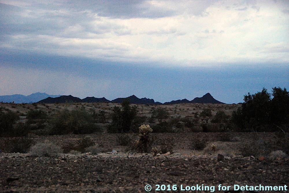
And so, here we are back on the alluvial fan coming southward off the Whipple Mountains, camping under cloudy skies.
The camp is fine, although the vehicle unmodified is an uncomfortable place to sleep. And it was crowded, because when it started raining I had to move most things back into the Jeep. And then ... lightning. At first the flashes were distant, south of the Big Maria Mountains and north of the Whipples. But it rained, and depressions in the desert pavement filled with water, and I worried about the major wash I had crossed: Would it flood?

I tried getting photos of the lightning, and this is as close as I came: a leftover bit of the strike over to the left, hitting behind the darker pointy hills (a light-colored line going straight down, probably easiest to spot if you know where it is).
After awhile, I dozed a little. Then it was suddenly quite bright, the flashes making me think that surely someone was bombing the area, although there was not much sound at first. I sat up and looked around, and it gradually became clear that the blinding flashes were bolts of lightning, this time all around, moving closer, until some thunderous crashes were finally within less than a mile. Would I be hit? Is a plastic topped Jeep as safe as an all metal pickup truck? I still don't really know, but I wasn't hit, and eventually the second downpour stopped. Finally I actually slept.
Turtle Mountains before they were obscured by rain.
Turtle Mountains in the morning.
In the morning, the wash was fine.
The road was its usual rolling self.

Thursday, April 14, 2016

Death Valley Trip, Getting There: Highway 95, Redlich, Columbus Salt Marsh, and Another View of Boundary Peak

After lunch, MOH and I drove back into Mina and turned south on Highway 95, continuing our journey toward our next stop (shown above and way down below), and our more distant destinations of Beatty and Death Valley, .


As a rule, I don't write much about U.S. Route 95—that preeminent north-south highway in the west ultimately connecting San Luis, Arizona with the Eastport, Idaho, border crossing into Canada—although I see that this is the 25th post tagged 95. I personally have traveled over a good deal of this road, missing out only on the southernmost portion south of Yuma and most of the northernmost section north of Moscow, Idaho.

Through Nevada, Highway 95 wanders around quite a bit, attaining a nearly north-south bearing only within four relatively short sections: 1) the Winnemucca to McDermitt section, 2) a section south of I-80, running from Trinity to Hawthorne, 3) the Tonopah to Lida Junction section, and 4) the section running from Boulder City to the California state line. Much of 95's wanderings, especially those that occur between Hawthorne and Las Vegas, are caused by the highway's attempt to stay within the state while being subjected to Nevada's western diagonal border. To do that, the road keeps cutting east, then south, then east again, every now and then actually attaining near parallelism to the diagonal, while completing three major south-to-east curves. These curves are at Hawthorne, at Coaldale Junction, and at or just south of Beatty.

From Hawthorne south, there are several opportunites for an unsuspecting traveler to veer from Highway 95 into California; a few of these occur at the three main south-to-east curves. (I always think of 95 as though I'm headed south, not just because in this series of posts that's the direction we've been and will be going, but probably because I'm often eyeing it from a northerly position.) The first—and second—potential deviations into CA from Highway 95 occur in Hawthorne, a town now largely bypassed by most road warriors. At the main light (the only light?), you can access both of these routes by driving south on paved S.R. 359. This road will take you south and then southwest into California, where it will become California S.R. 167. You'll end up on the north shore of Mono Lake south of Conway Summit. I don't think I've ever made this trip in either direction, but maybe, back in the way distant past... Prior to that, however, you have what I consider an even better opportunity to cut into California: Take the dirt road over the Wassuk Range into the Borealis mining area, past the Aurora turnoff, and then meander along the East Walker River north of Bodie to Nevada S.R. 338 and California S.R. 182, paved roads that will almost directly have you in Bridgeport, CA.

At Coaldale Junction, Highway 95 joins U.S. Route 6, essentially coming to a T while making it's second grand curve to the east. If you are persuaded to turn west, you might end up in Bishop, CA, by way of Basalt, Montgomery Pass, and the small berg of Benton. But before that, near a little jog at a place called Tonopah Junction, you might get suckered into heading into California at what is essentially a Y with S.R. 360, which cuts over to Route 6 at Basalt.

Beatty, just north of the third south-to-east bend in Highway 95, offers two alternatives for anyone wanting to leave the state before ending up having to drive through Vegas; both options require a sojourn into or through Death Valley. The most obvious of these escape routes is the paved Daylight Pass road, S.R. 374 in Nevada, which leaves Beatty at it's only stoplight. But before you make it to the stateline on this paved road, a one-way dirt road cuts straight west into Death Valley by way of Titus Canyon. We'll be taking that latter road later (ha!), and we'll be visiting the Nevada-California stateline along Route 6 even later than that.


MOH and I watched ourselves at Tonopah Junction, to make sure we didn't accidentally get sucked into California before we were ready. After ignoring said cutoff, we begin our ascent up to Redlich Summit.

We passed the turnoff to the Candelaria mining district, and soon arrived at Redlich Summit, an apparently obscure summit with surprisingly poor location information on the web (see my location map for the actual location if you are interested). Redlich Summit lies just north of an old gold exploration project mapped and drilled by Former Mining Company in the late 1980s, which we always called just called "Redlich." A little bit of Redlich's geology and exploration history can be found here and here. In the second linked report, it would seem to me that the reporting geologist confused Former Mining Company for another exploration company with formerly similar initials.

I had thought about stopping at Redlich to take a couple pictures for a story about the area, but we breezed on by in favor of looking for some ferrimolybdite, which as you might suspect from it's name, carries some molybdenum (Mo). I wasn't sure exactly where the collection spot was, but remembered it was at a color anomaly caused by hydrothermal alteration. We pulled off the highway just south of the main hill at the old Redlich property.
Some drill roads at Redlich, on the south side of the hill sometimes known as Conglomerate Hill (also seen in the first photo).
The canary yellow ferrimolybdite that I remembered from some field trip back in the late 70s or early 80s, maybe the same one I had learned about plating copper from what looks like plain-ole Mn-oxide while working for Northern Exploration Company, had been easy to find along a dirt road just west of the highway. I could tell without spending much time that this first pullout wasn't the spot, but we looked around a bit anyway.
The view from south of Redlich, looking SE toward the Monte Cristo Range.
A somewhat weak desert pavement had formed in the area.
While walking up the drainage looking for ferrimolybdite, I spotted this nice specimen of a cholla.
It's probable that the ferrimolybdite site noted for the Red Hill area (sometimes conflated with the Redlich mine, as in this Mindat list), is about 2 miles south of where we pulled out. We missed the turn, somehow, and instead pulled out at the historic marker for Columbus, an old borax mining town located to the west along the edge of the Columbus Salt Marsh.
Historic marker #20 can be read here. Boundary Peak in the White Mountains is out there beyond the salt flat.
I zoomed in to get a closer shot:
The north end of the White Mountains.
Montgomery Peak (13,441 ft or 4097 m) is a mere blip of a hill in California; Boundary Peak (13,140 feet or 4005 m) is the highest point in Nevada.
We turned back south, drove by Coaldale and made the second big south-to-east curve toward Tonopah and beyond.

Location map

Related Posts (in order of posting):
Death Valley, "Super" Blooms, Turtlebacks, and Detachments
Death Valley Trip, Part 2: More of the Badwater Turtleback Fault
Death Valley Trip, Part 3: Northward, and over Daylight Pass
Death Valley Trip, Getting There: Wave Clouds beyond the Sierra
Death Valley Trip, Getting There: A Hike to Pleistocene Shorelines

Death Valley Trip, Getting There: Walker Lake, Road Stories, A Bit about Copper, and Some Folds near Luning

Death Valley Trip, Getting There: A Jeep Trail, Folds and Cartoons of Folds, Even More Folds, and Boundary Peak

Tuesday, December 8, 2015

Twelve Months of LFD (2015)

I'm doing the year-end meme wherein I compile the first sentence of the first post of every month. Meme rules are as follows, as per DrugMonkey:
Post the link and first sentence from the first blog entry for each month of the past year.
I've also added the photo from the same first post, if there happened to be one. I've removed any captions from the photos, so if you want to find out more about locations, etc, you'll have to click through. The first sentences include some classically long, LFD-style sentences, one short sentence, and many that are in between. Previous takes on this Twelve Month meme at LFD were posted for 2008, 2009, 2010, 2012, and 2014.

Aaand...here's the year 2015 for LFD:
January:
A year ago today, a thin snow highlighted some Lake Lahontan shorelines on basalt-capped hills out in (or near) the Fernley Wildlife Management Area (FWMA):

February:
Yesterday, when out hiking in nearby Water Canyon (before the Super Bowl), MOH and I slowly (at least for me) made our way up a variably steep, grassy to rocky hillside until we came to a large rib of quartzite.

March:
Well, I'm back at the place I was working at about two years ago (see these three posts for more info), spending more time on a back paved road and on dirt roads than I was most recently while on the road to work (I'm still driving on the interstate some, but a lot less than during the last two years).

April:
It was a very windy day as I drove south along what's variably called the Surprise Valley Road or the Sand Pass Road (and to the north, is often called the Smoke Creek Road) into the Pyramid Lake Paiute Tribe's Reservation.

May:
It is often — more commonly than in the past, IMO — hazy or dusty in north-central Nevada where I routinely work and often travel, here and there across basins and over ranges.

June:
An El Niño has supposedly set in (starting when, exactly, I'm not sure).

July: Nada. Zip. Zero.

August:
Neil Young: Rockin' in the Free World (lyrics) Album: Freedom, 1989
This is technically a road song because it mentions streets twice and roads once, and because the video that came out with the song also shows a lot of streets.

September:
There I was minding my own business while flying north from RNO to SEA (that is to say, I was reading a thick book and trying to ignore a seatmate while crammed against the window near the rear of a Q400), when I looked out (to the east) and spotted the peak of an Oregon volcano sticking out through what I first thought was a low, thick cloud cover.

October:
South of the Klondyke District (our previous stop on this journey) and just north of Goldfield, one reaches one of the northernmost populations of Joshua trees (Yucca brevifolia)—or the northernmost population, depending on what range map you use.

November:
In later years—in the future of the 1976 "present" of these ongoing thesis-hunt stories—I made my way back into the Palmetto-Magruder area barely a handful of times.

December:
When I pulled up to Lida Summit two years ago—I was on my way to a property examination and had decided to check out the Lida and Palmetto areas—I stopped right in front of...a roadcut!

Friday, March 6, 2015

Back on a Sometimes Muddy Road

Well, I'm back at the place I was working at about two years ago (see these three posts for more info), spending more time on a back paved road and on dirt roads than I was most recently while on the road to work (I'm still driving on the interstate some, but a lot less than during the last two years). I find that I prefer the back roads and the dirt: I feel a bit like I'm going out in the field every day, although I'm really not.

It means that the road is sometimes wet, muddy, snowy, icy, or sometimes it has been recently sprayed by a water truck or recently magged. I decided to take a few pics of what that looks like on my jeep (in this case, the road had been sprayed by a water truck to keep the dust down). I wasn't actually on the road to work when taking the pictures, but instead had pulled over on a convenient side road while traveling elsewhere after a couple/few days at work. Consequently the tags include two locations; the post location (below) links to the photos.
The front of said jeep, the Eugene Mountains in the background.
The right side, with part of the East Range in the background.
The rear tire looks low, but isn't.
The rear and left sides. That's a high part of the East Range with the snow.
And the door handle area of the left, driver's side door.

Tuesday, September 23, 2014

Dust Hole

I was out driving around the other day, basically following I-80 from Lovelock to Reno, and I decided to take what I thought would be a short side trip, getting off at Toulon to check out a bit of remaining old Highway 40 just east of the Humboldt Dike.

After checking out the old alignment, I thought about turning around and going back to Toulon to get on the freeway, then decided to go on toward the old site of Trinity, where U.S. 95 south to Fallon meets I-80. Go forward, not back! To do this, I drove southwest on an easy portion of what turned out to be a long, tedious, and very rocky section of powerline road.

Near the top of the first rise, the road narrowed and turned rocky and then went into the first of a series of sideways excursions across several large and small washes coming south out of the south Trinity Range. Near the bottom of the first of these washes, I pushed my way through a small silt hole (I was already in 4WD in order to go slower over the sharp volcanic rocks). Rather than stopping and backing through the thing or trying to turn around at this somewhat late point (and thinking that Trinity would be just over the next rise), I kept going, only to suddenly find myself heading into an immense, roiled dust hole cut into old Lake Lahontan lake sediments (or Tertiary intra-volcanic sediments). I leaned on the gas pedal, thinking that if I came to a stop in the middle of the hole, I would be stuck and would have to send a SPOT help message or walk out to I-80 (or both). Waves of dust washed over the jeep covering it entirely, and for the last part of the hole, I couldn't see a thing. I didn't have time to turn on my window wipers, which probably wouldn't have helped anyway, and I kept going like a person with their eyes shut, trying to remember the next part of the road from the brief glance I had gotten.

I made it through, and instead of stopping to take any pictures of it, I continued on, just wanting to get the hell out of there. After a steep bit or two through rocks I actually scraped over a little (this is hard to do with the excellent clearance the jeep has), I arrived at the top of the next rise.
On an obscure powerline road, looking southwestward toward Trinity.
From the top of the rise, I could see that I had at least one more major wash to cross and more than a mile to go. At this point, I was just short of half way there (although I didn't really know that at the time), and I knew that I wouldn't be turning around to go back to Toulon, because I wasn't going to drive through that second dust hole twice in one day. (Or ever again!)
Here, I'm looking northeast across the wash I had just crossed.
Both dust holes are visible in the photo enlargement below, just right of the powerline in roiled, light-colored sediments in the center of the broad wash area:
From looking at this in Google Earth, I'm pretty sure that only the beginning of the second dust hole (the one closest to us) is fully visible in the photo.
I was running enough adrenaline right then, that I didn't try harder to get a better picture — I was focused more on getting out of there as quickly as possible and getting back to the highway!  I hurriedly cleaned the dust off the windows of the jeep, and drove on toward Trinity.
The view of the second hole that I would have had if I'd walked back over the hill a short distance.
When I got to Trinity, I took out the air filter out of the jeep and shook the dust out of it.

View Toulon to Trinity in a larger map

After getting onto I-80, I accelerated to traveling speed (warp 7.5+ or 75-80 mph; warp speed terminology on roads and highways explained here), leaving a trail of dust behind me for several miles, perhaps as far as about halfway to Nightingale Hot Springs.

Phew! Maybe I'll go back someday to get a better photo of the hole. Maybe.

(See embedded Google Maps view above for location of all geographic points of interest mentioned in this post.)

Wednesday, January 8, 2014

My Travels in 2013 (A Belated Travel Summary)

I apparently haven't participated in the Year of Travel Meme since 2010, possibly because I traveled back and forth across the same old roads in 2011, 2012, and 2013 -- or possibly I was just too busy at the holiday time of year to get that kind of blog post together. This year, Evelyn Mervine got her Year of Travel 2013 post up right at the end of the year; I'm getting mine up before the end of January, 2014. What follows is a brief summary.

January: Returned from a trip to Alaska.
Spruce on snow.
February: Visited Unionville, NV, in scenic Buena Vista Valley, stopping to take a photo of a cabin that purportedly once belonged to Samuel Clemens (Mark Twain).
Old cabin.
March: Visited Leach Hot Spring in Grass Valley, NV, and Kyle Hot Spring in Buena Vista Valley.
Leach Hot Springs.
At Kyle Hot Spring, looking across Buena Vista Valley toward Unionville.
April: Drove within sight of Wheeler Peak in eastern NV.
Wheeler Peak seen from Highway 50.
May: Drove by and contemplated the badlands near Rye Patch Dam several times.
Looking west from I-80 just south of Rye Patch Dam.
June: Drove several parts of old Highway 40 in Nevada, including this one near Humboldt House:
Old 40 looking northeast between Humboldt House and Imlay.
July: Crossed the Humboldt River, drove on the Applegate Trail past Haystack Butte, and visited Sulphur, NV, host to large piles of sulfur and scattered old junk.
Sulfur at Sulphur.
August: August was the month in which MOH and I rapidly toured parts of five western states. I blogged about the trip a little, but not as much as I hoped. Besides places already mentioned, we stopped briefly at the North Rim.
Distant view of the San Francisco volcanic field from the North Rim,
with the cherty Kaibab Limestone in the foreground.
After so much travel in August, I apparently didn't go anywhere until the last day of October.

November: Family matters took me to Alaska, where I took very few non-family-related photos.
Mt. Susitna. A little more about the "Sleeping Lady," as she is often called here,
and a bit about the Sleeping Lady brewpub here.
December: Another trip to points north.
Mt. St. Helens, Spirit Lake, and the Toutle River.
It is, perhaps, a little too late for this post to be considered part of a 2013 travel meme, but if you haven't posted a travel compilation for the year yet, feel free to take my cue and give yourself til the end of January!