Showing posts with label copper. Show all posts

Tuesday, April 5, 2016

Death Valley Trip, Getting There: A Jeep Trail, Folds and Cartoons of Folds, Even More Folds, and Boundary Peak

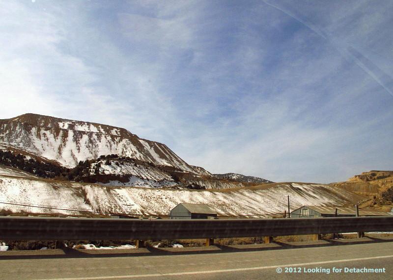
An unnamed portion of the Gabbs Valley Range.
From the vantage point of the end of the last post, a little southwest of Luning, Nevada, I turned around and pointed my camera northeast across Soda Spring Valley ... and paused to think back to the late 1980s, when we in the Western District of Former Mining Company had finally taken over exploration of the Walker Lane, which until then had been a mostly unexplored part of the Nevada District. We drove all the roads in the area—up canyons, over ridges, and across saddles—and one thing I remember in particular was coming over the top of a low ridgeline from the east, on a jeep trail that dived and went into a series of moderately sharp switchbacks as it approached some old mine workings.
The road in question is below the arrow.
Ah yes, the memories. We found a gold-bearing skarn—it's not quite in view in the photo above—and after some sampling and sketch mapping, we debated targeting some drill holes, but decided it was too small for our target size.

Back to the road itself. Coming over the top from the east (something I'm not likely to do in any near future that I am aware of), the road immediately drops and dives around a curve, making it hard to judge the condition of the road ahead. We maneuvered to some particular point and stopped. What the H! We would have to do a bunch of walking to actually explore the area anyway, so maybe it would be better to stop here at this turn-around spot than to go farther and find that the road requires backing up on steep slopes around sharp turns.

I don't really remember how we handled the sampling logistics. Sometimes it's easiest to drop a couple people off near the top and then meet them at the bottom later in the day, after they've sampled the upper slopes and you've sampled the prospects in the lower hills. Or maybe after a bit of walking around, we found the road acceptable and drove on down.
The road as seen in Google Earth. It's downhill to the lower left (SW).
The Google Earth view of the road is somewhat impressive *in* Google Earth; here's the Google Maps link in case you want to find it on Google Earth.

The view from the upper part of the jeep trail was grand. I've tried below to simulate the view by sloppily stitching together two Google Earth images:
Walker Lake is off in the upper right (W), Luning is just left of center on the other side of the beige plain (SW); Mina is out of the picture to the left (S). 
After grabbing the first shot or two, I pointed my camera more to the east—a little north of east, to be precise—at a folded part of the Gabbs Valley Range, another area we explored back in the late 1980s.
The notable landmark of this part of the Gabbs Valley Range is a dark pimple of a peak to the right of center: Volcano Peak.
Volcano Peak is not a volcano; rather, it is underlain by tilted beds of the Upper Triassic Luning Formation, which consists mostly of limestone, dolomite, and shale.
Zooming in, we get a better view of Volcano Peak and can identify a few old porphyry copper drill roads that probably date back to the 1960s or 70s.
In a similar Google Earth view, we can begin to see a fold nose, centered and just above the dark line (a Google Earth artifact).
I've cropped this image so I could zoom in farther. The upper drill roads are more apparent. Volcano Peak is now on the far right.
It can be fun to take a shot at the geology by drawing lines on photos like these, or on air photos. Drawing without checking the geology first can be chancy, if one is concerned about being right, as can drawing without checking the geology in the field afterward.

Before checking the geology, I came up with the following cartoon, wherein I assumed many features to be stratigraphic beds, and assigned a few other features to faulting.
Here's my first cartoon, with presumed bedding in cyan and a few tentative high-angle faults in dark purplish blue.
I wondered if the central dashed line across the first cartoon was a low-angle fault of some kind.

After concocting the first cartoon, I checked out the geology as mapped by Ekren and Byers in 1985. It turns out that I missed a large blob of quartz monzonite (mapped as JKqm).
The quartz monzonite is outlined in red.
The central line, which was dashed in cyan in the first cartoon, has now been drawn in dark blue, a mapped fault. It's a high-angle fault, however, and it's just our angle of viewing that makes it look horizontal. (Here we can see why apparent dip matters so much: from this angle, the dip looks to be nearly zero; in reality, it is closer to 90 degrees, although that's a guess, as there is no measurement of it on the geologic map.) The quartz monzonite is cut by this high-angle fault, which is down-to-the east, dipping eastward away from us. I left in the cyan bedding emphasizing the fold, and I left in my still tentative high-angle faults in dark purplish blue (toward the right).

These two cartoons show the problem with assuming too much from photos (or air photos). Features that look like bedding might, when field checked, actually be faults, dikes, or other structures like joints. In this when case, we checked the cartoon against a geologic map of relatively small scale, 1:48,000 or 1 inch = 4000 feet.

Somewhere in these canyons, way back in the late 1980s, we came across an old, partly broken-down core shed. The shed was mostly intact then, but the core had started to become scattered, either from vandalism or from the escalating disintegration of the core boxes (or both).


By this time on our trip to Death Valley, it seemed that we should be farther along, but we hadn't even gotten to Tonopah! So we moved on, but almost immediately we decided to stop not far down the road: it was getting to be lunchtime. Just before Mina, we pulled off the highway onto a major dirt road that goes eastward between the Gabbs Valley Range and the Pilot Mountains.
Looking southeast toward the Pilot Mountains from a broad alluvial plain above the town of Mina. Pilot Peak is hidden from view behind the unnamed, lightly snow-dusted, >8500-foot-high peak.
A lot of folding, thrusting, and possibly some low-angle normal faulting has occurred in the Pilot Mountains. In fact, the area is (or should be) one of the type localities for the Luning-Fencemaker fold-and-thrust belt.

While eating a cheese-bologna sandwich, I took a few photos of some of the folds. Some recumbent folds are actually better viewed from another road, but I forgot about that until looking around in Google Earth.
Folds! This is probably mostly Luning Formation limestone and shale, with some Tertiary volcanic rock in the lower left.
More folds!!
The potential here for great fold photos only increases with time spent in the area, and driving up into the hills would do the same.
I turned away from the folds to take this shot of Boundary Peak.
I grabbed this photo of Boundary Peak, hoping that MOH and I would get even closer later in the trip (and we did!). The photo shows both Boundary Peak (the highest peak in Nevada) and the higher Montgomery Peak, which is right behind it and slightly to the right in this photo—look carefully!

We'll continue our journey after lunch. We'll be stopping at Redlich and the Boss Mine. We'll see desert pavement and a cholla. We'll see Boundary Peak again. We might spy some breccia and a solar power plant.

Location map

Related Posts (in order of posting):
Death Valley, "Super" Blooms, Turtlebacks, and Detachments
Death Valley Trip, Part 2: More of the Badwater Turtleback Fault
Death Valley Trip, Part 3: Northward, and over Daylight Pass
Death Valley Trip, Getting There: Wave Clouds beyond the Sierra
Death Valley Trip, Getting There: A Hike to Pleistocene Shorelines
Death Valley Trip, Getting There: Walker Lake, Road Stories, A Bit about Copper, and Some Folds near Luning

Tuesday, March 29, 2016

Death Valley Trip, Getting There: Walker Lake, Road Stories, A Bit about Copper, and Some Folds near Luning

MOH and I left the area where we had stopped to hike (shorelines, remember?), and we steered steadily south—south to south by east—between the steep eastern face of the Wassuk Range and Walker Lake's western shore.

It can be hard to drive by Walker Lake without stopping for photographs, though I find myself doing that more often than not. Sometimes the lighting is off, with the sun high in the sky or at the wrong angle, other times the lake and mountains are obscured by a pervasive haze. Consequently I have few good photos of the lake. I got lucky in the spring of 2008.
Between a rock and a guardrail: the steep eastern side of the Wassuk Range, looking north along Highway 95.
I've always found this precipitous range front fascinating when driving past at 40 to 60 mph (o_O)—the granitic rocks along the range front look shattered, presumably munched by the Wassuk Range fault zone—but I've rarely pulled over to examine anything closely because of unusually minimal standing room on the inboard side of the highway.
Looking south toward Hawthorne from a pullout near what is now the north end of Walker Lake.
A strangely stitched agglomeration of six photos. Notice the pronounced shorelines in the foreground and in the distance on the left.
Driving toward Hawthorne, I had hoped to skirt town by breezing through on the hazardous waste bypass road, but our gas gauge read low enough to make me wonder if we would make Tonopah. I suspected there would be no open gas stations between Hawthorne and Tonopah. (It turned out that there weren't any, open or not!)

The first station we stopped at in Hawthorne was immediately frustrating for some reason, so I went to another station. The second station seemed to be still residing in the dark ages, without usable card readers, so I went inside. "Do you want to fill up? Leave your card here," the attendant said with her hand out. I looked at her like I'd never heard of such an archaic procedure, and she relented, "Go ahead, take it with you, just be sure to pay after." I filled up and went back in to pay. She apologized for the inconvenience, but I wasn't convinced that their card readers were actually broken. I thought it was at least 50-50 that the station was just trying to get customers inside to buy a drink or a snack or two. But maybe the out-of-order signs were legit...

For some reason I found the whole having-to-stop-in-Hawthorne situation just almost too much to handle, even though the city used to make you drive into town no matter what. Now there is a bypass. Then there was a great little Shell station at the downtown corner where you turned left after stopping at the town's single red light. It was a perfect opportunity to get excellent gas.

We pulled back onto the 4-lane part of Highway 95 near the west edge of Hawthorne and turned right onto the bypass.


Two things come to mind when I go through Hawthorne. First, I'll remember a dream I had once where I took the Hawthorne bypass and drove around town, north to south, and the bypass itself seemed to be the whole point of the dream. Second, after turning east onto Highway 95 at the south end of the bypass, my mind will go into a driving reverie and take me back to a time in the late 80s. I was telling someone that if I had enough money, I would quit my work in minerals exploration and just go out and map. Here or there. I'd seen a lot of places I thought were interesting, and I loved mapping. So, I'd just go out and map. And I'd start a map publishing company.

My unnamed sidekick said that mapping should have a point. Like I shouldn't just go out and map; maybe instead I should try to figure out something in particular about the geology of the area. I disagreed. The USGS mapped tons of quads and the whole point was getting the entire area (the West? the U.S.?) mapped. My mapping would be more detailed than quad mapping, and I would just go out and do it. Maybe I'd start right there—up ahead in the volcanic rocks near the pass outside of Luning. Maybe I'd start at any of several places I'd already done some detailed mapping, part of the point being to make the mapping available to the general population of geologists working in the area, not just to one exploration company.
Volcanic rocks in the Benton Spring area of the Gabbs Valley Range, about 7 miles north of Luning.
I drive east, my mind goes into this same reverie, and I remember that time—and how, when it came down to it and I had some money and some free time, I didn't do that.


MOH and I drove into Luning, and rather than stop at the Luning Rest Area, we took a dirt road going toward the hills of Black Dyke Mountain, accidentally choosing a road that would have eventually delivered us to the Blue Ribbon Mine. It was in this area that I learned how to test for the presence of copper in black Mn-oxides by using cold, dilute HCl to plate copper onto a rock hammer. This method tests for copper wad or neotocite (a hydrated Mn-silicate sometimes containing enough Cu to be considered an ore mineral), or a few other black copper minerals such as chalcocite and tenorite.

Not too far ahead, in the low hills of Black Dyke Mountain, we spotted some folds in unknown rock formations:
Folded, contorted rocks in the hills less than 2 miles SW of Luning.
Zooming in on the folds.
And that's it for this part of the road trip! We'll continue on towards Tonopah and Beatty next time.

Location map

Related Posts (in order of posting):
Death Valley, "Super" Blooms, Turtlebacks, and Detachments
Death Valley Trip, Part 2: More of the Badwater Turtleback Fault
Death Valley Trip, Part 3: Northward, and over Daylight Pass
Death Valley Trip, Getting There: Wave Clouds beyond the Sierra
Death Valley Trip, Getting There: A Hike to Pleistocene Shorelines

Monday, August 25, 2014

Rhyolite Porphyry from Majuba Hill III

GSN field trip Day 2: We've taken a few Majuba Hill samples out of the bag.
We'll now take a look at the farthest right sample, having already seen
Rocks #1 & #2 and Rock #3.
One side shows a weathered surface, with dark brown iron oxides and the copper carbonates malachite and azurite.
I suspect that the reason I picked up this rock was because of the mineralized appearance of the outer surfaces. I probably had no idea this rock would turn out to be yet another sample of rhyolite porphyry when I grabbed it off the dump. Scratching the iron oxide reveals it to be goethite mixed with jarosite — according to the old Bear Creek porphyry copper exploration method matching oxide color to a complex triangle of powdered goethite, hematite, and jarosite with mixes in between. The only partial example I can find of this method online can be seen here.
A fresh surface of the same rock.
Zooming in on the fresh surface, we can see that we indeed have yet another sample of rhyolite porphyry: 
Although the former feldspar phenocrysts are nearly completely gone to black tourmaline needles with a scattering of brown iron oxides (goethite + jarosite) and greenish to blue-green copper minerals, the gray, fresh-looking quartz eyes are clearly recognizable.
What's really interesting about this rock is the white to gray matrix.
The matrix of this current hand sample is considerably more altered than that of our previous sample, Rock #3: The matrix is shot through with tiny tourmaline needles and finely disseminated sericite. Additionally, the tourmalinized feldspar sites within this rock contain only minor copper minerals when compared to the feldspar sites of Rock #3. I was a bit surprised at this lesser amount of copper after spying the obvious blues and greens of copper minerals on the weathered surfaces.

And here's another surface of the rock, one showing a moderate amount of reddish brown iron-oxide (hematite + jarosite), a pale bluish green copper mineral (or combo of minerals), and black tourmaline.
The iron oxides are very fine-grained and powdery, and from a few boxworky textures, I'd say that they at least in part replace former sulfides (probably copper sulfides judging by the color of the iron oxides). Quartz phenocrysts are visible in the light olive gray right hand side of the sample (these are easier to see in person with a hand lens than in this photo because of the shadows in the photo).

And that's the last of our rhyolite porphyry samples, at least of those that haven't been brecciated!

Rhyolite Porphyry from Majuba Hill I
Rhyolite Porphyry from Majuba Hill II
Rhyolite Porphyry from Majuba Hill III (this post)

Wednesday, August 20, 2014

Rhyolite Porphyry from Majuba Hill II

GSN field trip Day 2: we're still at Majuba Hill.
Continuing with our progression from left to right of rhyolite porphyry hand samples, we move on to Rock Number 3, a weakly mineralized version of the tourmalinized porphyry. (Rock 1 and 2 were seen here.)
The feldspar sites in this rock sample contain needles of tourmaline, and powdery white sericite with a soft, blue green copper mineral.
An enlargement of the left part of the same photo.
I'm unclear as to the timing of mineral deposition in the altered, mineralized feldspar sites. Which came first, the tourmaline, the sericite, or the copper minerals (all after the original feldspar phenocrysts)?

The blue, green, and turquoise-colored copper minerals include at least include one spot of azurite, a few spots of possible malachite, and widespread possible chrysocolla — but at Majuba Hill, there are several bluish to greenish copper minerals that might be present (see this mineral list for Majuba Hill), including parnauite and goudeyite, both of which were first identified at Majuba Hill.
Another view of the same rock - this time the right part (turned sideways).
Which came first? I'm still wondering. Maybe we could use some thin sections (not that I have any to offer, sorry).

We'll move on to the highly altered rock on the far right (second photo) in a third episode.

Friday, October 18, 2013

Across the West and Back Day 2: Are We Lost Yet?

We left this meandering trip report almost two weeks ago, after MOH and I had taken our short hike into the limestone at the Grassy Mountain Rest Stop. From there to Salt Lake City, we cruised while admiring the shorelines of ancient Lake Bonneville.

Lake Bonneville shorelines in the southern Lakeside Mountains, looking northeasterly from I-80 about five miles northwest of Delle, UT.
And then: Salt Lake City.

Driving into SLC can make me somewhat apprehensive unless I'm going directly to the airport, and I had already started wondering if I was getting a migraine — possibly from normal trip concerns, possibly from driving, maybe from poor sleep the night before, possibly from some other, unknown cause.

I had looked at our route on Google Maps and had looked at the interchanges and major turns in Street View. Examining the route online is not the same as having a physical map in hand while driving (or in the navigator's hand, as the case may be) — at least not for me, or at least not unless I have some ingrained or recent familiarity with the particular roads in question. The last time I'd driven (or been driven) east through SLC without turning onto I-15 to go either north or south was in 1957 when I-80 didn't exist — and the 1957 trip definitely didn't count as recent, maybe more like Ordovician, or even late Precambrian.

I knew I was looking for the turnoff from I-80 to U.S. 40 — not that far past SLC, I thought — but I don't think I'd written down the miles to the exit, and I know I hadn't written down the exit number. And for some mysterious reason I was thinking that Park City (which I've never been to, except possibly on that long ago 1957 trip) was a lot closer to SLC than it really is.

Consequently, when the interstate turned a bit to the northeast and headed upward into the fairly tight canyon of Parleys Creek, I instantly freaked and thought it was the even narrower Echo Canyon, which I remembered from coming west out of Wyoming on I-80 on a 2006 trip. I was sure I didn't want to be heading into Wyoming on I-80, so I thought I must have missed the desired exit up somewhere near Park City (!).

I turned around at the first opportunity amidst a rash of roadwork, blocked exits, and narrowed lanes.

I knew I needed a map, so we got off at what turned out to be Exit 4 on 215. We pulled into a gas station and got some gas and a relatively small scale map of Utah. It was at this point that I was sure I had a migraine — and migraines do this funny thing to your overall thinking and analysis skills.

After examining the map while experiencing fairly moderate noise, light, and motion sensitivity that caused me to have problems looking at the map and then looking anywhere else, like at the road, I decided we were on an "outer" loop around SLC that I was previously unaware of. (This "outer loop" actually consisted of I-84 from Ogden, east and southeast to I-80 at the beginning of Echo Canyon, and south and then back west into SLC on I-80, but that part of I-80 wasn't marked, neither was 215 marked, and the insert for SLC was surprisingly small and lacking in detail.) We were actually at a gas station along the 215 partial ring road, and I probably knew that fact when I had turned on to it after turning around in Parleys Canyon.

I figured all we'd have to do was get back onto this previously unheard of "outer loop" and head east or south to our desired exit onto U.S. 40 near Park City. Wrong.
The map in question.
By this time, MOH had wisely taken over the driving while I endeavored to determine our exact location. With a blur of freeway lanes, cars and trucks, and exits coming too fast to comprehend (this should have given me a clue), what I was seeing on the map (how could Alta and Snowbird already be north of us?) wasn't matching the route I'd incorrectly figured was the one we were on, and it wasn't matching my still intact knowledge of where we really were along the Wasatch.

Suddenly, the "outer" ring road turned due west, and I knew something was very wrong. I realized where we had to be (on the "inner loop" road, i.e. 215) just in time to navigate properly and direct us onto the exit for I-15 south. Whew!

At this point, we thought it would probably be just as easy to take the next road south over the Wasatch than to turn around and go back for I-80, Park City, and U.S. 40. As for this thought: not exactly correct.


View Our Crazy Route through SLC in a larger map

Because we went (unexpectedly, for sure) south on I-15, I was able to get a pretty decent, albeit somewhat grainy, shot of the Bingham Canyon copper mine.
View of the Bingham Canyon copper mine, looking west from I-15.
It has been quite a while since I've been to Bingham Canyon — and I've never had a tour into the pit itself — but I strongly recommend going to the overlook and Visitors Center (the latter of which I've never seen) when they are reopened. The overlook area has been closed since the April 10th landslide (see a pre-landslide panorama of the pit here, view Kennecott's photos of the slide here, and read about the slide on several blog posts by Dave Petley).
Looking east toward American Fork Canyon.
And so, with our most recent trip decision finally behind us, we proceeded down I-15 to the Utah S.R. 92 exit, onto 92, and into the Wasatch via the easy, wide-looking American Fork Canyon.


View Day 2: Elko, NV to Vernal, UT in a larger map

The embedded map above shows the location of the three photos in this post (and also the rest of the Day 2 photos already posted, if you move around inside the map or view it in an enlarged version).

Related Posts:
Across the West and Back Day 2: A Hike along a Limestone Ridge
Across the West and Back Day 2: Across the Salt Lake Desert
Across the West and Back Day 2: A Side Trip in West Wendover
Across the West and Back Day 2: Pequop Summit to West Wendover
Across the West and Back Day 2: Looking for an Old Roadcut
Across the West and Back: The First Day
Intro to Recent Western Loop Trip

Friday, March 23, 2012

Goodbye...

...to the old mine.
Hello, way off in the distance, to the new.

I've started a new contracting/consulting job in a new place, a gold mine up on one of the Nevada gold trends, a move from copper to back to gold. I'm still in exploration rather than production, that aspect hasn't really changed. Some of the particulars have changed, some particulars remain the same or nearly the same. (The same and not the same: geology, geochemistry, drill rigs, core, RC chips, logging, samples and sampling, microscopes, cross-sections, various investigative instruments, PPE, geologists, techs, support contractors and companies, etc.)

The gold trend mines (Carlin trend, Eureka–Battle Mountain trend, Getchell trend, and Midas trend) are often, though not always, a long way from towns and cities (primarily Elko, Carlin, Eureka, Battle Mountain, and Winnemucca). The two major companies and some smaller companies facilitate transportation to the mines with busses and vans. My regular 10 hour work days are now lengthened by 45 to 60 minute drives or rides in both directions. My time from doorstep back to doorstep in the morning to late afternoon or early evening runs from about 4:30 am to about 5:00 pm, sometimes a bit earlier or later depending on variable logistics. Consequently, the time I currently have available for blogging is a little limited.

I'm also getting resettled in the new town, not really quite yet moving out of the old town in the hinterland of eastern Nevada. This process may take as much as a couple-three months. In other words, I'm fairly busy on my days off. There is also a whole new area to explore and investigate.

I'll post when I can!

Wednesday, November 23, 2011

The Contact at Contact

We continued on toward the small bordertown of Jackpot, Nevada, having passed out of the Great Basin by dropping into the drainage of Willow Creek – which joins with Dry Creek, which joins Jakes Creek, which enters Salmon Falls Creek near the railroad siding of Henry. Salmon Falls Creek then flows north, eventually emptying into the Snake River below Twin Falls. Skies were clearing somewhat, and snow was no longer thretening.

A few miles south of Henry, China Mountain rises into view east of Highway 93. China Mountain is a good place to see an intrusive-sedimentary contact at 70 mph. The generally rubbly or knobby looking rocks on the far north side of China Mountain are outcrops of the granodiorite of the Jurassic Contact pluton. It’s intruding late Paleozoic limestone and marble (and possibly other associated sediments and metasediments): the layered and moderately dipping beds across most of the mountain.
Here I’ve drawn the approximate contact in hot pink. Granodiorite is to the left (Jgd on this map); limestone and marble are to the right (PMl on the same map). Where I’ve ended the contact, it dives under undivided Miocene to possibly Pliocene tuff, ash, and sediments (mapped as Ts3).
The granodiorite of the Contact pluton shows some spectacular spheroidal weathering between Henry and the small outpost of Contact. This view to the west of the highway, taken just a couple minutes beyond that last photo, shows the granodiorite in the foreground, with Ellen D Mountain in the background. Ellen D is underlain by the same late Paleozoic sediments seen on China Mountain; the contact between the granodiorite and the sediments runs behind the wonderfully knobby mass of granodiorite and the base of Ellen D Mountain.
What isn’t clear from the highway, is that the intrusive contact passes eastward from the present site of Contact, runs west toward Ellen D Mountain, then curves southward. All along that contact, the topo map of the area (from MSRMaps) shows a series of old mines and prospects dug into mineralized, contact-metamorphosed rocks right along the contact. These are some of the mines and prospects of the Contact mining district, which were prospected originally for gold, but have been mined mostly for copper. The original mining town of Contact was moved from its original site fairly early on prior to being relocated a second time at its present location.
While we drive by Ellen D Mountain, the highway passes through some roadcuts in the Contact pluton. The knobby knob on the left and the low mass on the right are in granodiorite. The reddish brown hill to the far right is in Tts: rhyolitic ash-flow tuffs probably about 10 to 12 million years old, possibly erupted from the Bruneau-Jarbidge eruptive center to the west.
After stopping briefly in Jackpot, to gas up and grab a snack, we crossed the Idaho line at 1:20 pm PDT, 2:20 Mountain Time. Jackpot is not the only town in Nevada that operates on Mountain Time.

Oh, by the way, here's my take on the naming of the various contacts. First, the Jurassic granodiorite intruded the Paleozoic limestone. Later, uplift exposed the contact between the Jurassic and Paleozoic rock formations. Much later, people came along prospecting for gold and copper; they were attracted to the contact for various reasons, not the least of which was probably some nice float of copper oxides and copper carbonates. When they staked claims, they listed the claims as being in the Contact mining district, which they named after the mineralized contact they were so hot on. They set up a town and called it Contact, after the mineralized contact and the mining district. Eventually, all the nearby mining districts in the area were consolidated into one district called Contact. The order of the naming and founding of the latter two (Contact the mining district and Contact the town) is entirely speculative on my part.

I have a bit more information on this part of Highway 93, from south of Wells to the stateline, in an earlier post, here.

Map References:
Hope, R.A. and Coats, R.R., 1976, Preliminary geologic map of Elko County, Nevada: U.S. Geological Survey, Open-File Report OF-76-779, 1:100,000

Sheet 3 of the above, covering our area of interest in the upper left.

Sheet 6 of the above, the explanation for the entire map.

Monday, September 5, 2011

Report on an Afterwork Field Trip

This will be a brief field trip report from an undisclosed place and an undisclosed time. In fact, other such field trips over the years, whether during or after work, might be worth reporting on occasionally, mostly sans photos.

It was a sunny afternoon, approaching early evening, and several colleagues and I passed by some broken and brecciated road cuts while on the way to our various evening destinations, wherever they might have been. The purpose of the rather spontaneous mini field trip was to shoot the bull about the meaning of the road cuts and see if we could figure anything out—in other words, to get our creative thoughts flowing. Lines and crude cross-sections were drawn in the dirt on the side of the road, with less crude versions drawn in some field books.

Our first stop was essentially a mess of fractured, broken, and shattered rocks showing varying degrees of iron-staining and oxidation. Some jarositic-looking, weakly clayey limestones formed a possibly arched, upper zone above more typically calcite-veined dark gray Devonian limestone cut by hematitic seams and hematitic fracture-fill fines. Discussions ensued about what iron-oxides were staining the rocks and filling in fractures. A reddish coloration—reddish brown to reddish orange brown—in a batch of rocks, sometimes present in broad areas or even over whole mountains, is supposed to be a good sign when one is looking for the upper oxidized to leached portion of a porphyry copper system — at least according to a few old-timers who told me about such things back in the late 1970s when porphyry copper exploration had come to a standstill after what turned out to be a long-term decline in the price of copper.

---

An Aside: A long time ago, Bear Creek or Minefinders developed a color triangle for determining the composition of various limonites or generic to mixed iron-oxides. Powdered pure or nearly pure jarosite (a sulfate containing iron that can form as a weathering or oxidation product of pyrite) was placed in a circlular spot in the upper corner of the triangle, powdered pure goethite was placed in the lower left corner of the triangle, and powerdered pure hematite was placed in the lower right corner of the triangle. Three other circles were placed between the three corners, each composed of 50-50 mixes of the appropriate two of the three main powders, and one circle in the center contained the three end members mixed together. To summarize the triangles main colors, jarosite is pale yellow to white when powdered or scratched, goethite is the typical dark golden brown of the average "limonite," and hematite is its typical reddish brown. I've looked high and low for an online version of this field cheat sheet that consisted of stiff cardboard with clear plastic- or cellophane-covered circles of powders with appropriate labeling, but have yet to find anything resembling the original. Perhaps I'll draw up something similar to the original and go further into this little exercise in crude field determinations sometime at a later date. For now, back to the field trip.

---

I developed a question or two as we were standing beneath the large fractured to brecciated mass of structurally complex reddish to yellowish brown pile of carbonate rocks: (1) were we looking for copper and (2) doesn't the same guide to ore (red rocks and reddish color anomalies) also apply to finding porphyry molybdenum deposits? I also wondered (3) haven't red rocks been considered a guide to ore in at least some disseminated gold districts, for example at and around Florida Canyon? The answers: (1) maybe [seriously, what we were looking for was actually in question], and it is good to define what you are looking for without getting so stuck on what you've decided to look for that you can't see the possibility of finding something else, (2) yes, for sure, something I first learned from other not-quite old-timer types, also back in the late 1970s, and (3) well, of course, but not everywhere.

Our impromptu field trip then moved down the road to stop number two, where a breccia of unknown origin was exposed in a particularly hairy road cut on a tight curve with narrow shoulder and the occasional speeding vehicle. The breccia reminded me of the Titus Canyon megabreccia: mostly angular fragments of dark-colored carbonate rock were cemented by white, crystalline calcite. I thought it looked like a breccia of possible hydrothermal origin, one in which fragments had shattered but not moved far. It also looked a bit like a tectonic breccia, though no faulting surfaces were exposed. The expounder leading this part of our field trip said it could be a collapse breccia that formed over an oxidized massive sulfide deposit. Oxidation of sulfides produces volume loss, leaving a potential collapse waiting to happen. I'm not sure how the calcite gets into position to cement the breccia together, it somehow having to push the fragments apart to exploit the collapsed zone, but some long, thin beds of shaly limestone could be seen to be sagging downward in a couple places, testifying to possible collapse. Perhaps the breccia was really fragment supported instead of apparently matrix supported, in which case the calcite could have moved in later with groundwater or low temperature hydrothermal waters of some kind.

Resulting major questions arose from the two field trip stops and all the bull that was being shot around. One major one that was oft repeated: Should we drill here? Or there? Or over there? Everyone wanted to choose their own drill hole or two and locate them in specific favored spots. Another question: Should we sample here? The answer to that question? If you have to ask the question and don't just pile in with your bags, labels, and rock hammers, the answer is an automatic yes. Conclusion: get on with it! ASAP.

And so ended a spontaneous early evening field trip to two undisclosed field trip stops, along an undisclosed highway, at some vague undisclosed time within the last 10 to 30 years.

---
Torrent, José, and Barrón, Vidal, 2002, Diffuse Reflectance Spectroscopy of Iron Oxides (see page 1441 for Munsell color of some iron oxide minerals).

Somewhat Related Posts:
Some Thoughts on Weirdness, and A Picture (or Two) (or Three)
Megabreccia II: More Photos
Megabreccia III, the Continuing Saga

Monday, April 4, 2011

A Bit about Rosemont Copper


I received, via email, this promotional video about the proposed Rosemont Copper mine in Pima County, Arizona, and decided to post it. In some ways, it's a typical coroporate PR video, with an overly bright, cheery voice in the background — worth watching, neverthless. We used to view a lot of things like this at Former Mining Company: movies telling us how great the company was, how great our mines were, how great our hiring practices were, etc. Is there some reason these PR vids can't be made by real people? The real people in the video are, for the most part, much better spokespeople for the mine, IMO, than the PR voice that talks mostly about the nice day, pleasant festivities, and good food.

The fact booklet, made by the same PR company, is worth reading: it goes into some of the uses of copper, why we need it now, and why we will continue to need it in the future. If you are reading this blog post, you are using copper.

Rosemont Copper is a project of Augusta Resource Corporation. To learn more about Rosemont, see these posts at Arizona Geology, and read this pro and con list at Green Valley News & Sun.

I make my living through mining and through exploration to find ore for mining, and I don't find open pits as unsightly or unpleasant as some apparently do. In fact, I find them fascinating — small or large, active or inactive, old or new — and they are great places to see geology exposed in a three-dimensional setting.

Monday, June 28, 2010

Enargite from Goldfield

I've got a couple final mineral pictures from Goldfield, NV. The first two are of enargite and pyrite in a quartz matrix, with a fair amount of iron-oxide and possible jarosite.
Enargite is metallic, often dark gray, and it's orthorhombic — although the crystal form doesn't show well in these examples, and instead the enargite masses look almost globular. A key feature with these enargite specimens are tiny little pyrite crystals, the pyrite being in a bipyramidal (octahedral) form. Our field trip guide said that the occurrence of bipyramidal pyrite at Goldfield was often related to enargite, and that when one sees bipyramidal pyrite, one should start looking for enargite and other ore-related minerals (and gold).
Here's another example of what the enargite looks like, this time without much (or any) pyrite.
Enargite is a copper arsenic sulfosalt sometimes found at porphyry copper districts and at high-sulfidation epithermal gold districts like Goldfield (also see this report on a high-sulfidation system in Mexico).

High-sulfidation epithermal gold deposits used to be called quartz-alunite deposits, because of their dominant alteration minerals. "High sulfidation," which is really an adjective but is sometimes used as a noun, isn't something you can necessarily see in the field (it doesn't always indicate the existence of a high percentage of sulfide minerals, though abundant sulfides are common in high-sulfidation systems), so I prefer the old term, quartz-alunite. That preference definitely dates me as an oldtimer.

The opposite of quartz-alunite is, generally speaking, quartz-adularia (or quartz-sericite); the opposite of high-sulfidation epithermal is low-sulfidation epithermal. The former classification system is based on descriptive field terms; the latter is ultimately chemical or geochemical.

Friday, September 25, 2009

Friday - Back from the Road

Yes, we are finally back at our little house, back from being gone for a whole two weeks, traveling back and forth between Reno and the lake - back and forth, back and forth - more times than I care to mention. We stopped in Middlegate on our return; hence the photo, looking to the east through the window and screen door of Middlegate Station toward Middlegate The Place. My mind feels just about as clear as the hills and mountains look.
The night before, Middlegate The Place, with the Shoe Tree visible through the notch, looked serene in the evening light, as the sun went down and turned the Desatoya Mountains red.
Looking the other way, West Gate showed no sign of it's usual windmill, which was still lying on the ground waiting for repairs when we drove through.

Care to make a phone call?

We had great burgers, decent to good beers, and played a few uninspired games of pool. The usual Middlegate drama was taking place in the bar, though we heard only bits and pieces, off and on.

I'm in some kind of muddle-headed state and somewhat incapacitated regarding decisions about travel - which courses and field trips should I take, what stops along the way should I make. I'm travel-worn and peopled out. (People-worn and traveled out?)

Above: Tangled, prickly, but still blooming (Russian thistle AKA tumbleweed ).

Prior to leaving two weeks ago, I had plans to visit yet another past field area in the next couple or three days, then non-finalized plans for side trips on the way to and from the coming GSA meeting. I have, today, been wondering about changing my GSA plans (once again) in order to make it to a poorly scheduled SEG field workshop on uranium deposits in Albuquerque, which would mean flying to Portland instead of driving, would mean leaving GSA two days early because the course overlaps with the meeting even though they call it "post-meeting," and would mean flying from Portland to Albuquerque and then flying back to some possibly nearby (or not) western airport.

Or, instead of that, I could go to an expensive field course on copper deposits in Arizona, which conveniently follows - by several days so as not to be too crowded in time and place - the Northwest Mining Association Convention in December. The copper course is run by people who know what they are doing. (Not that the uranium course isn't, mind you.) I'll probably do the latter (copper). I'd need to sign up for the uranium course today; I'll need to sign up for the copper course by next weekend. Besides, the price of copper is holding; the price of uranium isn't.

The sign said Middlegate, but where were we, really?

While crossing Eighmile Flat on our way to Middlegate, we were approached rapidly from behind by two flashing, wailing, Churchill County sheriff vehicles. They beat us to Middlegate by several minutes. Why were they there? Does anyone really know? Hopefully the answer will not be found in Stephen King's Desperation, which I am currently reading.

Other questions need to be answered - will I stay one night with a cousin on my way up to Portland? Will I spend more than one night at the lake on the way? Will I make an Oregon detour on my way back? Or should I just blow all that off and fly up to Alaska for about a week. Maybe I'll just stay here and stare at a wall until I regain some internal mental composure.