Showing posts with label rt08. Show all posts

Saturday, January 3, 2009

RoadTrip Update: Bloggers Meet!

While on the road over the holidays, I had the great good fortune to meet two bloggers on my way through Colorado.
The first was ReBecca from Dinochick Blogs. We met at a Starbucks and chatted for a couple hours. Above: ReBecca in Starbucks. I'm the one taking the photo (ha!).
I also met Wayfarer Scientista, a self-proclaimed
"ologist" and wanderer. Having never met an ologist before, I had quite a lot to learn about ology. We had some great times wandering around her mystery town and thereabouts. Above: Wayfarer and I with a "paint" background. I can't hardly tell us apart in this photo, and, as you can see, we both favor gray and have almost identical hair. Amazing!

Anyway, thanks to both of you for taking the time to meet me. Hopefully we'll meet again!

Thursday, January 1, 2009

Happy New Year!

Here's a Happy 2009 to everyone, with a photo of the last sunset of last year, 2008. I thought about getting up and taking a photo of the first sunrise of this new year, but needed to sleep in. I'm still recovering: mostly from the flu-bug, but also from traveling.

Yesterday, travels started in the cold ice fog of Grand Junction and continued into the not-quite-so-cold ice fog of Utah's Sevier desert. That was quite an unexpected adventure, which could have been avoided by spending the night in Delta, Utah. Another almost adventure could have been avoided by filling the gas tank in Delta, Utah. Fortunately, although the gas pumps at the Nevada-Utah border truck-stop were either broken or empty, there was gas available at a card-reader station in the small town of Baker, Nevada. Otherwise I might still be at either the truck stop or in Baker, waiting for a gas delivery or pump fixing.

The year has started out with various geolutions, resolutions, and predictions going around the geoblogosphere.

Resolutions:
The poll (Clastic Detritus).
The results (my choices came in first and third, but many items on the list were not geared toward my line of work - surprisingly!)
Resolutions for Safer Slopes (Dave's Landslide Blog)

Geolutions:
Christie at the Cape
NOVA Geoblog
Magma Cum Laude
10 ABSOLUTELY BEST Resolutions for Geologists (Andrew's About.com) - This list is great! The first thing on it is "See More Rocks." Not only do I wholeheartedly ascribe to much if not all that is on this list, I'm pretty sure I can at least succeed on the first one! And I like that.

Predictions:
Clastic Detritus
Geotripper
Green Gabbro
Hypo-Theses
[And stay tuned, in case more geo-predictions come through geoblogospheric crystal balls or pizzas.]

With all that, one might suspect that I would now chime in with some resolutions, geolutions, or predictions - but I typically don't get around to that sort of thing until late in the month, and besides, I have my New Year's Year-End Letter to write (some people call those Christmas Letters), and first thing, I've absolutely got to knock out this dang bug! [I don't know if I've ever said "dang" in real life, but I have met a few people who do, and some of my favorite people say "darn" on occasion.]

I'd also like to point out that I missed out on December's Accretionary Wedge and January's Scientiae due to general and overall holiday-type busy-ness. The former blog carnival may not be published yet, but the latter is, and has many good posts relating to the closings and openings of various doors, and much relating to the ending of one year and the beginning of another. Currently, I'm not sure of my status with respect to certain doors, but the doors I'm aware of don't seem to be opening or closing with precise calendrical timing.

Last but not least, this morning I met up with MOH for the first time in almost two weeks. He has been working - and taking only the usual time off - while I was out visiting relatives. He did have time while I was gone to get in a few overnight snow hikes and camps, but that's another story...

Saturday, December 27, 2008

RoadTrip Update: Holidays below the Flatirons

Posting and commenting has nearly fallen by the wayside while I sit and bask in the sun and clouds and wind of the Rocky Mountain Front Range. So far, I still haven't climbed up to the base of the giant Flatiron outcrops, not only because the visiting schedule here has been intense, or at least full, but also because I have caught one of those nasty holiday viruses. This one may have come all the way from Alaska, or maybe it came from Nevada, Utah, or Colorado! Hopefully it will be in retreat by the time I need to head back home.
I've had some nice relaxing times sitting by the tree and gazing out the window...
...and have also gotten out and about a bit. The tree above was in the two-story lobby of the Hotel Boulderado, a fancy old European-style hotel and a great place to eat.

Hope you all are having good holidays!

Tuesday, December 23, 2008

RoadTrip Update: The Front Range

flatirons As you can see by comparing the photo taken a couple days ago, above, to the one taken in early summer a couple years ago from a slightly different angle, here, The Flatirons look about the same. There is the addition of a bit of snow, which can be seen mostly in the foreground, and the subtraction of a few clouds. I suspect some snow is hiding under trees, in gullies, and behind rocks in the background. Quite frankly, I expected a lot more snow.

So far I haven't had the chance to walk up to the rocky outcrops, but have instead been resting, visiting, and getting ready for last-minute shopping.
new snow Here in the suburbs, we had less than a skiff of new snow last night, which fell on patchy old snow and ice.

Monday, December 22, 2008

RoadTrip Update: Book Cliffs

Compared to the last time I drove by the Book Cliffs near Grand Junction, Colorado, a couple years ago (photo here), there was indeed a bit more snow when I drove by a couple days ago, although the snow was not deep.
The Book Cliffs are formed from a resistant sandstone in the Cretaceous Mesaverde Group - the two buff-colored cliffs at the top of the slopes above - which cap badlands formed on the Cretaceous Mancos Shale - the brownish to gray slope-forming unit below the capping cliffs. The Mancos Shale is fairly easy to recognize as you drive over it on I-70 in eastern Utah, because it is made of coaly beds and swelling clays, the latter of which cause the roadbed to become quite bumpy in places.
Above, a bit of detail in the Mancos Shale. Driving through the area from the San Rafael Swell into eastern Colorado always reminds me of the paintings of the artist Georgia O'Keeffe, who painted desert scenes and badlands, especially in New Mexico.

Thursday, December 18, 2008

Holiday Trip

sign I will be traveling into this part of the world soon...
cliffsPassing through here, right by the Book Cliffs on I-70...
flatirons On my way to here, in the Denver area, although I don't expect The Flatirons on the Front Range to look like this: they should be all snow-covered! I'll be stopping to meet a couple geo/bloggers on the way.

I don't know how my posting will go; I don't even know what the internet access will be like. I'll have comment moderation on by Friday, at least for awhile (if it isn't on sooner due to recent comment-spam attacks).

I will head back west after visiting family near the end of the month, probably just before the New Year, but am not sure of the timing quite yet! If any other geo/bloggers in the region are interested in meeting for coffee or lunch or something, please contact me by email.

Friday, December 12, 2008

Friday Field Photo #4

Gateway to Northumberland Canyon; photo looking east.

The entrance to Northumberland Canyon, coming in from Big Smoky Valley in central Nevada, is marked by a sentinel of Northumberland Tuff overlooking a dry wash that was in high flash-flood conditions on August 7, 1979, while I was doing field work in the area.

Well, that's a great lead in, but what I really wanted to do was post a field photo before Friday was completely over, and it looks like I've just barely made it. I took the photo a couple weeks ago while out driving around.

The cliff of strongly welded Tertiary ash-flow tuff looks like it may be capped by some black chert, and that would be Ordovician Vinini Formation chert on top of Tertiary ash-flow tuff. If that's what it is, it's pieces of chert and slide blocks the size of trucks, and larger, that slid into the caldera, forming an intracaldera breccia and slide-block formation that we called Unit 1, way back when.

A bit more on that later.

Sunday, December 7, 2008

In the Field

What is my favorite place to do field work? That's the subject of the November Accretionary Wedge (#14), which is being hosted by Dave Schumaker at Geology News.

I'm a little like Chris Rowan, I suppose, in that I'm not sure I really have a favorite field area - unless the entire Mojave Desert might count as a field area, or the entire state of Nevada, or... Well, you get the idea. So, my favorite field area is probably whichever one I happen to be working on when I'm out in the field.

The photo above shows some tree-covered to not-so-tree-covered hills in the center or north-center of the Northumberland caldera. The photo, which looks west towards the east front of the Toiyabe Range, was taken from the western approach to the Northumberland Mine, a closed-down gold mine at the top of Northumberland Pass, and the view is just a little to the south of West Northumberland Canyon. The highest peak in the caldera part of the photo, hides the area I got stuck out in one night back in the late 70's. Yeah, maybe that shouldn't make this a favorite area!

I spent a lot of time here, first doing some stream-sediment and rock sampling, walking around here and there, mostly from the tops of drainages to the bottoms, looking for high scintillometer readings to indicate the presence of uranium. Later, I spent quite a bit of time mapping parts of the caldera: the northern, central, and southern parts - bits and pieces, here and there, a lot of interesting rocks, formations, faults, ring-fractures, flow-domes, slide blocks, and rocks younger and older than the caldera itself. After that, I was given a fairly large budget for the time, and we started drilling like crazy, at one time having 3 core rigs and 1 or 2 rotary rigs drilling at once (way too many at once, but fortunately 2 were about to leave). That was the first year.

The place sticks in my mind partly because I spent so much time there, from 1978 through 1981, but also because of the people I worked with, the size and fascinating geology of the area, and all the stories that go with the area. I will be writing more!

Above, you can see another view of the northern part of the caldera. This photo takes off just to the right (or north) of the first photo, and continues north, where the tuff of Hoodoo Canyon takes over, covering the Northumberland Tuff. The view looks west, like the first one, across Big Smoky Valley to the east front of the Toiyabe Range, and our first-year camp at Bowman Creek can be picked out beneath the roundish, partly snow-covered mountain just a little bit right of center (and way southeast of Nome - oh, that's an unrelated song!).

Accretionary Wedge #14: Favorite Places for Field Work

Tuesday, December 2, 2008

Travel to Northwest

I will be/am en route and at the Northwest convention in Reno for the next couple days. I may already be behind on any comments, but will try to stay in touch, and do have mobile reading capability, but do not always have mobile commenting capability (it seems erratic or I just don't get it). Any posts in the next couple days will have been pre-posted.

If any other Geo/Bloggers will be at the meeting, I would probably be able to meet Thursday after the LLLL session or at the evening bash. I'll be there, passing my business cards around to any and all interested parties.

And now, just too tired to do anything but get to sleep!

Friday, November 28, 2008

Friday Fault Photos #9

On a fairly recent road trip to Baker, NV (gee, I almost wrote Baker, CA - yikes! - so many *fond* memories from there), I took the opportunity to look around while MOH was getting gas, and discovered that you can see the Snake Range decollement or detachment fault from town.
In case you need to have the low-angle fault pointed out, here's a great photo with a power line running parallel to the fault! Upper plate rocks are dipping westward (to the left), and lower plate rocks, besides the white-line mylonite right along the fault, are obscure.
Ah, then we drove up Wheeler Peak, where the road is closed part way up the mountain to the upper campground, and we had this great view of part of the Snake Range detachment fault, with a snow-covered mountain in the background. The detachment fault is a little difficult to see, but is essentially following a somewhat curved or arched line where all the tilted upper plate rocks end. The snow-covered mountain might be Mount Moriah, one of the highest peaks in Nevada.
And here's the Snake Range detachment fault again, this time from the rock glacier on Wheeler Peak. Bristelcone pines grow on the rock glacier, and can be seen in this photo mostly toward the far edge of the glacier. More info can be found about the detachment fault, the geology of the area, and the bristlecones in my series on Wheeler Peak.

Way out west, they got a name
For rain and wind and fire
The rain is Tess, the fire's Joe and
They call the wind Mariah [Moriah, in this case.]

See these sites for lyrical references.

Wednesday, November 26, 2008

Have Truck Can Travel

My truck is all fixed, and now I can travel with great security instead of wondering every time I pull off the road whether I'll be getting back on or not. YAY!

Travel over the weekend, travel to upcoming meeting, travel for Christmas, travel...

Monday, November 24, 2008

Here and There


I've been going here and there, and now have to get on with making lists, sending emails, and getting things done - like, can someone fix an intermittent vehicle problem? - so will just post a couple quick pics from the last road trip. The first, near Middlegate; the second, somewhere out near Eureka.

Sunday, November 2, 2008

Bowman Creek: Getting There

fan Bowman Creek, on the eastern slope of the Toiyabe Range in central Nevada: where we will be going next.

For topo maps of the Bowman Creek area: TerraServer [now MSR Maps] seems to have a glitch between the small-scale map and a more detailed large-scale map, though their interface works fine at all scales if you look at the air-photo, and you can slowly page through the Bowman Creek area in detail from the large-scale map (that is, the intermediate-scale maps supposedly of that area show some other area in central Nevada).
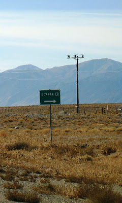
signAs you drive south on old Highway 8A (S. R. 376), past Kingston Canyon, on your way to Tonopah, long before you come to Ophir Creek you'll see this little green sign marking the main road in to Bowman Creek.
curve Don't turn there - actually, it's probably a good place to turn, and I'll have to try this road on the north side of the creek some day and see where it goes - instead keep driving a bit until you go past the first turn in one of the longest straight stretches of paved road in Nevada.
roadTurn here! This is the old road in, the one that goes up the alluvial fan on the south side of the creek to a long-ago campsite.
spring As I drove up the fan on the road we used back in the summer of 1978, I realized that I'd forgotten about the spring the road went by. If you click to enlarge, you can see that someone has actually built a house on top of the spring mound, a great spot with a great view of Big Smoky Valley. I was a bit surprised by this, and initially took a wrong turn. Stay right, not left, to bypass the house and private plot of land. Follow my tracks, if they are still there.

As you drive up the fan closer to Bowman Creek, the road will go to the base of the spring mound (an eroded fault scarp that forms part of the Toiyabe Range fault zone) and then will turn to the north to go around.
Above, a Google Earth image showing the Toiyabe Range fault zone (yellow lines), the spring with house symbol, Bowman Creek with fish symbol (good trout), and old camp with helicopter symbol (click to enlarge). The old RO Ranch is in the lower right corner.
colorBecause it was fall when I visited, the colors of sagebrush still in bloom, faded rabbitbrush, willows and other water-loving plants were absolutely stunning - so naturally I spent some time taking a few photos. The photo above looks westerly, toward the range front.
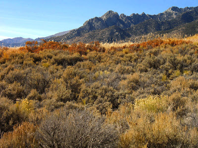
color This photo looks southwest, and you can see some of the particularly craggy ridges of the Toiyabe Range, which is one of Nevada's highest mountain range.
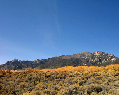
mountains The big picture, with the house on the spring hidden from view.
road After winding around a bit, the road goes past another house that wasn't there back then, and climbs up toward our old campsite. From the spring onward, this road was, in places, steep, rocky, and made of powdery dust that hid all the rocks. Rocks would jump out from beneath the dust and bash unsuspecting transfer cases and differentials. And even if you thought you memorized the locations of the rocks, the truck ahead of you - whoever had passed over the road last - was sure to have knocked a few rocks around or dug out a new one. The more we drove on the road, the worse it got. It's now much better, and maybe doesn't follow the exact same path as it did.
creek Ah, the creek: cold, running water. You can catch grasshoppers in the tall rushes and grasses on the other side of the creek and bait your hook, if you want. Some of the pools are big enough at least to sit in, and briskly cold for cooling off in summer heat.

Tuesday, October 28, 2008

Old Junk in Ophir Canyon

metal Okay, so yesterday's post was really a lead in and good excuse to get to one of exploration's finest perquisites, that of being able to wander around old mining districts and check out everything left behind by previous operations, sometimes going back to the late 1800's.

The miscellaneous piles of junk and still-standing or semi-standing parts of mills and old buildings that I found at the mouth of Ophir Canyon is supposedly part of the old Warfield-Ophir group of claims (any current claims may have different names by now), according to Kleinhampl and Ziony, 1984. The area was worked for tungsten (and molybdenum?) in the past, with the most recent mining efforts possibly being from the mid-1970's, but reports and locations are unclear.

The main part of the Ophir or Twin River silver-tungsten-gold mining district, at the old townsite of Ophir, AKA Toiyabe City, is farther up the canyon and is also well worth visiting.

machinery This appears to be a fly wheel flat pulley, possibly from a crusher. If anyone can identify this equipment more completely, please let me know. I just like the shapes and colors, and didn't spend a lot of time - this time - looking for manufacturers' names and dates.
yellow metal Yellow-painted meal framework and grating, with pipes and wires.
dump truck And old dump truck or haul truck, filled with rock. Is it scheelite ore?
roofA nicely colorful metal roof on an otherwise falling down shack. Photos of this cabin from about 2002, when it was still standing, along with photos of the entire equipment setup, can be seen here, near the bottom of their webpage.
roof and rocksFalling down cabin, with the metal roof being much sturdier than the rest of the building. A low part of the Toquima Range can be seen in the background: Moore's Creek to Dry Canyon to Road Canyon (or Charnock Pass) - a scenic, volcanic-rock ridden way into Monitor Valley.
Northumberland view Here's a view of the northern and central Northumberland caldera, which erupted the Northumberland Tuff about 32 million years ago. Also seen in the view is the area in which I stayed out all night once, just south (right) of Wildcat Peak, the pointed peak on the horizon, and the tuff of Hoodoo Canyon, a bit to the north (left) of that peak.
view through frameworkAnother view of the central part of the Northumberland caldera, through more metal frameworks.
south Northumberland I've retreated now to my parking area, near the creek seen in yesterday's post, giving yet another view of the central and northern part of the Northumberland caldera, across the vast expanse of Big Smoky Valley.
Mt. Jefferson And here, on a ledge where possibly some old buildings once stood, one can see across the valley to the southeast, getting a good view of Mt. Jefferson, which at 11,941 feet is essentially the third highest mountain in Nevada. Mt. Jefferson consists primarily of a huge pile of Tertiary volcanic rocks, mostly moderately to strongly welded ash-flow tuffs, including the tuff of Mt. Jefferson, which erupted from Mt. Jefferson caldera about 26.7 million years ago. Much more detail about the calderas in and around Mt. Jefferson is discussed here.

Mt. Jefferson is a great place to hike up, if you can stand the elevations, and even if you can't. The top, which is not accessible by vehicles, is almost surreal somehow - or maybe I was oxygen starved. It's mostly flat, with little hills of tuff. The Alta Toquima archaeological site sits up there at about 11,000 feet, above tree line.
Round MountainDriving away from Ophir Canyon, I had a great view of the Round Mountain gold mine to the southwest. Round Mountain has been in operation since the early 1980's 1977.

References:
Kleinhample and Ziony, 1984, Mineral resources of northern Nye County, Nevada, NBMG Bulletin 99B.

McKee, E.H., 1974, Northumberland caldera and Northumberland tuff, in Guidebook to the geology of four Tertiary volcanic centers in central Nevada: Nevada Bureau of Mines and Geology Report 19, p. 35-41.

Thomas, D.H., 1982. The 1981 Alta Toquima Village Project: a preliminary report. Desert Res. Inst. Soc. Sci. Cent. Tech. Rep. 27.

Monday, October 27, 2008

A Saturday Drive

smokyThe other day I decided I'd go out to Big Smoky Valley to explore a few things and places related to my past - things and places from days gone by when I worked in the area, which was primarily from 1977 through 1981. I was out to revisit some ancient Highway 8A history, as it were, although that particular section of old Highway 8A - which runs from Highway 50 east of Austin to Route 6 east of Tonopah - is now known as State Route 376.

8aI turned onto old Highway 8A and headed south. A long straight stretch of road immediately ensues, and so unless you are turning off to Spencer's Hot Springs or Pete's Summit, it can seem like forever before you get anywhere. It is, in fact, 19 miles of straight, paved pavement before you come to the first turn in the road, which is just after you cross over the Nye County line, and just before you come to the old road up the south side of Bowman Creek, where I made a little stop.


road Although I didn't really know where I'd end up after stopping at Bowman Creek, I finally continued south on old 8A, and then turned west to drive up the road to Ophir Canyon. Ophir Canyon is on the east side of the Toiyabe Range between Kingston Canyon (a canyon with a small retirement community) and Carver's Station, which was mostly a gas station, bar, and restaurant back when I lived in Big Smoky Valley.

I drove there to see if the road up Ophir Canyon was open - not because I thought that early snow might have closed it - but because I'd heard a rumor a few years back that it may have been blocked off by overzealous government agencies, but those may have been other roads, because Ophir Canyon was open.

steep The road to the canyon turns south right on the range front, where it then drops into the canyon. Ophir Canyon is the narrow notch above the little yellow sign on the side of the road.
very steep The sign is there to make sure that you know that the road is steep and narrow. In fact, the first time I went up the canyon, the day after resting up from my overnight helicopter escapade on volcanic hills across Big Smoky Valley, I had to grit my teeth in places and was glad another young geologist was driving. I would have rated parts of the road as 8 or 9 out of 10 on the 4WD scale of difficulty, but experience changes things like that. I do recommend the drive: it makes a good alternate route over the Toiyabe Range - not a short cut, but a scenic route - steep on the east side, and shallow with a broad view on the west side.
canyonAbove, driving into the mouth of the canyon.
4WD sign I drove a little past the initial entry area of the canyon, to see what the sign said - lot of signs in this canyon. This one says, "4WD ROUTE MAINTAINED BY CENTRAL NEVADA FOUR WHEELERS." And trust me, in these parts, that's a good thing. Some county roads have been closed, and then reopened with bulldozers.
flood Just before the road is about to drop back into the canyon for good, another sign pops up, this one warning of flash floods. Fortunately, there was barely a cloud in the sky. Little stickers on the sign also indicate No Cars and No 2WD Trucks. ?The sign also suggests that open-topped jeeps aren't recommended.
creek I parked near the mouth of the canyon, where some old mining stuff is lying around, and went over to the creek.
bridge I crossed the little foot bridge - woh, be careful, it's a little wobbly.
waterOf course, the creek isn't very deep if you happen to fall in, like most Nevada creeks.
viewThere is some nice old mine and mill miscellany on the other side of the creek - mining and milling equipment from operations now defunct, falling-down to skeletal buildings, and pieces of metal, wood, and glass - along with a nice view of the Toquima Range across the valley.