Monday, July 30, 2012

Geo-beers: Gimme an Icky

Ichthyosaur "Icky" IPA, usually known as "Icky," is a true geo-beer, made by geologists for geologists — and for Nevadans and all beer lovers. It's named after our official state fossil, the Ichthyosaur, found and preserved at Berlin-Ichthyosaur State Park.
"Distinct, not extinct."

Icky is one of my ultimate favorites — especially for a local, often on-tap beer (on tap at least as far east as Winnemucca, NV) — competing quite nicely with all my other favorite local, Alaskan, and IPA brews. (Okay, so the last two are Alaskan.)
"A brew more than 200 million years in the making."
"You better hold on tight. This is one tough species."
"PROTECT THE SPECIES. Enjoy a long-necked Ichthyosaur today."
and
"Do as the locals do - say "GIMME AN ICKY".
"A highly evolved brew."
"Savor the pioneering spirit of the Great Basin."
"Named after Nevada's official state fossil."
I don't, currently, have an actual photo of an Icky, but I hope to remedy that lack sometime in the next few days, when I will finish logging the hole I'm on and take some well-earned days off.

Great Basin Brewing Co.
Icky IPA

UPDATE: See Accretionary Wedge #54 for more interesting posts about beer and other libations.

Monday, July 23, 2012

Birds along the Humboldt River

Having posted a couple pictures of American White Pelicans, I'm going ahead with this post showing a few of the many birds I've seen along the Humboldt River between Golconda and a little east of Preble. Pictures were taken on two days in mid-June and mid-July, essentially late spring and early mid-summer.
Snowy Egret perched on an old dam or abutment near Preble.
An egret or heron on a nest on the far bank (left), Snowy Egret on the same bank to the right.
Forster's Tern.
Two egrets, possibly Great Egrets (AKA Great White Egret or Great White Heron).
Western Grebe.
Killdeer.
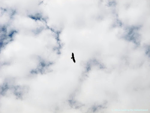
Turkey Vulture.
Blue Heron #1, flying over the river not far downstrem from Preble.
Blue Heron #2, same general location as #1.
Blue Heron #3, just below the dam east of Golconda.
Lower left: Snowy Egret. Upper center, blending in with the river: Blue Heron #3. Upper right: Great Egret. Hard to see, I know, although the photo will enlarge. It's easy to scare up some medium to large birds when approaching the dam, so next time we'll walk in, rather than drive.
Snowy Egret from the last photo, below the same dam.

Other birds I've seen: numerous Ravens, possibly a White-winged Scoter or two, several Mallards, Canada Geese, and some unidentified birds including what looked like a hovering, then diving or swooping, mostly brown hawk.

Monday, July 16, 2012

Sunrise, Smoke, and Pelicans

It looked like an auspicious day for birds and photos of the sunrise as I left for work last Wednesday, so I ran back and grabbed my camera.
The Long Draw fire near McDermitt, NV, had sent smoke toward Midas the day before; last Wednesday, the second day of the fire, smoke created a bright red sunrise over the Osgood Mountains, visible from I-80 just west of Button Point. Then, because of sun angle, topography, and changes in elevation while moving eastward on the freeway, the sun appeared to set behind the high mountains.
Dense smoke lowered visibility to the north, effectively hiding the Hot Springs Range.
Coming into Emigrant Canyon, I got lucky, and the pelicans that frequent the river were closer than ever, flying right in front of the truck...and, I had my camera!
Here, one small group of the large pelican flock appears to fly straight toward the sunrise.
As the truck approached the railroad crossing at Preble, the pelicans flew upriver en masse more or less toward Valmy.
Somewhat farther up the road, the Midas Trough became barely visible through the smoke coming down from McDermitt.
The day before, much of the area north of the Owhyhee Bluffs had been completely lost in smoke. Here, the bluffs are barely visible, highlighted by the rising sun.

It was a smoky day.

Friday, July 13, 2012

Quick Tour of Historic Golconda


View Golconda in a larger map

To get to Golconda, Nevada, don't follow the Google Maps (GM) directions, which will (currently) take you to the wrong side of the Humboldt River.
Instead, first take Exit 194, going east or west, off I-80.
If you exit from the east bound lane, a sign pointing toward "Mines" will turn you toward Golconda, which is north of I-80 on old U.S Route 40 (also, see Highway 40 in Nevada).
Then, at the junction of Old Highway 40 and Morrison Avenue, don't follow these signs 20 miles to Pinson or 28 miles to Turquoise Ridge; instead, go north on Morrison (the street in view just behind the signs) toward the river.
At Stanford, turn right (not left as in any GM directions you happen to be given) and, voilĂ , a street that has a couple remaining old buildings, including this one, looking fairly well kept...
...and this one, looking quite picturesque, but slightly frayed around the edges.
The colorful front of the second building, looking inside through broken glass.


After taking these first photos, I drove along the Humboldt River east of town, stopping here and there, watching birds and photographing a local dam, then came back into town on a dirt road that becomes Crocker Street according to GM.
A few more old buildings.

From here, I turned northward on Morrison, drove past Stanford, and stopped to take a few more shots.
A leaning barn or out building.

Interesting rock work.

Old ranch house.

Golconda at Nevada-Landmarks
Golconda at Backyard Traveler by Rich Moreno
Golconda School at National Register of Historic Places
History of Humboldt County, 1912>

Friday, July 6, 2012

Two Spots on the Humboldt River

The active channel of the Humboldt River, NV, at a fairly sharp bend.
An old meander, now filled with salt bush, wild rose, and other scrub, and frequented by many mosquitoes.


View Humboldt River in a larger map

These stitched photos were taken about three weeks ago near the site of Preble (just off the map to the west). The river was high and flowing forcefully. Birds were everywhwere. The road I took to get to the river was one of the tracks of the California Trail through Emigrant Canyon.

The birds haven't left (although those on nests may have been left high and dry), but the river has dropped dramatically, just over the course of my five-day, pre-4th break.

Looking at Google Earth (and the Google Map view), I've spotted a few oxbow lakes that are easy to get to or view from bluffs above the river. I had thought I might traverse some of the old meander scars while I was out there, but I found the scrub brush impenetrable and wasn't prepared for mosquitoes. Now, with the drop in the river, the lakes may be dry.