Showing posts with label mojave. Show all posts

Tuesday, March 28, 2017

Tales of the Mojave: A Dry Placer

And now, let us continue with my Tales of the Mojave series. In our last post, we had barely left town—town being Reno, NV, hundreds of miles to the north, and we being Allie and I, two young and fairly junior geologists: I was beginning my fourth full year as an exploration geologist; Allie was beginning her first. Besides the several recon targets I had generated while we were still in Reno, we also had a placer submittal to examine and evaluate.

A Dime a Dozen


Placer claims are a dime a dozen in the Mojave, and they are typically worthless—at least in my limited experience. (Actual placer miners might disagree with my assessment, but I'm using the mindset of large, hard-rock mining and exploration companies.) Unlike lode mining claims, placer claims can be increased in size if an association (group of more than one person) locates the claim: The usual 20 acres per lode claim or individual placer claim can be as large as 160 acres in an association placer when located by 8 or more claimants.[1] Association placers can, in other words, cover an entire quarter section, making it possible to cover a lot of ground with relatively few claims, something that was done widely across the lowlands of the Mojave Desert of California in the 1980s (and elsewhere, like Arizona, and elsewhen, perhaps even right now). Many of the placer submittals we received during the 80s were located not only for gold, but also for platinum, an element that is quite rare in the placer settings of the southwestern deserts.
“A degree of skepticism should also be reserved for ores said to contain uncommon metals or minerals. Because of their rarity, these substances may command a very high price and are therefore extremely attractive to the investor. The platinum-group metals including platinum, palladium, rhodium, ruthenium, iridium, and osmium, are the darlings of the swindler. Considering their high unit-value, even minute amounts of these metals appear to be a reasonably good bet to the innocent investor.”
–from Mining Scams, AZGS
In any case, I’m not sure why we were called upon to appraise these particular placer claims, nor do I remember their exact location or size.[2] I did already know a few things about placer deposits—a little—having looked at a number of placer submittals in the California foothills earlier that year. The Mojave placer, however, was different from those in the Mother Lode region of California, being “a dry placer” or “desert placer,” which means they were not located on or very close to any actively running water. Flash floods in usually dry washes, and sheet runoff across the fans during storms had formed the sand and gravel deposits that might (or might not) contain placer gold, but the nearest naturally running water was several miles to the southeast in the Colorado River. (Water in the nearby Colorado River Aqueduct was nearer by half, but was inaccessible to any would-be placer operators, including us.[3])

The Desert Sun


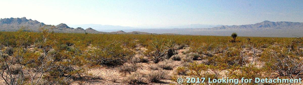
The desert sun glared through the windshield of the truck as if to threaten us with heat stroke or worse, and heat waves rose inexorably from broad alluvial fans and bajadas, countless meandering dry washes, and endless desert pavement. As we turned onto dirt somewhere between Vidal Junction, CA, and Parker, AZ, I wondered what we were getting ourselves into. It wasn’t just the question of evaluating a dry placer property located miles from running water, but also the larger question: What were we doing in the Mojave in June? We drove down the fan, over rocks and by countless jumping cholla, not knowing for sure where we'd end up, not having to meet with the prospector, as one does so often when checking out a submittal. It didn't take long, really, before we found the spot, nearly lost in low, decapitated hills and erratic dry washes south of the Whipple Mountains, buried under  a millennium’s worth of accumulated sand and dust. Dust covers entire mountain ranges in the western Mojave Desert, and it collects on pool tables in towns up and down the Colorado River in the eastern Mojave. Parker, Arizona, is one of those towns. Hopefully we'll stop in Parker some other time.
We had brought extra water with us in 5-gallon containers, including 1 or 2 basic upright cooler types and several clear, collapsible plastic types. The extra water was, at this point, for evaluation of the claims, not for our own hydration, but the extra containers would serve us well as our expedition unfolded. So far we hadn't noticed anything untoward in the flavor of the water, primarily because we had filled our containers north of the NV-CA line, probably in Reno. Desert water can taste absolutely awful.

As property reviewers, we would not only have to determine whether gold was present, but we would have to make some deliberation as to the feasibility of mining by a fairly sizable company. I could think of three scenarios for processing (mining) any placer deposit we found:[4] 1) haul water into the area from the Colorado River or from Lake Havasu to wet-separate the heavy gold from the lighter quartz and feldspar sand and gravel, 2) haul the gold-bearing sand and gravel to the water, presumably the Colorado River, for wet-separation offsite (no doubt requiring further land acquisition), or 3) dry wash the sand and gravels without water. Dry washing using the oldtimers' dry winnowing method is notoriously inefficient at gold recovery and can be totally worthless if not done with extreme care and diligence.
How we get gold in California: winnowing gold, near Chinese camp.
Original in Harper's Monthly, v. 20, 1860; source: Library of Congress (no known restrictions).
Of course there are more current methods of dry washing available than winnowing, if you happen to have some gold-bearing sands and gravels on your Mojave placer claims. I'd look into the Bedrock Dreams website (UPDATE 15Jun2019: no longer available) which used to show many possibilities and has a lot of info for the up-and-coming small-time gold miner (hard rock and placer).

The Dry Wash


At the dry wash, we camped in trenches dug by the claim holder. In the “cool” of the evening—when temperatures dropped somewhere between 70º and 85ºF by morning—we panned for gold using the precious water we had hauled in. Because the paved roads of Highways 95 and 62 and the desert-river town of Parker were not so far away, we went ahead and used a lot of our water for panning. We didn't have to save most of the water for drinking, which we would have done had we been camping four hours away—over hot, dusty roads—from anywhere of desert significance: any place with water, food, people, and, preferably, gas, spare parts, and tires (the latter preferences ruled out places like Goffs and Essex)

We were lucky, and our pans showed some color: a few, small flecks of gold almost too tiny to see. With repeated tries, we consistently got 2 to 4 colors in each pan. After we used up our extra water, which happened faster than we had envisioned, we took to dry panning. (It doesn't matter how close you are to town; it's ill-advised to use up all your water. You might need it during some unexpected, unplanned-for vehicle mishap or environmental disaster like a clogged fuel filter, a flat, a washed-out road, or a flash flood. See A Few Rules of the Desert.)

At some point, perhaps out of boredom, we gave up on classic dry panning, which looks a lot like regular panning but with tons of dust. One more time we filled the gold pan with the weakly gold-bearing alluvial sand and threw the material expectantly skyward. The evening breeze blew the lightweight fines toward Arizona—where all Mojave sand and dust aspires to reach—and the heavier material fell back toward the pan. We had reinvented dry winnowing! In theory, we should, after several skyward tosses of material, have been left with a few heavies, some black sand, and a few flecks of gold. We weren't, though; maybe our technique was subpar. Regular wet-wash gold panning requires some skill, but if there’s gold in the pan, even an unskilled person will usually find it—although I've seen newbies mistake golden-colored quartz, gold-flecked biotite, and that common mineral pyrite, AKA fool’s gold, for gold. All of these minerals might fool some of the people some of the time, though with practice or a good course in mineralogy, you should not get duped by any of them. Gold is the only mineral that will shine or look bright golden yellow in the shade. Pyrite pales next to gold, and put in the shade it won’t shine—it becomes just another mineral, barely tinted beyond pale brown, nowhere near the bright golden yellow of real gold. (The exact color of gold depends on its fineness and upon which of several other elements, notably Ag, Cu, Fe, Pt, Cd, might be contained within the gold. These factors will affect how bright yellow or golden the gold looks. And then there's chalcopyrite, not as common as pyrite, but often lying somewhere between pyrite and gold in it's yellow-gold sheen. So it is possible to be fooled. But don't be. A Niton™XL3t GOLDD+ xrf analyzer can be a friend.)

Dry panning and air winnowing hadn't done much besides create a lot of dust and two ravenous geologists. So we put the gold pans away and turned our thoughts toward dinner. The sun was fairly low over the Turtle Mountains to the northwest, and my time estimation method indicated we had about 1.5 hours to sunset. What should we eat? We went ahead and established our Mojave Desert, south-of-the-border-style cuisine of tacos or burritos, with avocado and as much hot salsa and jalapeño as we could stand. This type of food is not too heavy for the heat, and (I’ll swear to this—or ask any desert rat) the spicy burning of the peppers created a cooling effect, something we would really need as our time in the desert progressed. Besides, there’s enough vitamin C in the peppers to fight scurvy, a credible desert plague: Rapid melting of the ice will spoil many vegetables and a few fruits over the course of our stay.

Yeah, we had just arrived in the desert and were still greenhorns, not quite able to call ourselves Mojave Desert rats. Not yet.
A little fooling around with SunCalc produced this reproduction of sunrise and sunset at our campsite (approximate location and date).
As the sun sank behind the Mopah Peaks, I thought about the next day. We'd be moving upslope into the Whipple Mountains proper. We were done with the placer submittal and, back in Reno, would recommend “No Further Work.” Although we didn't really know how large the weakly gold-bearing sands are, we suspected that their likely flash-flood origin from upstream copper-gold diggings in the Whipples would make mapping out the gold bars and channels difficult at best.

To be continued...

Notes:


[1] (Read about basic claim location rules here.)

[2] In later years, when working for Former Mining Company, I rarely took on placer submittals; in fact I actively avoided them, especially after one particular submittal (a classic scam) led to a fabricated conflict between our lode claims and the association placer claims of the submitters.

[3] The Colorado River Aqueduct is a 242-mi (392 km) water conveyance in southern California. The aqueduct diverts water from the Colorado River at Lake Havasu (at Parker Dam north of Parker, AZ) on the California-Arizona border west across the Mojave Desert to the east side of the Santa Ana Mountains. The aqueduct is operated by the Metropolitan Water District of Southern California (MWD) as one of the primary sources of drinking water in southern California.

[4] A note about my usage of "found" and "deposit." We knew there were claims for placer gold. We didn't know for sure if any gold existed on the property or in the area. If there was gold in the dry washes, the claim owner had discovered it, not us. We, however, wouldn't think of any gold on the claims as an economic deposit until it had been tested, which usually involves drilling or—especially in the case of placers—small-scale test mining. It's not considered accurate to call a mineral occurrence a deposit until it meets economic parameters and passes mining feasibility studies. It is therefore correct for me to assert that the claim owner discovered the gold, but Northern Mining Company's representatives (us!) might discover a gold deposit.

Tuesday, March 7, 2017

Tales of the Mojave: A Bit About Northern Exploration Company

I planned to have this descriptive section as part of the last post—the one about being packed and ready to leave town—but this "little bit" grew and grew, and eventually it had to find its own home. I've written lots of little pieces like this; many of these could be hyperlinked from several main posts. This one might most properly go near the beginning of a Tales of the Mojave book.

N.E.C.


Northern Exploration Company (NEC), a famous former international mining and minerals exploration company, had seven exploration offices when I began working there as part of a small horde of young or “junior” geologists in NEC’s Western District. Some of us were temporary summer hands (and many of us, like me started that way); many of us were on year-to-year contracts (me!); and a very few of us ended up with permanent positions in the company. There were three or four permanent geos leading the horde when I began working there; that permanent cadre had expanded to maybe six by the time I left.

When not out in the field, we worked out of one of several office-warehouse complexes scattered here and there in Reno and Sparks.[1] The complexes seemed to have been slapdashed together and often had a few problems; for example, the typical southwest-desert–inspired flat roofs were prone to leak during storms or snow-melt. Our complex—and a nearby complex leased by another, also famous former mining company—was near the Truckee River and so occasionally flooded. The large windows of the office half of our complex faced south across a largely undeveloped area of the Truckee Meadows; these windows caused overheating, especially in winter when the low sun provided unplanned for solar energy. Nonetheless, we had a good setup that included a smallish warehouse in the back with shelves for field supplies, tables for core logging, and rock saws and grinding wheels for cutting and polishing hand samples.

The Western District of NEC was a decidedly renegade district, though at the time renegade attitudes were fairly common within exploration groups based out of Reno.[2] Geologists aren’t ordinarily known for their adherence to rules, and they are especially not known for following pointless and questionable rules sent down from above—an above that was usually either outside the country or east of the Mississippi, the latter being nearly the same thing as a foreign country to those born and bred in The West.


We can argue nearly forever about where The West begins or ends. The Mississippi River clearly constitutes one viable boundary for defining what is east and what is west. The hundredth meridian has also been used as the boundary between east and west; for example, in 1843, Thomas Farnham said lands between the 100th meridian and the Rockies were “usually called the Great American Desert” (Stegner, 1954). Later, Thomas Durant held a “100th Meridian Excursion” when Union Pacific crews passed the 100th meridian in 1866, a goal set by Congress. A little later, John Wesley Powell, writing for the USGS in 1879, recognized the 100th meridian as a line roughly defining the eastern boundary of his “Arid Region,” an area that generally receives less than 20 inches of rainfall per year and encompasses most of the west (by any definition). I think one could also use the Great Continental Divide as the boundary between east and west: All drainages east of the divide would drain to the Gulf of Mexico or the Atlantic. All drainages west of the divide would drain to the Pacific.
Google Earth image with yellow line marking part of the 100th meridian. The meridian cuts several states in two and roughly separates a greener area in the east from a notably browner area in the west.
I usually maintain that the true west, “The West” as I capitalized above, begins at the eastern edge of the Front Range of Colorado. Denver is not inside The West by this definition. (Neither is Boulder, for that matter.)


As mentioned in our main text above, geologists within the exploration offices of the west (however we define west) were often fractious and rebellious, and they were unlikely to listen to anyone from Chicago, say, some muckety-muck who might be sporting a fancy three-piece suit and polished black shoes. (There are numerous stories revolving around entertaining such VIPs.) Denver’s offices were often a little spiffier than those in Reno, perhaps having been influenced somewhat by the fancier petroleum offices in the area. Also, some Denver offices acted as headquarters for the minerals explorations groups of larger companies, and some *were* the headquarters for smaller companies. Consequently, geologists who had the misfortune to be based in Denver often ended up being a little more stilted, a little less rebellious, a little more formal: they were ever-so-noticeably more well-behaved when it came down to orders from above, and they were a little more likely to look at you askance if you decided that a rock-throwing contest was in order before the sampling program began in earnest. (A few were definite leaders as far as renegade actions go—here I’m particularly thinking of some unnamed few during my later years at Former Mining Company. Most, though—well, many—tried hard to keep up.)

The Kmart of Exploration


Our Hughes 500-D in 1978.
The Western District of NEC came to be known, at least to a select few, as “The Kmart of Exploration.” This appellation had been assigned to NEC by a summer hire[3] —Dan, the guy with the Frisbee dog, a black and white Aussie of one variety or another—during the uranium summer of 1979. He said he came up with the epithet after being involved in procuring supplies and provisions for the field largely at Kmart. I thought the nickname—seemingly indicating that the company was cheap—was overstated; after all, each uranium camp[4] had a trailer with space for a full kitchen; an office with drafting area, map storage cabinet, and beaucoup supplies; a camp cook; canvas tents with room for two field hands in each tent; a couple of 1978 4WD pickup trucks, brand new during the uranium summer of 1978; and a Hughes 500-D helicopter equipped with radiometric instruments capable of detecting radiation and breaking it down into the three major source elements, potassium (K), thorium (Th), and uranium (U). I thought our camps and equipment were pretty plush, especially when compared to the archaeological camps my husband frequented.

Much to the head honcho's dismay, "Kmart of Exploration" stuck. Perhaps it was partly our field schedule that made the name stick. We worked eleven and three, drive-on-your-own-time. That schedule meant eleven days in the field, three days off, with the driving time between home and field (and vice versa) being on our own time, not on paid-for company time. Perhaps the name stuck because we were encouraged, if not required, to camp out rather than stay in motels.

Camping supposedly saved gas, time, and money because we didn’t have to drive in to town every morning and evening and didn’t have to spend money on motel rooms. We also bought groceries instead of eating in restaurants, resulting in a lowered food expense. So we typically lived outdoors—in the dirt and weather of whatever area we were working in—for two to four nights; then we were into town for one night to get a shower, to sleep in a cool, air-conditioned motel room, to gas up, to stock up on fresh food, and—most importantly in the Mojave—to stock up on water and ice. Then, back into camp mode we went. I thought there were some flaws to the party line about camping, although I never did an actual cost-benefit analysis. For one thing, those of us who didn't have a permanent camp located somewhere near running water in the higher and cooler reaches of eastern Nevada (a certain lucky few that I was rarely part of) spent a certain amount of time setting up camp every evening. After getting our new camp in order, we made dinner and cleaned up. Then, nighty-night. After waking up in the morning, we tore everything down and repacked the back of the truck. With all the unpacking at night and repacking in the morning, we often ended up rearranging boxes of sample bags twice a day. Because we prepped our own camp and food daily, we were essentially working twelve to fourteen-hour days, rather than ten, with little time to rest or recoup in the evening before falling asleep (on cots or on the ground). Ten-hour field days were de rigueur at NEC. That meant we'd quit camp at 7:00 am, say, with breakfast and camp tear-down already complete, then work in the field until 5:00 pm. Then we'd finally get on to camp setup and dinner making after that. When someone else was cooking your meals and when there was running water available for cooling off and even showers, as in the uranium and moly camps, the hours were okay—long, but feasible.

In the Mojave, they were hell.

To be continued...

Notes:


[1] These complexes were often called "geo-ghettos" back then—although that term would probably not be politically correct now—often because they weren't built all that well in some respects, and also because they seemed to house a lot of geological groups.

[2] We cultivated—or were known for—a semi-outlaw attitude and everyday defiance that was deliberately exacerbated by the temperament of the head honcho in Reno.

[3] We didn’t call our summer employees “temps” until a good number of us moved to Forminco, where "temp" was already in use.

[4] For more about the uranium camps, see this series about the Caliente camp of the first uranium summer (that's what we called them: the first uranium summer, and the second uranium summer).

A Reference


Stegner, W.E., 1954, Beyond the hundredth meridian: John Wesley Powell and the second opening of the west: Penquin Books, 496 p., 1992 reprint. Quote from p. 215-216 of 1992 reprint.

Tuesday, February 28, 2017

Tales of the Mojave: We're Almost Ready to Go

The Road South:


Our story—the 1981 story of Allie and I doing recon down in the Mojave—began in Reno in the spring of the year and ended unexpectedly and abruptly in Needles before the end of June. I no longer remember exactly how long we spent in the east-central Mojave, but we looked at six different target areas—depending on how you count them—and we probably spent at two to five days in each area.
"A beginning is the time for taking the most delicate care that the balances are correct. ...
- from 'Manual of Muad'Dib' by the Princess Irulan"


A Caravan Camper on a white truck
in front of a mine dump in eastern Nevada.
Allie and I left Reno in a dull gray, four-wheel drive Chevy pickup truck topped with a matching Caravan Camper, a type of heavy-duty metal camper shell with carpet kit, similar to the one I have now. We were equipped with an ice chest full of food, drinks, and ice; a 5-gallon water cooler or two; sundry camping gear; assorted tools; one spare tire (only one!); and all kinds of exploration equipment and supplies. We had sample bags and sample books, Estwing rock hammers and rock chisels, triplet hand lenses and little magnets on rawhide straps, and little plastic squeeze bottles filled with a 10% dilute solution of hydrochloric acid (HCl). The acid bottles were usually held tight in leather cases that could be slid onto belts. We also had a carefully stowed glass bottle of non-dilute HCl, so we could make additional dilute acid as needed. (HCl was easy to get back then, and the bottle came meticulously packed in vermiculite within a sturdy cardboard box.)

We had files of topographic maps, geologic maps, published reports, books, and copies of company reports in plastic file boxes that would help to keep everything organized while also protecting it from water and the pervasive Mojave dust. We had Brunton compasses in leather holders, ready to attach to our belts. And we had various mapping paraphernalia: mechanical pencils with black, blue, and red leads; colored pencils; pens and markers; and six-inch C-Thru® protractor-rulers of various scales: 10-50, 20-40, 10-20, and 30-60. We had field notebooks to hold notes and sketches, and we had aluminum clipboards that would protect our maps, air photos, and reports. We carried everything we needed for any particular day’s traverse in Filson® survey field vests[1], on belts, or in backpacks. A geologist, fully attired and field ready, is easily distinguished from desert rats, ranchers, and routine hikers.

We also had a pile of camping and cooking gear scattered in the back of the truck: pots and pans; plates, bowls, and utensils; a gas Coleman stove and fuel for said stove; sleeping bags and sleeping pads; a tent, which we didn't use while down in the Mojave; a tarp or two; and other miscellany. We may have rustled up some of the gear from a stash in the company warehouse—though had we not been timely in choosing gear (and we were late that year), we would have been out of luck. A certain person's name was used to describe what happened if you didn't grab your gear in time, or if you got stuck with second-rate supplies. Had his last name been Gibbs, it would have been called "getting Gibbsed." 
U.S. 95, looking south, just a few miles north of Beatty.
Before leaving Reno, we spent a little time pondering two particular questions: 1) should we take a thermometer and 2) should we abstain from beer and other alcohol? We debated back and forth about the thermometer and finally decided to leave it behind. Maybe we'd feel cooler if we didn’t see the expected 3-digit Fahrenheit temperatures!

If the creosote has bloomed, the field season is over.
Speaking of temperatures, when we got to our first locality, the temps we encountered didn't seem too bad, though it took a little time to adjust after coming from the higher and cooler elevations of Reno. We adapted. We devoured lots of fresh fruit. For lunch we’d have half avocados, their centers filled with Italian salad dressing, and we’d roll whatever else came out of the icebox in flour or corn tortillas.[2] We also prepared our own variant of south-of-the-border food, using lots of hot peppers, gobs of hot sauce, and unlimited spicy guacamole. We figured there would be something medicinal in mixing the spicy fire of the food with the scorching heat of the desert. And in fact, these were the only foodstuffs we could bring ourselves to eat in the heat. And throughout the day, from sunup to sundown, we drank gallons of water, juices, and sodas—and zero beers.

To be continued...

Notes:


[1] It looks like the standard survey vest isn't being made anymore—at least I don't see it on the C.C. Filson website. Perhaps that's because so many geos are now wearing safety vests much of the time. I hope my current beige style-12 and orange style-8 vests will last indefinitely: I still use them on field trips, while hiking, and on most sampling and mapping excursions. My beige vest is partly held together by duct tape; a gaping hole in the lower right area developed after carrying a leaky acid bottle inside the inner pocket. (I really don't like having things hanging from my belt, though I did used to wear my Brunton that way. Now I stick it in one of the side pockets.)

[2] This was called a "Bill Rehrig" lunch, although we didn't use that term until many years later.

Tuesday, February 14, 2017

Tales of the Mojave: An Intro

Intro


I'm going to move into what I hope to be the blog-publication of a few of my old stories, which I began here quite a while ago with several posts that became the Caliente series and other posts that were part of my Finding a Thesis series (which I haven’t finished). I'm not sure how far I'll get into this new project, but it's something I want to start in order to see how my writing has progressed from the first drafts, which I probably began in the late 1990s. I'll no doubt be interspersing this Mojave set of posts with other field notes, road trips, or miscellany like Friday Fault/Fold, etcetera; we'll just have to see how it goes. Also, at this point the old stories have become tied up with some fictional stories or novel I've been playing with. The fictional book or novel doesn’t really have a plot yet, and it also has a lot of completely made-up to deeply modified or wildly intertwined adventures. I'm attempting, here, to remain true to life.

The Mojave


You can check out any time you like,
but you can never leave.[1]

My memory of the Whipple Mountains, where we'll be heading shortly, extends back to 1981, when Allie [2] and I conducted some preliminary geologic reconnaissance (recon) during June for Northern Exploration Company (NEC). It was my first visit to the Mojave Desert of southern California. (I can’t speak for Allie, but I think it was hers, also.)

The Mojave Desert is outlined in red.
Image courtesy USGS, modified from here.
Hell, that's not strictly correct. Looking back carefully, I really can't say that I had never been to the Mojave before 1981—though I do often say that very thing, not usually thinking about the technical boundaries of the Mojave The boundaries, right, largely though not completely faithfully, follow the range of that well-known Mojave denizen, the Joshua tree.

So when did I first visit the Mojave? Well, let me think. Sometime in the late '70s I was in Vegas for an archaeological conference—we had driven all night to get there and had beheld a truly spectacular thunderhead near Tonopah. Before that, I’d seen (and drawn and photographed and summarized) the Charlie Brown Outcrop during the third field trip in Larsen's Geology of Nevada class. On the way down to the Charles Brown Highway, we had camped in the Beatty dump on Thanksgiving night after a particularly mediocre meal at the C-rated Exchange Club. Fortunately for everyone involved, there had been plenty of beer afterward to settle the stomach.70

Beatty is technically just inside the Mojave Desert, and the Charlie Brown Outcrop isn't far from its center. So yes, using almost anyone's definition of that southern desert, I had been there before '81. Nevertheless, I usually think of June, 1981, as my first foray into the area, and indeed it was the first time I had been south of Shoshone on the California side or south of Vegas on the Nevada side...

Our Carryall probably had 4 doors.
Photo credit: CZmarlin.
No wait! Most maps place Baghdad, Arizona, in the Mojave, and I'd been to Baghdad during field camp in '73; that was the place we'd gotten a Carryall stuck in the sand while trying to take a short cut back to Flagstaff. We weren't even supposed to have gone that way, but we'd purposefully drifted to the rear of the caravan and then left the pack. It had taken us an hour to dig out. We had finally made it back to Flag for dinner, only to find that no one had even missed us! The mishap instantly became one of the highlights of field camp, albeit one with apocryphal overtones: We exaggerated our difficulties while building road to get unstuck, we gleefully inflated the story during the two-hour drive back to Flag, and we greatly hyperbolized the event while telling the story over beers later that evening.

This little spate of reminiscing has brought me to the realization that I still don’t always think of the Mojave by its technical definition, and that in 1981 I generally thought of the Mojave as a big hot unknown encompassing the entirety of the southern California desert, or at least the part of it that lies south of the Garlock Fault. Back then I often thought that the SoCal areas north of the Garlock, including the broader Death Valley region, belonged to a kind of never-never land that should really be part of Nevada. I still often think the CA-NV border should run along the crest of the Sierra, though I’m not sure where that line should jog eastward to leave the main bulk of southern California in California, and somehow place Clark County of Nevada in SoCal.[3]  Perhaps the new border would look something like this, with the CA-NV border in white, and the southern CA border in yellow:
Google Earth image with proposed new borders.
Later in my career—later being when I worked at Former Mining Company, AKA Forminco—we, the southern explorationists of Forminco's Western District used the presence of cholla as a key factor when trying to push our district north into Nevada, as far north as the Gilbert mining district in the Monte Cristo Range northwest of Tonopah. The Nevada District had responded with uncharacteristic equanimity and had let us in, mostly because they didn't really want that part of Nevada.
Anyhow, back in the early 80s I liked placing the northern boundary of the Mojave at the Garlock Fault: It made geographic and geologic sense to me at the time, and it affirmed a feeling I had, when driving south across the Garlock, a feeling of dropping off into another, lower land. And as far as I was concerned, the eastern boundary of the Mojave was the Colorado River. My boundaries, however, held as little water as most Mojave washes—for one thing, there really isn't an elevation drop when driving south across the Garlock along U.S. 395 or S.R. 14, and even though there is quite a drop when coming into the Mojave from the west at Tehachapi, one has at that point crossed the southern Sierra Nevada, so a drop is to be expected; and for another thing, the Mojave is really defined as more of an ecologic or biologic-climatologic region than a physiographic region—and I knew that, so I always spoke of the "Mojave Desert of California" when referring broadly to all of the southern California deserts, or even those just south of the Garlock, hoping that the phrase would exonerate my technical sloppiness.[4]
Google Earth image showing part of the western Mojave, a bit of the Garlock Fault (dark blue), and U.S. 395 and S.R. 14. Ignore the road marking for 58; it is inaccurate.
This recon program was completely mine. Prior to that summer, the target areas of grass-roots ventures I'd been involved in had been at least partly chosen by others. I did the research in the spring, generating several targets across the region, from Tehachapi to Barstow to Needles[5], and I decided where to start. We'd begin in a few relatively low areas along the Colorado River—the district boundaries of NEC were such that someone else was in charge of Arizona, so like an aquaphobic saguaro in reverse, I wasn't supposed to cross the Colorado River—and we'd work our ways toward higher elevations, hoping to get ahead of the summer heat.

Because of a delayed start to my recon targeting, it was late in the field season, probably the first of June, when Allie and I finally left Reno to drive as far south as Parker, Arizona. I wondered how long we'd last down there in the heat of early summer; we knew it wasn't the most auspicious time to begin field work in the Mojave, but we hoped we could stick it out and find a property or two to stake.

My first recon program! I was both excited and apprehensive.

To be continued...

Notes


[1] Felder, Don, Henley, Don, and Frey, Glen. "Hotel California" (lyrics) perf. by the Eagles. Hotel California (album), Asylum Records, 1976.

[2] Names have been changed.

[3]Northern boundary of Southern California, at Wikipedia.

[4] In reality the Mojave Desert is an ecologic area defined by plants and climate, which extends as far north as Beatty, Nevada, and which doesn't include all of southern California's desert, because some of that area belongs to the Sonoran Desert. Whether the Whipple Mountains is in the Mojave proper seems to depend on who draws the map. These stories will take place mostly in the deserts of southern California, and I'll usually refer to that area as "the Mojave." 

[5] A target area can consist of a whole region (like the Mojave Desert itself), an entire mountain range (like the Whipple Mountains in the eastern Mojave Desert or western Sonora Desert), a large or small mining district (like the Savahia Peak area in the Whipple Mountains), or a smaller area around one old mine or prospect (like the Dollar Bill Mine on the south side of Savahia Peak.).

Friday, March 15, 2013

Repost: Blackhawk landslide, California - from Pathological Geomorphology

This article was originally posted at the soon-to-be-defunct Posterous.com site, Pathological Geomorphology, and was transferred here (thanks Kyle!) to the active Pathological Geomorphology (Tumblr). My original post was a response and addition to Callan's Blackhawk landslide post on Posterous, which is now here on the Tumblr site. I've transferred the original photos, added captions, and added a Google Maps location link at the bottom. I've added the original comments (with soon-to-be-dead links to Posterous) at the bottom. Also see this related post here on LFD.


I'm posting a few additional views of the Blackhawk Landslide in California, to emphasize the truly pathological geomorphology of the area. In the views showing slide toe and slide source, I've moved the source area farther into the mountain from the original given by San Diego State [dead (kmz) link originally sourced here]. I've done this based on prior knowledge and published maps. Basically, the entire steep northern face of Blackhawk Mountain is the slide source area.
Google Earth view showing the slide source and slide toe.
Google Earth view looking from above the toe toward the source.
Google Earth view looking from above the source toward the toe.
Additionally, there are other older landslides in the area, most notably the one sometimes called the Silver Reef landslide, which is just east of the Blackhawk. Also, many additional breccias and possible landslide deposits have been mapped in the area. The geologic maps (Big Bear City quad and Cougar Buttes quad) are really awesome, especially if you know how complex the geology really is. There are numerous thrusts from the south, placing brecciated rocks of multiple ages on usually older rocks. In at least one place, bedrock has been pushed over one of the older breccias. Or is it really bedrock?

Back in the 1980's, I mapped a large area of Blackhawk Mountain and surrounding areas at 1inch = 500 feet. I found, and so have others working in the nearby northern slopes of the San Bernardino Mountains, that if you start at the top, clearly in bedrock, sometimes brecciated, and map down, then you will be tempted to map bedrock until you are clearly in landslide debris. If you start from the top and map up, the opposite is likely to happen.
Google Earth aerial view.
Aerial view with annotated geology.
The reason for northward thrusting is the bend in the San Andreas fault, causing the westward, southward side to be pushed northward, breaking over the steepened San Bernardino Mountains in low-angle faults. The thrusts cause brecciation, and the steepening, brecciation, and low-angle faulting predisposes the area to massive sliding. Stratigraphy is somewhat retained in the slides, and gold has been mined from nicely pre-broken landslid rock of the Blackhawk Slide. Silver occurs in somewhat disturbed veins in the Silver Reef Slide.

In the annotated view, the Younger LS deposits (yellow) are Holocene or late Pleistocene; the Older LS deposists (turquoise and pink) are middle or early Pleistocene; the Moderately Old LS deposits (purple and orange) are middle or early Pleistocene; the very old debris flow fan deposit (purple) is middle or early Pleistocene; and the QT Breccias (blue and red) are Pleistocene or Pliocene.


Lockwood DeWitt responded:
Lockwood DeWitt
Nice! The annotated map/image at the end really help clarify the messyness of interpretation here.
Silver Fox responded:
Silver Fox
And it doesn't even show the really screwed up bedrock!
Katharine North responded:
Great images, Silver Fox! I'm going back and forth between the annotated image and the non-annotated ones, looking at the landscape differently each time, picking out the details. I like your note about the effect of where you start mapping - good to remember!

Friday, February 22, 2013

Things You Find in the Field: An Oasis

The Oasis in Niption, CA.
It's a decent place to get a burger, drink iced tea, hang out, and play pool.
Pool cues.
The Oasis is surrounded by trees, and has lots of historic and informational photos on the wall. We thought about staying the night, but accommodations weren't available on zero notice, so we went on to Needles (fondly known as Needless). When leaving, we had to wait for a train to pass.

Tuesday, February 19, 2013

Things You Find In the Field: World's Worst Road?

A road not taken.
Its beginning located here in Google Maps.
Back in 2009, MOH and I were heading up this road in search of a particular "world's worst road," when it turned out we were on very old access road, which soon petered out into the creosote.
Continuation of the road not taken, with destination canyon off in the distance below the faintly pinkish exposure just right of center.
We were heading up toward a road that went up a long canyon, which began at the top of the alluvial fan in the distance. I wanted to drive the canyon road to remind myself about good roads and bad roads. The canyon road, being entirely passable by almost anyone in a high-clearance 4WD vehicle, was merely tedious and quirky at its entrance into the canyon from the top of the alluvial fan. Giant rocks, embedded in the fan, stuck out here and there, almost always precisely in the wrong place. The rock placement, along with considerable rutting of the road on its downhill side, made severe scraping of differentials and other low-hanging parts and lines moderately likely, even highly possible.

I was first led up the canyon by a prospector/submitter/promoter, who wanted to show me some claims of his (or his company's), which were south up the long canyon road, then west beyond some steep or somewhat precarious switchbacks, and then farther west on the other side of the mountain ridgeline. I don't remember our driving arrangements, but I do know that I always prefer to go into the field in my own vehicle (or a company vehicle if one is available), and that, as far as I can remember, I have never been escorted by prospectors onto their claims without me driving my own truck behind them.


An Aside: Prospectors—who are not geologists but are people who may make a living or add to their regular living by staking and leasing mining claims to exploration and mining companies, their regular living often being related to ranching, possibly to small market or gas station ownership, perhaps to small or large equipment operation (think cat operator), or perhaps including or primarily being related to retirement income of some sort, and which can be related to any other type of occupation including real estate—are often men, but I have known or met at least two non-geologist prospectors who were women.

I don't, BTW, consider myself a prospector, although my work can require me to conduct prospector-like activities, which, as a professional, I call exploration. The (IMHO) erroneous labeling of trained persons with geology or other related earth science degrees as prospectors, came up on Twitter recently. I reject any assertion that professional explorationists can be called "prospectors"—except as a colloquialism—and reserve the term for that used-to-be large, used-to-be ubiquitious (in Nevada, and perhaps in southern California, although a Mojave or otherwise California version of a true prospector is hard to come by: the Mojave version is, in my experience, more likely to be a scam artist), and used-to-be crucial (to the mining industry) contingent of non–geo-type individuals found out and about throughout the backcountry, banging on rocks or panning for gold, staking and maintaining their claims.


Back to Roads: There are numerous roads here and there in the west, and especially in the Mojave Desert of southern California, that could perhaps qualify for submission to the world's-worst-road competition. In that competition, I'd consider only roads that are theoretically passable, even if one might have become stuck while driving said road. (Getting stuck can result both from driver error or misjudgment and from nasty or terrible road conditions.) Some roads are impassable (or nearly impassable) for short periods of time—after flash floods or during winter snows or spring melts. These roads could be submitted to the world's-worst-road competition using their condition during their passable (or nearly, but not quite, impassable) periods. For the competition, I might develop different categories of "worst," including (1) steep, hairy overhangs, (2) rocks, possibly in more than one category, (3) mud you can get through, but you wish you had never made the attempt, (4) narrow, unlikely passages, including those through tall, thick, and aggressive brush, overhanging willows, or jutting junipers, (5) other narrow, sometimes harrowing or at least challenging passageways through slot canyons and holes-in-the-wall, and (6) essentially one-way routes through canyons or over mountains that don't allow chances for pulling over or turning around if one happens to meet another vehicle or a suddenly impassable section. Oh, and then there are the endless and endlessly variable wash roads where you have to "drive like a river."

Many roads in the Mojave were, when I drove them with some frequency, long and rocky, and we drove them at breakneck speeds of 5 to 15 miles an hour. Back then, 10 mph equaled Warp 1. It was always considered good to reach and exceed Warp 1; attaining Warp 2 (20 mph) would push a Mojave road into the merely average category instead of keeping it hopelessly and endlessly stuck in the bad. Dodging the often small but always persistent rocks on flat to barely sloped alluvial-fan ground in attempts to get into named and unnamed canyons and, from there, to get farther uphill to prospects or areas of interest was a tedious and frustrating procedure. A two-mile length of rocky alluvial fan road could take 1 to 4 hours of travel time.

In the canyons and up in the mountains of southern California, roads sometimes deteriorated rapidly, with giant rocks jumping out, trying to high center your truck or to sideswipe your doors or side panels. I can, offhand, only think of three roads in Nevada that rivaled the average road in the Mojave for its rocks and high centering capabilities. Both of these Nevada roads were navigable with use of considerable 4WD skill; one road resulted in a truck side dent when driven by someone with less skill than I (or with less concentration devoted to their driving).

Nevertheless, I have been stuck in the Mojave more than once (and in Nevada several times, often because of mud). One time, while working for Former Mining Company, my field assistant and I were up some road in the Turtle Moutains, around some corner that I nearly had to back around when leaving, and we came to a narrow, very rocky juncture where the road was almost eroded by a small side drainage. I tried to go around on the high side, which, on the second, third, or fourth attempt, resulted in a major high centering episode wherein only two wheels remained on the ground. We carefully built a road under one or both of the in-air wheels. (Sometimes it's good to tie your vehicle off to any large rock or tree (ha!) that happens to be available.) Then we backed down to a turnaround point—after walking up to, sampling, and sketch mapping the higher prospects we had been trying to reach. Careful examination of the getting-stuck point convinced me that truly artful four-wheeling would have rendered the rocky point passable, but neither of us wanted to make another attempt.

Various views of the location in question can be seen below.


Air photo view from TNM 2.0 Viewer.
Topographic map vew from TNM 2.0 Viewer.

Tuesday, October 2, 2012

In the morning...

In the morning after I wake up—while I'm drinking my first, second, and maybe third cup of coffee—I often think of things to write for the blog, how to write them, maybe even what pictures to use.

I also think of things to write while I'm on the way to work, bouncing around in the front seat of a pickup truck (actually, the ride is usually pretty smooth and solid, I just thought bouncing just sounded better). A moving truck is not a great place for writing (there is *some* bouncing), especially because all I have is my semi-smart phone; perhaps if I had a tablet...

My thoughts while riding or driving into work typically run along the lines of...well, maybe it's time for some drilling stories...let's see, there was the guy who yelled and threw things when he was mad at his helpers, which was almost all the time. Ugh. Or, there's a story or two floating around about drill rigs brought onto staked claims in order to make a discovery before the company that owned the claims, thereby being able to, hopefully, make claim to at least some of the already staked ground.

And then, once again, I'm back here at my computer, it's early morning, and the briefest hints of coffee are trying to course through my veins, trying to rev my brain. Ideas are at a standstill; I don't get very far...until I'm back on the road and the ideas start popping. Another story, or general story idea, will come into my head: mud and getting stuck stories. Hey, there's one just over that not-so distant hill! It happened not long ago, and, remarkably, I have a few photos for it! And not too much farther down that road and over the next hill or two to the south, there's a mud without stuckness story...and that leads to a more typical claim jumping story...which leads to another claim jumping story out of sight from this road but down a road I was writing about last fall and winter before I got distracted by our recent move.

But then, I'm sure I'm missing something...maybe it's the details...because when these ideas start while I'm on the road (any road will do, me driving or sitting as a passenger, either way), other ideas come in and crowd out and confuse the first ideas, which then sometimes include other people's stories: other accounts with drillers, other encounters with mud, other overstaking problems. Which story to tell? What details to use? And, without a tablet, and even with a small notebook, how will these stories make it from barely incipient idea to fully written account?

One story would be about the driller (and set of helpers?) that got thrown off a job down in the south-central Mojave one spring (I hope it was spring and not summer) for showing up to work drunk and carrying a small flask of whiskey or JD. The driller that came to replace him had an interesting time using one of the two only pay phones in town—and so did I, although I used the other of the two pay phones in town—but the guy that had real problems with the one pay phone, which was sitting there on the corner of Main Street and the cross street that formed the junction that made the town, was one of our claim stakers, who was out there running a soil grid across the claims he was staking. And his problems with the pay phone had something to do with the druggy nature of the town, the drugs being the second main reason for the town, the first reason being the intersection of two sub-major (major in the Mojave) roads.

And so the ideas come and go, just like that, while I'm sitting here in the morning partly coffeed up, glancing constantly at the clock so I won't be late: sometimes the ideas get written down, sometimes they don't. These kinds of stories generally don't have photos to go with them, and the Mojave stories are not likely to have photos any time soon or in any systematic fashion: collecting the photos would take almost as long as the original years of exploration.

And now, with one last chug of ever-so-good nice-and-hot coffee, I leave this post behind and start getting ready for work.