Pu‘u ‘Ō‘ō in May, 1987.
In late May, 1987, I attended the Cordilleran Section meeting of the GSA, which was in Hilo on the Big Island of Hawai‘i during one of Pu‘u ‘Ō‘ō's many eruptions (Episode 48, which lasted from 1986 through 1992 and consisted mostly of lava flows from a new vent, Kūpaianaha, although I don't remember hearing that name in 1987).
 A young geologist with bright red Lang Drilling hat and Nikon camera sits on a 1972 pahoehoe flow that cascaded over the Holei Pali (pali = cliff).
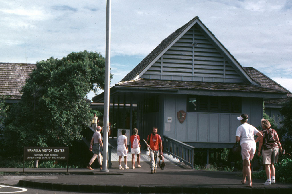
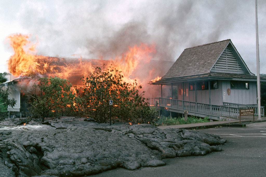
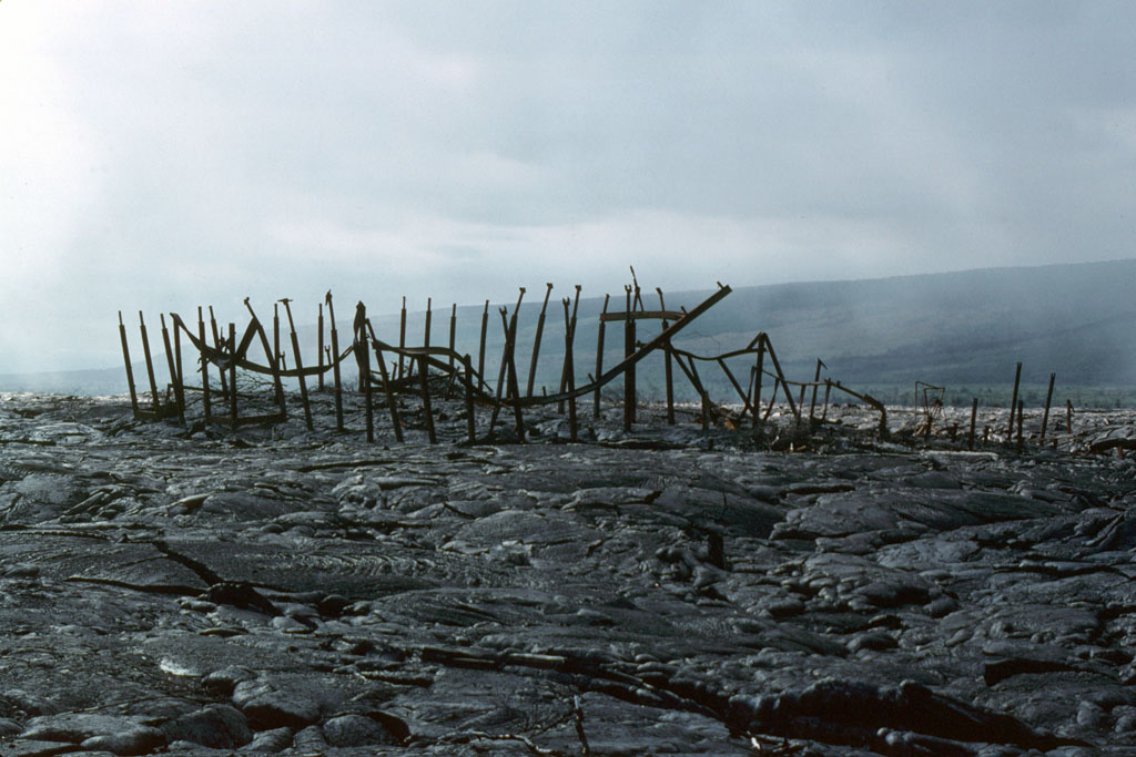
The timing of the GSA meeting in Hilo wasn't bad, although maybe it wasn't perfect, and the volcano-oriented field trip I went on before or after the meeting took us down the Chain of Craters road to the Waha‘ula Visitor Center (USGS TNM 2.0 Viewer location of the Visitor Center near Kupapau Point, showing an old topo map). The Visitor Center was later destroyed by a 1989 flow (before, during, and after photos).
We arrived on the scene in time to see a scene similar to this one from a slightly earlier field trip: the Chain of Craters road blocked just east of the then extant Visitor Center by what was for us a week-old lava flow.
 This is the week-old pahoehoe flow, which flowed southeastward from its vent at Kūpaianaha, ultimately making it into the ocean. The lava was still hot, although not molten at the surface. We had been cautioned to bring boots with Vibram® soles. A couple orange hot spots can be seen in the original print of this photo (notably in the dark shadow between the two geologists on the flow, click to enlarge). We were the only ones allowed out on the flow that day, and our trip leaders guided us carefully around (and away from) thinner and more dangerous spots, places that were thought to be more likely to collapse.
Flow activity in the area had begun about six months prior to our visit; even the 6-month-old part of the flow radiated heat and was warm to the touch.
 Here, a geologist stands next to one of the open cracks while a stick stuck just below the surface bursts into flames.
 My best closeup of hot lava only three feet below the flow surface we were walking on.
 In the distance, steam is rising from the week-old lava flow where ocean waves are hitting the flow.
Black sand beaches had already started forming along part of the six-month-old flow. The land surface had been extended oceanward by the flows; we were told that all new land belongs to the state of Hawai‘i. Several of these flows, along with earlier flows of 1983 through 1985 (eruption Episodes 1 through 47, I think), destroyed houses in the area and blocked the road toward Kalapana. Housing and subdivision destruction continued with later parts of Episode 48 (1986-1992) and with even later eruptions. While we were there, some people were still hopeful that roads would be rebuilt. Roads can be built on new flows after about 1 to 1.5 years.
 The flows we saw that year are shown here in black, lumped with all the Episode 48 flows erupted from the Kūpaianaha vent (map from Heliker et al, 1998, detailed version here). In 1987, the flows weren't as extensive as shown here, especially on the west side where the Waha‘ula Visitor Center was still intact.
We were quite excited about walking on the flow, and sometime after the field trip a few other geologists and I went around to the eastern side of the flow where a tongue of lava was coming down the hill from above. A couple people ran up to the flowing lava to take a close look. I think we were about a hundred yards below the molten rock, and I kept wondering if unknown lava tubes would unexpectedly spurt lava out closer to us, but nothing quite that exciting happened (thankfully, in my view).
Additional Information:
Summary of Pu‘u ‘Ō‘ō–Kupaianaha Eruption, 1983 to present at HVO.
Heliker, C.C., Mangan, M.T., Mattox, T.N., and Kauahikaua, J.P., 1998, The Pu‘u ‘Ō‘ō - Kūpaianaha Eruption of Kīlauea, November 1991–February 1994: Field Data and Flow Maps: U.S. Geological Survey Open-File Report 98-103 Version 1.1.
Heliker, Christina, Swanson, D.A., and Takahashi, T.J., 2003, editors, The Pu‘u ‘Ō‘ō-Kūpaianaha Eruption of Kīlauea Volcano, Hawai‘i: The First 20 Years: U.S. Geological Survey Professional Paper 1676.
Takahashi, T.J., Abston, C.C., and Heliker, Christina, 1995, Images of Kilauea East Rift Zone Eruption, 1983-1993: U.S. Geological Survey Digital Data Series DDS-24.
A Couple More Maps:


UPDATE: List of AW#41 participants.
Updated 2Jun2016, minor link revision.