Showing posts with label rain. Show all posts

Tuesday, November 8, 2016

From the Road: Storms

I got kind of bogged down with traveling and went light on the posting. Part of this has to do with the nature of posting from the road. I decided not to try to post using a mobile connection, for various reasons, and so that meant that I needed a wifi connection at night. One night, that was unavailable. Additionally, my chosen destination had me so busy that I didn't hardly touch the computer, even though I had great wifi. While there, I had Other Priorities.
Jumping cholla fruit.
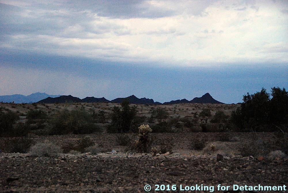
And so, here we are back on the alluvial fan coming southward off the Whipple Mountains, camping under cloudy skies.
The camp is fine, although the vehicle unmodified is an uncomfortable place to sleep. And it was crowded, because when it started raining I had to move most things back into the Jeep. And then ... lightning. At first the flashes were distant, south of the Big Maria Mountains and north of the Whipples. But it rained, and depressions in the desert pavement filled with water, and I worried about the major wash I had crossed: Would it flood?

I tried getting photos of the lightning, and this is as close as I came: a leftover bit of the strike over to the left, hitting behind the darker pointy hills (a light-colored line going straight down, probably easiest to spot if you know where it is).
After awhile, I dozed a little. Then it was suddenly quite bright, the flashes making me think that surely someone was bombing the area, although there was not much sound at first. I sat up and looked around, and it gradually became clear that the blinding flashes were bolts of lightning, this time all around, moving closer, until some thunderous crashes were finally within less than a mile. Would I be hit? Is a plastic topped Jeep as safe as an all metal pickup truck? I still don't really know, but I wasn't hit, and eventually the second downpour stopped. Finally I actually slept.
Turtle Mountains before they were obscured by rain.
Turtle Mountains in the morning.
In the morning, the wash was fine.
The road was its usual rolling self.

Thursday, January 14, 2016

2015 Top Ten Posts at LFD...

...and—as for 20142013, and 2012—a few more. My rules, as modified from last year:
Because of the vagaries of stat reporting (in this case, by Google Analytics), I'm listing both the top ten posts for the year (in large font, with respective Top Ten number), and the top post for month's without a top-ten posting (non-Ten-rated posts are in a smaller font).
And so, here are the top 10 posts, plus 2 extra, along with a few pretty pictures:

January:

February:

March:

April:

May:

June:

July: No posts in July!

August:

September:


October:

November:

December:

Tuesday, June 30, 2015

El Niño Near Long Valley Creek, Lassen County, CA

I've got a few more pictures from that rainy May day, the 21st, when MOH and I were on what was really the first leg of a trip to Colorado and back.
A downpour over unnamed hills just off the north end of the Bald Mountain Range and just south of Beckwourth Pass. Photo taken May 21st, 12:44 pm.
Looking up Dinwiddie Arm (of Long Valley Creek?) into the area of Roberts and Coulee Canyons. Mount Ina Coolbrith, with summit at 8051 ft (2454 m), is the long sloping mountain in the mist; Little Haskell Peakat 6135 ft (1870 m), is the dark hill on the far left.
More hills in the foreground, more peaks of the Bald Mountain Range in the background, as the downpour continues.
Note in these pictures how green everything already was! It's been a green spring because of the unusually rainy May, though I haven't noticed any particularly unusual areas of high wildflower density. It is starting to brown up now, with the halogeton and tansy mustard being the last to fade to brown, although bushes such as sagebrush, rabbit brush, and fourwing saltbush are still plenty green.

These particular photos are all from Long Valley in Lassen County, and they were taken from the south-bound lanes of Highway 395 between Hallelujah Junction, CA, and Border Town, NV.

Related Posts:
El Niño at Honey Lake
The Beginning of an El Niño Trip: North-Central and Western Nevada

Wednesday, June 17, 2015

El Niño at Honey Lake

After our brief stay at The Nugget during the first part of our journey last month, we made a brief foray north on Highway 395, then quickly retreated southward along the same road. When we stopped at the Honey Lake Rest Area, it was raining hard in a localized but intense shower.
Looking across the partly muddy Honey Lake toward the Skedaddle and Amedee Mountains; May 21st, 11:56 pm.
Well, no that looks like a bit of hail!

As a bit of reference, the next photo was taken two weeks later when things had greened up and clouds were still prevalent (they are currently mostly out of the picture--it's summer!). That's the same mountains, same tree, different phone pole.
Photo taken June 4th, 2:38 pm.
The nearshore part of the lake in its northwesternmost lobe is considerably greener than usual in these pictures. Beyond the nearshore green swath, which grades into a brown, muddy-looking patch, a dark line and another green patch marks an area where water has been standing off and on this past year.
Photo taken June 4th, 2:37 pm.
A seagull poses for its picture, May 21st, 12:02 pm..

Monday, June 1, 2015

The Beginning of an El Niño Trip: North-Central and Western Nevada

An El Niño has supposedly set in (starting when, exactly, I'm not sure). And if precipitation continues to be anything like it has been during the last several weeks, I hope it's here for the the long haul, that is, into the winter.
Rain shower in the northern part of the East Range near Winnemucca, NV, looking SW. Photo taken May 17th, 12:03 pm. The highest, roundish mass on the left is probably Dun Glen Peak.
Rain showers in the Eugene Mountains to the east of the East Range, looking west. Photo taken May 17th, 12:10 pm.
The low hills of the southern Pah Rah Range, as seen from the JA Nugget, looking NE. Photo taken May 17th, 4:35 pm.
March 2015 ENSO discussion: El Niño is here
NOAA, March 5th.

Scientists Suggest a Strong El Nino Is Possible. Why Should You Care?
The Weather Channel, May 14th.

El Nino Delivers Drought-Busting but Flooding Rain to Texas; California May be Next
AccuWeather.com, May 19th.

With El Niño likely, what climate impacts are favored for this summer?
NOAA, May 28th.


Monday, May 23, 2011

A Bit of the Garden

We've been very busy this month, and the month before, as you might be able to guess from the lack of posting on this blog -- but we have managed to get a bit of our garden going in the backyard of our little house, just like we did last year, though not on such a grand scale. The chocolate mints, which were in the ground all winter in pots, so as to prevent too much die back, are going quite well, and were yesterday pulled out of the ground. These pictures, from May 16th, show them with a sparkle of snow.
We have fewer plants from seedlings grown indoors this year (so far), and most will be in the ground by the end of today [written yesterday, see update below]. Hopefully it isn't too early for them, but we need to get them on the drip line, so in the ground they go. We'll be planting flower seeds around our seedlings, maybe right where these mints are sitting now, and also in the front garden and in a little patch along the edge of the street, where I'm hoping the overly easy to grow Cosmos and cornflowers will flourish.

Update just prior to posting: One squash and two tomato seedlings are in the ground; the rest are waiting for a less rainy day. It poured and hailed and lightninged and thundered and rained ... and our garden became a little too damp for planting (ha! -- drenched is more like it). And we're getting another deluge right now!

Friday, March 26, 2010

Three Years Ago Today: Hat Creek

I'm quite busy these days, so I didn't post anything about Hat Creek for World Water Day. Instead, I'll go ahead and post this already standing pre-post. If anyone wants to find out more about water and rivers than the small amount of information written here, I suggest reading posts by Anne Jefferson at Highly Allochthonous, and be sure to check out this video developed by Little River Research & Design. [What I'm busy at is something I can't talk about (as usual), so it won't appear in this month's Accretionary Wedge - the due date is today in case *you* want write for The Wedge.]
Three years ago today, in the middle of a rainstorm turning later to snow, MOH and I went to the Cave campground, located near Old Station, California, right across Highway 89 from the turnoff to the Subway Cave lava tube. We wandered around in the rain, spending most of our time along the banks of Hat Creek, which runs on the west side of the highway. I recently conferred with Anne Jefferson and her students about the picture above, wondering if any part of the picture shows a hydraulic jump. The answer is yes, the whitewater marks locations of hydraulic jumps, in this case several small ones, no large ones. [Photo credit: MOH.]

I learned a lot more, too. We can see a "long tongue of high subcritical Froude" along the right bank. [By convention, the right bank is the one on the right side when you are looking downstream, in this case the bank closest to us.] The subcritical flow regime is indicated by the standing waves just beyond the irregular-looking whitewater in the near foreground. There is also subcritical flow upstream of the log in the center, indicated by bow waves upstream from the log.
Not knowing exactly what I was looking at three years ago, other than a very nice, swiftly flowing stream, I almost missed getting a closer shot of the bow waves, which can be seen here amidst the raindrops. I can identify three waves in this view for sure, possibly a couple others.
And now, looking straight downstream just right of the central log, I've managed to freeze the water motion just above one of the small rapids. The smooth water flows and drops into the whitewater.
Same view with the water action not frozen by the camera. At least two of the bow waves come over toward the center of these two nearly identical photos.
This is a view of a log across Hat Creek; the log was also seen downstream in the last two photos. [Photo credit: MOH.]
This is what Hat Creek looks like in the upstream direction from about the same location: smooth water along the right bank in the foreground, more irregular and choppy-looking whitewater or riffles along the left bank and farther upstream, then more smooth water beyond that just before the stream goes out of view. The rain made the grass stand out, and brought out the reddish tones of the dominantly Ponderosa pine forest.
The region north of Lassen Peak is volcanic, and right at Hat Creek the bedrock is basalt. Here the trees are growing amongst basalt boulders or small outcrops.
By the time we left, it was back to winter again, and we drove away through mostly untracked snow.

For some detail about the isotope hydrology of the region:

Rose, T.P., and Davisson, M.L., 1996, Radiocarbon in Hydrologic Systems Containing Dissolved Magmatic Carbon Dioxide: Science,,Vol. 273, no. 5280, p. 1367 - 1370.

Rose, T.P., Davisson, M.L., and Criss, R.E., 1996, Isotope hydrology of voluminous cold springs in fractured rock from an active volcanic region, northeastern California: Journal of Hydrology, Vol. 179, Issues 1-4, p. 207-236.

Saturday, October 17, 2009

Highlights of the Day: Travel Day Two

I'm already at the national GSA Meeting in Portland, but I took my time getting here, four days to be precise. Here are a few highlights from travel day two.
The lighting was great between Susanville and Klamath Falls. Here, I'm dropping into a Basin and Range valley, the valley that's home to Eagle Lake (MSRMaps link). Eagle Lake, which is reported to be a closed basin with no hydrologic outlet, is shown as being either in or out of the Great Basin, depending on whose map you use. Eagle Lake was not connected to Pleistocene Lake Lahontan.
Eagle Lake (Google Maps link), looking almost west, from Highway 139.
This is a basalt dike on the east side of Highway 139, just south of Lassen County Milepost 52 (Google Maps location), and just before you get to the Willow Creek Campground if you're driving north.
The columnar jointing in the dike is nearly horizontal, making the rock look like a bunch of stacked logs.
Looking end-on at the pile of stacked logs, the cross-section through the stacked columns shows the typical though irregular polygonal shapes common to basalt columns. Kim posted about another dike with horizontal columnar joints earlier this year, and Andrew's article on basalt columns has a great photo of a piece of basalt with an almost perfect hexagonal shape. It seems like I've seen another post more recently on columnar jointing, but I'm not finding it right now.
Closer to my KFalls destination, it started raining, but without the intensity of the previous day.
And then there was the IPA awaiting me at The Creamery Brew Pub & Grill . . .

Wednesday, October 14, 2009

Through the Rain

Yesterday, my travels toward the GSA meeting in Portland, Oregon, took me across Nevada into the face of the oncoming storm.
cloud Lenticular cloud in eastern Nevada.

dust Dust storm, with overhead mass of lenticulars, while approaching Eureka.
rain Serious rain started as I crossed Big Smoky Valley and drove toward the Toiyabe Range. I couldn't hardly see the mountains until I got into them, and Big Smoky Valley to the south was a near whiteout (gray-out?) from the rain and low clouds.
mountains Looking south toward the west side of the Toiyabe Range from the center of Reese River Valley: clouds roil over the back side of the mountain near Big Creek.

A relatively dry spell ensued, until somewhere east of Fallon.
windmill Good news! The windmill is back up and running at West Gate. A lot of happy cows were lying down in the nearby field. Happy cows are ones that are lying down, rather than having to stand up and spend their entire time eating. Cows aren't usually that "happy" in the desert and steppe rangelands of Nevada and southern California (the Mojave Desert).

Driving from Fallon onward included barely being able to see with windshield wipers going full blast from the intensity of the rain and from semis splashing water all over while passing me in the canyon of the Truckee River east of Reno. There was enough standing water on the roads to cause unexpected hydroplaning in places - and the winds were blasting sideways across the water-sheeted concrete highway between Fallon and Fernley, strong enough locally to push my truck sideways.

Oh, and how much gas did I have? Usually that isn't a problem for me, but I didn't want to stop and risk getting completely drenched, didn't want to stop and risk driving over the mountain pass in the coming darkness. My odometer seemed to be telling me I had been getting 20 mpg or more for the last 400 to 500+ miles. Since I couldn't believe that, I chose to think I had not reset the odometer, and must not have traveled as far as it said, thus giving me enough gas to get to my destination without refilling. About 40 miles from the next gas station, I did the math and realized that with less than a quarter of a 30 gallon tank, I had really gone 560+ miles, another 40 would make that 600 miles, a precise 20 mpg. I usually fill up at 500 miles, and although I probably had enough gas to make it 40 miles - probably, maybe - I turned around and drove back less than a quarter mile to the last gas station, getting a little damp for the trouble. I'm packed for wet and cold weather, but was only dressed for cold.
sun Finally, after driving through the most consistently intense rainstorm I've seen in Nevada for a long time - over a broad area from east of Fallon to beyond Reno - I spotted this bit of clearing on Highway 395 south of the Honey Lake rest stop.