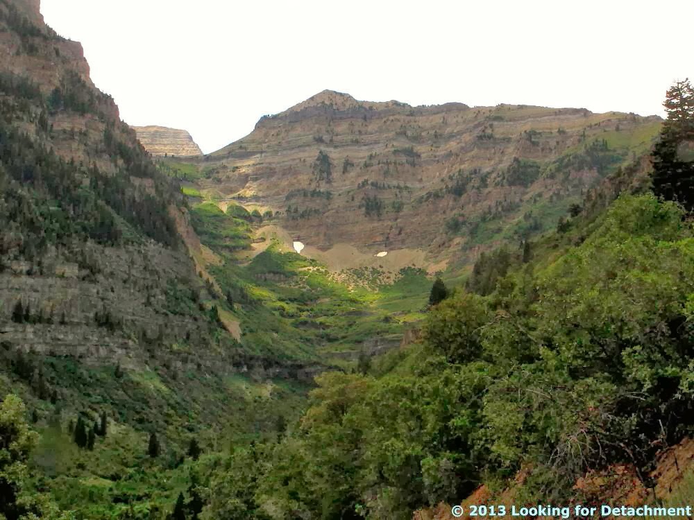
Getting back to my October-November road trip (last seen here), I stopped to get some fuel in Parachute, CO, on what was Day 7 of the trip, and I ended up taking a few photos (surprise!), partly thinking that the cliffs show good examples of bedding, and also because I was becoming fascinated by the exceptional talus slopes coming off the cliffs. The first photo is a cliff at a round nose sticking out from Mt. Callahan. The second photo is of a cliff at the southern end of a nose known as Allen Point, a long skinny ridge running about 1.5 miles south of a broader, arcuate area also called Allen Point.
When I investigated this area after my trip was over, I was surprised to find that these cliffs are part of the Roan Cliffs: while still enroute, I thought I was driving along the Book Cliffs. The Roan Cliffs are the cliffs that break south off of the broad Roan Plateau, a large plateau area that extends from Rifle, CO, to at least somewhere north of Grand Junction, possibly bounded on the west by Roan Creek. The Roan Cliffs, however, at least as shown here, encircle a broader area extending westward from Rifle, CO, to the mountains just east of the Wasatch in Utah.
The Roan Cliffs are capped by the Eocene Uintah Formation (which we may or may not see in these photos), and slopes below the uppermost cap are composed of the Eocene Green River Formation. Some of the lower, reddish slopes in the area are underlain by the Paleocene to Eocene Wasatch Formation. You can read a little more about the geology of the area in this USGS Bulletin.
The Roan Cliffs stratigraphically overlie the Book Cliffs, which we'll see later. I'm not sure how I mistook the cliffs of the Uintah Formation and upper Green River Formation for cliffs of the Cretaceous Mesaverde Group, or slopes of the Green River Formation for the usually easy-to-spot Cretaceous Mancos Shale. I can only plead that geology at 70+ mph isn't always spot-on.
Showing posts with label utah. Show all posts
Thursday, March 9, 2017
Sunday, November 27, 2016
Links: Here Are a Few, But Great, Great Basin and Great Basin Divide Links
Great Basin—Mojave Desert Region - the hydrographic, physiographic, and floristic Great Basin (GB) regions and climate; v. good map of vegetation zones, lots on flora and fauna; pretty good map of the GB itself although it goes all the way to Colorado River (!!); Fremont coined "Great Basin".
Quaternary stratigraphic, hydrologic, and climatic history of the Great Basin, with emphasis on Lakes Lahontan, Bonneville, and Tecopa - Morrison, cited in the first ref, said the area of the GB "exceeds 500,000 square kilometers" ; this source is not available online, is part of DNAG - this volume.
The Great Basin: A Natural Prehistory - Grayson, at Amazon. (and here's a Google Book preview.) A better map of the GB. Grayson discounts having the Salton Sea in the Great Basin on page 11. His map, page 12, also ends the Great Basin in Pahranagat Lake, as justified below (Witt etal, 2008):
Jonathan D.S. Witt, Doug L. Threloff, and Paul D.N. Hebert -
Genetic zoogeography of the Hyalella azteca species complex in the Great Basin: Rapid rates of molecular diversification in desert springs:
Geological Society of America Special Papers, 2008, 439, p. 103-114, doi:10.1130/2008.2439(05). Page 104 (clip from Google Books):
(Witt et al, 2008 is in GSA Special Papers 439:
Late Cenozoic Drainage History of the Southwestern Great Basin and Lower Colorado River Region: Geologic and Biotic Perspectives -
edited by Marith C. Reheis, Robert Hershler and David M. Miller).
Fishes of the Great Basin - a Google Books preview - shows the White River above the lower end of Pahranagat Valley as in Great Basin.
Google Books preview).
The Jarbidge Mining District, 1923 - mentions the GBD.
Quaternary stratigraphic, hydrologic, and climatic history of the Great Basin, with emphasis on Lakes Lahontan, Bonneville, and Tecopa - Morrison, cited in the first ref, said the area of the GB "exceeds 500,000 square kilometers" ; this source is not available online, is part of DNAG - this volume.
The Great Basin: A Natural Prehistory - Grayson, at Amazon. (and here's a Google Book preview.) A better map of the GB. Grayson discounts having the Salton Sea in the Great Basin on page 11. His map, page 12, also ends the Great Basin in Pahranagat Lake, as justified below (Witt etal, 2008):
Jonathan D.S. Witt, Doug L. Threloff, and Paul D.N. Hebert -
Genetic zoogeography of the Hyalella azteca species complex in the Great Basin: Rapid rates of molecular diversification in desert springs:
Geological Society of America Special Papers, 2008, 439, p. 103-114, doi:10.1130/2008.2439(05). Page 104 (clip from Google Books):
(Witt et al, 2008 is in GSA Special Papers 439:
Late Cenozoic Drainage History of the Southwestern Great Basin and Lower Colorado River Region: Geologic and Biotic Perspectives -
edited by Marith C. Reheis, Robert Hershler and David M. Miller).
Fishes of the Great Basin - a Google Books preview - shows the White River above the lower end of Pahranagat Valley as in Great Basin.
Google Books preview).
The Jarbidge Mining District, 1923 - mentions the GBD.
Location:
The Great Basin, USA
Thursday, June 30, 2016
Road Sign Thursday: Dust Storm!
Someone at US Ends.com suggested, when posting a photo of a similar sign on eastbound I-70, that there is one speed limit for regular travelers and a second, lower speed limit for dust storms.
I took this photo in 2006 on I-70 in Utah, while MOH and I were traveling in an easterly direction. The sign was located near Cisco (location way below), and it's apparently no longer there, or anyhoo it isn't shown on the current rendition of Google Street View. The Colorado River is less than 10 miles to the south of the interstate, and one happens to be driving through an upland largely underlain by Mancos Shale, which often makes paved roads lose their originally smooth surface, leaving drivers and passengers alike to feel about the same as they would while driving over bad frost heaves on the Alaskan Highway between Destruction Bay, Yukon, and Tok, Alaska.
Anyway, this is my first post in an off-and-on series of Thursday road sign posts. Many of the signs I've photographed over the years are standard mileage signs, exit signs, warning signs (curves, low flying aircraft, what-have-you), regulatory signs (stop, yield, do-this, do-that), mileposts (often photographed so I'll know where a certain roadcut or outcrop was located along the road), and other signs, some of which have nothing to do with the road (Iditarod signs, pub signs, signs on and inside buildings): anywhere signs, in other words.
I took this photo in 2006 on I-70 in Utah, while MOH and I were traveling in an easterly direction. The sign was located near Cisco (location way below), and it's apparently no longer there, or anyhoo it isn't shown on the current rendition of Google Street View. The Colorado River is less than 10 miles to the south of the interstate, and one happens to be driving through an upland largely underlain by Mancos Shale, which often makes paved roads lose their originally smooth surface, leaving drivers and passengers alike to feel about the same as they would while driving over bad frost heaves on the Alaskan Highway between Destruction Bay, Yukon, and Tok, Alaska.
Anyway, this is my first post in an off-and-on series of Thursday road sign posts. Many of the signs I've photographed over the years are standard mileage signs, exit signs, warning signs (curves, low flying aircraft, what-have-you), regulatory signs (stop, yield, do-this, do-that), mileposts (often photographed so I'll know where a certain roadcut or outcrop was located along the road), and other signs, some of which have nothing to do with the road (Iditarod signs, pub signs, signs on and inside buildings): anywhere signs, in other words.
Location:
I-70 near Cisco, UT, USA
Monday, April 21, 2014
Across the West and Back Day 2: Beyond the Wasatch
It was a cloudy and soon to be stormy day, and we were just about over the Wasatch, just about to U.S. 189, which runs in a northeasterly direction through Provo Canyon toward Heber City, where we planned to meet up with U.S. 40. On our way to 189, still on S.R. 92, we passed by one or two roadcuts exposing some tilted beds, a general configuration that was rapidly becoming familiar on our trip, one I soon came to think of as "another tilted section." In this case, it turned out that we were looking at the basal member of the Oquirrh Formation: the Bridal Veil Limestone.
I found out later—from Geolex—that this medium to dark gray, thick to thin bedded limestone, which was named for Bridal Veil Falls on the south side of Provo Canyon, is about 1200 ft thick.
We made it into Provo Canyon. About 3 miles up the canyon, Highway 189 crossed from the north side of the canyon to the south side, ending up south of the dammed Provo River at Deer Creek Reservoir.
We started seeing some modified roadcuts.
These types of roadcuts, where the steep rock exposures appear to be cemented for slope stabilization and then painted or stained to look somewhat like natural rock, became another hallmark of our trip, being seen fairly commonly at least in Utah and Colorado. I found these types of roadcuts to be fascinating, and I consider them to be better (more scenic? an attempt at a "natural" look?) than some types of wholesale roadcut destruction.
Moving along past Deer Creek Reservoir, we finally came into a downpour. Visibility was worse than shown in this photo, for several miles. We were entering the part of the west that was having an abnormally wet monsoon, although we didn't realize how wet it would really be until later.
When I first started this series last summer or fall, I was really planning on doing more with it than I seem to have time for now, and I was planning on making notes about the geology on the road trip and the formations being seen in these photos. I also have been keeping the locations of photos up to date on the map seen in the last post (link here, not updated at the moment). I'm finding this level of detail to be just too much at this point, so am going ahead with things the way they are right now.
What I noticed when looking up info about the rock formations on this part of the trip and in the last post, was that it's possible that the Bear Canyon member of the Oquirrh Formation and Ely Limestone may be at least in part correlative (also mentioned here). It's a similar age (or the same?), reportedly has abundant nodules of black chert (Geolex), and some fossils in certain parts of the Oquirrh have been tentatively identified in rocks possibly correlative with the Ely (1998 paper here).
Selected References:
Baker, A.A., and Crittenden, M.D., Jr., 1961, Geology of the
Timpanogos Cave quadrangle, Utah: U.S. Geological Survey
Geologic Quadrangle Map, GQ-132, 2 sheets, scale 1:24,000.
Interactive geologic map of Utah (UGS)
My initial notes: Bridal Veil overlies Manning Cnyn Shale, but although the next formation we see looks like it could be a shale, it's more of the Bear Canyon Member of the Oquirrh. This was named as the basal member of the Oquirrh Fm in an area where the Bridal Veil Limestone does not occur or doesn't otcp.
Geloex (Bear Canyon): says "gray to tan and reddish-brown, limy to quartzitic sandstone with thin to thick beds of gray to black limestone, in part sandy, and in part with abundant nodules and stringers of black chert" -- both of these units, their age and description (and not so much what I've seen of their otcp or exposure) remind me of the Ely Limestone, which we saw here and here (search blog="oquirrh" for one, including "ely") (blah blah). And indeed, the fossils within certain parts of the Oquirrh have been tentatively identified in rocks possibly considered part of the Ely (1998 paper here)
Going back to Roberts Horn (last post) and here - it might even look like the Ely!
Related Posts:
Across the West and Back Day 2: Over the Wasatch Range
Across the West and Back Day 2: Are We Lost Yet?
Across the West and Back Day 2: A Hike along a Limestone Ridge
Across the West and Back Day 2: Across the Salt Lake Desert
Across the West and Back Day 2: A Side Trip in West Wendover
Across the West and Back Day 2: Pequop Summit to West Wendover
Across the West and Back Day 2: Looking for an Old Roadcut
Across the West and Back: The First Day
Intro to Recent Western Loop Trip
![]() |
| Bridal Veil Limestone member of the Oquirrh Formation, Pennslyvanian in age. |
We made it into Provo Canyon. About 3 miles up the canyon, Highway 189 crossed from the north side of the canyon to the south side, ending up south of the dammed Provo River at Deer Creek Reservoir.
We started seeing some modified roadcuts.
![]() |
| A modified roadcut of the Bear Canyon member of the Oquirrh Formation. |
![]() |
| An original part of the roadcut can be seen in the gully ahead, although I imagine it might be hard to examine. |
![]() |
| With it still raining, we finally hooked up with U.S. 40, which we had lost in Salt Lake City before we started our unplanned side trip through the Wasatch via American Fork Canyon and Utah S.R. 92. |
What I noticed when looking up info about the rock formations on this part of the trip and in the last post, was that it's possible that the Bear Canyon member of the Oquirrh Formation and Ely Limestone may be at least in part correlative (also mentioned here). It's a similar age (or the same?), reportedly has abundant nodules of black chert (Geolex), and some fossils in certain parts of the Oquirrh have been tentatively identified in rocks possibly correlative with the Ely (1998 paper here).
Selected References:
Baker, A.A., and Crittenden, M.D., Jr., 1961, Geology of the
Timpanogos Cave quadrangle, Utah: U.S. Geological Survey
Geologic Quadrangle Map, GQ-132, 2 sheets, scale 1:24,000.
Interactive geologic map of Utah (UGS)
My initial notes: Bridal Veil overlies Manning Cnyn Shale, but although the next formation we see looks like it could be a shale, it's more of the Bear Canyon Member of the Oquirrh. This was named as the basal member of the Oquirrh Fm in an area where the Bridal Veil Limestone does not occur or doesn't otcp.
Geloex (Bear Canyon): says "gray to tan and reddish-brown, limy to quartzitic sandstone with thin to thick beds of gray to black limestone, in part sandy, and in part with abundant nodules and stringers of black chert" -- both of these units, their age and description (and not so much what I've seen of their otcp or exposure) remind me of the Ely Limestone, which we saw here and here (search blog="oquirrh" for one, including "ely") (blah blah). And indeed, the fossils within certain parts of the Oquirrh have been tentatively identified in rocks possibly considered part of the Ely (1998 paper here)
Going back to Roberts Horn (last post) and here - it might even look like the Ely!
Related Posts:
Across the West and Back Day 2: Over the Wasatch Range
Across the West and Back Day 2: Are We Lost Yet?
Across the West and Back Day 2: A Hike along a Limestone Ridge
Across the West and Back Day 2: Across the Salt Lake Desert
Across the West and Back Day 2: A Side Trip in West Wendover
Across the West and Back Day 2: Pequop Summit to West Wendover
Across the West and Back Day 2: Looking for an Old Roadcut
Across the West and Back: The First Day
Intro to Recent Western Loop Trip
Location:
Wasatch Range, Utah, USA
Labels:
189,
geology,
highway 40,
road trip,
roadside,
sedimentary rocks,
stratigraphy,
travel,
US 89,
UT S.R. 92,
utah,
western loop trip
Thursday, January 23, 2014
Across the West and Back Day 2: Over the Wasatch Range
Possibly I can now -- now that holidays are over -- get back to the western road trip MOH and I took last August, where, if you remember, we're still on day two, and about to head into American Fork Canyon south of Salt Lake City, Utah.
South of the canyon and on the left side of the photo, the sequence of mostly Mississippian sediments is definitely dipping southward, according to the online, interactive geologic map of Utah. The section includes the Deseret Limestone, Humbug Formation, and Great Blue Limestone.
On the north side of the canyon, the geology is more complicated, but at least part of the section dips to the north.
As we head into the canyon, the road fairly suddenly becomes a very narrow two laner (? -- more like 1.5!!) and goes upward and into the mountains. Not knowing at all what to expect at this point, we hope we have made a good choice in not turning back toward SLC (you'll have to read the last installment to find out more about why we ended up in American Fork Canyon in the first place).
Nevertheless, despite the demanding road and my migraine, we see some good scenery (and awesome rock formations).
Much of the drive was through fairly dense trees, often aspens. And, like I said, the road was fairly narrow, and it lacked a viable shoulder, making some of the curves and brief overlook sites rather startling.
Roberts Horn is a true glacial horn, surrounded by several cirques: Primrose Cirque, with two cirque basins (Emerald Lake and Hidden Lakes basins) above the main cirque, lies to the south; the Timpanogos Basin to the north is an elevated cirque that above the Giant Staircase, a cirque and glacial valley.
At this point in our trip across the Wasatch, we've almost made it down S.R. 92 to our next road, and hopefully the last section of the trip report for Day 2.
View Day 2: Elko, NV to Vernal, UT in a larger map
Related Posts:
Across the West and Back Day 2: Are We Lost Yet?
Across the West and Back Day 2: A Hike along a Limestone Ridge
Across the West and Back Day 2: Across the Salt Lake Desert
Across the West and Back Day 2: A Side Trip in West Wendover
Across the West and Back Day 2: Pequop Summit to West Wendover
Across the West and Back Day 2: Looking for an Old Roadcut
Across the West and Back: The First Day
Intro to Recent Western Loop Trip
![]() |
| As a reminder, we're here on Utah S.R. 92. |
![]() |
| As we approach, it appears that the canyon bisects an anticline, with bedding dipping north on the north side of the canyon and south on the south side. |
![]() |
| Closer view of the south wall of American Fork Canyon. |
![]() |
| A closer view of the north canyon wall. |
As we head into the canyon, the road fairly suddenly becomes a very narrow two laner (? -- more like 1.5!!) and goes upward and into the mountains. Not knowing at all what to expect at this point, we hope we have made a good choice in not turning back toward SLC (you'll have to read the last installment to find out more about why we ended up in American Fork Canyon in the first place).
Nevertheless, despite the demanding road and my migraine, we see some good scenery (and awesome rock formations).
![]() |
| North Timpanogos Peak (or North Peak), rising to 11441 ft (3487 m), reportedly underlain by the Bear Canyon Member of the Pennsylvanian Oquirrh Formation. |
![]() |
| Here we are a little farther on, looking back down South Fork toward American Fork Canyon. |
![]() |
| We approach the summit, which is marked at 8060 ft. |
![]() |
| More aspens. |
![]() |
| Our first glimpse of Mt. Timpanogos, 11749 ft (3581 m), also in the Bear Canyon Member of the Oquirrh Formation. |
![]() |
| Something not clear from most of these photos: it was a dark, cloudy day, always threatening rain. |
![]() |
| Roberts Horn, with the peak at 10993 ft (3351 m), same formation as before, looking about the same. |
At this point in our trip across the Wasatch, we've almost made it down S.R. 92 to our next road, and hopefully the last section of the trip report for Day 2.
View Day 2: Elko, NV to Vernal, UT in a larger map
Related Posts:
Across the West and Back Day 2: Are We Lost Yet?
Across the West and Back Day 2: A Hike along a Limestone Ridge
Across the West and Back Day 2: Across the Salt Lake Desert
Across the West and Back Day 2: A Side Trip in West Wendover
Across the West and Back Day 2: Pequop Summit to West Wendover
Across the West and Back Day 2: Looking for an Old Roadcut
Across the West and Back: The First Day
Intro to Recent Western Loop Trip
Location:
Summit of Utah S.R. 92
Labels:
geography,
geology,
geomorphology,
glacial,
road trip,
roadside,
sedimentary rocks,
travel,
trees,
UT S.R. 92,
utah,
western loop trip
Friday, October 18, 2013
Across the West and Back Day 2: Are We Lost Yet?
We left this meandering trip report almost two weeks ago, after MOH and I had taken our short hike into the limestone at the Grassy Mountain Rest Stop. From there to Salt Lake City, we cruised while admiring the shorelines of ancient Lake Bonneville.
And then: Salt Lake City.
Driving into SLC can make me somewhat apprehensive unless I'm going directly to the airport, and I had already started wondering if I was getting a migraine — possibly from normal trip concerns, possibly from driving, maybe from poor sleep the night before, possibly from some other, unknown cause.
I had looked at our route on Google Maps and had looked at the interchanges and major turns in Street View. Examining the route online is not the same as having a physical map in hand while driving (or in the navigator's hand, as the case may be) — at least not for me, or at least not unless I have some ingrained or recent familiarity with the particular roads in question. The last time I'd driven (or been driven) east through SLC without turning onto I-15 to go either north or south was in 1957 when I-80 didn't exist — and the 1957 trip definitely didn't count as recent, maybe more like Ordovician, or even late Precambrian.
I knew I was looking for the turnoff from I-80 to U.S. 40 — not that far past SLC, I thought — but I don't think I'd written down the miles to the exit, and I know I hadn't written down the exit number. And for some mysterious reason I was thinking that Park City (which I've never been to, except possibly on that long ago 1957 trip) was a lot closer to SLC than it really is.
Consequently, when the interstate turned a bit to the northeast and headed upward into the fairly tight canyon of Parleys Creek, I instantly freaked and thought it was the even narrower Echo Canyon, which I remembered from coming west out of Wyoming on I-80 on a 2006 trip. I was sure I didn't want to be heading into Wyoming on I-80, so I thought I must have missed the desired exit up somewhere near Park City (!).
I turned around at the first opportunity amidst a rash of roadwork, blocked exits, and narrowed lanes.
I knew I needed a map, so we got off at what turned out to be Exit 4 on 215. We pulled into a gas station and got some gas and a relatively small scale map of Utah. It was at this point that I was sure I had a migraine — and migraines do this funny thing to your overall thinking and analysis skills.
After examining the map while experiencing fairly moderate noise, light, and motion sensitivity that caused me to have problems looking at the map and then looking anywhere else, like at the road, I decided we were on an "outer" loop around SLC that I was previously unaware of. (This "outer loop" actually consisted of I-84 from Ogden, east and southeast to I-80 at the beginning of Echo Canyon, and south and then back west into SLC on I-80, but that part of I-80 wasn't marked, neither was 215 marked, and the insert for SLC was surprisingly small and lacking in detail.) We were actually at a gas station along the 215 partial ring road, and I probably knew that fact when I had turned on to it after turning around in Parleys Canyon.
I figured all we'd have to do was get back onto this previously unheard of "outer loop" and head east or south to our desired exit onto U.S. 40 near Park City. Wrong.
By this time, MOH had wisely taken over the driving while I endeavored to determine our exact location. With a blur of freeway lanes, cars and trucks, and exits coming too fast to comprehend (this should have given me a clue), what I was seeing on the map (how could Alta and Snowbird already be north of us?) wasn't matching the route I'd incorrectly figured was the one we were on, and it wasn't matching my still intact knowledge of where we really were along the Wasatch.
Suddenly, the "outer" ring road turned due west, and I knew something was very wrong. I realized where we had to be (on the "inner loop" road, i.e. 215) just in time to navigate properly and direct us onto the exit for I-15 south. Whew!
At this point, we thought it would probably be just as easy to take the next road south over the Wasatch than to turn around and go back for I-80, Park City, and U.S. 40. As for this thought: not exactly correct.
View Our Crazy Route through SLC in a larger map
Because we went (unexpectedly, for sure) south on I-15, I was able to get a pretty decent, albeit somewhat grainy, shot of the Bingham Canyon copper mine.
It has been quite a while since I've been to Bingham Canyon — and I've never had a tour into the pit itself — but I strongly recommend going to the overlook and Visitors Center (the latter of which I've never seen) when they are reopened. The overlook area has been closed since the April 10th landslide (see a pre-landslide panorama of the pit here, view Kennecott's photos of the slide here, and read about the slide on several blog posts by Dave Petley).
And so, with our most recent trip decision finally behind us, we proceeded down I-15 to the Utah S.R. 92 exit, onto 92, and into the Wasatch via the easy, wide-looking American Fork Canyon.
View Day 2: Elko, NV to Vernal, UT in a larger map
The embedded map above shows the location of the three photos in this post (and also the rest of the Day 2 photos already posted, if you move around inside the map or view it in an enlarged version).
Related Posts:
Across the West and Back Day 2: A Hike along a Limestone Ridge
Across the West and Back Day 2: Across the Salt Lake Desert
Across the West and Back Day 2: A Side Trip in West Wendover
Across the West and Back Day 2: Pequop Summit to West Wendover
Across the West and Back Day 2: Looking for an Old Roadcut
Across the West and Back: The First Day
Intro to Recent Western Loop Trip
![]() |
Lake Bonneville shorelines in the southern Lakeside Mountains, looking northeasterly from I-80 about five miles northwest of Delle, UT. |
Driving into SLC can make me somewhat apprehensive unless I'm going directly to the airport, and I had already started wondering if I was getting a migraine — possibly from normal trip concerns, possibly from driving, maybe from poor sleep the night before, possibly from some other, unknown cause.
I had looked at our route on Google Maps and had looked at the interchanges and major turns in Street View. Examining the route online is not the same as having a physical map in hand while driving (or in the navigator's hand, as the case may be) — at least not for me, or at least not unless I have some ingrained or recent familiarity with the particular roads in question. The last time I'd driven (or been driven) east through SLC without turning onto I-15 to go either north or south was in 1957 when I-80 didn't exist — and the 1957 trip definitely didn't count as recent, maybe more like Ordovician, or even late Precambrian.
I knew I was looking for the turnoff from I-80 to U.S. 40 — not that far past SLC, I thought — but I don't think I'd written down the miles to the exit, and I know I hadn't written down the exit number. And for some mysterious reason I was thinking that Park City (which I've never been to, except possibly on that long ago 1957 trip) was a lot closer to SLC than it really is.
Consequently, when the interstate turned a bit to the northeast and headed upward into the fairly tight canyon of Parleys Creek, I instantly freaked and thought it was the even narrower Echo Canyon, which I remembered from coming west out of Wyoming on I-80 on a 2006 trip. I was sure I didn't want to be heading into Wyoming on I-80, so I thought I must have missed the desired exit up somewhere near Park City (!).
I turned around at the first opportunity amidst a rash of roadwork, blocked exits, and narrowed lanes.
I knew I needed a map, so we got off at what turned out to be Exit 4 on 215. We pulled into a gas station and got some gas and a relatively small scale map of Utah. It was at this point that I was sure I had a migraine — and migraines do this funny thing to your overall thinking and analysis skills.
After examining the map while experiencing fairly moderate noise, light, and motion sensitivity that caused me to have problems looking at the map and then looking anywhere else, like at the road, I decided we were on an "outer" loop around SLC that I was previously unaware of. (This "outer loop" actually consisted of I-84 from Ogden, east and southeast to I-80 at the beginning of Echo Canyon, and south and then back west into SLC on I-80, but that part of I-80 wasn't marked, neither was 215 marked, and the insert for SLC was surprisingly small and lacking in detail.) We were actually at a gas station along the 215 partial ring road, and I probably knew that fact when I had turned on to it after turning around in Parleys Canyon.
I figured all we'd have to do was get back onto this previously unheard of "outer loop" and head east or south to our desired exit onto U.S. 40 near Park City. Wrong.
![]() |
| The map in question. |
Suddenly, the "outer" ring road turned due west, and I knew something was very wrong. I realized where we had to be (on the "inner loop" road, i.e. 215) just in time to navigate properly and direct us onto the exit for I-15 south. Whew!
At this point, we thought it would probably be just as easy to take the next road south over the Wasatch than to turn around and go back for I-80, Park City, and U.S. 40. As for this thought: not exactly correct.
View Our Crazy Route through SLC in a larger map
Because we went (unexpectedly, for sure) south on I-15, I was able to get a pretty decent, albeit somewhat grainy, shot of the Bingham Canyon copper mine.
![]() |
| View of the Bingham Canyon copper mine, looking west from I-15. |
![]() |
| Looking east toward American Fork Canyon. |
View Day 2: Elko, NV to Vernal, UT in a larger map
The embedded map above shows the location of the three photos in this post (and also the rest of the Day 2 photos already posted, if you move around inside the map or view it in an enlarged version).
Related Posts:
Across the West and Back Day 2: A Hike along a Limestone Ridge
Across the West and Back Day 2: Across the Salt Lake Desert
Across the West and Back Day 2: A Side Trip in West Wendover
Across the West and Back Day 2: Pequop Summit to West Wendover
Across the West and Back Day 2: Looking for an Old Roadcut
Across the West and Back: The First Day
Intro to Recent Western Loop Trip
Location:
Western Utah, USA
Labels:
bonneville,
copper,
geology,
highway 40,
I-15,
I-80,
landslides,
mining,
road trip,
roadside,
shorelines,
travel,
utah,
western loop trip
Monday, September 30, 2013
Across the West and Back Day 2: Across the Salt Lake Desert
MOH and I left Nevada and entered Utah shortly after getting back onto I-80 following our brief sojourn in West Wendover, and began crossing the Great Salt Lake Desert (and Bonneville Salt Flats).
When almost to milepost 16, I took an obligatory photo of Floating Island, no doubt named for the mirage that often makes it look like it's floating above the salt flats. Here, the mirage is minimal but present. (See better photos of Floating Island with strong mirage here.)
It turns out that Floating Island *may* be at least partly underlain by our old friend, the Ely Limestone — or perhaps it's underlain by a Utah equivalent, the Lake Point Limestone, or another Utah equivalent, the Erda Formation. On the interactive online Utah state geologic map, clicking reveals that Floating Island is listed as being underlain by the Oquirrh Group (with the symbol PP - Pennsylvanian undivided?), consisting of such formations as the "Wells, Weber, Ely, Callville and other Fms" — at the same time, the map shows the symbol PPe on the northeastern side of Floating Island. PPe is the usual symbol for the Ely Limestone in eastern Nevada, but perhaps it could also refer to the Erda in Utah. For me, the island is too far away to make any snap judgements!
It was a cloudy day, overall, but nevertheless you could see a good 90 miles to the far peaks.
It became clear about halfway across the desert that distances were more than usually deceptive. The eastbound road markers on I-80, which begin with milepost 1 exactly one mile east of the NV-UT border, essentially mark the distance you have travelled across the desert from its western edge at just east of West Wendover, NV (in fact, you travel almost exactly a mile from the state line before ramping down onto the flats). Just before milepost 21, we passed a road sign indicating that it's 22 miles to the Knolls. The Knolls exit is just past the eastern edge of the salt flats, so I knew we were just almost exactly half way across.
View Approximate half-way point in a larger map.
It seemed like we had been driving forever! The low hills in the distance, marking the other side of the desert, only looked about 8 to 12 miles away, though they were really about 21 miles off. We knew we had another "almost forever" still left to go!
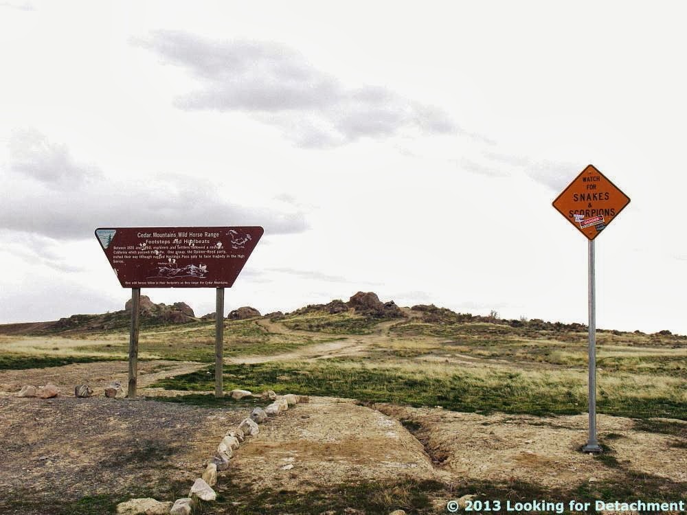
At the exit for Knolls (a siding? some hills?), we knew we were getting close to one of our favorite rest stops, Grassy Mountain. The rest stop is known for a short hiking trail and a sign saying "Watch for SNAKES and SCORPIONS."
And I'll have to save the hike for another post...
Photos to this point in Day 2 have been added to the day's trip log on Google Maps, along with the ones from West Wendover, which I forgot to add after the last post:
View Day 2: Elko, NV to Vernal, UT in a larger map.
Related Posts:
Across the West and Back Day 2: A Side Trip in West Wendover
Across the West and Back Day 2: Pequop Summit to West Wendover
Across the West and Back Day 2: Looking for an Old Roadcut
Across the West and Back: The First Day
Intro to Recent Western Loop Trip
When almost to milepost 16, I took an obligatory photo of Floating Island, no doubt named for the mirage that often makes it look like it's floating above the salt flats. Here, the mirage is minimal but present. (See better photos of Floating Island with strong mirage here.)
![]() |
| Floating Island. |
It was a cloudy day, overall, but nevertheless you could see a good 90 miles to the far peaks.
![]() |
| Looking ESE across the desert at the Cedar Mountain, and the crest of the Stansbury Mountains beyond that. |
View Approximate half-way point in a larger map.
It seemed like we had been driving forever! The low hills in the distance, marking the other side of the desert, only looked about 8 to 12 miles away, though they were really about 21 miles off. We knew we had another "almost forever" still left to go!
![]() |
| Milepost 39: Finally we were approaching the east side of the broad, flat crossing. |
![]() |
| Exit 41, Knolls, one mile past the first sand dunes at the east edge of the desert. Milepost 40 is visible in the photo, not far beyond the exit sign. |
![]() |
| Despite this sign, I've never seen any of either... |
![]() |
| ...although we did see a horned lark noshing on a pretzel. |
![]() |
| More commentary has been added to a second warning sign. |
The second sign says, among other things, "DANGER: Sex, Sleds, and Snowboards."
![]() |
| Finally, on a day perhaps as cloudy as the one shot here in 2011, we started out on a little leg-stretching expedition. |
Photos to this point in Day 2 have been added to the day's trip log on Google Maps, along with the ones from West Wendover, which I forgot to add after the last post:
View Day 2: Elko, NV to Vernal, UT in a larger map.
Related Posts:
Across the West and Back Day 2: A Side Trip in West Wendover
Across the West and Back Day 2: Pequop Summit to West Wendover
Across the West and Back Day 2: Looking for an Old Roadcut
Across the West and Back: The First Day
Intro to Recent Western Loop Trip
Location:
Great Salt Lake Desert and environs, Utah, USA
Labels:
desert,
geography,
geology,
highway 40,
hikes,
I-80,
mirage,
playa,
road trip,
roadside,
sedimentary rocks,
signs,
travel,
utah,
western loop trip
Thursday, September 19, 2013
Across the West and Back Day 2: Pequop Summit to West Wendover
On our journey eastward across Nevada, MOH and I were last seen approaching the Pequop exit in the Pequop Mountains. Just beyond that exit — which provides access to such places as Milk House Spring, Adele Spring, and Nanny Creek to the south and East Squaw Creek to the north — I-80 crosses Goshute Valley, heading for a passage over a low spot in the Toano Range.
Around the bend in the photo above, I-80 crosses a large alluvial fan coming southward off one area of the Toano Range. Both sets of mountains in the photo are parts of the Toano Range, with the low point in the center just beyond the fan being Silver Zone Pass.
A little farther on, in the center of Goshute Valley, you can look back toward the Pequops and see the drill roads of Newmont's Long Canyon project, which was acquired by buying Fronteer Gold (link to Fronteer's website now goes directly to a 2011 Newmont announcement about the buyout), who had done a good portion of the work on the property (along with others before them). An inferred resource of 2.6 million ounces of gold has been announced by Newmont.
About midway across Goshute Valley, shadows to the south made Shafter Knoll, about 13 miles distant, stand out against the faded blue of the Dolly Varden Mountains, which are about 42 miles south of the highway.
As I've mentioned in earlier posts, we saw a lot of construction on the roads we travelled. This is the first time I've seen a mini-tunnel installed over a road to prevent rocks from falling, sliding, or flying through the air into the roadway. Two of these were being used, with the second spanning the westbound lanes of the freeway.
After crossing the Toano Range at Silver Zone Pass, I-80 goes into a straight section in the south end of Pilot Creek Valley. Here, the alluvial fan in the distance, coming off of the Leppy Hills north of the highway, looked as though it was crossing the valley to run up against the mountain range on the south, which is actually an eastern bulge in the Toano Range.
The topo maps of the area make it clear that alluvial fans from the Leppy Hills and meet fans from the Toano Range in the middle of the valley at a low, broad juncture between the ranges.
The associated air-photo view shows a lot of shorelines from ancient Lake Bonneville. I'm wondering if the gravel pit seen in both views isn't in a gravel bar formed during Lake Bonneville times, but haven't found any literature to support that idea (and we zoomed by, not stopping for the fan or hypothetical gravel bar).
As we moved farther across the south end of Pilot Creek Valley, this unexpected view of rustic-looking buildings, reminding me of old western movie sets, popped into view.
Just beyond the buildings on the range front, I could see what looked like a small limestone mine. This turns out to be the Pilot Peak lime plant, operated by Graymont, which processes material quarried on site (you can see the highwall of the small mine behind the plant).
A few minutes later, we were across Pilot Creek Valley, and our first glimpse of the Great Salt Lake Desert came into view beyond a low divide.
All through this leg of the trip, I'd been keeping my eye on the small portions of old U.S. 40 that hadn't been wiped out during construction of the interstate. Coming into Wendover, you end up looking straight down a still paved portion of the old highway, which is the main street in West Wendover, known as West Wendover Boulevard.
We had to get off in Wendover for some travel supplies, so we ended up driving on old highway 40 for a very short distance.
Be sure to check out the map insert below (and a larger view in Google Maps as desired), where I show the day's photos (to this point in the day). I've added a few of the locations mentioned in the post, including the alluvial fans shown above, Shafter Knoll, the lime plant, and an old part of U.S. 40 in West Wendover (which I'm often in the habit of calling Wendover, even though Wendover is in Utah and West Wendover is in Nevada).
View Day 2: Elko, NV to Vernal, UT in a larger map
Related Posts:
Across the West and Back Day 2: Looking for an Old Roadcut
Across the West and Back: The First Day
Intro to Recent Western Loop Trip
![]() |
| Large alluvial fan in Goshute Valley. |
A little farther on, in the center of Goshute Valley, you can look back toward the Pequops and see the drill roads of Newmont's Long Canyon project, which was acquired by buying Fronteer Gold (link to Fronteer's website now goes directly to a 2011 Newmont announcement about the buyout), who had done a good portion of the work on the property (along with others before them). An inferred resource of 2.6 million ounces of gold has been announced by Newmont.
![]() |
| Long Canyon drill roads on the east side of the Pequop Mountains. |
![]() |
| Looking south. Shafter Knoll is on the left, the Dolly Varden Mountains are in the center, and the Pequop Mountains are on the right. |
![]() |
| Road construction on I-80 in the Toano Mountains. |
After crossing the Toano Range at Silver Zone Pass, I-80 goes into a straight section in the south end of Pilot Creek Valley. Here, the alluvial fan in the distance, coming off of the Leppy Hills north of the highway, looked as though it was crossing the valley to run up against the mountain range on the south, which is actually an eastern bulge in the Toano Range.
![]() |
| Looking southeast down I-80 at an alluvial fan coming out of the Leppy Hills on the left, with hills of the Toano Range on the right. |
![]() |
| Topography is from the USGS TNM 2.0 Viewer (link). |
![]() |
| Air-photo view of the same area (link). |
![]() |
| Looking southwest toward the Toano Range. |
![]() |
| Pilot Peak lime plant and quarry. |
![]() |
| Looking southeast across a bit of the Great Salt Lake Desert (white, beyond the closer hills), with Dutch Mountain about 35 to 40 miles away in the distance. |
![]() |
| Looking nearly east down the main street of West Wendover to the Bonneville Salt Flats out beyond the NV-UT state line. |
Be sure to check out the map insert below (and a larger view in Google Maps as desired), where I show the day's photos (to this point in the day). I've added a few of the locations mentioned in the post, including the alluvial fans shown above, Shafter Knoll, the lime plant, and an old part of U.S. 40 in West Wendover (which I'm often in the habit of calling Wendover, even though Wendover is in Utah and West Wendover is in Nevada).
View Day 2: Elko, NV to Vernal, UT in a larger map
Related Posts:
Across the West and Back Day 2: Looking for an Old Roadcut
Across the West and Back: The First Day
Intro to Recent Western Loop Trip
Location:
I-80 in eastern NV, USA
Labels:
alluvial,
bonneville,
buildings,
geography,
geology,
gold,
highway 40,
I-80,
lime,
mining,
nevada,
places,
road trip,
roadside,
sedimentary rocks,
travel,
utah,
western loop trip
Thursday, August 22, 2013
Intro to Recent Western Loop Trip
This little post will serve as an introduction to the trip MOH and I took recently through parts of five western states.
It was a trip of views...
And of new places.
A trip with roadcuts...
And old roads...
A trip over lots and lots of Mancos Shale, especially in UT and CO...
And a trip of wonderful cross bedding.
The map shows major locations or stopping points on the trip, not locations of photos.
It was a trip of views...
![]() |
| Looking south toward Zion from Utah S.R. 14. |
![]() |
| Fog coming off volcanic rocks, as seen from Colorado S.R. 34, AKA Trail Ridge Road, AKA Highway to the Sky, in Rocky Mountain National Park. |
![]() |
| Another view from Trail Ridge Road (with snow!) from above 11,000 feet, possibly from above 12,000 feet. |
![]() |
| On the road to Dinosaur National Park, from just outside Dinosaur, CO, looking south. Utah says this is Jurassic Entrada Sandstone on the Jurassic Carmel Formation. Colorado is vaguer about its formations. |
![]() |
| Looking straight down old U.S. 40 (West Wendover Boulevard, Wendover, NV) from I-80 toward the Great Salt Lake Desert. |
![]() |
| U.S. 40 in Utah, with an old alignment of 40 off in the bushes. (Which road did my family and I travel on in 1957?) |
![]() |
| Mancos Shale just west of the UT-CO stateline near Dinosaur, with a bit of Mesaverde Group sandstone on top. |
![]() |
| Mancos Shale, seemingly everywhere, looking south from U.S. 40 near Elk Springs, CO. |
![]() |
| Navajo Sandstone along Utah S.R. 89 about 6 miles north of Kanab. |
Location:
The West
Labels:
colorado,
geology,
highway 40,
I-80,
nevada,
parks,
roadside,
sedimentary rocks,
travel,
US 89,
utah,
volcanic rocks,
western loop trip
Subscribe to:
Posts (Atom)