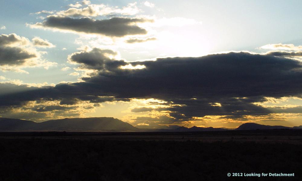
Showing posts with label morning. Show all posts

Monday, September 1, 2014

Early Morning Smoke

The sun is about to rise through thick smoke blanketing the
southern Humboldt Range.
Here, the sun is up, and the smoke is so thick that the high part of the Humboldt Range, which would normally be visible in the distance on the left part of the photo, is completed covered by the smoke layer.
Looking off to the southwest, layers of smoke over a green field. 
A screeching hawk on a phone pole. 
Not sure exactly where this smoke, smoke so thick I could smell it most of the day even when working inside, is coming from, but I'm suspecting the Happy Camp fire complex and others in NW California, at least until I hear anything to suggest otherwise.

Note: Photos uploaded directly from my phone to the Blogger app. Blog post was then manipulated on the phone using the Chrome web interface, which is quite awkward. Final touches added on the laptop.

Tuesday, October 2, 2012

In the morning...

In the morning after I wake up—while I'm drinking my first, second, and maybe third cup of coffee—I often think of things to write for the blog, how to write them, maybe even what pictures to use.

I also think of things to write while I'm on the way to work, bouncing around in the front seat of a pickup truck (actually, the ride is usually pretty smooth and solid, I just thought bouncing just sounded better). A moving truck is not a great place for writing (there is *some* bouncing), especially because all I have is my semi-smart phone; perhaps if I had a tablet...

My thoughts while riding or driving into work typically run along the lines of...well, maybe it's time for some drilling stories...let's see, there was the guy who yelled and threw things when he was mad at his helpers, which was almost all the time. Ugh. Or, there's a story or two floating around about drill rigs brought onto staked claims in order to make a discovery before the company that owned the claims, thereby being able to, hopefully, make claim to at least some of the already staked ground.

And then, once again, I'm back here at my computer, it's early morning, and the briefest hints of coffee are trying to course through my veins, trying to rev my brain. Ideas are at a standstill; I don't get very far...until I'm back on the road and the ideas start popping. Another story, or general story idea, will come into my head: mud and getting stuck stories. Hey, there's one just over that not-so distant hill! It happened not long ago, and, remarkably, I have a few photos for it! And not too much farther down that road and over the next hill or two to the south, there's a mud without stuckness story...and that leads to a more typical claim jumping story...which leads to another claim jumping story out of sight from this road but down a road I was writing about last fall and winter before I got distracted by our recent move.

But then, I'm sure I'm missing something...maybe it's the details...because when these ideas start while I'm on the road (any road will do, me driving or sitting as a passenger, either way), other ideas come in and crowd out and confuse the first ideas, which then sometimes include other people's stories: other accounts with drillers, other encounters with mud, other overstaking problems. Which story to tell? What details to use? And, without a tablet, and even with a small notebook, how will these stories make it from barely incipient idea to fully written account?

One story would be about the driller (and set of helpers?) that got thrown off a job down in the south-central Mojave one spring (I hope it was spring and not summer) for showing up to work drunk and carrying a small flask of whiskey or JD. The driller that came to replace him had an interesting time using one of the two only pay phones in town—and so did I, although I used the other of the two pay phones in town—but the guy that had real problems with the one pay phone, which was sitting there on the corner of Main Street and the cross street that formed the junction that made the town, was one of our claim stakers, who was out there running a soil grid across the claims he was staking. And his problems with the pay phone had something to do with the druggy nature of the town, the drugs being the second main reason for the town, the first reason being the intersection of two sub-major (major in the Mojave) roads.

And so the ideas come and go, just like that, while I'm sitting here in the morning partly coffeed up, glancing constantly at the clock so I won't be late: sometimes the ideas get written down, sometimes they don't. These kinds of stories generally don't have photos to go with them, and the Mojave stories are not likely to have photos any time soon or in any systematic fashion: collecting the photos would take almost as long as the original years of exploration.

And now, with one last chug of ever-so-good nice-and-hot coffee, I leave this post behind and start getting ready for work.

Friday, June 29, 2012

More Views from the Road to Work

A few more views from the road to work: the sunrise photos are from early April, and the cloudy photos are from early May.
A flock of geese (?) over the Humboldt River, seen from the near the site of Preble in Emigrant Canyon. The south end of the Midas Trough is just coming into view below the rising sun.
I've seen smallish groups of pelicans along this part of the river, but they don't typically fly in Vs.
North edge of the Midas Trough, AKA Owyhee Bluff.
North Valmy Power Plant. The two yellowish, sunlit hills near the plant comprise Treaty Hill. The north, sloping end of Battle Mountain (the mountain) is behind and to the right of Treaty Hill; the bluish Shoshone Range defines the far horizon.
The Pettit Ranch on the east slope of the Osgood Mountains. The supposed true geographic name of this ranch (from the 1945 Osgood Mountains 15' topo) is the Hugh Bains Ranch, but I'm going with what the sign to the ranch says (and what I've known it as for quite a while). I remember driving up to this ranch a long time ago, despite no trespassing signs and barking ranch dogs. I think I was getting the key to a gate near Preble, where some drill cuttings or rock samples for the Pinson Mine had been stored.
At the time, the Pinson was most properly known as the Ogee and Pinson Mine (map from Hotz and Willden, 1964).
Now we're looking westerly, about 20 to 25 miles across Red House Flat, toward a batch of mostly unnamed hills south of the Snowstorm Mountains and the Midas Trough and north of the Sheep Creek Range.

All views above were from south of the turnoff to Midas, Hollister, Ivanhoe, Willow Creek, and Tuscarora on the Midas Road (see previous post).
Here's a second look at the same hills, this time from where the road splits to go to either Getchell or Twin Creeks.
This time, beyond the Roosters Comb, we can see the low spot between the mostly unnamed hills and the Sheep Creek Range, where Sheep Creek flows out toward the Humboldt River. The Izzenhood Ranch and Izzenhood Gap are tucked away behind the hills in front of the low spot.
Area covered by this post; map courtesy USGS, The National Map Viewer. To see this map more clearly and to explore the area, go here.
A zoomed in map showing Sixmile Hill, Roosters Comb, Izzenhood Gap, Sheep Creek, and the north end of the Sheep Creek Range; map courtesy of USGS, from The National Map Viewer, explore the area using this link.

Selected Reference:
Hotz, P.E. and Willden, Ronald, 1964, Geology and mineral deposits of the Osgood Mountains quadrangle, Humboldt County, Nevada: USGS Professional Paper 431, 128 p., 1:62,500.

Monday, June 25, 2012

The 4:45 Bus to Work

I thought I'd post a trip report I wrote back in March, when the early mornings were very dark and I was riding the 4:45 bus in to work. Nowadays, I'm sleeping in just a little and taking a later ride whenever possible. Photos are from various times since mid-April.

Riding to work on the 4:45 bus: It's dark. Cars and trucks — some clearly heading out to the mines — pass us on the freeway.
Many people on the bus are sleeping. Maybe they didn't have any morning coffee like I did, coffee that makes it possible for me to get ready for work and impossible to sleep on the bus. The light from the phone I'm writing this on, carefully picking out letters with my stylus, is the only light I see besides headlights on the road.

Button Point: Button Point is a promontory at the north end of the Sonoma Range, where I-80 takes a nearly 90-degree turn, and the Humboldt River goes from flowing northwest, makes a kind of large semi-circle, and then ends up flowing west-southwest before heading in more southerly directions toward the Humboldt Sink. Button Point is also a rest stop. We pass it by.
Volcanic rocks south of I-80 just east of Button Point.

Golconda: We get off the freeway here and drive slowly through the small berg of Golconda on the original Highway 40.
Sign on the eastbound exit for Golconda: In case you didn't know which way to go!

Other buses have stopped to pick up people at a large, jumbled parking lot near the center of town; we pass them by, and — leaving the old highway behind at a sharp, 25-mile-an-hour as-posted turn beyond the far end of town — go out the paved road through Emigrant Canyon, where the railroad tracks follow the Humboldt River. Picking up speed after making the turn, we wind through a canyon cut into green, brown, and orangey-purple phyllites of the Cambrian Preble Formation.

At the site of Preble, now a small agglomeration of dilapidated (or rustic) ranch out buildings and sheds, we stop at the railroad tracks before crossing. Up in the distance I see one red taillight.
Preble and the railroad crossing come in to view.

The data connection cuts out somewhere between Golconda and the railroad crossing, picks up again at 5:16 past the curves through the dusty, phyllitic hills, but my mobile device doesn't quite make a connection. I keep trying and finally get a solid connection in the windswept, sand-covered swath affected by last October's fire.
The Osgood Mountains, with the Pettit Ranch (the trees just barely in shadow) in the distance on the alluviual fan.

The road ahead of us is still paved. Vehicles going out to the mines — Hollister, Midas, Twin, TR, and Pinson — pass us. Our speed is regulated by a GPS-based system tied to actual speed limits. A few trucks — including two-trailer semis — go by us in the other direction, leaving the mines, ranches, and isolated outposts like Tuscarora and Midas to make their way back to Golconda, the freeway, and beyond.
A view of the Midas Trough, not far from the turnoff to the Midas Road. Miners (and geologists) going out to the Midas and Hollister mines head out toward the broad low area beneath the rising sun.

The bus driver has a radio on, set to one mine frequency or another, and chatter picks up now and again, about the road and the traffic.

5:25: We come to the Midas turnoff. At the turnoff, a plethora of signs pop up on the right side of the road, pointing the way to various mines. Companies with signs: Atna, Barrick, Newmont, and Great Basin Gold. Mines mentioned on the signs: Pinson, Turquoise Ridge, Twin Creeks, Midas, and Hollister.
A plethora of signs.

We have now left S.R. 789, called the Getchell Mine Road by NDOT, and are on its extension, a well magged (treated with magnesium chloride), fairly smooth, wide dirt road that I've always known as...the Getchell Mine Road.
This is (reportedly) a county road maintained by Newmont with monetary contribution from Barrick. Road access is still public: side dirt roads, if you know which ones to take, lead to canyons, mountain passes, ranches, and reservoirs.

I see the vague dark outline of the Osgood Mountains to the west, and the lights of Twin at one o'clock. We pass some lights on the left (probably the Pinson Mine), and come to the "No Passing Next 3 Miles" sign at 5:31, after crossing a cattle guard.
The old tungsten mine [Pacific or Valley View mine] north of Atna's Pinson Mine, which we pass at about 5:30, just before crossing the cattle guard. In March, the outline of the Osgood Mountains was just an outline: black on a dark background.
The lights of Newmont's Twin Creeks Mine off in the distance to the right.
5:34:The road splits, with one road heading off toward Twin, the other continuing straight toward TR-Getchell. Access on both roads is still public, at least for a short ways: the continuing Getchell Mine Road provides access to at least one side canyon; the Twin Creeks road provides access to the Chimney Reservoir.

Beyond this final juncture, the road becomes a little more curvy, maybe a little more corrugated or rutted. Lights from both mines are visible. After passing through the main gate at 5:39, the bus makes its way to at least one stop before arriving at my worksite at 5:53.

End of Trip. (E.O.T.)

Tuesday, May 1, 2012

Early Morning View of the Midas Trough and Jake Creek Mountain

Just a quick post showing a photo I took about two weeks ago at 5:50 am, on my early morning ride to work. We're looking easterly at a broad, generally flat-topped sloping part of the southern Snowstorm Mountains. The entire mesa-like, gently north-dipping hill may be called Jake Creek Mountain, or perhaps only its highest peak, barely visible from this angle, is called Jake Creek Mountain. Part of the abrupt slope to the south is called the Owyhee Bluffs.

The low area immediately south (right) of the central flat-topped mesa or mountain is at least locally called the Midas Trough. Tectonically, the trough is a somewhat complex graben, sharp edged on its north and south sides, bounded by ENE-trending faults (MSRMaps topography showing the Midas Trough; also see this Google Maps image). References to the Midas Trough are mostly found in the gold exploration literature and on related company websites, but was referenced in the tectonic literature at least as early as 1980. I also found a Santa Fe Pacific Mining Company reference to the fault along the north edge of the Midas Trough, which was called the "Midas road fault," presumably because it more or less follows the graveled road to the tiny berg of Midas (the date on the map says 2005, but mapping was done in 1988-1991, and Santa Fe Pacific Gold was bought by the "Evil Empire," Newmont Mining, in 1997). I'll visit Midas (the town) someday, and report back about whether Kirby's Midas Bar is still in business, the way it was during the boom days of the 1980s.

North (left) of the mesa-like Jake Creek Mountain, the next low spot is referred to as the Jake Creek graben, at least in the report accompanying Santa Fe's map. Farther north, the next hill -- also part of the Snowstorm Mountains, which trend NNW parallel to the Northern Nevada Rift, even though its southern sub-parts trend ENE parallel to the Midas Trough -- is called Kelly Creek Mountain (or at least its high point is called that; I can't get on MSRMaps at the moment to check the old topos for names).

A couple references:
Laravie, J.A., 2005, Geologic Map of the Kelly Creek Area, Humboldt, Elko, and Lander Counties, Nevada: Nevada Bureau of Mines and Geology Open-File Report 05-1 -- Text, Plate 1 with the Midas road fault, Plate 2, with a more readable map explanation.

Zoback, Mary Lou, and Zoback, Mark D., 1980, Faulting Patterns in North-Central Nevada and Strength of the Crust: Journal of Geophysical Research, v. 85, p. 275-284.


Location shown below is the west end of the Midas Trough.

Tuesday, April 10, 2012

A Few Views

I thought I'd actually have time over my 5-day break to get caught up on some blogging, but that hasn't been the case, and things aren't looking all that great for the coming 8- or 9-day work week and the break following that, so I'm posting a few views from the new area.

First, an early morning view: inside the bus before it's left the parking lot for the mine.

Next, a view on the way back from work on a relatively clear day, looking off to the southeast toward the North Valmy Power Plant, Battle Mountain, and the Betty O'Neal mine near the range front below the snow-covered peaks of the Shoshone Range.

And last, a fairly typical view inside The Griddle, one place to be if you happen to be hanging around The City of Paved Streets, the starting point of the Winnemucca-to-the-Sea-Highway.

Winnemucca-to-the-Sea Highway posts at LFD.

Saturday, April 2, 2011

Snow and Light in the Morning

The inside of my truck on the morning of March 25th: I'm all packed and ready to go, but I haven't yet shoveled the snow off the truck and scraped the windshield. The clock reads 6:45 am: Ack, I'm late!
Light from my headlights illuminate the untracked snow of the driveway and street in front of me. (Yay for 4WD!)
I attempt to get a photo showing the snow falling in one of those starburst patterns, like this one that someone linked to recently (was that you, Dana?).
Illuminated snow ruts on the main road, which hasn't yet, at 6:53 am, been plowed.
A street light glows through the falling snow and my spotted windshield.
The old schoolhouse at Lane City almost blends into the snow-covered sagebrush.
I never saw a single snow plow once that morning!

Friday, March 25, 2011

Recent Morning Views

Sunrise from the road to work, March 19th.
A dusting of snow in the parking lot, March 20th, the vernal equinox.
A messy road going into the canyon, March 21st.
Early morning moon over two limestone formations, March 22nd. Snow blows and drifts deep later in the day.
Getting gas amidst the falling snow, March 24th.

And some call this spring. Maybe next month.

Friday, October 9, 2009

Two Years Ago Today: Two Drill Rigs

Two years ago today, I went out early in the morning to visit two drill rigs. This is the first drill rig. They are fairly deep in the hole, but we'd like to go deeper.
The shadows were long, and although there was frost here and there, the ground wasn't frozen. Neither drill rig was inside an active mine; they were conducting brownfields exploration around the edges of an old pit.
When I arrived at the second drill rig, the sun was still low on the horizon with the frost unmelted in the shadows.
The rig had twisted off in bad ground at less than 200 feet, leaving a lot of pipe in the hole. The driller, who had been on shift with his crew since midnight, was not happy.
The front end is jacked up to level the rig on this slightly non-level drill pad.
While I was there, the driller shut the rig down prior to trying to get the twisted-off steel out of the ground. If you know how many pieces of pipe were on the truck to begin with, you can figure out how many are now in the hole.
This is some of the miscellaneous equipment and paraphernalia near the sampling side of the drill rig.

I stayed on site for most of the morning. It turned out that both rigs were going to need to move to start new holes, with neither having reached the target depth, and I had to show them the new sites and make sure the drillers were okay with the sites.