Monday, November 28, 2016

The Left-Lateral Strike-Slip Garlock Fault Near Highway 395

While out on the last road trip, I started taking pictures from places where roads crossed the Great Basin Divide. Unfortunately, I soon gave that up because freeways, which I traveled not exclusively but considerably, are lousy places from which to take pictures. But thinking about divides also made me think about the Garlock Fault, and how I'd be crossing it on 395 heading south into the Mojave. Here I've pulled over as I'm about to cross the fault.
I've drawn the Garlock fault with a thick blue line, and a secondary strand (air-photo linear) with a thinner blue line.
Besides the two fault strands, you can see the towns of Randsburg and Johannesburg, which were founded in 1896. The Yellow Aster open-pit gold mine was operated by Glamis Gold from about 1987 to 1997.

The haze was thick and the day overcast, and it looked like the photos I was taking would be fairly lousy, but MS Photos was surprisingly able to revive the dark, lackluster originals (I usually don't rely on the Photos app, but in this case it worked better than my other free programs).

After crossing the fault on 395, I took the road toward Goler Heights and Garlock. (Goler Gulch in the El Paso Mountains at Goler Heights is unrelated to Goler Wash in the Panamint Range at the edge of Death Valley National Park.)
Looking west along the southern range front of the El Paso Mountains toward Goler Heights.
The Garlock Fault is mostly behind low hills in this shot, and it runs to the right of us about three quarters of a mile to the north.
I've drawn in two (or three) apparent strands (or air-photo linears―my interpretation may not be precise in all cases) in dashed blue lines; where thin, the fault is behind hills or out of view.
We're now back near the junction of the Goler Road with Highway 395, looking to the northeast.
I took this photo thinking that we might be seeing part of the Garlock Fault, when in fact what we're seeing is a couple of fault strands parallel to the Garlock (air-photo linears).
The Garlock Fault proper is out of view beyond the low hills.
A little more than a mile to the NNE from the place I took that last photo (above), there's a great example of a shutter ridge and offset drainages.
Google Earth image with a blue line I added using the "Path" function.
The same image with more scribbles.
This marked up Google Earth image shows a small portion of the left-lateral Garlock Fault (long blue line). The fault line is basically the same as shown here (Roder, 2012). If you blur yours eyes a little (and even if you don't), you'll probably see several lines or linears that are running parallel to the main fault trace. I drew a few of these in with thinner dark blue lines. I can easily spot a few more.

The fault has offset two drainages in a left-lateral sense; that is, the south side of the fault, moving to the northeast (right) has brought in a ridge that has blocked the dry wash in the center of the image, forcing it to flow to the northeast to get around the ridge. That ridge is labeled "shutter ridge," which is the term for a ridge that blocks a drainage in this fashion along any strike-slip fault, whether it's right lateral, like the San Andreas, or left lateral like the Garlock. A second drainage way off in the upper right corner of the image has been blocked and offset in the same fashion. That drainage appears to have two shutter ridges, one that is north of the main trace of the fault, and another that looks like it's south of the main trace (at least the way the main trace has been drawn; we can see by drawing in just a few air-photo linears that there may be a few complications, and faults often meander around a bit).

I got back onto Highway 395 and continued south toward my destination, figuring that I could get a photo looking back toward the Garlock from somewhere up near the turn-off to Randsburg. I finally found a pullout on the east side of the highway; it offered me a four-wheeling opportunity to drive a very narrow, rocky road to the top of a small hill. The photos I took from there looked really lackluster, so I didn't spend a lot of time trying to get a really good panorama. Consequently, the two photos I've stitched together below do meet up on the horizon, but they are way off in the foreground, primarily because I ended up moving to keep the dirt road I was on out of the picture. We can, nevertheless see where the Garlock and a couple parallel strands or linears are located.
Stitched photo. The center of the photo is looking just west of north.
The same photo with a few labels.
And that's basically it for the Garlock Fault, but there's a location near Goler Heights that might be a good spot to look around the fault, and there are probably some good locations near Garlock.
Looking northeast from Goler Heights along the Garlock Fault.
UPDATE: Be sure to view Ron Schott's GigaPan of this portion of the Garlock Fault.

Sunday, November 27, 2016

Links: Here Are a Few, But Great, Great Basin and Great Basin Divide Links

Great Basin—Mojave Desert Region - the hydrographic, physiographic, and floristic Great Basin (GB) regions and climate; v. good map of vegetation zones, lots on flora and fauna; pretty good map of the GB itself although it goes all the way to Colorado River (!!); Fremont coined "Great Basin".

Quaternary stratigraphic, hydrologic, and climatic history of the Great Basin, with emphasis on Lakes Lahontan, Bonneville, and Tecopa - Morrison, cited in the first ref, said the area of the GB "exceeds 500,000 square kilometers" ; this source is not available online, is part of DNAG - this volume.


The Great Basin: A Natural Prehistory - Grayson, at Amazon. (and here's a Google Book preview.) A better map of the GB. Grayson discounts having the Salton Sea in the Great Basin on page 11. His map, page 12, also ends the Great Basin in Pahranagat Lake, as justified below (Witt etal, 2008):

Jonathan D.S. Witt, Doug L. Threloff, and Paul D.N. Hebert -
Genetic zoogeography of the Hyalella azteca species complex in the Great Basin: Rapid rates of molecular diversification in desert springs:
Geological Society of America Special Papers, 2008, 439, p. 103-114, doi:10.1130/2008.2439(05). Page 104 (clip from Google Books):
(Witt et al, 2008 is in GSA Special Papers 439:
Late Cenozoic Drainage History of the Southwestern Great Basin and Lower Colorado River Region: Geologic and Biotic Perspectives -
edited by Marith C. Reheis, Robert Hershler and David M. Miller).


Fishes of the Great Basin - a Google Books preview - shows the White River above the lower end of Pahranagat Valley as in Great Basin.


Google Earth image of the West with a lot of lines. The Great Basin divide according to me is in magenta, wrapping around the Great Basin. Note the two possibilities at Pahranagat Lake, and no Salton Sea.
There is a mention of the Great Basin divide (GBD) in "Ore Deposits of the Jarbidge Mining District" 1912, (Google Books preview).

The Jarbidge Mining District, 1923 - mentions the GBD.

Thursday, November 24, 2016

From the Road: A Joshua Tree Lunch Stop with Volcanic Rocks

It wasn't long after I stopped to make coffee on the Turtle Mountains road, that it was time for lunch.

(Actually, before I found a place for lunch, I mistakenly pulled off on the paved road to McLaughlin, thinking that I could get a better picture of the Castle Mountains, a place I had worked long before, only to find that the road had no legitimate turnarounds until nearly reaching the Colorado River. This unforeseen escapade surely added an extra hour to my driving time!)

North of Searchlight, I found a suitable dirt road and drove away from the four-lane highway on blessed dirt. (Highway 95 wasn't four-laned in this part of the world the last time I drove on it; road widening began sometime after publication of the 2002-03 Nevada road map and was complete by the publication date of the 2005-06 road map.)

Before making lunch (and then more coffee), I wandered around and took a few pictures, including this one of an alive but bent over and half-burned Joshua tree. (I don't know if the tree was hit by lightning or lit on fire by an obnoxious passerby. The other Joshua trees nearby showed no signs of fire, so I don't suspect an old wildfire.)
What's that in the distance beyond the Joshua tree?
It's a hill of light-colored rocks covered by darker rocks (part of the Highland Range, Clark County, NV) .
My idea of the geology while out there was simple, and turned out to be fairly incorrect. I did get the type of rock right: Yes, it's (primarily) volcanic. I was thinking of a fairly thick ash-flow tuff sheet, with a thick poorly welded zone (in buff or pale orange), a very thin to intermittent vitrophyre (the thin black bed on the far hill), all overlain by a strongly welded zone (the sloping dark brownish hill-capping formation). Wrong. And wrong.

I found the detailed geology in this M.S. thesis (Colombini, 2009); the basics of her geology was largely from a map by Faulds et al (2002), but with more detail than I want to report. The larger picture consists of hill-capping basaltic andesite (this section might commonly be identified as basalt in the field) overlying a thin, dark, glassy rhyolite to rhyodacite flow (I guess I was partly correct on this!), overlying pale orange non-welded tuffs of mixed sedimentary and volcanic origin (and partly correct on this). Some flow-banded rhyolitic flows are mostly hidden at the base of the orange hills, barely sticking up high enough to be seen in the photo.

These rocks are all mid-Miocene in age, and they have all been tilted to the west (away from us) by widespread extreme extension related to detachment faulting within the Colorado River extensional corridor. The structure of the area is complicated by being within or near the Black Mountains accommodation zone (Faulds et al, 2002; abstract only, the rest is behind a paywall).

Tuesday, November 22, 2016

Titus Canyon: The Klare Spring Breccia

Klare Spring in Titus Canyon is well known as a petroglyph site (with a sign and everything); it is less well known as a breccia site and as a place to view the low-angle normal faults of the Titus Canyon fault zone (TCFZ). MOH and I were both immediately attracted to the breccia, and then—after examining it closely—we turned our attention to the various petroglyphs. (If you want petroglyphs, go here, here, or here, or to other Google-able websites.)
The breccia is the orange-brown mass of rock that MOH is inspecting intently. It's composed largely of fragments of Carrara Formation (Єc), with a few scattered chunks of gray limestone, which are presumably from either the Carrara Formation or the tectonically higher Bonanza King Formation (Єb). The upper strand of the Titus Canyon fault zone (TCFZ) cuts above the breccia, somewhere between my Єc and Єb labels, possibly at the base of the first cliff, or possibly behind and above that cliff. Rocks in this lower part look brecciated to me, but I didn't scramble up the slope to see them in person.

In fact, here are some of my ideas about the placement of the upper strand (or multiple upper strands?) of the TCFZ.
An image from Google Earth approximating the first photos.
I wasn't sure whether the two very large angular fragments of gray limestone, including the block festooned with petroglyphs, were an actual part of the tectonic breccia, or whether they had at some point slid down the cliffs and been cemented in place by the waters of Klare Spring.
Angular fragments of the Carrara Formation are healed by travertine.
The waters of Klare Spring emerge from the lower strand of the Titus Canyon fault zone, just down-canyon from the petroglyph site. The lower strand has placed this fractured, shattered, and brecciated Carrara Formation over the older Wood Canyon Formation (ZЄw, see next photo set).
Looking up canyon past Klare Spring.
I happened to shoot this pic looking eastward, back toward Klare Spring from a couple hundred yards down canyon. Once again, I had fortuitously grabbed a view of the TCFZ, this time including the lower strand that runs right through Klare Spring, and also including the upper strand (although the exact location is of that strand(s) is imprecise).
The same view with some geologic labels, including a few question marks.
The faults up the canyon (on the right) were seen in more detail in an earlier post; basically, we're looking at the upper strand of the TCFZ, which has placed the Bonanza King (Єb) over the Carrara (Єc) and some possible breccia (labeled "?"). Klare Spring is past the white car in the lower left of the photo. The lower strand of the TCFZ, which runs right through Klare Spring according to many, places the pale orange brecciated Carrara (Єc bx) over the reddish brown rocks of the Wood Canyon Formation (ZЄw). I've labeled the Bonanza King where I'm sure of it (Єb), and have left the first light gray cliff above the Єc breccia as "?". These lower cliffs, held up by rocks that appear brecciated in the first set of photos, might be composed of Carrara or Bonanza King, or even some tectonic jumble of both.

And so, we've left Klare Spring, and will continue our way down the canyon...

Location map

Related Posts:
The Approach to Titus Canyon: Tan Mountain
The Approach to Titus Canyon: Up and over White Pass
The Approach to Titus Canyon: To Red Pass
The Approach to Titus Canyon: Just Below Red Pass
A Hike at Red Pass, Titus Canyon Road, Death Valley, CA
Titus Canyon Road: A Little History and a Few Maps
Down into Titus Canyon: We Leave Red Pass Behind (Finally!)
Scribbles
Titus Canyon: The Upper Part of Lost Canyon
Leadfield: Scams with a Side of Geology
Leadfield: Views from Old Mine Buildings
Leadfield: Geology...and a Cactus...on the Way Back to the Parking Area
Almost Titus Canyon: Is This a Fold? And... Apparent Dip with Post-it® Notes
Titus Canyon: The TCFZ, the FCFZ, and a few Other Faults
Titus Canyon: Another Look at the Titus Canyon Fault and A Scramble
Titus Canyon: We Make Our Way Toward Klare Spring

Sunday, November 20, 2016

Links: The Sump, Nevada

This is about as close as I've gotten to The Sump, a place in Nevada that I had never heard of until I was doing some research into stops for our Death Valley trip of last February. And mind you, the declivity I've pointed out in the photo above is just the southern entrance to this apparently intriguing place. Fossils have been found here!

While trying to figure out if The Sump would be a stop along the way or the way back (it wasn't), I collected a few links. Most of the links show only one picture from the place; a few show more. I'll leave it to you to do more investigation (and visitation, I hope!). The links are listed rather randomly. Links about the fossils, in particular, are at the bottom.

The "Sump"—Strange Name but Amazing Place - Backyard Traveler by Richard Moreno

The Sump, Esmeralda County, Nevada - Eastern Mojave Vegetation (schweich.com)

The Sump Canyon paradise - Terry's World (Terry Wright, geologist)

The Sump (Esmeralda County, Nevada) - Weekend Wanderluster

The Fossils:
Hardy, F.C., and Bonde, J., 2015, Stomping Around the Sump: Miocene Pygmy Gomphothere from Esmeralda County, Nevada [also here], in Pennell, W.M., and Garside, L.J., eds., New Concepts and Discoveries: GSN 2015 Symposium Proceedings: Geological Society of Nevada, p. 929-937.

Sand and Bone - a photo slide show (in color): "Go along with a band of UNLV researchers as they uncover the skull of an extinct elephant-like creature that once roamed Esmeralda County."

Photo Essay: In the Footsteps of the Elephant -  VegasSeven (really nice B&W photos)

Tuesday, November 15, 2016

From the Road: Ocotillo, Coffee,Palo Verde, and The Turtle Mountains

After my overnight stop in the Whipples, I drove north, figuring I'd get a couple more photos of the Turtle Mountains. No, wait—from many previous trips, I knew the dirt road going out to the Turtles would be a good place to pull over for a pit stop.

I'd forgotten how tall the ocotillo can grow!
Ocotillo with Jeep for scale and the northern Turtle Mountains in the background. The hazy mountains on the right are the Old Woman Mountains.
I have a couple stories about the Turtle Mountains, one of which features an old prospector who successfully witched the copper pennies my field assistant and I hid beneath some smoothed-over sand. I'm still a little dumfounded by his luck—or did he have an exceptionally precise witching tool?
Making coffee in the back of the Jeep, a somewhat messy prospect due to the lack of a proper gold (or silver) cone-shaped filter.
I parked near a shaggy-looking Palo Verde tree.
The ocotillo is diagnostic of the Sonoran Desert (biotically speaking), as might be the Palo Verde tree (AKA paloverde).

Sunday, November 13, 2016

Links: Auriferous Gravels in CA

Here are a few links about the Au-bearing gravels of the California foothills and Sierra Nevada. (It's time to get this out of my drafts folder.)
Early Tertiary Geology References - at Sierra Geology: where rocks meet the human environment (or vice versa) -- several good articles linked

Garside, Larry J., Henry, Christopher D., Faulds, James E., and Hinz, Nicholas H., 2005, The Upper Reaches of the Sierra Nevada Auriferous Gold Channels, California and Nevadain Rhoden, H.N., Steininger, R.C., and Vikre, P. G., eds., Geological Society of Nevada Symposium 2005: Window to the World, Reno, Nevada, May 2005, p. 209-236.

Yeend, W.E., 1974, Gold-bearing gravel of the ancestral Yuba River, Sierra Nevada, CaliforniaU.S. Geological Survey Prof. Paper 772, 44 p., Plate 1 and Plate 2.

Thursday, November 10, 2016

Titus Canyon: We Make Our Way Toward Klare Spring

We're making our way down Titus Canyon toward Klare Spring, an obligatory petroglyph stop about two miles below Leadfield. On this rather short leg of our journey, we'll be seeing a hodgepodge of photos from two trips taken in two separate years, all shot within a short distance of each other not far upstream from the spring. The canyon distance of the views that our photos will show, upstream to downstream, will be about two miles (3.2 km).

Our first photo set looks back to the east. You do remember that last time, before we stopped for our little hike scramble, we had looked to the south and had seen what I think is the main strand of the Titus Canyon fault zone. We can see this same fault exposure from our current stopping point just north of a shadowy cliff. The mile-distant fault is placing Bonanza King Formation dolomite (Єb) of the upper plate over Carrara Formation (Єc) limestone and a bit of Zabriskie Quartzite of the lower plate (we can't see the Zabriskie from this angle). I’ve sketched the main strand of the Titus Canyon fault zone (TCFZ) in hachured dark blue.
As explained previously, that fault appears to wrap around to become what I've drawn in as the same fault strand, high on the cliffs in the upper right. I've postulated a lower strand, drawn in hachured bright blue. The exact position of the proposed fault is questionable, possibly higher on the hill than I've shown it, as is the formation contained within in the resulting "middle plate," which I've shown as Bonanza King. In this first photo, taken in late February of this year, things look pretty brown, because spring has just barely arrived.

The cliffs on the side of the road are captivating in that they look iron stained and possibly brecciated. I think they make a great backdrop to a photo that's very similar to the first one, but which was taken on a green spring day in early May, 2009. The creosote was in bloom, and so were some cacti and other wildflowers.
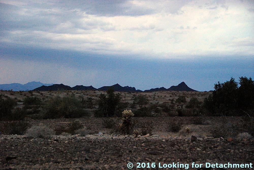
I'm not sure what rock formation is exposed in this almost-always shadowed cliff. It might be Carrara, as labeled, or it might be Bonanza King.
MOH and I wandered around this area quite a bit, checking out the wildflowers.
Here we are, a little to the north of the last spot, along an old wash channel paralleling the road, still looking to the east. 
The same photo with geologic labeling by moi.
(H/t to Dana Hunter for the "moi.")
What are we seeing here? Well, we're looking at the main strand of the TCFZ on the cliff in the distance to the east, as before, but here I've postulated an offsetting high-angle normal fault, down-to-the-north, and drawn it in with lighter blue. As for the cliffy areas north and south of the wash and road (left and right, respectively), I'm unsure of the exact location of the Titus Canyon fault. On the left, there is definite Єc in the lower cliffs, some unknown in a slope and cliffy area above that (labeled Єc?), and definite Єb near the top of the cliff (unlabeled! who let that slip by?).

Looking back to the first photo set, there’s a huge alluvial fan coming off the higher cliffs south of the road. On our most recent trip through the canyon in early 2016, I became fascinated by the massive alluvial fans within this part of the Grapevine Mountains. It looked like one hell of a lot of erosion to me—and probably all taking place fairly rapidly and fairly recently when the Grapevine Mountains were uplifted radically in the late late Cenozoic—and so I took a number of photos of fans, some that looked active, like this one, and others that looked older.
A steep side canyon area south of the road has filled with coarse alluvial debris, forming an alluvial fan complex.
A closer view of part of the alluvial fan.
A Google Earth image of the fan complex. North is not up! The magenta line on the right is the main strand of the TCFZ (extrapolated); the magenta line on the left is possibly the lower strand in this area.
Then I looked off to the northwest and took this photo after spotting the reddish alluvial fan remnant seemingly stranded high on the active fan slopes:
A reddish color in alluvium is often indicative of an older age. Rocks above the fan are all Bonanza King Formation.
I have a hard time comprehending the amount of uplift required, possibly in pulses, to create the alluvial record that can be seen within and on the edge of the mountains in the Death Valley area.
Google Earth image of our second fan complex; magenta lines are related to my idea(s) of the TCFZ.
A little bit of alluvial air-photo mapping.
The current wash (above) is obvious. What I've labeled as 'terrace 1' can be seen in the last photo as the alluvium in front of the alluvial ledge in the lower part of the photo, the alluvium I was standing on when I took that photo. Beyond that, we have the larger fan complex, including the reddish fan in the photo, which I've labeled. I couldn’t decide where to mark the lower boundaries of that reddish fan. Anyone up for some mapping?

I then turned to the west, zooming in to see what I thought might be some reddish talus, possibly small alluvial fans, high on the slope.
Reddish talus high on the slope below dark gray and reddish outcrops of the Bonanza King Formation.
It turns out that this photo shows two mapped strands of the TCFZ, although the exact location of both is somewhat in question.
Here is my best guess of the geology, taken from Niemi (2012) and Google Earth air-photo interpretation.
The mapped upper strand of the TCFZ has placed younger Bonanza King Formation rocks (Єb) over older Carrara Formation (Єc), with the Єc forming what is here a middle plate, while the mapped lower strand has placed the Carrara over the even older Wood Canyon Formation (ZЄw).

Meanwhile, back on the lower slopes:
Bloomin’ cactus!
The barrels are leaning strongly to the south. They grow faster on the shady side, causing them to lean over, giving them the nickname “compass cactus.”
These leafy green plants were everywhere.
Barrel cactus, yellow wildflowers, and ephedra (the olive green plant behind the barrel clump).
Here’s another view of the same plants, with dolomite of the Bonanza King Formation as a backdrop. The ledge on the left might be the location of the upper strand of the TCFZ, just above Klare Spring.
And that puts us in a good position to move on to Klare Spring.

Location map

Related Posts:
The Approach to Titus Canyon: Tan Mountain
The Approach to Titus Canyon: Up and over White Pass
The Approach to Titus Canyon: To Red Pass
The Approach to Titus Canyon: Just Below Red Pass
A Hike at Red Pass, Titus Canyon Road, Death Valley, CA
Titus Canyon Road: A Little History and a Few Maps
Down into Titus Canyon: We Leave Red Pass Behind (Finally!)
Scribbles
Titus Canyon: The Upper Part of Lost Canyon
Leadfield: Scams with a Side of Geology
Leadfield: Views from Old Mine Buildings
Leadfield: Geology...and a Cactus...on the Way Back to the Parking Area
Almost Titus Canyon: Is This a Fold? And... Apparent Dip with Post-it® Notes
Titus Canyon: The TCFZ, the FCFZ, and a few Other Faults
Titus Canyon: Another Look at the Titus Canyon Fault and A Scramble

Tuesday, November 8, 2016

From the Road: Storms

I got kind of bogged down with traveling and went light on the posting. Part of this has to do with the nature of posting from the road. I decided not to try to post using a mobile connection, for various reasons, and so that meant that I needed a wifi connection at night. One night, that was unavailable. Additionally, my chosen destination had me so busy that I didn't hardly touch the computer, even though I had great wifi. While there, I had Other Priorities.
Jumping cholla fruit.
And so, here we are back on the alluvial fan coming southward off the Whipple Mountains, camping under cloudy skies.
The camp is fine, although the vehicle unmodified is an uncomfortable place to sleep. And it was crowded, because when it started raining I had to move most things back into the Jeep. And then ... lightning. At first the flashes were distant, south of the Big Maria Mountains and north of the Whipples. But it rained, and depressions in the desert pavement filled with water, and I worried about the major wash I had crossed: Would it flood?

I tried getting photos of the lightning, and this is as close as I came: a leftover bit of the strike over to the left, hitting behind the darker pointy hills (a light-colored line going straight down, probably easiest to spot if you know where it is).
After awhile, I dozed a little. Then it was suddenly quite bright, the flashes making me think that surely someone was bombing the area, although there was not much sound at first. I sat up and looked around, and it gradually became clear that the blinding flashes were bolts of lightning, this time all around, moving closer, until some thunderous crashes were finally within less than a mile. Would I be hit? Is a plastic topped Jeep as safe as an all metal pickup truck? I still don't really know, but I wasn't hit, and eventually the second downpour stopped. Finally I actually slept.
Turtle Mountains before they were obscured by rain.
Turtle Mountains in the morning.
In the morning, the wash was fine.
The road was its usual rolling self.