Showing posts with label camps. Show all posts

Tuesday, November 8, 2016

From the Road: Storms

I got kind of bogged down with traveling and went light on the posting. Part of this has to do with the nature of posting from the road. I decided not to try to post using a mobile connection, for various reasons, and so that meant that I needed a wifi connection at night. One night, that was unavailable. Additionally, my chosen destination had me so busy that I didn't hardly touch the computer, even though I had great wifi. While there, I had Other Priorities.
Jumping cholla fruit.
And so, here we are back on the alluvial fan coming southward off the Whipple Mountains, camping under cloudy skies.
The camp is fine, although the vehicle unmodified is an uncomfortable place to sleep. And it was crowded, because when it started raining I had to move most things back into the Jeep. And then ... lightning. At first the flashes were distant, south of the Big Maria Mountains and north of the Whipples. But it rained, and depressions in the desert pavement filled with water, and I worried about the major wash I had crossed: Would it flood?

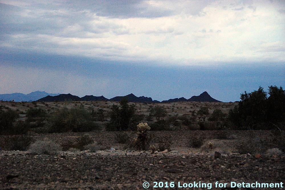
I tried getting photos of the lightning, and this is as close as I came: a leftover bit of the strike over to the left, hitting behind the darker pointy hills (a light-colored line going straight down, probably easiest to spot if you know where it is).
After awhile, I dozed a little. Then it was suddenly quite bright, the flashes making me think that surely someone was bombing the area, although there was not much sound at first. I sat up and looked around, and it gradually became clear that the blinding flashes were bolts of lightning, this time all around, moving closer, until some thunderous crashes were finally within less than a mile. Would I be hit? Is a plastic topped Jeep as safe as an all metal pickup truck? I still don't really know, but I wasn't hit, and eventually the second downpour stopped. Finally I actually slept.
Turtle Mountains before they were obscured by rain.
Turtle Mountains in the morning.
In the morning, the wash was fine.
The road was its usual rolling self.

Thursday, January 15, 2015

Cliffs of the Ruby Mountains: Some Pretty Pictures

And while we're waiting an even longer time for me to get around to posting about the nappe in Lamoille Canyon, here are a few of my favorite pretty pics taken from our campsite at Camp Lamoille in late September. I can say that a bit of the nappe can be seen in a few of these photos, if you know where to look!
Cliffs (with sunset, first night) and the U-shaped valley of South Fork Lamoille Canyon about where it merges with the main part of the canyon.
Oooh! Cliffs and colors!
Oh, besides the nice colors on the cliff walls (sunset, still the first night in camp), this photo shows part of the Lamoille Canyon nappe.
Sunset colors and burning orange aspens.
Alpine glow on the cliffs behind the roof of the wood-heated lodge.
Back to a view of the U-shaped valley.
Our camp and lit-up lodge, with granitic gneiss in the core of the nappe barely visible in the dark cliffs behind the tent.
The next day, noonish: the upper part of the cliffs that were in darkness in the previous photo.
The same cliffs on the morning of the third day; orthogneiss in the core of the nappe showing in the lower left of the photo.
A red-tailed hawk soars overhead just before the downpour of the second day.
Dinner bell at the lodge.
Cliffs, clouds and chimney on the second day.
The rocks of the chimney blend in with the not-so-distant cliffs.
A dusting of snow, cliffs, and orange aspens; early morning of the third day.
The sun rises behind a hill. The shallow slope to the right of center is part of the lateral moraine of  South Fork Lamoille Canyon.

Related Posts:
Cliffs of the Ruby Mountains: More Views from the Hanging Valley Pullout
Links: Lamoille Canyon Geology
A Hanging Valley in Lamoille Canyon
Cliffs of the Ruby Mountains: Mt. Gilbert
First Trip into the Ruby Mountains of Nevada

Saturday, August 27, 2011

Alpenglow and Tentglow

On the way over to Great Basin National Park last week, I grabbed this quick photo of the alpenglow hitting the west side of Wheeler Peak (13,063 feet ASL), partly because the lower line of the pinkish band was hitting the mountain at just about tree line. The pinkish band is sometimes known as the Belt of Venus or antitwilight arch, at least when it is seen in the sky, and the dark purplish blue area below the alpenglow is the Earth's shadow on the mountain. It is sometimes called the dark segment, at least when seen in sky.

If you happen to be standing on a mountain when this pinkish phenomenon is visible to those to the west of you, you will be standing in the pinkish, dying light of the sun, just before it goes below your western horizon (presuming you aren't in Alaska or somewhere very far north or very far south, where the sun doesn't always set in the west, but can set in the north or south, or not set at all). As the pinkish, last light of the sun leaves you on your mountain perch, the terminator will come upon you, you'll be in the twilight zone, and then you will pass into the night (all while standing still).
In this grainier enlargement of the same photo, you can see that the pinkish alpenglow isn't exactly congruent with tree line in all places.
We drove on, to find and set up camp in the dark, at about 9800 feet on the other side of that same mountain.

Recent Great Basin N.P. Blogospherics:
A Park without it's Namesake at Geotripper
We Head Underground in the Great Basin at Geotripper
Great Basin National Park at Nature's Blog
My Backyard - Great Basin NP at WATCH FOR ROCKS

Thursday, July 14, 2011

Left Behind: Pink Point

It's rare that I haven't brought too much back from the field, rather than too little, so I had to think hard about the question for this month's Accretionary Wedge:
What do you regret leaving behind at a geological locality?
and I'm not sure that what and where I left this one thing qualifies as terribly geological.

One day, while in the middle of our 1978 helicopter camp in Hot Creek Canyon (camp #3, not yet blogged), I was let off by the helicopter in the early morning on the top of a drainage — a fairly typical thing for days when the helicopter was in camp. That particular morning, there was no good place near the top of the drainage to be let out, and so the pilot put one skid on a rock outcrop jutting 10 or 20 feet up in the air, a rocky mass all surrounded by dense juniper and piñon. He told me to hop out on the downhill side. (We hadn't really gotten any hover-exit training the way Indiana Meg did; our pilot seemingly expected us to know everything he learned over his many years in Vietnam and Alaska.)

I looked, and sure enough it was somehow possible; after I threw my pack into the brush below me, I managed to get myself onto the skid. Maybe it was only 5 feet down, but it was the hairiest "landing" save one other that I can recall.

The rest of the day was somewhat standard save for three things.

(1) I found a large pink projectile point in the middle of the drainage I was walking down, a drainage that had obviously seen some flooding in the last 1 to 5 years. The point was possibly made of Ivanhoe "chert" (more precisely opalite or silicified tuff) from the Tosawihi Quarries of northern Nevada, a large series of rock quarries made by ancient to nearly present-day native Americans in the Ivanhoe mercury-gold district north of Battle Mountain. I had been trained by my archaeological contacts to leave things like this in place, but I debated a long time before complying and moving downstream. GPS didn't exist back then, so I carefully spotted the location on my 7.5' topo map, planning to report the location later to the NAS or BLM. The problem with this approach is that the point was an anomaly: it was probably washed downstream in the most recent flash flood and would probably end up being buried by the next. I should have picked it up, marked the location on the map, and turned it in to a museum or some other appropriate outfit.

That's the thing I regret leaving in the field.

(2) A second fairly unusual thing happened that day when I nearly stepped on a rattlesnake. It was by no means the first rattler I'd seen that summer, but it was the closest I had come to one without being warned. I was walking rather quickly downhill through some trees, having bypassed part of the drainage because of dense vegetation. I stepped, and in mid-step I saw the rattlesnake just as it saw me. I sidled rapidly to the right while it slithered rapidly to the left. It had absolutely no interest in making a stand, which is what I've found to be the case in most of my rattlesnake encounters. Needless to say my adrenalin shot up.

(3) Later that day, after having walked and sampled the entire drainage down to the range front, I picked out a likely helicopter landing spot on the upper part of the alluvial fan. The sun was hot. The willows, or some other large, clumpy masses of sticks with minimal leaves, were not casting any shadows worth using, and trees were lacking. I took my flannel shirt (worn in early morning when the temperatures were sometimes chilly) out of my backpack, placed it half over a sagebrush and half over my head and face, and lay down under the shade I had just created.

I think that the only reason I recall the last bit is because of the three earlier unusual events and because it was possibly the first time I created shade in the desert that way. The trunk of a juniper tree would have been most welcome.

---

For the record, I also regret leaving behind one or two boxes of jasperoid from my thesis area in the yard or shed of a house I moved away from in 1979 or 1980. As far as I know, samples of that jasperoid no longer exist, certainly there are no more outcrops of it.

Related Posts:
A Few Rules of the Desert
The Caliente Series & Caliente Camp Series

Monday, July 4, 2011

First Jobs in Brief

Once upon a time ... I was a budding but green economic geologist of the hard rock kind (I'm no longer green or budding, but otherwise the same). It was an era when many mineral exploration companies and related outfits looked to hire graduates who had recently completed their Master's degree in geology, a time when summer jobs (not internships as they seem to now be called) were often available to M.S. students prior to graduation, and a time when some summer jobs were available for geologists still working on their Bachelor's degrees. A solid background in mineralogy, petrography, structure, and completion of field camp were usually expected, and for "real" jobs (the so-called full-time jobs, permanent or semi-permanent, which eventually led to variable benefits), it was expected that your graduate degree had focused on hard rock geology of some kind, with a thesis centered around some economic problem—the mapping of a mining district being one classic type of thesis that companies looked for and encouraged (and sometimes funded).

Never mind your background and degrees, however, one could still expect to do some kind of fairly basic field work for one's first summer or two—or even for many of the early years—the details of that work depending on your aptitude, the availability of more creative or responsible assignments (and the possibility of designing self-generated exploration programs), and the type of on-the-job training you might get (or not get). Because we all came from hard rock and mineral-exploration–oriented backgrounds, companies and bosses expected us to want to go out and find something (a gold or moly deposit or prospect, for example), and companies and bosses expected us to be enthusiastic about getting out there and doing it, despite the long hours, hard work, variable to poor accomodations, and generally poor connections to what might have been our home life, if we had managed to create one while in grad school. It was a work-hard–play-hard sort of ethic, one left over from field camp, one that stayed with many of us through the long years. In recompense, you got paid somewhere between one half and two thirds of what petroleum companies were paying M.S. grads, and you got to see lots of new countryside (the Brooks Range in Alaska was quite popular for a couple-three years), and you probably would get some serious 4WD experience and maybe even learn a few basics of helicopter flight (which you would hopefully never have to use).

For my first field job, a summer job, I collected stream sediment and water samples across a good portion of central Nevada. I worked for a young woman younger than my then 25 years; I did most of the navigating, she did most of the driving.

For my second field job, a summer job that ended up lasting four years, with one-year renewals every winter, I was given a hand sample test as part of my interview, an interview conducted by at least two, if not three or four, male geologists who were perhaps mostly in their late twenties to possibly mid-thirties.

After being hired, I was, as I've mentioned before, almost immediately sent out to a semi-remote helicopter camp (town was only a few miles of pavement away, but town was small, and we were all a long way from home, with the company offering transportation and accomodations on days off to whatever "larger" town was nearby*). Our primary job was to collect numerous stream sediment samples and the occasional rock sample on daily traverses down 3 to 5 mile drainages, while also taking scintillometer readings along the way and at sample sites. We worked in 4-man crews (2 women, 2 men in my camp—plus camp cook, a helicopter pilot and fuel truck driver shared between two camps, and an occasional boss). We were fortunate to do some on-the-ground geologic mapping in four areas staked by the company during the course of, and as a result of, our summer explorations.

I hired my own field assistants/partners from 1981 through about 1991, usually one per summer or year, sometimes with jobs lasting as long as two years. I unabashedly practised reverse discrimination as much as possible: looking around, I could see that if I didn't hire women, none or very few would get hired. I rarely ended up hiring someone who didn't know basic rocks and minerals. In fact, the young geologists I interviewed, my age to a few years younger than me, often knew more than the basics, and they usually knew the basics quite well. Some were mineralogical hot shots; others were strong in geochemistry. I would often have to teach sampling methods and what in particular to look for; this basic exploration introduction was often accomplished by an early season field trip designed to see mineralized areas of interest, whether or not those areas were held under claim by us or by others (the latter would, of necessity, involve some stealth operations). My favorite place to go for this recon intro was Yuma, where we could always get good food and pitchers of margaritas (stories of Yuma not yet told).

Because of the orientation of geologists coming in to interview, and the orientation of schools we sometimes recruited at, I rarely had to work with young geologists who had no, or little, interest in the work we would set out to do every morning. I had one or two field assistants who were rather lackluster, maybe showing little inclination to learn the terminology of the field or to put in the required hours of throwing drilling samples into the back of my truck, only to lug them once again from the bed of the pickup to the sample trailer—but I've been lucky and have rarely run across these lackluster types. At least once I was at fault for hiring the wrong person (choosing the right people hasn't always been easy for me, and at least once, with the company refusing to match the going summer rate during the slowdown of the late 80s, the best candidate got away to some worthy competitor, maybe Freeport or Newmont). At least one of the lackluster types was hired by someone else for later in the season, with me being stuck with that person until my temp showed up later in the year. (At Northern Exploration Company, our summer geologists were called "summer hires" or "summer" somethings; at Former Mining Company, we called them "temps," an epithet I gradually adjusted to and finally used.)

During my own slowdown years (and perhaps the trend had already started sometime during the 80s), it gradually came to pass that geologists with solid hard rock basics and Master's degrees became unavailable or less and less abundant, schools changed directions and dropped mining-related degrees and course work, and some schools eventually ran out if funding for field trips and field camps while basic on-campus field methods classes fell by the wayside. Some Schools of Mines became Schools of Earth Sciences. And so it went...

---

* On my first days off, because I refused to be shipped off to the larger town of Las Vegas (at only 4 years in Nevada, I was already a die-hard, not interested in casinos or glitz), I stayed in camp, driving a company truck up to Wheeler Peak one day, and driving around the Caliente area on other days. We had three days off for every 11 worked (that, by the way, fully identifies "Northern Exploration Company" to those in the know).

Friday, October 22, 2010

Backroads: The Lower Part of Ophir Canyon, central Nevada

MOH and I began our recent trip up and over Ophir Summit by turning off Highway 50 onto old Highway 8A, now known as S.R. 376. We were headed west, toward Middlegate, we had my truck and not the Prius, and we had at least a half day to spare. Additionally, the weather was clear with no rain or snow expected. We’d have to see about snow on the high passes when we got there. Austin Summit was clear, the pass between Kingston Canyon and Big Creek looked clear, and some north slopes above 9500 feet had light snow left from a week or two prior.

We drove south into Big Smoky Valley, down 8A's long straight stretch, into Nye County, past the first curve in the road, and then past at least two more curves, until we finally saw the sign for Ophir Canyon about 34 miles south of U.S. 50.
I've been thinking about Ophir Canyon for a long time, perhaps since the first time I went up that road 32 years ago this month in October, 1978. That was the day after our newbie helicopter pilot forgot to pick me up—we were camped on Bowman Creek while mapping the Northumberland caldera. Driving up Ophir Canyon was our way of avoiding flying with that pilot ever again (for other reasons besides being left out all night).

Ophir Canyon, above, begins at its partly-in-shadow mouth on the left side of the photo, then goes through steep and rocky terrain to the summit in the far background, the sloping saddle left of the far peaks, also on the left side of the photo. That’s a climb from about 6250 feet at the range front to 10,109 at Ophir Summit. The lowest point on the Big Smoky Valley basin floor is at about 5450 feet.
I’ve long remembered the Ophir Canyon road as steep, rocky, and overhung where the road is cut into the hillside. It has, however, been my experience over these many years that most roads improve with time: my memory of roads traveled during my first years out in the desert has exaggerated any steepness and rockiness, and has generally made the roads worse than they really were. I was more impressed with these early roads, having fewer extreme roads to compare them to, and my 4WD driving skills have improved.

It's possible that I’ve been up the Ophir Canyon road once or twice since my initial encounter with it in 1978—but I don't clearly remember those trips, if they existed, and I do remember that first time, it being so intricately associated with unexpectedly staying out one cold October night.

So, with all these considerations, I was expecting the road to be less difficult than I remembered, less intense, less steep and rocky: a relative walk in the park. (It wasn’t less of anything.)
When we drove up to the mouth of Ophir Canyon, I immediately noticed that two signs were missing, signs I’d photographed during my earlier visit in October, 2008. You can see the post for the second sign behind a bush on the right side of the road, just where it narrows down in preparation for dropping into the canyon. I couldn’t recall what the missing signs said. (The first missing sign was shown on my last blog post.)

The second missing sign (left, photo from 2008) said, “Warning: Flash Flood Area.” Fortunately, there were only a few wisps of high cirrus scattered in the visible part of the western sky. The lower part of the sign said, and may still say, no cars, no 2WD trucks, and jeeps with tops down not recommended. One spot the size of a warning sticker is blank, as though some other warning is missing—perhaps one that says no long-bed 4WD trucks.

I’d have to agree with the warnings on this sign, and with the earlier sign, "Narrow Steep Road." Narrow: yes. Steep: yes. Road: maybe. Jeep trail would be a more accurate description of most of the road through Ophir Canyon, and on the South Toiyabe Peak, Nevada, 7.5 minute topo map, the road up Ophir Canyon is marked as a jeep trail, rather than a double-dashed dirt road, from about 1.5 miles into the canyon to within a mile of the summit. (Google Maps route through Ophir Canyon.)
Much of the Ophir Canyon road is overhung by alders, willows, and other road-encroaching brush. That’s why you shouldn’t go up in a topless jeep.

The lower part of the road requires crossing Ophir Creek about seventy-million times: six crossings are shown on old and new maps between the canyon mouth and the ghost town of Ophir, with most crossings being steep going into the creek and steep coming out. Crossings are usually narrowed and partially obscurred by willows and other brushy trees, and rocks are often scattered randomly here and there—the kind of rocks you don't want to hit with your transfer case, tie rods, or differentials, the kind of rocks you can't really see once past a certain point because they are hidden by the hood of your truck.
This is the best picture we got of a creek crossing—it’s not one of the rockiest or nastiest crossings; it’s probably the first. All creek crossings were successfully excecuted without scraping rocks even though my half-ton Chevy pickup truck has stock tires, tires that really should be one size taller for this kind of backcountry travel. [Photo © 2010 by MOH.]
The lower part of the road requires constant rock watching and dodging, and I managed to hit fairly good once, somewhere near the center of my truck, possibly on the transfer case bash plate. While driving, you need a good memory for rock placement, otherwise it seems as though they move between the time you last saw them—the time when you made the decision to ease by or over on the right or left—and the time when they disappeared from view behind the hood. It probably doesn't help being short while driving through these kind of rocks. But really, the thing that would be best would be one tire size taller—or a shorter wheelbase. [Photo © 2010 by MOH.]

We didn't get any pictures of the really rocky parts of the road. These parts were too attention demanding for me to feel comfortable stopping. I had the truck in Low Range most of the time because of the steep rockiness. I used low low on many occasions.
Here's a nice view of Mt. Jefferson, third highest peak in Nevada, taken on the uphill side of one of the creek crossings. All creek crossings had little pullouts on one side or the other, pullouts that allowed stopping and pulling off the road in case other traffic was passing by. Fortunately, we saw no one. The off chance of meeting someone coming down the hill while we were going up kept me quite vigilant, even though rules say the driver going uphill has the right of way. [Photo © 2010 by MOH.]

There are really no turnarounds in this lower part of the canyon, although it's possible that the little pullouts at each creek crossing might have allowed for very tight, multi-point turning to go back downhill. At one point (the second, third, or fourth crossing), I considered turning back, not remembering that the road had so many crossings, was so tight and overgrown, and was so rocky and steep, and because it was taking much longer than planned and the sun was getting lower and lower. I'm not sure if turning around would have been possible in a full-length pickup—this is where having a real jeep would have been ideal. I suspect that a jeep—or anything with a shorter wheelbase than my truck—would have been able to turn around.
The fall colors, seen in an in-your-face sort of way at times, were out in full force in the lower part of the canyon.
Then, about 30 minutes after entering the canyon mouth—30 minutes of not-quite knuckle-biting concentration—we arrived at a nice wide spot in the canyon, a wide spot where the old-timers built the town of Ophir. This location was chosen partly because of its proximity to the old silver workings, and partly—no doubt—because the canyon is fairly wide and relatively flat, level ground being a commondity in short supply. One could turn around at Ophir, and I suspect that many people have.

Back in '78, it's entirely possible that we took a side cut instead of driving most of the lower canyon, a narrow side road which goes up to some of the canyon-mouth workings, and which avoids the many creek crossings in the lower canyon. That road would have come back into the canyon just below the town of Ophir. I have no idea what the side road is like today, though it's shown as a jeep trail on the old map (MSRMaps).

So much for the first part of the canyon—the passable part.

Wednesday, January 13, 2010

Caliente Camp Part 8: Getting Out of Pennsylvania Canyon

While driving through Pennsylvania Canyon last summer, I was keen to find some really good examples of the soft, loose sand we had gotten stuck in 30+ years ago. Well, guess what? The 2005 flooding of the area, along with whatever else had happened to the wash in 30+ years, had firmed up the roadbed. The worst places were loose but not too loose: though the sand pushed me around some, especially in turns, it would have been difficult to get stuck in 2WD, not that I really tried.

The wide, sandy area that snagged our truck in 1978 looked a lot like the picture below, a picture taken more than 1.5 miles downstream from our getting-stuck site. Back then, the central driving area of the wash was all sand, the soft, sandy area was much wider than our truck tracks, and the sand was free of any stabilizing plants. It was the kind of sand that makes walking uphill difficult, and difficulty in walking- whether uphill or down, whether through mud, snow, or sand - is a good sign that one might need 4WD, not that we stopped and checked.

Pennsylvania Canyon still contains considerable sand, but most of it is peripheral to the active channel (AKA main roadbed) and elevated above it - as in this photo where sand piles can be seen on the right, and sand ledges or partially eroded banks can be seen way to the left (click to enlarge). It looks like flash flooding over the years has removed a lot of sand and caused about two to five feet of downcutting.

*** *** *** *** ***

What would Pete and I do, now that one of our two trucks was stuck in the sand? Well, first off, notice that I said, "one of two." We were lucky enough to have two trucks, and one wasn't stuck! Whew!

Floyd was still in sampling mode and making his way slowly down the wash, so Pete and I set about seeing if we could figure out how to get the two-wheel drive truck upstream through the sand. Pete had a great idea: we would go to the prospect area we had checked out earlier and see if we could find some rope. For some unknown reason, our trucks were not equipped with gear for getting unstuck. Maybe we could scrounge something.

We drove up the side drainage in our good, 4WD truck. All we found around the old mining camp was the spool of copper wire we had already noted, no rope. We debated the options. I felt uncomfortable taking what surely must be someone’s wire. We were, after all, not in any kind of dire straits: we had one perfectly good truck. We could drive it back to camp, get towing gear, and come back for the truck. But we were a little worried about wasting too much time or getting in trouble for getting stuck. We took the wire to use in lieu of a tow rope.

Our first couple attempts at towing the 2WD truck with the 4WD truck using the thick copper wire were pretty unsuccessful - we made a few feet each time before the wire stretched thin and broke. So we backed the good, 4WD truck down the wash until its back bumper was right against the front bumper of the bad, 2WD truck, then wrapped the copper wire tight around both bumpers, around and around several times. With the wire wrapped this way, it held as we made it slowly through the sand, until we were finally on solid ground. We still didn’t know if the crippled truck would make it up that last hill below the distant saddle, but we would have to give it a shot. With me driving one truck and Pete driving the other - the bad truck in the rear in case we had to ditch it - we continued up the main canyon, keeping our eyes open for the still sampling Floyd.

After meeting up with Floyd and helping him finish the sampling of his part of Pennsylvania Canyon, we drove both trucks up and over the saddle, down into the northern drainage, past Tepee Rocks, through Caliente, and back to camp. Stuart had walked into camp by the time we got there. We now had a truck that would not go into four-wheel drive, and the nearest Ford dealer was in Ely, a good two to three hours away. That truck sat in the Ely shop for several weeks before the right part arrived - they kept getting the wrong part from Salt Lake City. And it turned out that Stuart had not been at fault that one day in Kane Springs Valley - one hub had been put together backward at the factory, so repair was covered by warrantee.
A northerly view from below Ella Mountain Lookout, looking toward the next camp area near the Nevada-Utah border.

Related Posts listed at The Caliente and Caliente Camp Series.

Sunday, January 10, 2010

Caliente Camp Part 7: Getting Stuck in Pennsylvania Canyon

Shortly after the first truck misadventure of 1978 - with the helicopter still out of commision - four of us took off in two trucks for a kind of piggyback form of recon. From Caliente, we drove east up Clover Creek, entered Barnes Canyon from the north, drove past Tepee Rocks, then eventually crossed over into the south end of the large Ash Canyon drainage at the place I lost my way while driving through last summer. We finally arrived at a well-remembered saddle, the divide between the north-draining Ash Canyon and the the southwest-draining Pennsylvania Canyon.

From the saddle at the north end of the drainage, we looked down Pennsylvania Canyon toward the Meadow Valley Mountains beyond Elgin. We couldn't really see the day’s work laid out in front of us because a bend in the canyon blocked our view, but we could see a long ways.

We dropped Floyd off at the saddle - he would sample his way down Pennsylvania Canyon on foot, about 4 miles of drainage. We then drove down the steep upper part of the canyon in two trucks, into the main part of the canyon, heading toward a juncture where the remaining three of us would split up. This juncture was the turnoff I looked for but didn't find last summer, the place where the main road leaves the canyon. From there, Stuart and I would walk and sample one drainage each; these were between 2 and 3 miles in length and drained toward toward the main road south of camp. Pete would take one truck toward camp, sampling along the way; he would then pick Stuart and I up later in the day. We would leave the second truck in the main wash of Pennsylvania Canyon close to the point where the three of us split up, and Floyd would pick it up and drive it to camp at the end of his day.

On our way down the canyon, the three of us turned up a side canyon to look at some prospects. We dinked around a couple old mining cabins, inspecting them inside and out, a required exploration pastime. One shack showed signs of fairly recent use, signs that were verified by dates on the most recent newspaper and a wall calendar. We took mental note of all the miscellaneous supplies and gear strewn here and there, and found a large spool of shiny-new, thick copper wire. Then we moved on, making our way to the point where we would part ways.

Is it the hill in the foreground, or the hill going out of the next wash?

We left the truck for Floyd in the main wash, that large sandy area in the foreground of the Google Earth image, and then we drove up the side road in the truck Stuart and I had used the day before. Either right at the turn out of the wash or a short way in, we came to a steep hill that the truck couldn't climb. Our driver, Pete, backed down, Stuart and I got out, and Pete tried running the truck at the hill to get up as much speed as possible. The back tires spun: the truck clearly wasn’t in four-wheel drive, even though the transfer case was in 4H and the hubs had been rotated from free to locked. After several attempts and some miscellaneous head-scratching, we finally determined that the driver’s side hub really wasn’t in the locked position; not only that, we couldn't persuade it to go in, even with the judicious use of a rock hammer or two. The truck didn't have operable 4WD.

After we discussed our options, Stuart eagerly went on ahead to traverse and sample his drainage, starting from the bottom of the hill instead of the more convenient, and half-mile-away, top of the hill. Pete and I were left to deal with two trucks, one that had a useful 4WD option, and one that didn't. We turned the funky truck around and started back up the main road in the wide and sandy Pennsylvania Canyon dry wash. Maybe we could trade trucks and leave Floyd with this one; afterall, he wouldn't need 4WD to get back to our starting point at the saddle.

Uh, no. As soon as we got very far into the sand of the sand wash - soft, roiled sand had constituted the road for the last hundred yards at least - we were stuck. Both trucks had come down through the sand just fine. The damaged truck had come down in two-wheel drive without operable four-wheel drive - it would not make the return journey upstream through the sand.

To be continued...

NOTE: Most names in these stories have been changed, on the advice of dubious council consulted friends and colleagues, to protect the innocent other geologists and related field-demented posers.

Friday, January 8, 2010

Caliente Camp: Part 6

Our truck mishaps in the summer of 1978 were fairly rare, but they began while we were still at the Caliente camp. [Caliente Camp series; Caliente Camp Continued: Part 5.] The first incident didn't seem like a big deal. The helicopter was down for a few days after one of our many fuel-filter problems, so we did some ground reconnaissance by truck.

Click image to enlarge.

That day, Stuart and I had driven southwest along the Kane Springs Wash dirt road to take some samples in Kane Springs Valley. We were on dirt roads most of the day, crossing the coalescing alluvial fans coming out of the Delamar Mountains and driving up to the foot of the mountains to take samples.

Stuart drove. We got out at a particularly tough-looking creek crossing to put the hubs in so we would be in four-wheel drive. To put the hubs in, each geologist jumps out quickly while the truck is in neutral with the engine running and the parking brake on and rotates his or her hub from “Free” into “Locked.”

FULL STOP. -- DO NOT TRY THAT AT HOME OR ANYWHERE. -- It is now required that you put the clutch in, brake, put the truck in gear, turn the engine off, put the parking brake on, get out, and immediately chock your tires. Of course, you don't have to get out to put hubs in anymore, unless you have an antiquated or old-fashioned truck. These were the days of manual hubs. Later, with more experience, I would have put the hubs in much earlier, soon after crossing onto dirt, but at the time, we discussed when to put the hubs in at some length - Stuart did not want to put them in early, preferring, I guess, to tough it out.

Click image to enlarge.

So there we were, at our creek crosssing. Maybe we were on this unlikely looking road on our way to Kane Springs. (And maybe we were on some other alluvial fan entirely. Not trying to be vague - I didn't check these roads out, and don't know if I'd recognize the place anyway.) We discussed putting the hubs in, decided to do it, did our routine of getting out and rotating the hubs, and then jumped back in the truck. I thought the truck acted as though it was still in two-wheel drive; Stuart was sure it was in 4WD. As we conversed some more, it became clear that Stuart thought he had memorized the hub rotation direction and had concluded, without looking at the hubs, that his side was already in 4WD.

Later in the day, it became clear that we had driven around for some time with his hub out and mine in, not the way a manual-hub truck is supposed to be operated. As soon as we discovered this error, we made sure the hubs were in identical positions - and because we were nearing the end of the day, we took both hubs out and drove back to camp. Stuart insisted on not reporting this incident - he was sure his mistake was of no import.

That was the first truck mishap, the minor one that occurred in Kane Springs Valley. The next one took place in Pennsylvania Canyon.

To be continued...

NOTE: Most names in these stories have been changed, on the advice of dubious council consulted friends and colleagues, to protect the innocent other geologists and related field-demented posers.

Sunday, January 3, 2010

The Caliente Series & Caliente Camp Series

I'm bringing everyone up to date about my Caliente series because I'll be adding new posts soon. The series is multiple in nature: two related series have been running side-by-side. I'm calling the first one I started the "Caliente Camp series" and the second one the "Caliente series." In real time and in blog time, the Caliente Camp series started before the Caliente series.The Caliente Camp series: These posts are mostly about a helicopter exploration camp I was part of in 1978, with some accounting of the two 2009 road trips I took to the area to travel down old roads. These stories will continue have now been completed.
The Caliente series: These posts are mostly about my 2009 road trips to the Caliente area, although part of the two trips are documented in the Caliente Camp series, and some 1978 stories are told in at least one of the Caliente series posts. The Caliente series includes a couple posts about the geology and rock formations of the area, and other related items like the wildfires that were in progress during my second field trip. These stories will also be continued have been completed.
These two series overlap, and I've switched back and forth between the series, partly because I started the Caliente Camp series before I made the second road trip into the area and didn't know what kind of series I was starting.

Last update on 15Oct2012

Thursday, September 10, 2009

Caliente Camp Continued: Part 5

hearth The fuel-truck driver's antics diminished in import as the rest of the summer crew started trickling in to our Caliente camp in Meadow Valley Wash. We would have, when everyone finally arrived, two camps - L’s camp and G’s camp - and we would share the one helicopter between the two camps. Each camp would have about two weeks of helicopter-assisted recon work and about two weeks of ground work using trucks to get to mapping and sampling sites.

As the crew trickled in, the second woman came into camp, giving me a little respite and some symbolic support: Norma, the second cook, who would cook for G’s crew. George did not like sharing camp with a second cook, especially a woman. He had his own way of doing things, and this own way of his became more and more eccentric as the summer progressed. Those of us in G’s camp would end up quite pleased that we had Norma and not George by the time summer was over. George was a meat-and-potatoes sort of cook, and he was from some old school where women did not cook in field camps. He would actually growl if Norma even came near.

He fed us well, though. A typical breakfast from George was plates and plates piled high with scrambled eggs, bacon, sausage links, ham, hash brown potatoes, pancakes, cinnamon rolls, and toast and all the trimmings: butter, jams and jellies, orange juice, milk, coffee, syrups, fresh fruit like apples, oranges, and bananas, and - did I leave anything out? All this barely fit on the long table we sat around inside the mess tent. Dinner was equally bounteous: we always had more than enough to eat.

As appetites waned during the course of a meal, George would go around the table telling everyone to eat up, insisting that everyone have a second or third or even fourth helping. He acted hurt if you did not take more, even though one or two helpings was usually more than enough. George was even known to take matters into his own hands and slap a large scoop of potatoes onto your plate if you had said, “No, thank you,” on his first pass around the table.

“Damn it, I worked all day on this, now eat it,” he’d say as the potatoes hit your plate.

George would not take suggestions from the hoi poloi - us - about what to cook. Norma did. She made pizza, tacos, enchiladas, and spaghetti as special requests, and anything else she could work out within the restrictions of a trailer kitchen and limited food runs to town. But this creative cookery of hers would have to wait until we split into two camps in June. George would have none of it. By the end of the first month, even the more meat-and-potatoes sort of guys were beginning to show signs of wear with his constant heavy fare. And no one would lose weight that summer, even though we worked strenuous ten-hour days in the sun and sage.

The other camp, L's, had a long summer ahead of them - a long Summer of George. I would join up with them much, much later, at Bowman Creek. George would still be there.

...To be continued...

Wednesday, September 9, 2009

Caliente Camp Continued: Part 4

As I sat there beneath a tree that may have provided afternoon shade to my tent in that long-ago year of 1978, more stories came to me.

When we first set up camp in Meadow Valley Wash, about 14 miles south of Caliente, I was the only woman in camp. It was early in the summer field season - mid-May - before most of our college-student help was available. I was hired early. I was done with school, having successfully defended my Master’s thesis the month before. Three other young geologists were available for similar reasons, so we went ahead and set up camp, starting out with four young geologists, two off-and-on camp-boss geologists, one helicopter pilot, one fuel truck driver, and one cook.

As the only woman in camp, I was the subject of some unwanted attention, but not by any of the geologists in camp. George, the short, grizzled, 78-year-old camp cook plied me with candy bars, which he hoarded in the camp refrigerator and gave out like the rare objects they were. Or, that is, he tried to ply me with them. I wasn’t much of a candy bar freak in those days, and though I constantly turned them down, he never really comprehended my lack of interest in his prized chocolate-covered treats, sure in his heart that all young women could not resist them.

Other unwanted advances came from the fuel truck driver, a young, wild, ski bum who took odd jobs when he wasn’t at some mountain resort skiing. He liked to run around shirtless, the lower half of his body covered by the shortest of shorts. [I'm sure his attire wouldn't have been popular in certain quarters of the partly Mormon town of Caliente, NV, located just a few miles up the road.] He tried to get me to show some interest, but that just wasn't going to happen. He kept trying, though, and I kept saying no. He would ask me to mend his shirts and pants. He asked me to get coffee for him, from George. For some reason, he kept taking the approach of trying to get me to do things for him. L and G, the Western District head honchos, thought it was funny; I thought it was annoying.

I was twenty-six years old. I have no idea, anymore, how old the fuel truck driver was; he was probably somewhere in his twenties, but his age was immaterial. His final ploy was to ask me to model a swimsuit he had supposedly bought for his girlfriend back home. He said he wanted to make sure it would fit her, and she and I were supposedly the same size. He kept coming to my tent about this. This was too much for me: I did not want him coming unasked to my tent, which was my refuge from all the people I ate with and worked with, my bit of privacy amongst the trees below the cliffs. L finally stepped in and told him to lay off. Thankfully, upon threat of losing a summer job, he did.

...To be continued...