Showing posts with label shorelines. Show all posts

Tuesday, November 20, 2018

Winnemucca to Hwy 395 north of Susanville, Part 2

Well, it’s taken me awhile to get back to this road trip—for various reasons, including work schedules and personal things—but I’m going to give it a try again. Part 1 was the July 14th post, Winnemucca to Hwy 395 north of Susanville, Part 1. Part 2, as far as distance down the road goes, was actually an earlier post about Sulphur, Things You Find in the Field: Sulfur at Sulphur, on June 19th. Also see a little about the spot we ended last time, Pulpit Rock, though I don’t have much on the geology of that geographic landmark.

And I guess I should really pool some photos of mine taken of and near Hycroft’s gold mine sometime, but that would take a little more effort than I have time & energy for right this moment, so we’ll skirt past Hycroft, unless you’d like to stop at Sulphur briefly and look back, which we did on June 19th.
Looking east from Sulphur toward the barely active Hycroft gold mine.
Anyway, we’ll proceed westward. The road we’re on, the Jungo Road, would have been largely under water during the high stand of Lake Lahontan, which was in Sehoo time about 13,000 years ago. Consequently, there are several good spots along this stretch of road to see old Lake Lahontan shorelines, including the highest shoreline.
And here’s one such spot. The road goes just north of an elongate, somewhat oval hill with two rocky basalt knobs that would have been two small islands when the Sehoo lake was at it’s highest. The dark, rocky horizontal lines are some of the higher old shorelines.
Here’s a closer view. All of the upper, rocky portion of this knob was an island during the Lake Lahontan high stand. The break in slope, where the hill goes from bushy to rocky, is at about 1334 m (4377 ft). But wait, what do I see?
When I zoomed way in, I could see that the back side of this knob (the east side) is formed of the tops of columns! And the rubble or talus at the base of the knob consists of broken columns! Read more about columnar jointing here at Evelyn Mervine's blog, Georneys.
After crossing the spit coming northward off the elongate, dual-knobbed hill, we get a nice sideview of both knobs, looking south. The far knob, which has the highest elevation, and which we can call Hill 1362 because it's labeled as such on the USGS topo map (the hill is 1362 m high), exposes some nice basalt columns, slightly tilted. And shorelines. The entire hill is encircled by shorelines. The tops of both of these knobs stuck up out of the highest stand of Lake Lahontan, which was at about 1334 m (4377 ft) in this area.
Google Earth view of Hill 1362.
A USGS TNM Viewer map of approximately the same area.
Driving onward...
...here’s what the elongate hill of two knobs looks like looking back to the east from a little farther down the Jungo Road. Perhaps much of the talus is composed of chunks of basalt columns. Next time I’ll stop and check.

These photos of basalt and shorelines were taken on various trips I’ve taken on the Jungo Road. The first three are from 5/24/2017; the next, a browner, dryer picture, was taken 8/3/2012 in high summer; the last was taken 6/14/2006.
We'll continue farther, on our mid-June, 2018, journey. About 2½ miles closer to Gerlach, I stopped and grabbed this photo of the Black Rock Desert, the playa shining in the sun. The hills on the left of the photo are low hills belonging to Pahsupp Mountain; the mountains in the farest distance are the main part of the Granite Range, which runs northward out of Gerlach.

Numerous views can be had of the Black Rock Desert from Sulphur to Gerlach. Light and shadow change with the seasons and with the passing of clouds. Sometimes the playa is brightly lit, other times it’s in shadow, with the mountains around it glowing in sunlight. There are a few notable places to stop along the road, one being Trego Hot Springs and another being the Frog Pond (although it’s usually posted No Trespassing and the gate is usually locked).

On this trip, I hurried past those spots and others, and declined to drive out onto the playa, as it looked like it might still be a little muddy from winter. Nearer to Gerlach, I pulled off on the side of the road, mostly for a pit stop, and also to see if I could find some Prince’s Plume. Alas, it was past the best blooming date.
Not finding any Prince's Plume, I realized this was an excellent spot to take a photo looking more or less to the northeast, across the railroad tracks and across the desert toward the playa arm going up toward Soldier Meadow. The pinkish Calico Mountains are mostly in the sun just left of center, and the southern part of the Black Rock Range is mostly in shadow way over to the right.

After a moment, I noticed a nearby lizard, who kindly didn’t run off while I took this photo.
I’m a little surprised I saw it, camouflaged as it was amidst the patchy desert pavement.

It was already getting late by this time—well, it was 2:30 pm, anyway—and I had miles and miles to go, so I drove through Gerlach without stopping, but only after doing a gas mileage calculation to make sure I would get to the next gas station, which would be almost 91 miles down the road, across another desert, up a creek, over a mountain, and down the other side.
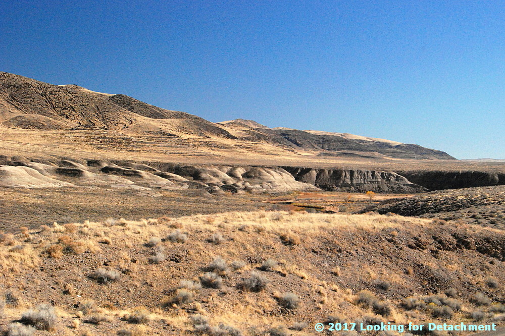
Nearly an hour later, after passing through Gerlach without stopping for ravioli or anything else, I made it to the northwest side of the Smoke Creek Desert and stopped to see if there was still any water in the playa. There had been quite a bit in the spring of 2017, just a little more than a year before this trek. Straining my eyes to see, I decided there wasn't any water, but I took this photo, thinking maybe I'd spot some water later. The desert does look little shiny near the center of the photo, in front of Pah-Rum Peak and a ridge of the Fox Range, but probably that’s just mirage. Toward the right of the photo, the playa is darkened by cloud shadows.

Not much farther down the west side of the Smoke Creek, I pulled over for a quick examination of some tufa.

To be continued...

Selected Reference:
Adams, K.D., Wesnousky, S.G., and Bills, B.G, 1999, Isostatic rebound, active faulting, and potential geomorphic effects in the Lake Lahontan basin, Nevada and California [link to access pdf]: GSA Bulletin, v. 111, no. 12, p. 1739-1756. https://doi.org/10.1130/0016-7606(1999)111<1739:IRAFAP>2.3.CO;2

Related Posts:
Winnemucca to Hwy 395 north of Susanville, Part 1
Blue Mountain (2012)
Pulpit Rock (2012)
Things You Find in the Field: Sulfur at Sulphur
Smoke in the Black Rock & Smoke Creek Deserts (2102)
Where in the West: Black Rock Desert (2008)
Where in the West - June: A Second Look (2008)
Where in the West - June (2008)
Name That Place (Gerlach, 2008)

Tuesday, July 24, 2018

Winnemucca to Hwy 395 north of Susanville, Part 1

We began our northern Nevada road trip about a month ago at this blog post about Sulphur, Nevada, a real ghost town located more or less a third of the way along our route. To continue with the trip, we’ll take a step back for a re-start in Winnemucca (The Griddle, above is a good place to stop for breakfast or lunch), though we could just as easily start somewhere to the east, say Elko, although the trip then would become longer. Our goal will be to make it, eventually, to the NV-CA state line west of the Smoke Creek Desert, and from there to U.S. Route 395 north of Susanville. We'll get to 395 by way of a fairly obscure dirt road that will take us from the Smoke Creek Desert in Nevada to a nearly non-place called Viewland, CA. See my Google Maps plot of this route, along with photo locations and other points of interest along the way. I'll add points to the map as our trip progresses.

The Jungo Road (Nevada S.R. 49 and 48) will be our gateway to the Black Rock Desert and points west, and to get on the Jungo Road we'll take U.S. Route 95 north out of the center of Winnemucca a very short distance, where we'll turn left onto the Jungo Road almost immediately after crossing the Humboldt River. Right at the Winnemucca convention center, essentially our starting point, you’ll note a sign stating that the road north (U.S. 95) is part of the Winnemucca-to-the-Sea Highway.

If you're inclined to travel northward instead of westward, have a look at my 2010 Oregon Trip Series, a series dedicated to road tripping over a portion of the Winnemucca-to-the-Sea Highway and other roads as well.
Lo and behond, the Jungo Road starts out paved as it leaves Winnemucca. That’s Blue Mountain nearly straight down the road.
At this point, just about 6 miles into our journey, we get a good view of Little Tabletop Mountain, which is a basalt-capped mesa south of the road. MOH and I used to call these hills “The Pancakes.” From the south side, they look a little like a tilted stack of pancakes.
"The Pancakes" from the south, as seen in Google Earth.

It’s difficult to get a photo of these hills when driving 80 mph on I-80, unless you happen to be sitting in the left passenger backseat, so I resorted to a G.E. view.
Before long, the paved portion of the Jungo Road ends; it becomes a magnesium-chloride treated road...a magged road. I figured the magged road condition would extend all the way out to the Hycroft gold mine, but I forgot that they are not operating with a large crew like they were a few years ago when the mine was active. Hycroft is still running their heap-leach operation while testing the feasibility of operating a sulfide leach pad, but the large crews are a thing of the past, at least for now (see Hycroft’s January 10th press release [pdf] for more about sulfide leach testing).
Here we are at the same locality as the previous photo, about 9 miles west of Winnemucca, looking back towards Winnemucca and the Sonoma Range.
The magged part of the Jungo Road currently ends at the turnoff to the Blue Mountain geothermal field, aka Blue Mountain Faulkner 1, which is just on the west side of Blue Mountain. Magging prevents dust, so the road is dusty to the west. One good thing about dust: you have a better chance of seeing that someone is heading toward you. A bad thing about dust: breathing it, of course. Magged roads have one particular disadvantage: they are very slippery when wet, almost like driving on greased snot!

Although the sign at the turnoff to the geothermal field says "NGP Blue Mountain 1 LLC," the power plant is now owned by AltaRock (or not - UPDATE 15June2019). The field was discovered during gold exploration conducted in the 1980s or 90s.
I often stop on a small-looking playa near Jungo—it seems to be a good spot for a pit stop, being about 1 coffee from Winnemucca, and when it’s hot, which it was on June 15th when these photos were taken, it’s definitely time for more hydration. It turns out that this playa is the southern part of the larger Desert Valley playa, which extends 46 miles north-northeast from about 6 miles south of Jungo, all the way to the Quinn River about half way between Winnemucca and Denio. Desert Valley is the 10-mile-wide basin between the Jackson Mountains on the west and the Slumbering Hills (a mountain range) on the east. The Sleeper gold mine was named for it's location in the Slumbering Hills (and also because it was a "sleeper?").
Here we are coming into Jungo, which is a railroad siding located at or near the junction of the Jungo Road with the Bottle Creek Road, which heads up toward the Bottle Creek mining district and the main part of Desert Valley. The well-bedded rocks in the hills ahead of us—a northward continuation of the Antelope Range or a southern part of the Jackson Mountains—are part of the Jungo Terrane, a thick pile of turbiditic shales with sandstone and limestone interbeds that were deposited in Late Triassic to Early or Middle Jurassic time (Luddington et al, 1996 and Crafford, 2007).
Not recognizing in the moment the exact location of Jungo, I took a photo of the junction with the dirt road that comes up with Imlay. If you happen to start this trek in Imlay, you'll cross the Humboldt River just above Rye Patch Reservoir, and you'll pass by Haystack Butte, a geographic marker that can be seen from the Applegate Trail.
I don’t do it often, but on this trip I went ahead and took a couple photos of two of the old mining cabins at Mandalay Spring. I’m not sure why these shacks are present (besides the spring) or what era they date from. I’ve been inside at least one of them—for some reason the entire enterprise struck me as depressing (maybe it was the peeling wallpaper or strings of disintegrating clothes; maybe it was just me).
This cabin is located a little closer to the spring and at about the same elevation; whereas the first cabin sits up above overlooking the spring.
I took this photo at one of the first spots to pull over and get a good look at the Black Rock Desert, which on this day was partly obscured by summer haze. Black Rock Point, for which the desert was named, is a small, dark hill just to the left of the road as it points off toward the vast playa; a closer view of the point can be seen here. The little hill in the foreground is part of a Pleistocene Lake Lahontan shoreline. There was another obvious shoreline just 200 m east of this smaller one.
We'll end this part of our trek at Pulpit Rock.
Google Maps location map.

Selected References:
Crafford, A.E.J., 2007, Geologic Map of Nevada: U.S. Geological Survey Data Series 249, 1 CD-ROM, 46 p., 1 plate.

Ludington, Steve, McKee, E.H., Cox, D.P., Moring, B.C., and Leonard, K.R., 1996, Pre-Tertiary geology of Nevada, Chapter 4 in Singer, D.A., ed., An analysis of Nevada's metal-bearing mineral resources: Nevada Bureau of Mines and Geology Open-File Report 96-2, p. 4.1-4.17, 1 sheet, scale 1:1,000,000.

Tuesday, February 7, 2017

From the Road: Talus Stripes and Shorelines along the Truckee River

Talus, shorelines, and fall colors.
It was a late fall day, and I stopped along Route 447 to see if I could get close to some of the brilliantly colored trees along the Truckee River a few miles north of Wadsworth. I didn't end up finding a good spot for pics of fall colors—other than maybe this one taken down near the Numana Hatchery—but I did find lots of wonderful talus stripes and some Lake Lahontan shorelines.

At two stops a little farther to the north, at and near the junction of 447 with Chicken Road and at the Historic Marker 448 pullout, I grabbed a hodgepodge of photos.
Looking SSE from the historic marker pullout.
These two photos look south-southeastward along the Truckee River toward distant Fernley. A good portion of the river in this area runs parallel or sub-parallel to Walker Lane strike-slip faults. Wadsworth Amphitheater, which shows up in the Google Earth images we'll see in a minute, is not visible from any of our photo sites; it's an amphitheater-shaped topographic feature cut into Lake Lahontan sediments right along the east bank of the Truckee, beyond the dark basaltic hills on the right side of these two photos (east side of the Truckee).
I love the lone Cottonwood in this photo.
I went ahead and drew a few lines on Google Earth, then I rotated the resulting images to two different orientations so we could see a little more of the terrain. Be sure to check the north arrow in the upper right! The linears I drew are parallel or sub-parallel to the trend of the Walker Lane. You might be able to pick out a few more in the images (or go to Google Earth and looking around a bit).

The Walker Lane—on Google Earth (G.E.)and on other aerial representations such as air photos—shows up best at very small scales; that is, if we zoom way out and observe the area from way above, we can see the trend of the Walker Lane better than if we zoom way in, like we've done here. Nevertheless, individual strike-slip faults have been identified throughout the Walker Lane, and a few of these occur right in this area.
The A is centered on Wadsworth Amphitheater. The purple camera icon shows the location of the first photo.
The next G.E. image zooms in to the area we can see in the photos. I've got all three photo locations turned on, the A for Wadsworth Amphitheater, and my drawn-in linears. These linears aren't necessarily faults, although I'm pretty sure the one on the far left is. Unfortunately, because I currently have a very lousy internet setup (thanks Frontier!), I can't load very many research web pages. Google works well—and Blogger is a Google product—so I can blog even with 25 to 100% packet loss (it's 50% this very moment). And because Google Earth is a Google product, it's working for me also! (But I can't routinely access my non-Google email.)

Back to the faults and linears. I do know from personal experience that Walker Lane structures pass through the Lake Lahontan sediments in the area where the Truckee is running in a particularly linear fashion. I know this from some work I did a long time ago with J.O. Davis, who was studying Lake Lahontan and using tephra beds to date various aspects of the stratigraphy. The two linears or faults in the lower right of the image cross through the area where I've seen older Lake Lahontan sediments faulted and highly contorted by the major structures that pass through the area. I can't say that my particular linears are right on the major structures, and I can see other possible lineaments.

UPDATE 3Feb2017: I now have good internet back, and I've been able to compare my "map" to a geologic map of the area (Bell, Garside, and House, 2005). My linear passing through the hatchery location (below) is spot on for their most prominent fault, which was mapped as a dominantly extensional fault.
A zoomed in G.E. view of the area.
Not sure why, but I prefer to spell amphitheater with an "re" at the end: amphitheatre. I also have a hard time sticking the first "h" into the word!

I sure wish Frontier was a better internet service provider! (I never had this kind of semi-routine trouble with AT&T in eastern and northern Nevada; their every-day speeds were faster, and service was (generally) provided more quickly.

Back to the photos! 😊
Horizontal Lahontan shorelines and vertical basaltic talus stripes.
Some of the same talus stripes in Google Earth.
This photo shows a juxtaposition of talus stripes, faint shorelines, and layered Lahontan sediments.
On this trip, I focused mostly on trying to get good photos of the talus, because that's really what caught my eye. I later noticed that a few shots showed the Lake Lahontan sediments fairly well.
White, gray, greenish gray, and pinkish layers of the Eetza Alloformation.
While driving through the area, I'd been assuming that the prominently exposed white units were part of the Sehoo Alloformation. I was wrong! The Sehoo is barely identifiable in this zoomed in photo, and it's the older Eetza that is most conspicuous. In fact, the Sehoo here is mapped as gravelly beach deposits, so it mostly comprises the dark gray or brownish gray layered deposits above the whitish units.

Note: I usually use "formation" when talking about the subdivisions within the Lake Lahontan section, but "alloformation" is technically correct. In explanation, Bell et al (2005) say this, "Lake Lahontan and related subaerial deposits were considered lithostratigraphic units in the early studies of Morrison and were designated as formations. With the revision of the North American Stratigraphic Code in 1983, new allostratigraphic and pedostratigraphic unit definitions were added which allowed the definition of time-transgressive, lithology-independent rock units and soils."
Qsm = middle member of the Sehoo Alloformation; Qe = Eetza Alloformation.
After taking all these photos, it was time to move on, so I looked to the north, in the direction I'd be heading.
What I saw was more talus, more shorelines, and more Lahontan sediments. (And some fall colors.)
Selected Reference:
Bell, J.W., Garside, L.J., and House, P.K., 2005, Geologic map of the Wadsworth Quadrangle, Washoe County, Nevada: Nevada Bur Mines and Geology Map 153.

Tuesday, March 29, 2016

Death Valley Trip, Getting There: Walker Lake, Road Stories, A Bit about Copper, and Some Folds near Luning

MOH and I left the area where we had stopped to hike (shorelines, remember?), and we steered steadily south—south to south by east—between the steep eastern face of the Wassuk Range and Walker Lake's western shore.

It can be hard to drive by Walker Lake without stopping for photographs, though I find myself doing that more often than not. Sometimes the lighting is off, with the sun high in the sky or at the wrong angle, other times the lake and mountains are obscured by a pervasive haze. Consequently I have few good photos of the lake. I got lucky in the spring of 2008.
Between a rock and a guardrail: the steep eastern side of the Wassuk Range, looking north along Highway 95.
I've always found this precipitous range front fascinating when driving past at 40 to 60 mph (o_O)—the granitic rocks along the range front look shattered, presumably munched by the Wassuk Range fault zone—but I've rarely pulled over to examine anything closely because of unusually minimal standing room on the inboard side of the highway.
Looking south toward Hawthorne from a pullout near what is now the north end of Walker Lake.
A strangely stitched agglomeration of six photos. Notice the pronounced shorelines in the foreground and in the distance on the left.
Driving toward Hawthorne, I had hoped to skirt town by breezing through on the hazardous waste bypass road, but our gas gauge read low enough to make me wonder if we would make Tonopah. I suspected there would be no open gas stations between Hawthorne and Tonopah. (It turned out that there weren't any, open or not!)

The first station we stopped at in Hawthorne was immediately frustrating for some reason, so I went to another station. The second station seemed to be still residing in the dark ages, without usable card readers, so I went inside. "Do you want to fill up? Leave your card here," the attendant said with her hand out. I looked at her like I'd never heard of such an archaic procedure, and she relented, "Go ahead, take it with you, just be sure to pay after." I filled up and went back in to pay. She apologized for the inconvenience, but I wasn't convinced that their card readers were actually broken. I thought it was at least 50-50 that the station was just trying to get customers inside to buy a drink or a snack or two. But maybe the out-of-order signs were legit...

For some reason I found the whole having-to-stop-in-Hawthorne situation just almost too much to handle, even though the city used to make you drive into town no matter what. Now there is a bypass. Then there was a great little Shell station at the downtown corner where you turned left after stopping at the town's single red light. It was a perfect opportunity to get excellent gas.

We pulled back onto the 4-lane part of Highway 95 near the west edge of Hawthorne and turned right onto the bypass.


Two things come to mind when I go through Hawthorne. First, I'll remember a dream I had once where I took the Hawthorne bypass and drove around town, north to south, and the bypass itself seemed to be the whole point of the dream. Second, after turning east onto Highway 95 at the south end of the bypass, my mind will go into a driving reverie and take me back to a time in the late 80s. I was telling someone that if I had enough money, I would quit my work in minerals exploration and just go out and map. Here or there. I'd seen a lot of places I thought were interesting, and I loved mapping. So, I'd just go out and map. And I'd start a map publishing company.

My unnamed sidekick said that mapping should have a point. Like I shouldn't just go out and map; maybe instead I should try to figure out something in particular about the geology of the area. I disagreed. The USGS mapped tons of quads and the whole point was getting the entire area (the West? the U.S.?) mapped. My mapping would be more detailed than quad mapping, and I would just go out and do it. Maybe I'd start right there—up ahead in the volcanic rocks near the pass outside of Luning. Maybe I'd start at any of several places I'd already done some detailed mapping, part of the point being to make the mapping available to the general population of geologists working in the area, not just to one exploration company.
Volcanic rocks in the Benton Spring area of the Gabbs Valley Range, about 7 miles north of Luning.
I drive east, my mind goes into this same reverie, and I remember that time—and how, when it came down to it and I had some money and some free time, I didn't do that.


MOH and I drove into Luning, and rather than stop at the Luning Rest Area, we took a dirt road going toward the hills of Black Dyke Mountain, accidentally choosing a road that would have eventually delivered us to the Blue Ribbon Mine. It was in this area that I learned how to test for the presence of copper in black Mn-oxides by using cold, dilute HCl to plate copper onto a rock hammer. This method tests for copper wad or neotocite (a hydrated Mn-silicate sometimes containing enough Cu to be considered an ore mineral), or a few other black copper minerals such as chalcocite and tenorite.

Not too far ahead, in the low hills of Black Dyke Mountain, we spotted some folds in unknown rock formations:
Folded, contorted rocks in the hills less than 2 miles SW of Luning.
Zooming in on the folds.
And that's it for this part of the road trip! We'll continue on towards Tonopah and Beatty next time.

Location map

Related Posts (in order of posting):
Death Valley, "Super" Blooms, Turtlebacks, and Detachments
Death Valley Trip, Part 2: More of the Badwater Turtleback Fault
Death Valley Trip, Part 3: Northward, and over Daylight Pass
Death Valley Trip, Getting There: Wave Clouds beyond the Sierra
Death Valley Trip, Getting There: A Hike to Pleistocene Shorelines

Tuesday, March 22, 2016

Death Valley Trip, Getting There: A Hike to Pleistocene Shorelines

On the second day of our road trip (which began here), we left Yerington at a reasonable though not early hour, knowing full well we'd make Beatty by dinner time.

About an hour later, after reaching the Alt-95–95 junction near Schurz and while still approaching Walker Lake, we found an opportunity to stretch our legs and see some geology in the process. We pulled into a side road leading to a gravel pit...and noticed a dirt road heading straight for some terraces, which I think are either tufa-cemented Lake Lahontan shorelines or a fault scarp.
These are some relatively low hills along the range front in the northern Wassuk Range.
But then we found the old highway, which was built above a historic highstand of Walker Lake—one that must have been at about 4060 feet, below Walker Lake's historic highstand that occurred in 1868 and was between 4089 and 4108 feet—and we left the gravel pit, driving north and looking for a dirt road to take us to the range front.
Here we're looking NNE along the old highway, toward some brightly colored, possibly hydrothermally altered rocks in the northern Wassuk Range.
Oh yeah, I'm a sucker for old roads!

We found a dirt road, one heading toward the canyon way to the left (below). Our goal? The Lake Lahontan shorelines and apparent Lake Lahontan high strandline on the rounded hill near the left.
We're looking southwesterly toward the range front.
A zoomed view of what look like shorelines. One range-front fault may be at the base of the slopes at the bottom of the photo. It's unclear to me from Google Earth how faults and shorelines are interacting.
The same range front and shorelines, looking more to the northwest.
Hike, hike, hike...hike, hike, hike. After about 15 minutes, I arrived at a boulder-strewn shoulder just below what I think is the highest Pleistocene shoreline.
We're looking west toward Reese River Canyon (not the same Reese River as in central Nevada). The canyon looks worthy of future explorations.
Now I'm standing on, as near as I can tell, the highest Lake Lahontan shoreline, looking to the south.
What's that across the dry wash?
Zoomed in, we can see a contact: poorly sorted Quaternary deposits above orange-brown hydrothermally altered rocks.
Is that a fault? Is it a sedimentary contact, either related to fan material being deposited along the range front or a wave-planed shore? I can't answer that question without going back to investigate.
MOH went on ahead to the top of the hill.
The highest ancient shoreline (Sehoo age) looked to me to be at the flat area I was standing on, just about at the often reported elevation of 1332 m (4370 feet), although the next slight break in slope—the change in color just below MOH—coincides with a strandline reported elsewhere of 1338-39 m (about 4390-4393 feet).
Looking to the north, we can see this same break in slope (the one I was standing on), with some ancient shorelines below it (especially to the far right). Note the change in color—green above to yellow below.
The yellowish or straw-colored areas along the break in slope are from a closely spaced, dried-out plant, probably Halogeton.
Done with my brief shoreline study, I walk back down to the bouldery shoulder, thinking that I'll eventually examine the intriguing contact across the wash.
First, I'm distracted by the granitic boulders. This one has a nice pegmatite dike cutting across, weathering out in relief.
Then I'm distracted by these little wildflowers growing on, near, and all around the granite boulders.
This is some kind of filaree or storksbill, probably Erodium cicutarium.
A lizard!
A bee!
Perhaps I got carried away (and didn't get to the contact across the wash) because this was the first wildflower spot of the trip.
The bouldery slope seen from below.
I turned my sights to the east, to the western range front of the Gillis Range, where I could see more ancient Lahontan shorelines.
This part of the Gillis Range is called the Agai Pah Hills.
Back at the Jeep, I looked off to the northeast, to a broad, flat area really out in the middle of nowhere.
I decided to test out my 300mm zoom (450mm in 35mm equivalent). The closer, rocky hills don't have a place name on USGS maps. Red Ridge is the name of the lower hills beyond that; the mountains beyond are the Sand Springs Range, south of Fairview Peak.
We continued on our way, southward toward Hawthorne, Mina, Coaldale, Tonopah, and Beatty.

Location map

Related Posts (in order of posting):
Death Valley, "Super" Blooms, Turtlebacks, and Detachments
Death Valley Trip, Part 2: More of the Badwater Turtleback Fault
Death Valley Trip, Part 3: Northward, and over Daylight Pass
Death Valley Trip, Getting There: Wave Clouds beyond the Sierra