Showing posts with label waterfalls. Show all posts

Monday, July 18, 2011

A Hidden Waterfall

Eastgate Wash upstream from Eastgate, looking southeast toward its headwaters in the Desatoya Mountains .

Eastgate Wash is a major drainage incised into more than one alluvial fan complex on the western flank of the Desatoya Mountains of central Nevada. As you can see above, it also cuts into the darkly iron-stained middle Tertiary volcanic rocks of the Eastgate Hills. It's shown on most maps as an ephemeral stream, but I've often it running near Eastgate, and westward out to Middlegate, the eastern notch in the Clan Alpine Mountains. (It doesn't necessarily run year-round all the way to Middlegate Station).
Aerial photo of Eastgate Wash going throught the Eastgate Hills, a small western arm of the Desatoya Mountains, from MSRMaps.

Recently, while driving over scenic Highway 722, formerly S.R. 2, formerly Highway 50, we stopped at a pullout because I thought we might be able to see the Mazama Ash in the banks of the creek. I couldn't remember exactly where that ash locatlity is, and the channel was filled with willows and other dense vegetation, not terribly inviting for a quick reconoiter, so we decided against trying to find the ash.

Instead, as I stood there, I could hear the stream roaring, so I walked down to check it out.
View looking upstream.
View looking downstream, with the volcanic rocks of the Eastgate Hills in the background.
Zooming in on that last view, you can just begin to see the water pouring over a little cliff in the upper right.
I scrambled back uphill, then back down, moving downstream until I came to this little viewing area, with the stream running rapidly in the foreground, and yes, a waterfall in the background, almost hidden by the brush. That little waterfall was causing all that roaring!
A zoom shot of the little waterfall.
And the water flows by at my feet.

I stood there, breathing in the green, flowing turbulence, then scrambled back up to the roadside. We got in the car and drove on, over the pass.

Sunday, September 26, 2010

Deep Creek Falls: Continuation of our Oregon Roadtrip

I just love waterfalls, and this one — Deep Creek Falls — was fascinating simply for it's unexpected appearance and basalt-column goodness.
So we turned around, pulled into a small pullout on the north side of the road, climbed over the guard rail on the other side, and I took a few pictures as the light moved across the landscape.
Stop here to see the falls (and some interesting polygonal cracks in columnar basalt on the side of the road).
The basalt columns in at the falls don't seem to show the polygonal cracking seen in exposures on the side of the road — they are either eroded and somewhat subdued if caused by water during basalt cooling, or they are not present because they haven't yet had the chance to be exposed to the forces that create spheroidal weathering. You Choose! (I would have to back and do some mapping and maybe some detailed whole rock sampling or petrography to decide.)

Trip report to be continued...

Monday, November 16, 2009

Travel Day Four, Part #1: Multnomah Falls

drive When I left the GSA meeting in Portland, I decided to take a different route back, one that would normally be shorter, except for several sidetrips that I took. After figuring out how to get away from downtown Portland despite faulty Google Maps directions, I immediately headed east on I-84, which goes up the Columbia River. My first goal: stop at Multnomah Falls (Google Maps location), one of my favorite places. To that end, I got off the freeway and took the old road, the Historic Columbia River Highway, which goes by several falls.
fog The first view of the falls, from the parking lot area, made it seem as though it was coming out of the low-hanging clouds. Would I be able to see the entire falls?
bridge The upper and lower Multnomah Falls, and the footbridge, from a little ways in. The bridge - Benson Bridge - was built in 1914 by Simon Benson, an early emmigrant to Oregon.
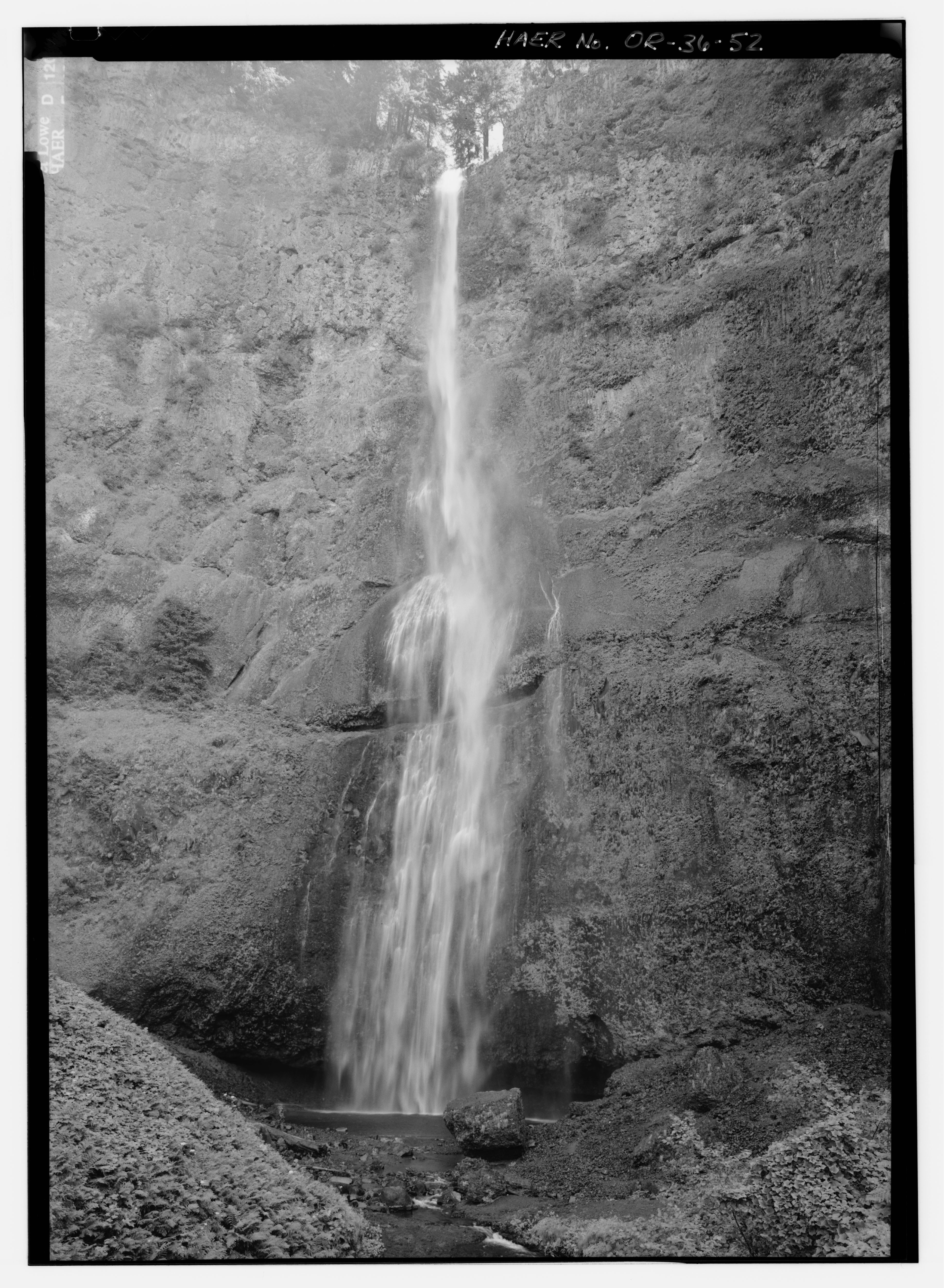
trees Multnomah Falls - the second highest year-round waterfall in the U.S. - flows over part of the Columbia River Basalt Group (CRBG), specifically five flows of the Grande Ronde Basalt, which is the lower part of the Yakima Subgroup of the CRBG (Mangan et al, 1986). Many of the online links I found say that six flows are exposed in the cliff face of the falls; from what I can tell from an original source, six flows of the Grande Ronde Basalt are exposed from the Columbia River to the top of the falls, with pillow lavas being at or just below the very top of the upper falls (Norman and Roloff. 2004). Norman and Roloff's strat section makes it look like there are five flows in the cliff faces of the uppper and lower Multnomah Falls. Anyway, check out their drawing and see what you think!
lower These are the lower falls, with Benson Bridge above and the upper falls above and behind the bridge.
path It's a moderately easy hike on this trail, through wonderful rainforest - see the ferns! - to the bridge.
sign At the bridge, this sign tells part of the story of a huge rock that came off the face behind the upper falls in 1995. The rest of the story is told here. The huge rock mass that fell off the cliff shattered when it hit the upper plunge pool, resulting in minor injuries to some people on the bridge. When I was there in late 2000, five years after the rockfall, the falls didn't look the way I remembered - from visits decades earlier and from photographs.
upper The entire upper falls. Can you tell where the rock fall came from? (It's shown on the sign.)
fracture Well, I'm thinking that the rock fell from the large diagonal fracture area just above the curvilinear, nearly horizontal fracture cutting across the entire lower part of the photo. I base this conclusion partly from memory, and partly from a July, 1995, photo on Wikimedia that shows a rock mass instead of a diagonally fractured area. Also, compare the full resolution version of the Wikimedia photo to Ron Schott's gigapan of Multnomah Falls, from August 6, 2009.
rock And one more thing before we look higher: the rock in the center foreground of this photo is not "the" rock that fell in 1995. For one thing, it's not large enough to be the bus-sized rock. For another thing, the mass that fell shattered into pieces upon hitting the ground. And besides that, this rock is present in old photos including the Wikimedia photo of July, 1995.
pillows This tan area near the top of the falls shows some interesting radiating to irregular columnar jointing in the basalt, just below some of the pillow lavas, which can be seen in the upper part of this photo (enlarge to see the pillows).
top And finally, here is a close-up view of the uppermost part of the upper falls, which was almost hidden in the low-hanging clouds. I've walked the trail to the top - once, I think - back in 1993. I highly recommend the trail just for the immersion into the rain forest. And there's a great view looking straight down the falls.
water Ooh, neat water near the bottom of the upper falls!
forest Another shot of the wonderful rainforest, this time on the way back toward the parking lot. Anyone who visits Multnomah Falls should consider eating in the historic Multnomah Falls Lodge, which was built in 1925. This time, I just stopped at an outdoor coffee and snack stand and got a hot chai tea to go.


Some References:
Mangan, M.T., Wright, T.L., Swanson, D.A., and Byerly, G.R., 1986, Regional correlation of Grande Ronde Basalt flows, Columbia River Basalt Group, Washington, Oregon, and Idaho: Geol. Soc. America Bulletin, v. 97, p. 1300-1318. [also see this Geoscience World link]

bonus1
Norman, D.K., and Roloff, J.M., 2004, A Self-Guided Tour of the Geology of the Columbia River Gorge—Portland Airport to Skamania Lodge, Stevenson, Washington: Washington Division of Geology and Earth Resources, Open File Report 2004-7.


UPDATE 4Jun2010: For a view of the basaltic rock types at Multnomah Falls see this post at Geology Blues.

Tuesday, February 24, 2009

Two Years Ago Today: Frozen Waterfall

frozen Two years ago today, I was in a car with my parents and MOH, and we were driving down the Seward Highway toward the Kenai Peninsula. We drove by this frozen waterfall, which is located right on the highway, in Turnagain Arm, not very far west of Beluga Point, somewhere between Mile 117 and Mile 110 on Alaska 1. It's always frozen, this time of year.

We were heading down to the cabin, a place I like to go in winter, partly to see the frozen river, partly because it can be much colder on the peninsula than in Anchorage, and partly because it's just so different than it is during the summer.
cabin The cabin area in too much snow to drive to the front door.
temp Relatively decent temperatures for the middle of winter.
river A low but not very frozen river. Note the bald eagle in the highest tree straight across the river (click to enlarge); it's just a little dot near the top of the tree.

The pump was frozen so we didn't stay. This year we probably won't even go. The view is always stunning; and U-shaped, glacially carved valleys abound.

Sunday, February 22, 2009

TGIMT: Meme Time

Just when my content and photo posts were starting to drive me nuts - a new meme!! Yay! Seen at Outside the Interzone: Thanks, Lockwood. He states: "The origin of this list is here (with discussion and nice photos) via Swans On Tea." WARNING: This is another one of those 100% U.S.-centric memes. I personally have been to zero falls outside the U.S. and Canada.

You all know what to do: "Bold the ones you've visited, add comments as desired, and as a bonus, add a personal favorite that's not on the list, and that you think other waterfall enthusiasts would enjoy."

This meme counts backwards, from #10 to #1. If you make it to the end, Lockwood added a bonus falls, which I haven't been to. I should add some waterfall on the Alcan, let me think about it a minute... Oh, not to keep you waiting, or anything! (P.S. I'm just sure Callan Bentley has been to all but one or two of these!)

#10 Lower Calf Creek Falls, Escalante National Monument, Utah

#9 Lower Falls of the Yellowstone River, Yellowstone National Park, Wyoming

#8 Upper Whitewater Falls, in southwestern North Carolina

#7 Snoqualmie Falls, between Snoqualmie and Fall City, Washington - have I been there? Maybe. Do I remember it? No.

#6 Havasu Falls, Supai Village, Havasupai Indian Reservation, Grand Canyon, Arizona [Been to Lava Falls, however; I know, not the same!]

#5 Shoshone Falls, Twin Falls, Idaho [Ooh, a pretty one that I haven't been to, yet.]

#4 Multnomah Falls, Columbia River Gorge, Oregon [My absolute favorite falls in the whole world - I've been to the bottom millions of times, to the top once. It's a family falls, I think.]

#3 Bridalveil Falls, Yosemite National Park, California [What about Yosemite Falls, Vernal Falls, Staircase Falls, all the other ones in Yosemite?]

#2 McWay Falls in Julia Pfeiffer Burns State Park, Big Sur, California [Hmm... check this one out; it's only on the list because it supposedly is the only waterfalls in the U.S. falling directly into the ocean.]

#1 Niagara Falls, Niagara, New York

Bonus Waterfall: Salt Creek Falls, Oregon [via Lockwood]
Bonus Waterfall: Palouse Falls, eastern Washington [via me] - a remnant of the floods that created the Channeled Scablands. Picture and some info here.
[I don't think you have to keep adding to the list, here, like I did - just add a bonus one and pass it on.]

I have 4, including my bonus one.