Showing posts with label talus. Show all posts

Wednesday, October 24, 2018

One Year Ago Today: Some Talus Up Close, a Lake in the Humboldt Sink, and Bonus Fall Colors

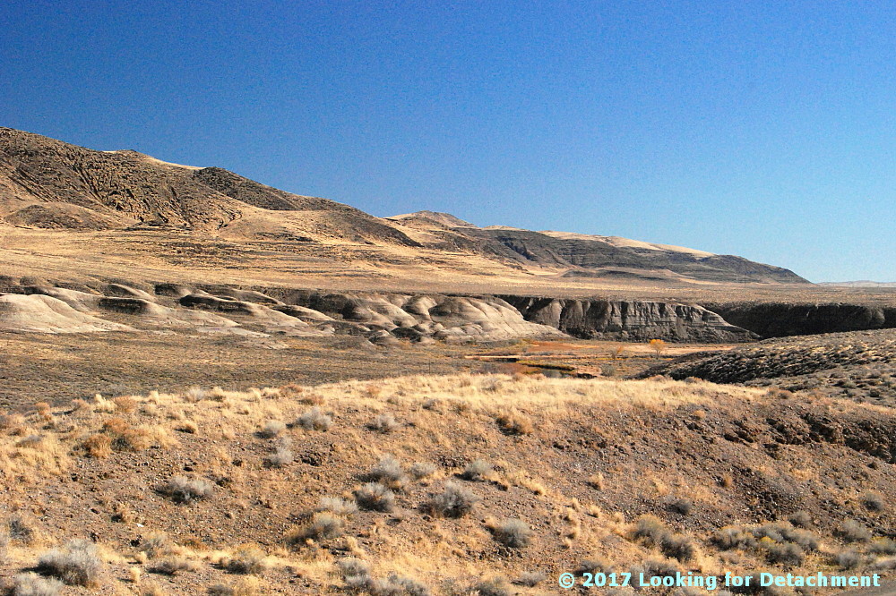
It was a fall day, and while driving out to my field site near Winnemucca I stopped for a hike. I got up high enough to see the water in the Humboldt Sink quite clearly (although way off in the distance), and I clambered over piles of talus. The tallish cheatgrass and possibly an ephedra bush are showing their fall colors, though the cheatgrass takes on this straw yellow color by mid June, and keeps showing it until it regenerates itself from seed sometime in the spring.
And here I am, on top of part of the talus, with a great deal of foreshortening going on so the hill seems nearly flat, and the nicely filled but not overflowing Humboldt Sink is in the background. My Jeep can be seen as a vague dot between talus and lake about half way between the center and right of the photo and not far above the vertical center. Water in the desert is always a precious thing, and it's always something worth stopping for.
Somewhat unrelated: I stopped along the Truckee River before making it to that rocky perch above the Humboldt Sink and took a few photos of bright yellow leaves.

Friday, December 22, 2017

Twelve (or Ten?) Months of LFD (2017)

I'm doing the year-end meme wherein I compile the first sentence of the first post of every month. Meme rules are as follows, as per DrugMonkey (2014):
Post the link and first sentence from the first blog entry for each month of the past year.
I also add the first photo from the same first post. Previous takes on this Twelve Month meme at LFD were posted for 2008, 2009, 20102012, 2014, 2015, and 2016.

Aaand...here's the year 2017 for LFD:

January:
It's been icy cold in the far northlands, with temperatures hovering not too far above zero for several days.

February:
It was a late fall day, and I stopped along Route 447 to see if I could get close to some of the brilliantly colored trees along the Truckee River a few miles north of Wadsworth.

March:
I planned to have this descriptive section as part of the last post—the one about being packed and ready to leave town—but this "little bit" grew and grew, and eventually it had to find its own home.

April:
I was looking back through some photos and realized I had some of the Roan Cliffs from the spring of 2006.

May:
What is this?!!1?1!?
It all started when I was trying to find out what rock formations and rock types I was seeing while making the long trip to work and back out near Elko.

June:
I'm moving slowly on this mini-series about the Humboldt River while working essentially 12-hour days and while (hopefully) recovering from some long-lasting bug I caught on the road or out in Elko more than two months ago.

July:
Returning once again to my spring mini-series about all the rivers and lakes that are at higher levels than I've seen in quite awhile (most recent post), I decided this time to show a few pics of the Truckee River, which I drive by quite frequently.

August: Nothing.

September:
It's been a busy summer, such that I really haven't had time to get much blogging done—and I had so many good posts planned!

October:
This is a classic road song with "road" right there in the title, courtesy once again of MOH.

November: Nada.

December: (this post).
I'm doing the year-end meme wherein I compile the first sentence of the first post of every month.

Tuesday, April 4, 2017

From the Road: Talus-y Goodness and More of the Roan Cliffs, and a Question (at the end)

I was looking back through some photos and realized I had some of the Roan Cliffs from the spring of 2006. These first two photos are taken from an impromptu campsite MOH and I found not far from the Rulison exit on I-70, and they somewhat approximate the views seen in Ron Schott's excellent gigapan of the cliffs. I'd embed the gigapan here, but Blogger seems to have some problem with either the iframe coding or the flash implied within the code (or maybe it's Chrome, and I'm being deluded as to what's possible). In either case, we're looking northwest toward the cliffs in the first photo (above), and northeast toward the cliffs in the second photo (below).
It was a very green spring, according to these photos, so the color balance doesn't match with my fall 2016 photos below, which were taken from near or at the Rulison exit. Also, my Nikon tends towards blue.
The reason I stopped for these particular photos during my semi-mega roadtrip of last fall was the talus. I found the striping caused by alternating zones of vegetated and non-vegetated slope areas to be fascinating in the way that perhaps only a geologist, geomorphologist, or photographer can. So I grabbed a few quick shots focusing largely on the talus slopes. More recently, I decided some approximated geologic contacts were in order.
In this photo (above), the cliff and talus slope below the cliff are formed on the Tertiary Green River Formation (Tg), and the colorful beds near the bottom of the photo consist of the Tertiary Wasatch Formation (Tw). The thin cyan line near the base of the cliff marks (hopefully) the top of the Mahogany ledge as extrapolated from this USGS preliminary geologic map, as deduced from this report (Fig. 9, p. 16)—which points out the top of the ledge in a cliff to the west—and as mapped from Ron's gigapan of the cliffs. A few other reports were helpful for exploring the general geology and reading some background info about the ledge and zone—it's called the Mahogany zone when intercepted in drill holes.
In this set of two photos, I've zoomed in on the striped talus section that was on the far right of the previous two photos. The vertical striping of the talus contrasts nicely with the horizontal layering of the Wasatch beds, don't you think? I've labeled the photos below. This time, a tiny bit of the Tertiary Uinta Formation (Tu) is barely visible at the top right. The stratigraphic contact between the Tg and Tw is crudely outlined in faded cyan: It crops out behind the foreground slope where we can't see it.

This set of two photos is not that different from the previous set, but here (below) I've sketched in the Mahogany ledge (as approximately extrapolated), and I've broadly labeled the geologic formations without drawing in the contacts. The circle is where an old mine, the Rulison Oil Shale Mine is shown on the topo map of the area  (USGS TNM 2.0 Viewer link). I can't see it there in the photo—though maybe it's just not apparent—but there is a tiny black area that *might* be an adit just beneath the arrow.
The cliffs in these 2016 photos lie northwest of the Rulison exit and occur between the first two 2006 photos.
In this last set of two photos, we're looking northeast from the Rulison exit, zooming in on cliffs that approximate what we can see in the second of the two 2006 photos. I once again focused in on striped talus, but then I really zoomed in on some switchbacked roads that I thought might be drill roads. It turns out that the switchbacks climb up to some underground workings into the Mahogany ledge, which I've marked approximately with a thin cyan line (below, with thicker lines marking formational contacts; Tu = Uinta Formation; Tg = Green River Formation). The line is taken directly from the previously linked-to preliminary geologic map of the Anvil Points Quadrangle (O'Sullivan, 1986). The map can be viewed directly in Google Earth, an option I always appreciate.

The underground workings here consist of several adits comprising the Anvil Points Oil Shale Mines. The mine was active intermittently from 1925 to 1982 (the last link includes some undated photos), with some clean-up operations running from 2008 to 2013.
How do you spell Talus-y? I see 3 options: talus-y, talusey, and talusy. I went with the first option in the title but prefer the last. Yes, I know it's not a *real* word.

Tuesday, March 14, 2017

The Roan Cliffs Again, This Time with Some Contacts

After seeing Ron Schott's awesome and enlightening GigaPan of the Roan Cliffs, I decided I had to mark some contacts on the photos from my last post (and partly because what I said or implied about the formations were a little off). To deduce the location of these contacts, I extrapolated from this USGS preliminary geologic map, using the USGS TNM 2.0 Viewer and Google Earth.
In the first photo, it's still a toss-up, imo, as to whether the Tertiary Uinta Formation (Tu) can be seen—but if so, it's way up at the top of the cliff. Most or all of the cliff and most of the slope is underlain by the Tertiary Green River Formation (Tg). Aaaaand maybe there's a bit of the Tertiary Wasatch Formation (Tw) at the bottom of the photo.
In the second photo, there is (probably) just a tiny bit of the lower part of the Uinta Formation (Tu) above the cliffy area, and the reddish-brown foreground slopes are underlain by the Wasatch Formation (Tw). The rest, cliff and slope, consists of Green River Formation (Tg).

Thursday, March 9, 2017

From the Road: Bedding and Talus in the Roan Cliffs of Colorado

Getting back to my October-November road trip (last seen here), I stopped to get some fuel in Parachute, CO, on what was Day 7 of the trip, and I ended up taking a few photos (surprise!), partly thinking that the cliffs show good examples of bedding, and also because I was becoming fascinated by the exceptional talus slopes coming off the cliffs. The first photo is a cliff at a round nose sticking out from Mt. Callahan. The second photo is of a cliff at the southern end of a nose known as Allen Point, a long skinny ridge running about 1.5 miles south of a broader, arcuate area also called Allen Point.
When I investigated this area after my trip was over, I was surprised to find that these cliffs are part of the Roan Cliffs: while still enroute, I thought I was driving along the Book Cliffs. The Roan Cliffs are the cliffs that break south off of the broad Roan Plateau, a large plateau area that extends from Rifle, CO, to at least somewhere north of Grand Junction, possibly bounded on the west by Roan Creek. The Roan Cliffs, however, at least as shown here, encircle a broader area extending westward from Rifle, CO, to the mountains just east of the Wasatch in Utah.

The Roan Cliffs are capped by the Eocene Uintah Formation (which we may or may not see in these photos), and slopes below the uppermost cap are composed of the Eocene Green River Formation. Some of the lower, reddish slopes in the area are underlain by the Paleocene to Eocene Wasatch Formation. You can read a little more about the geology of the area in this USGS Bulletin.

The Roan Cliffs stratigraphically overlie the Book Cliffs, which we'll see later. I'm not sure how I mistook the cliffs of the Uintah Formation and upper Green River Formation for cliffs of the Cretaceous Mesaverde Group, or slopes of the Green River Formation for the usually easy-to-spot Cretaceous Mancos Shale. I can only plead that geology at 70+ mph isn't always spot-on.

Tuesday, February 7, 2017

From the Road: Talus Stripes and Shorelines along the Truckee River

Talus, shorelines, and fall colors.
It was a late fall day, and I stopped along Route 447 to see if I could get close to some of the brilliantly colored trees along the Truckee River a few miles north of Wadsworth. I didn't end up finding a good spot for pics of fall colors—other than maybe this one taken down near the Numana Hatchery—but I did find lots of wonderful talus stripes and some Lake Lahontan shorelines.

At two stops a little farther to the north, at and near the junction of 447 with Chicken Road and at the Historic Marker 448 pullout, I grabbed a hodgepodge of photos.
Looking SSE from the historic marker pullout.
These two photos look south-southeastward along the Truckee River toward distant Fernley. A good portion of the river in this area runs parallel or sub-parallel to Walker Lane strike-slip faults. Wadsworth Amphitheater, which shows up in the Google Earth images we'll see in a minute, is not visible from any of our photo sites; it's an amphitheater-shaped topographic feature cut into Lake Lahontan sediments right along the east bank of the Truckee, beyond the dark basaltic hills on the right side of these two photos (east side of the Truckee).
I love the lone Cottonwood in this photo.
I went ahead and drew a few lines on Google Earth, then I rotated the resulting images to two different orientations so we could see a little more of the terrain. Be sure to check the north arrow in the upper right! The linears I drew are parallel or sub-parallel to the trend of the Walker Lane. You might be able to pick out a few more in the images (or go to Google Earth and looking around a bit).

The Walker Lane—on Google Earth (G.E.)and on other aerial representations such as air photos—shows up best at very small scales; that is, if we zoom way out and observe the area from way above, we can see the trend of the Walker Lane better than if we zoom way in, like we've done here. Nevertheless, individual strike-slip faults have been identified throughout the Walker Lane, and a few of these occur right in this area.
The A is centered on Wadsworth Amphitheater. The purple camera icon shows the location of the first photo.
The next G.E. image zooms in to the area we can see in the photos. I've got all three photo locations turned on, the A for Wadsworth Amphitheater, and my drawn-in linears. These linears aren't necessarily faults, although I'm pretty sure the one on the far left is. Unfortunately, because I currently have a very lousy internet setup (thanks Frontier!), I can't load very many research web pages. Google works well—and Blogger is a Google product—so I can blog even with 25 to 100% packet loss (it's 50% this very moment). And because Google Earth is a Google product, it's working for me also! (But I can't routinely access my non-Google email.)

Back to the faults and linears. I do know from personal experience that Walker Lane structures pass through the Lake Lahontan sediments in the area where the Truckee is running in a particularly linear fashion. I know this from some work I did a long time ago with J.O. Davis, who was studying Lake Lahontan and using tephra beds to date various aspects of the stratigraphy. The two linears or faults in the lower right of the image cross through the area where I've seen older Lake Lahontan sediments faulted and highly contorted by the major structures that pass through the area. I can't say that my particular linears are right on the major structures, and I can see other possible lineaments.

UPDATE 3Feb2017: I now have good internet back, and I've been able to compare my "map" to a geologic map of the area (Bell, Garside, and House, 2005). My linear passing through the hatchery location (below) is spot on for their most prominent fault, which was mapped as a dominantly extensional fault.
A zoomed in G.E. view of the area.
Not sure why, but I prefer to spell amphitheater with an "re" at the end: amphitheatre. I also have a hard time sticking the first "h" into the word!

I sure wish Frontier was a better internet service provider! (I never had this kind of semi-routine trouble with AT&T in eastern and northern Nevada; their every-day speeds were faster, and service was (generally) provided more quickly.

Back to the photos! 😊
Horizontal Lahontan shorelines and vertical basaltic talus stripes.
Some of the same talus stripes in Google Earth.
This photo shows a juxtaposition of talus stripes, faint shorelines, and layered Lahontan sediments.
On this trip, I focused mostly on trying to get good photos of the talus, because that's really what caught my eye. I later noticed that a few shots showed the Lake Lahontan sediments fairly well.
White, gray, greenish gray, and pinkish layers of the Eetza Alloformation.
While driving through the area, I'd been assuming that the prominently exposed white units were part of the Sehoo Alloformation. I was wrong! The Sehoo is barely identifiable in this zoomed in photo, and it's the older Eetza that is most conspicuous. In fact, the Sehoo here is mapped as gravelly beach deposits, so it mostly comprises the dark gray or brownish gray layered deposits above the whitish units.

Note: I usually use "formation" when talking about the subdivisions within the Lake Lahontan section, but "alloformation" is technically correct. In explanation, Bell et al (2005) say this, "Lake Lahontan and related subaerial deposits were considered lithostratigraphic units in the early studies of Morrison and were designated as formations. With the revision of the North American Stratigraphic Code in 1983, new allostratigraphic and pedostratigraphic unit definitions were added which allowed the definition of time-transgressive, lithology-independent rock units and soils."
Qsm = middle member of the Sehoo Alloformation; Qe = Eetza Alloformation.
After taking all these photos, it was time to move on, so I looked to the north, in the direction I'd be heading.
What I saw was more talus, more shorelines, and more Lahontan sediments. (And some fall colors.)
Selected Reference:
Bell, J.W., Garside, L.J., and House, P.K., 2005, Geologic map of the Wadsworth Quadrangle, Washoe County, Nevada: Nevada Bur Mines and Geology Map 153.