Thursday, February 28, 2013

Five-year Blogger-versary!!

It was hard to know what date to consider my real 5-year blogiversary. I started blogging in a very limited way on a non-public site back in November of 2006, and continued in that lackadaisical fashion with a second post on the same non-public site in July of 2007. As noted in my first blogiversary post and first Blogger-versary post, I started blogging on that same site in earnest in January of 2008, continuing into February of 2008, with the goal of going public with the blog sometime before the end of that year. Because of the rapid expansion of The Geoblogosphere in late 2007 and early 2008, I made my first post here at LFD on February 28, 2008, and began transferring posts from the now defunct non-public site on February 29, 2008 (Leap Day).

Readership has swelled during the past couple years, with subscriptions to the RSS feed numbering over three hundred.

Individual blog hits have increased gradually over time, though they have never been very high (over 100 in a day is exceptional). Hits declined during the last two months of 2012, but surged back a bit in January.

In any case, I plan to continue blogging as time allows (I've been trying to maintain one or two posts per week during this last, very busy year), and will now go through some of my most used blog tags, with a few accompanying photos.

My blog tag list is huge compared to most blogs (see lower sidebar), and was set up primarily so I could find my posts as easily as possible (i.e., it's my own personal cross-referencing system). Tagging has not been entirely consistent, and I try to correct the inconsistencies whenever I see something, or whenever a category becomes large enough to add a tag retroactively. The number of tags I'm citing below was current on January 1, 2013, when I began this post.

View of the Clan Alpine Mountains, Nevada, from the Fairview Peak fault scarp.
My first largest tag or category is (no surprise here!) Nevada, with 463 tags as of January 1, 2013. My Nevada category includes at least two unfinished series: posts about the Midas area and some Northumberland-related posts including posts relating to The Geographic Center of Nevada. For comparison, the next largest state, country, or province category is california, which came in 13th with 74 posts. Alaska was close behind at 17th, with 67 posts.

Geology is in 2nd place, with 171 tagged posts. I haven't used the tag as often as I could: so many things on this blog could fall under geology, or geoscience in a broader sense, and the tag didn't originally seem that useful to me, especially for my own sense of organization.
Geologic map showing a portion of the Osgood Mountains (map from Hotz and Willden, 1964).
For example, the post from which I took the above geologic map, is not tagged geology (or map!), because I really don't discuss the geology (or the map!). I found the post because I knew it was tagged "work."

Drill rig in eastern Nevada.
The tag in the field comes in third with 163 posts. This is a somewhat inconsistently used tag that includes a variety of overlapping topics. For me, "in the field" often means drilling, sometimes mapping, and sometimes life in the field. It can also mean other things, for example old junk or old buildings found in the field.

Monitor Valley Road, more or less south of The Geographic Center of Nevada.
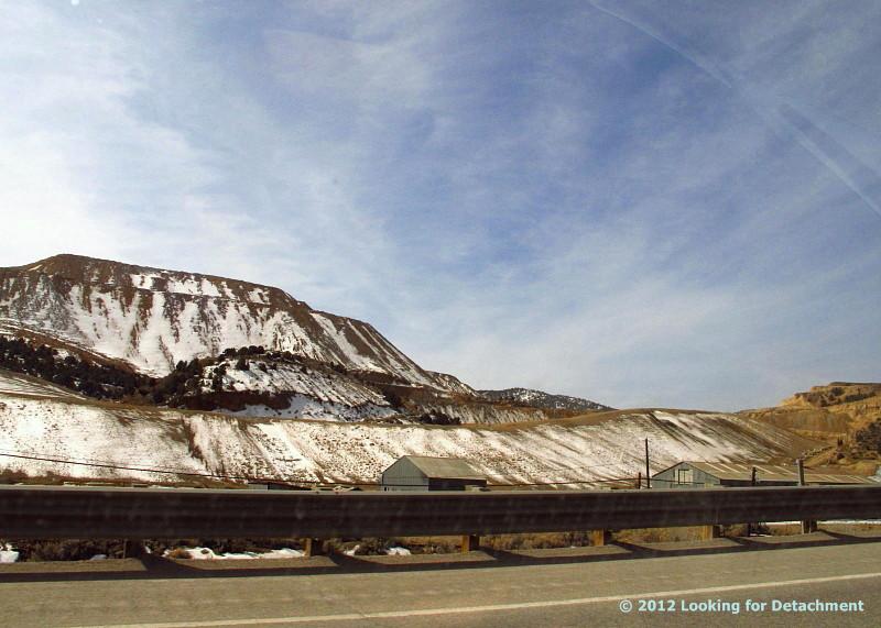
My variously tagged road posts include those tagged road trip, which comes in fourth at 143 posts. Road trip posts include trips on pavement, including those on interstate highways, and trips on goodfair or middlin', and bad dirt roads. The category includes trips far from home, trips closer to home (or field station location), and trips out in the middle of nowhere (or center of everything, depending on how you view things).

The roadside posts (5th in our countdown) numbered 136 at the beginning of 2013. These posts include what I consider to be my roadside geology category and also include posts about things or places located along the road, always a particular road. Highway 50 has the highest number of overall posts at 108, Highway 8A comes in second at 44, and I-80 comes in third at 20.
Falling rock sign on Highway 89, with Lassen Peak in the background.
An example of a roadside geology post: The dacite of Mount Helen near Lassen Peak on Highway 89, CA.
Another example: Phyllitic slate near Connors Pass, Highway 50, eastern Nevada.
Okay, so the various tags can get a little redundant! The previous picture could be tagged, if pictures were tagged individually, Nevada, Highway 50, rocks, metamorphic rocks, roadside, geology, and possibly a few other things. Highway 50, with its roadside geology posts, reminiscing posts (old times, see below), and roadside attractions posts, comes in 6th overall with a fairly whopping 108 tags through the end of last year. That's largely because I've spent a good deal of time driving that road during the course of the last five years, and spent an even greater time driving that road between the years 1975 and 1991 or so. It's also because I've included in the tag posts for some back roads and highways are within some certain, undefined distance of Highway 50.

Our next category, old times, is 7th with 93 posts.


Posts in this category include those that are entirely about the past, AKA the "good old days," and also include posts about current times wherein I mention how it was in the past or tell some part of an old story.


Old times posts rarely include old photographs; sometimes they include new photographs of old places.

Remains of the old bathing cabin at Spencer Hot Springs (story here).
Somewhat surprisingly (to me, at least), the category volcanic rocks comes in 8th at 80 posts. Well, maybe it's not so surprising: I began my career (after my thesis and after some few short stints at government, government-related, and company jobs) doing exploration in volcanic rocks. Consequently, some of the stories of old happen to be about volcanic rocks or the drilling and exploration thereof, and I somehow just seem to pass by and stop to look at volcanic rocks in my travels here, there, and everywhere.
Tuff of Hoodoo Canyon at the entrance to Northumberland Canyon, central Nevada (from Drilling Stories: Getting Started at Northumberland)
Tuff of Hoodoo Canyon and Northumberland Tuff (more here).
Other types of rocks have been tagged less often at LFD: sedimentary rocks were tagged 74 times by the beginning of 2013; metamorphic rocks were tagged in only 24 posts (although mylonite, a type of metamorphic rock, continues to be one of my favorite rocks); intrusive rocks were tagged 14 times, including one of my favorite of 42 beer posts, Icky with Anorthosite.

The tags mining and winter are tied for 9th place at 81 posts each.
A wintry, mining-related photo from this post.
Exploration, a perennial subject here at LFD, comes in 10th with 79 posts. Exploration can be related to roads, rock hammers and other field tools, geology, geologistssampling, drilling, mapping, field camps, and helicopters.
Hughes 500-D sitting on an outcrop somewhere west of Beatty, NV, in 1978.
Many exploration posts don't have pictures.

Monday, February 25, 2013

Things You Find in the Field: Another Oasis

The Oasis at Rye Patch.
A jukebox and "I Want Brew" sign in the corner.
A pool table across the room.
Pull up a chair?
It was a wintry day when MOH and I stopped by The Oasis sometime late last year. We sat at the bar, had a burger or some such, and an Alaskan Amber. I was surprised to find anything but the Bud, Bud Light, Coors, Coors Light, or (if you're lucky) MGD that are prevalent in small bars across Nevada—but good brews are becoming more popular in the outback and are, hence, more available.

The Oasis at Rye Patch is a cozy place, overall, with a nice sign out front (see this) and good pizza inside. I recommend the pizza from a dining experience or two back in 2004, when I was working in the area for a now defunct company that was running one of the nearby mines (the mine is still running).

Friday, February 22, 2013

Things You Find in the Field: An Oasis

The Oasis in Niption, CA.
It's a decent place to get a burger, drink iced tea, hang out, and play pool.
Pool cues.
The Oasis is surrounded by trees, and has lots of historic and informational photos on the wall. We thought about staying the night, but accommodations weren't available on zero notice, so we went on to Needles (fondly known as Needless). When leaving, we had to wait for a train to pass.

Tuesday, February 19, 2013

Things You Find In the Field: World's Worst Road?

A road not taken.
Its beginning located here in Google Maps.
Back in 2009, MOH and I were heading up this road in search of a particular "world's worst road," when it turned out we were on very old access road, which soon petered out into the creosote.
Continuation of the road not taken, with destination canyon off in the distance below the faintly pinkish exposure just right of center.
We were heading up toward a road that went up a long canyon, which began at the top of the alluvial fan in the distance. I wanted to drive the canyon road to remind myself about good roads and bad roads. The canyon road, being entirely passable by almost anyone in a high-clearance 4WD vehicle, was merely tedious and quirky at its entrance into the canyon from the top of the alluvial fan. Giant rocks, embedded in the fan, stuck out here and there, almost always precisely in the wrong place. The rock placement, along with considerable rutting of the road on its downhill side, made severe scraping of differentials and other low-hanging parts and lines moderately likely, even highly possible.

I was first led up the canyon by a prospector/submitter/promoter, who wanted to show me some claims of his (or his company's), which were south up the long canyon road, then west beyond some steep or somewhat precarious switchbacks, and then farther west on the other side of the mountain ridgeline. I don't remember our driving arrangements, but I do know that I always prefer to go into the field in my own vehicle (or a company vehicle if one is available), and that, as far as I can remember, I have never been escorted by prospectors onto their claims without me driving my own truck behind them.


An Aside: Prospectors—who are not geologists but are people who may make a living or add to their regular living by staking and leasing mining claims to exploration and mining companies, their regular living often being related to ranching, possibly to small market or gas station ownership, perhaps to small or large equipment operation (think cat operator), or perhaps including or primarily being related to retirement income of some sort, and which can be related to any other type of occupation including real estate—are often men, but I have known or met at least two non-geologist prospectors who were women.

I don't, BTW, consider myself a prospector, although my work can require me to conduct prospector-like activities, which, as a professional, I call exploration. The (IMHO) erroneous labeling of trained persons with geology or other related earth science degrees as prospectors, came up on Twitter recently. I reject any assertion that professional explorationists can be called "prospectors"—except as a colloquialism—and reserve the term for that used-to-be large, used-to-be ubiquitious (in Nevada, and perhaps in southern California, although a Mojave or otherwise California version of a true prospector is hard to come by: the Mojave version is, in my experience, more likely to be a scam artist), and used-to-be crucial (to the mining industry) contingent of non–geo-type individuals found out and about throughout the backcountry, banging on rocks or panning for gold, staking and maintaining their claims.


Back to Roads: There are numerous roads here and there in the west, and especially in the Mojave Desert of southern California, that could perhaps qualify for submission to the world's-worst-road competition. In that competition, I'd consider only roads that are theoretically passable, even if one might have become stuck while driving said road. (Getting stuck can result both from driver error or misjudgment and from nasty or terrible road conditions.) Some roads are impassable (or nearly impassable) for short periods of time—after flash floods or during winter snows or spring melts. These roads could be submitted to the world's-worst-road competition using their condition during their passable (or nearly, but not quite, impassable) periods. For the competition, I might develop different categories of "worst," including (1) steep, hairy overhangs, (2) rocks, possibly in more than one category, (3) mud you can get through, but you wish you had never made the attempt, (4) narrow, unlikely passages, including those through tall, thick, and aggressive brush, overhanging willows, or jutting junipers, (5) other narrow, sometimes harrowing or at least challenging passageways through slot canyons and holes-in-the-wall, and (6) essentially one-way routes through canyons or over mountains that don't allow chances for pulling over or turning around if one happens to meet another vehicle or a suddenly impassable section. Oh, and then there are the endless and endlessly variable wash roads where you have to "drive like a river."

Many roads in the Mojave were, when I drove them with some frequency, long and rocky, and we drove them at breakneck speeds of 5 to 15 miles an hour. Back then, 10 mph equaled Warp 1. It was always considered good to reach and exceed Warp 1; attaining Warp 2 (20 mph) would push a Mojave road into the merely average category instead of keeping it hopelessly and endlessly stuck in the bad. Dodging the often small but always persistent rocks on flat to barely sloped alluvial-fan ground in attempts to get into named and unnamed canyons and, from there, to get farther uphill to prospects or areas of interest was a tedious and frustrating procedure. A two-mile length of rocky alluvial fan road could take 1 to 4 hours of travel time.

In the canyons and up in the mountains of southern California, roads sometimes deteriorated rapidly, with giant rocks jumping out, trying to high center your truck or to sideswipe your doors or side panels. I can, offhand, only think of three roads in Nevada that rivaled the average road in the Mojave for its rocks and high centering capabilities. Both of these Nevada roads were navigable with use of considerable 4WD skill; one road resulted in a truck side dent when driven by someone with less skill than I (or with less concentration devoted to their driving).

Nevertheless, I have been stuck in the Mojave more than once (and in Nevada several times, often because of mud). One time, while working for Former Mining Company, my field assistant and I were up some road in the Turtle Moutains, around some corner that I nearly had to back around when leaving, and we came to a narrow, very rocky juncture where the road was almost eroded by a small side drainage. I tried to go around on the high side, which, on the second, third, or fourth attempt, resulted in a major high centering episode wherein only two wheels remained on the ground. We carefully built a road under one or both of the in-air wheels. (Sometimes it's good to tie your vehicle off to any large rock or tree (ha!) that happens to be available.) Then we backed down to a turnaround point—after walking up to, sampling, and sketch mapping the higher prospects we had been trying to reach. Careful examination of the getting-stuck point convinced me that truly artful four-wheeling would have rendered the rocky point passable, but neither of us wanted to make another attempt.

Various views of the location in question can be seen below.


Air photo view from TNM 2.0 Viewer.
Topographic map vew from TNM 2.0 Viewer.

Friday, February 15, 2013

And Even More Ice!

On our third snowy, icy hike in mid-January, we came across even more ice crystals near the lower, rocky section of our Water Canyon trail, where the creek had frozen almost solid.
Ice and hoarfrost in frozen creek bed, two boots for scale.
Needle ice crystals on ice, with rocks poking through,
located in the upper left of the first photo.
Ice blades or feathers are like petals in an icy rose,
from the lower right of the first photo.
Gradually, the weather changed, overall temperatures warmed, and the ice fog left. Since then, we've had warmer days, more snow, a little more ice on one or two mornings, and most recently, some very clear, sunny days. Some think that winter is over, but it's only mid-February, and I really doubt it.

Tuesday, February 12, 2013

Another Hike...More Ice

It was another icy, foggy morning, with hoarfrost covering everything in sight, and the Pogonip barely lifting from the ground.
Splotchy-pattered frost on the window, and the tree from the first photo beyond.
We, of course, headed up to Water Canyon as soon as the temperature warmed a bit. (The high for the day is listed at 13°F, so I'm not sure how much it warmed up, but it least it was warmer than the official low of -21°F!)

This time, rather than snowshoeing, we hiked, possibly using chains on our boots. This may have been the trip when our chains iced up, making walking awkward, and causing us to revert to just boots.
Partially frozen creek.
At the rocky area in the lower part, we found some unusual ice patterns, apparently caused by intermittent freezing and thawing of the creek.
Flow patterns in ice.
Intriguing flame-like structures in ice, with flowing water beneath.
Side trail into snow.
We came to point-three-mile canyon (which I have, in the past, erroneously called half-mile canyon), and didn't take the trail, although some intrepid snowshoer had been up and back at least once (a trail goes around the deadfall).

The creek and frozen waterfall at third-mile creek crossing was covered with ice thick enough to walk on. (Photo below: compare to this photo from my last post.)
I can see at least five layers of ice in this photo: the first is a broken one around the edge, the second is the one the surface hoarfrost is growing on.
Little, dark bubbles of air moving beneath the ice were almost the only clue that the creek wasn't frozen solid. A second clue was a faint gurgling sound.
A layer of needle and feather ice crystals (hoarfrost) on a thick, transparent layer of ice, with  less shapely ice and snow on a deeper, dark-looking layer of ice.
Sagebrush and shadows on frosted snow.
My feet finally froze, and we turned around.

Thursday, February 7, 2013

Icy Snowshoeing in early January

It was early January, the inversion was still heavy and snow was thick enough for snowshoeing, so off we went, out of the city and into nearby Water Canyon.
Snow and aspens in Water Canyon.
The rocky area, not quite covered with snow and ice.
After trudging a ways up the canyon, we came to third-mile creek crossing, which had a narrow snow bridge packed across it's downstream side.

We stopped for a few photos.
Standing on the snow bridge, looking upstream at the small, frozen waterfall.
Closeup of the waterfall area, frozen and covered with hoarfrost.
Frost crystals were growing here and there across the iced-over creek, especially near the edges where feathery and leaf-like crystals were growing outward from the snow.
Frost crystals with snowshoe for scale. Crystals in the next photo are located in the left center of this photo.
Enlarged frost crystals, shaped like leaves or flower petals.
Hoar frost "leaves" and ice needles or spikes.
Where these frost crystals had grown upward from their ice base, they looked like flowers to us, but they are not the same as frost flowers (which is what we wanted to call them).
Delicate feathery ice around the edge of larger hoarfrost formations.
And finally, we looked off downstream at more snow, ice, and hoarfrost, and set off back down the canyon.

Tuesday, February 5, 2013

Things You Find in the Field: Old Cabin...

...overlooking a currently inactive open-pit mine.

Cabin overlooking one of the old Willard pits.
The pit was in production from 1989 through 1992, with operations conducted by the now defunct Western States Minerals (which became or became managed by NewWest in 2006, which was bought by Fronteer in 2007, which was acquired by Newmont in 2011).

It looks like it would be a nice place to live provided mining in the future didn't eat into the front yard, and if only there was a tree or two and a nearby running stream. Oh well, can't have everything!

The area is visible and accessible, via dirt roads, from I-80 at the Coal Canyon exit. Mining claims on the property are currently active, so access may be partially restricted.