Showing posts with label food. Show all posts

Tuesday, May 24, 2016

Beatty: Old Buildings, A Fold, and Onward toward Titus Canyon

Before a mediocre breakfast with slow service at the casino at the north end of Beatty, I walked around in the early morning light taking various photos of some of the old (and old-styled) buildings.
The Sourdough Saloon and Happy Burro sit across the street from the parking lot of the Exchange Club Motel.
By the way, you can get a dinner at either place photographed above, and over the course of our two nights in town, MOH and I ate at both of them. Both establishments are relatively congenial. During dinner at the Sourdough Saloon the first night, we found out from other superbloom afficionados that "the best place" was down near Badwater. Additionally, the Sourdough has interesting graffiti on the ceiling: Geology, geography, and geoscience students from around the world (at least as far away as Norway) have left their mark while stopping in for burgers (or pulled pork) and beer.
Ceiling in the dining area of the Sourdough Saloon.
Unfortunately, I can't say that I recommend eating at the Sourdough (although I've since read that you can get a good pizza at the bar, something we didn't try). There seems to be no method for getting your order in other than finally realizing that you are supposed to go up to the kitchen window and harass the cook; the food takes nearly forever; and the sole person present does all the cooking, table waiting, and table cleaning—and she isn't shy about letting you know how put-upon she feels about that! Besides, my memory says that the beer was fairly standard. (I'd rate a bar average or standard if either Sierra Nevada Pale Ale or Blue Moon Belgian White were the best beer available—or if zero IPAs were offered—although the presence of either beer, bottled or on tap, would mean that the selection was better than what is typical of old-style Nevada bars, where Coors or Bud are standard and MGD, Killian's Red, or Heineken might be the best beers available). We relaxed with our ales and enjoyed ourselves as much as possible but didn't go back the next night (or rather we did, but we stayed only a minute or two—long enough to figure out it would be the same slow and dramatized scene as the night before).
The Exchange Club casino and restaurant, closed since 2004.
The Exchange Club holds a few old memories of mine, mostly of lousy food back on Thanksgiving Day, 1975, when the third Geology of Nevada field trip stopped there for dinner, and we all spied the "C" rating on the wall, saw the ghastly looking mayo they were serving, and hesitantly ate the pathetic sliced turkey. Canned cranberry sauce was the best part of dinner. Why were we there on Thanksgiving? That was just part of being a grad student. After dinner, we retired to the Beatty dump to camp. (Jokes about radiation? Yes, although we were not at that dump.)
Old sign for the Exchange Club near the center of town.
I took two pictures of the innacurate sign (I repeat: there is no casino).
On this particular morning, the third day of our rambling journey undertaken primarily to see the superbloom in Death Valley, I puzzled over a fold up in the hills just southeast of town.
Recumbent fold?
At first I was wondering what a fold like that would be doing in the Miocene volcanic formations that surround the city. I later realized this possible recumbent fold was in older rocks—Paleozoic or even Precambrian. Looking at Google Earth and the geologic map of the area (Monsen et al, 1990), there's definitely some folding on that hill, but I'm not sure of its geometry. The rocks are mapped as the Late Proterozoic (formerly Precambrian Z) lower member of the Wood Canyon Formation: quartzite, siltstone, dolomite, and limestone.

After breakfast and a fuel stop, we left Beatty's main intersection by going straight instead of turning left.
U.S. Highway 95 turns left toward Las Vegas; MOH and I went straight.
Our trip into Titus Canyon begins here!

Location map

Related Posts (in order of posting):
Death Valley, "Super" Blooms, Turtlebacks, and Detachments
Death Valley Trip, Part 2: More of the Badwater Turtleback Fault
Death Valley Trip, Part 3: Northward, and over Daylight Pass
Death Valley Trip, Getting There: Wave Clouds beyond the Sierra
Death Valley Trip, Getting There: A Hike to Pleistocene Shorelines

Death Valley Trip, Getting There: Walker Lake, Road Stories, A Bit about Copper, and Some Folds near Luning

Death Valley Trip, Getting There: A Jeep Trail, Folds and Cartoons of Folds, Even More Folds, and Boundary Peak

Death Valley Trip, Getting There: Highway 95, Redlich, Columbus Salt Marsh, and Another View of Boundary Peak

Death Valley Trip, Getting There: Coaldale, Black Rock, Lone Mountain, and the Boss Mine

Death Valley Trip, Getting There: Black Rock to Lida Junction to Beatty

Monday, February 25, 2013

Things You Find in the Field: Another Oasis

The Oasis at Rye Patch.
A jukebox and "I Want Brew" sign in the corner.
A pool table across the room.
Pull up a chair?
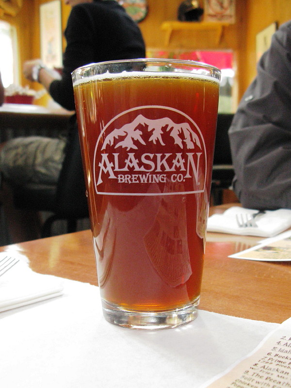
It was a wintry day when MOH and I stopped by The Oasis sometime late last year. We sat at the bar, had a burger or some such, and an Alaskan Amber. I was surprised to find anything but the Bud, Bud Light, Coors, Coors Light, or (if you're lucky) MGD that are prevalent in small bars across Nevada—but good brews are becoming more popular in the outback and are, hence, more available.

The Oasis at Rye Patch is a cozy place, overall, with a nice sign out front (see this) and good pizza inside. I recommend the pizza from a dining experience or two back in 2004, when I was working in the area for a now defunct company that was running one of the nearby mines (the mine is still running).

Friday, February 22, 2013

Things You Find in the Field: An Oasis

The Oasis in Niption, CA.
It's a decent place to get a burger, drink iced tea, hang out, and play pool.
Pool cues.
The Oasis is surrounded by trees, and has lots of historic and informational photos on the wall. We thought about staying the night, but accommodations weren't available on zero notice, so we went on to Needles (fondly known as Needless). When leaving, we had to wait for a train to pass.

Thursday, June 14, 2012

First Day Off After Nine

Early morning: This was my rousing view of clouds and the foothills of Winnemucca Mountain when I awoke this morning. This photo now seems to represent what was a somewhat inspirational beginning to what turned into a busy, erratic day. Perhaps the day was also a bit like the clouds: scattered.
Early evening: It was a hectic day, seemingly, and I'm finally relaxing with a cold beer — a Rotator IPA in a Ruby Mountain Amber pint glass. I think the only reason the day seemed hectic was that I did things other than what I planned, things that weren't on my TTD list, so I felt as though I didn't accomplish anything. Instead of relaxing and blogging (both were on the list), I did a modicum of unpacking, a bit of arranging, and quite a bit of rearranging. I did get two things on my list done, including having a relaxing hot bath. And, for things not on the list, I accomplished the hanging of a peg strip near the front door of the apt, which now looks like this (sign compliment of furnished apt):
By the end of the day, prior to beer, I didn't find a Father's Day card to my liking. Whereas it seemed that the cards in our moved-away-from town were dorky and quite repetitive year to year, it seems as though the cards in this new town, while ostensibly or superficially quite varied, trend overall either toward the overly sentimental (for either myself or the way I view my dad), or they are raucous musical and noisy things that I'm pretty sure he wouldn't like. Consequently, because I'm already late in mailing anyway, I'll probably dig through the many cards I have on hand, which I've bought for myself not to use but to look through and enjoy (art cards), then I'll pick one out and hopefully get it sent by tomorrow afternoon when the mail gets picked up at our nearby apt-based boxes. With any luck, the card will arrive in AK by Monday, only one day late.

In the meantime, I'm expecting a phone call from MOH. He's on his northern adventure, checking out oil fields and small towns in northerly areas that I've never visited. (I'm jealous, in a way, but am getting daily pictures of campsites, rivers, and the way my old truck currently looks as a mini-RV. One thing I've learned is that the Yellowstone River is quite beautiful, though a long way from here.)

And now, my beer is still cold but needs to be refreshed with a new one, the sun coming through the open-to-the-freeway window — open to let swamp-cooler air on high out — is warm. After beer I'll have a dinner either of mint chocolate cookie ice cream or mini-ravs and milk. That will be the end to what I now see as a good day.

P.S. The "our town" tag refers to the old place in the hinterland of eastern Nevada, and the "wnmca" tag refers to a uniquely named town in north-central or north-western Nevada (depending on how you view Nevada geography).

P.P.S. I am finding myself, as I've mentioned before, considerably shorter on time for blogging while working the industry-wide normal 10-hour days and having a door to door driving/riding time of 45 to 60 minutes, depending on particular logistics. These logistics create what are actually 12 hour days, longer than my previous 10-hour work days plus 30 to 45 minute max round trip times (10.5 to 10.75 hour days compared to ± 12 hour days). I'm still adjusting, rather slowly, to my lack of blogging time. I'm not awake enough in the morning to do much serious (or very good) writing or link finding, and the short evening is often crammed with brief winding down, dinner, getting ready for the next day, enjoying a netflix-streamed old TV series episode or two with MOH when he's here, OR just crashing, OR reading the internet but not blogging. Haven't figured all that out quite yet — and I haven't quite scheduled time in for any excercise besides what I get at work, walking up and down metal-grated stairs and walking back and forth down my rubber-padded cement-based core-logging lane.

P.P.P.S. Wrist and elbow overuse pain (started in one arm, is now also in the other becuase of using the other almost exclusively at times) has also limited what I have been able to do on the computer. The pain, soreness, inflammation, whatever it is, is better. It all probably began from packing and lifting/carrying boxes; consequently, any unpacking I do puts me at least slightly at risk of a longer healing time. (RICE: REST, ice, compression, elevation — need the former, acheiving very little of the latter - how does one raise the elbow without using it or other possibly compromised muscles? Meh.)

Wednesday, March 7, 2012

Backroads: Too Cold to Change a Flat, and other Considerations

Upon getting out of the truck at the north end of the Monitor Valley playa, it became rapidly clear to me that it was very cold. (Later, the weather calendar for Eureka showed a max of 28°F and a min of-3°F for the day.) When I pulled off to the side of the road, possibly running over some spiky twigs from the roadside saltbushes, I hoped I wouldn't get a flat tire. I then immediately reassured myself that my fairly new tires still had good tread, and that *of course* I wouldn't get a flat.

By the time we got back to the truck after our excursion a relatively short distance out onto the playa, my fingers were freezing and my face was icy. I once again considered the chances of getting a flat from running over thorny bushes, so instead of turning around in the middle of the road, I drove a short way to a wider turnaround spot. I decided then that I wouldn't change a tire if one happened to go flat: it was just too damned cold. Instead, I figured I would immediately get into the back of the truck and climb into one of our -20°F sleeping bags. (Well, maybe I would have run the heater to warm my hands up first, but I wouldn't have wanted to use much gas. MOH, however, says we wouldn't have had a problem changing a flat, so maybe he wasn't as chilled!)

After getting back on the Monitor Valley Road, we proceeded north past Diana's Punchbowl, a travertine hill with inset bowl or depression containing hot water that will presumably boil any living thing that falls into it (reported temperatures range from 138°F to 200°F), and drove on to Potts Ranch Hot Springs, where we ultimately decided that the water was too cool for the outdoor temperature that I guessed was possibly as low as 5 or 10°F — or maybe it was 15°F with a wind of 7 mph, or 20°F with a wind of 10 mph. The average wind at the Eureka Airport was 7.4 mph that day, with gusts from the northwest, though we remember a breeze from the south.
At some point, either at the hot springs, or more likely as we were heading up the road past The Geographic Center of Nevada, we had a brief discussion about the cold and what we would do if the truck broke down on this relatively desolated, but mostly good, graveled road.

What would we do if the truck broke down out here? Would we walk to the nearest occupied ranch? Well, no, we'd stay with the truck and probably get in our sleeping bags, which were in the back inside the metal Caravan camper.

We had some food (and coffee), along with a Coleman stove for heating some of the water we had brought with us — water we had carefully preserved from freezing by placing in a large ice box. Although our food was really meant for two days and the second day was getting on toward dusk, we could stay with the truck awhile before getting too hungry or thirsty. The nearest active ranch that I knew of, the Monitor Valley ranch, was about 7 miles from Potts Ranch Hot Springs, about 11 miles SSW of the sign for the geographic center, and maybe about 14 or 15 miles back from the place where we started this conversation. Highway 50, at this point, was "only" 11 or 12 miles to the northeast. We had just passed a sign that said a ranch was off to the east up some side road, but I had no idea how far up the road the ranch might be, or whether the ranch was active.

So, had we broken down during the late afternoon or dusk of early evening, we would have stayed with the truck. We could try to spot ranch lights by dark, giving us a better idea of what we might to do by the light of the next day.

Would we activate one of our SPOTs to send a 911 message? Well, probably not right away.

I suspect that the Monitor Valley Road is fairly well traveled ordinarily, although I haven't been on it routinely for many, many years. I would expect at least one or two ranchers or other travelers to come by per day, even in the dead of winter. We would have, therefore, stayed in the truck hoping for someone to come by the next day instead of sending a SPOT 911 call right away and incurring possible search-and-rescue charges. Because we had really only packed food for two days, we might have been getting low on food by the end of the second, unless I still happened to have a stash of old canned food somewhere in the back of the truck, which I doubted.

If no one had come down the road by noon to mid-afternoon of the next day, we would have faced the same choice: walk, stay another night with our dwindling food and adequate water, or SPOT a 911 call. (There was no cell service, as far as I know.) I suspect that we might have stayed another night and then walked or sent a SPOT call for help on the third day, but we didn't end up having to make that choice.
I had been thinking about some of these possibilities since stopping at the north end of the Monitor Valley playa. There, we could have considered walking to the far side of Diana's Punchbowl, where warm or hot water flows in a creek coming from the eastern base of the spring mound. Reasons not to walk? I didn’t know the temperature of the water, our trek would have taken us farther off the main road than we already were, and we would have been going away from the shelter of the truck. (One can always burn tires for heat.) I suppose we could have carried food and some water along with our sleeping bags, but in my mind, no tent means no real shelter, and we didn’t have a tent to carry with us. Additionally, the warmth factor of the water, which I remembered as warm but not hot, was in question. (It turns out that the water was probably warm enough at about 110 to 120°F.) All in all, we would have faced similar circumstances and made similar choices as we might have made farther to the north: we were about 0.5 miles from the main road, about 4 miles from Diana's Punchbowl, and about 9 or 10 miles from the active Monitor Valley ranch.
Had we broken down at Potts Hot Springs, we would have stayed overnight, maybe getting warm in the springs before retiring to our sleeping bags (and maybe not, since the water was only around 100°F), leaving us to face the same choices the next day. Potts, however, is closer to the active Monitor Valley ranch — it's about 7 miles away — making it fairly likely that we would have walked the next day. Seven miles is still a fairly long hike over the repetitive ups and downs of the main road, which crosses alluvial fans coming off the east side of the Toquima Range, but 7 miles is feasible. We would have still been taking a chance by walking away from the shelter of the truck; but in this case, the truck was on a side road and probably not visible to the rest of the world, and we would have been walking down a main road, visible to anyone that might happen by.

An active ranch doesn’t necessarily have people present, but if no one is home, one can presumably break in if needed, make a phone call (if there is phone service), wait for people to come, or send a 911 call via SPOT while one waits indoors.

After all this consideration during the course of two hours or less, I realized that I really haven't done much field work out in the middle of nowhere in very low temperatures during the middle of winter. Also, when I did that sort of thing at all, other field partners were likely to have been waiting back at the motel, ready to go out looking if necessary. For this wintry trip, we had blithely traversed at least 90 miles of dirt roads by the time we had reached the geographic center of Nevada, and I hadn’t given the temperatures and our relative isolation a second thought until late afternoon: those roads and that area had become familiar to me over the years, although most of my familiarity dates back 20 to more than 30 years ago.

I think I'll at least take more food with me the next time I go out into the chilling cold.

Monday, August 29, 2011

A Rainy Trip to Homer / No Augustine: AK2011 Day 8

The 8th day started out cloudy, and gradually turned rainy. Here we're heading down to Homer, having already passed Clam Gulch, and having just passed Ninilchik. As we drove by, I was thinking maybe we'd stop at Ninilchik or the beach on the way back, though we hadn't gotten an early start, and I didn't know how rainy the day would turn.
Not much farther on, we pulled over to look at the view across Cook Inlet (in the far distance in this wide angle shot) and to look at the lupines and cow parsnip, which were also blooming alongside fireweed.
It is at about this spot that one might hope for a view of Augustine looking south down and across Cook Inlet. Augustine is an island volcano that last erupted in 2006. Check out these much better images (ha!) at AVO. Augustine (sometimes called St. Augustine or Mount St. Augustine but shown as Augustine Volcano on topo maps) is officially a stratovolcano, one with a central dome and flow complex or cluster; it's part of the Aleutian volcanic arc, and it's the most active volcano in the Cook Inlet area (location map at AVO).
Ah, yes. We arrived at this famous sign, which doesn't mention Homer as a "quaint little drinking village with a small fishing problem," supposedly seen locally on bumper stickers.
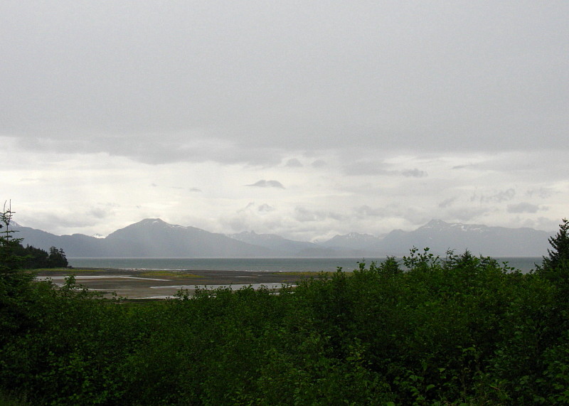
Despite the fall-like weather (even for an Alaskan summer), we manage to get this view of the Kenai Mountains across Kachemak Bay. The glacier in the upper left is a small glacier coming out near the Doroshin Glacier (not visible farther left or in the clouds). It probably has a name, but not on topo maps available to me (MSRMaps location).
Before a late lunch, we stopped briefly at the Alaska Islands & Oceans Visitor Center, which has some interesting wildlife and ocean displays and a nice little gift shop, where I bought art notecards of two puffins and four ravens.
The Visitor Center parking lot overlooks a small mud flat just below Beluga Lake (MSRMaps location).
That's Grace Ridge, tucked behind Sadie Cove and in front of Tutka Bay, across the flats and across Kachemak Bay.
By the time we finally stopped for lunch, the rain had become a downpour. Sitting outside was out of the question, although at least one brave (or crazy?) soul was out in the weather.
I had to take a picture of this "Local Organic Wi-Fi" sign, which I noticed when we were leaving the organic lunch joint.

A Couple Augustine References:
Power, J.A., Coombs, M.L., and Freymueller, J.T., eds., 2010, The 2006 eruption of Augustine Volcano, Alaska: U.S. Geological Survey Professional Paper 1769, 667 p., 1 plate, scale 1:20,000, and data files.

AND (part of above) Section 2: The Geology of the 2006 Eruption.

Related Posts:
Wordless Wednesday: I Love the Color of the Water

Record Reds

Down to the Kenai: AK2011 Day 4

At the Cabin: AK2011 Day 4

Fishing for Reds and Other Miscellany (including a Volcano): AK2011 Days 5-7

Wordless Wednesday: Seen at Homer

Monday, August 8, 2011

Fishing for Reds and Other Miscellany (including a Volcano): AK2011 Days 5-7

We spent a good deal of our Kenai cabin days standing in the river fishing for reds (Sockeye salmon), hip high in the water, sometimes soaking wet from our first day's leaky boots, sometimes not quite as wet from enthusiastically getting in a little too far. I really don't have many pictures of these operations; I was too busy standing in the river fishing, catching and not catching, throwing back "foul caught" reds*, and hauling in the one keeper. Also, I didn't have a waterproof camera.
One day, we walked a trail down to a part of the river that turned out to be not very far away had we walked along the bank (not possible), and fortunately, in my opinion, we didn't see any bears or come upon any unsuspecting moose on this walk. Instead, we saw a juvenile bald eagle flying overhead, and saw an adult bald eagle being hassled by a gull.

Those were two of the only four bald eagles we saw the entire trip, which seemed unusual to me, but apparently that's because I'm used to being on the Kenai during silver season in late August. The bald eagles really move in after spawned-out reds and kings start dying and floating downriver and onto the beaches, which means there are a lot more bald eagles to be seen in late August (along with a lot more dead fish and "floaters").
We ate salmon that we caught, we went to St. Elias Brewery, we went back to Buckets — where two of us were left behind by the other two, to be picked up almost immediately upon being spotted hitchhiking down on the main drag just below Buckets. That's the errant vehicle beyond and behind the Buckets sign, returning for my mom and me. Fun for the Family! :)
And we picked up a needed part for the boat, where I saw a wonderfully pink drill rig.
We also took a trip to the other side of the river, which involved driving a long way to a bridge and then driving a long way through the trees, coming finally to unmarked dirt roads. Our goal was ultimately unobtainable, so we made the long trip back. Our reward was this veiw of Mt. Redoubt, as seen from the airport runway in Soldotna (Redoubt activity and webcams).

And then down to Homer on the 8th day...

---

*Reds can only be caught by being hooked in the mouth, and they typically aren't biters, although they sometimes bite the wet flies on the bottom of the river in irritation, it is said, or maybe just because their mouth was open and the fly drifted in (!?). Consequently, reds are sometimes caught after being "snagged" legally in the mouth -- there is such a thing as illegal snagging, that is, you are *trying* to snag by using a "snagging motion" -- and many fish are accidentally snagged in fins and tails; those have to be returned to the river. I got one possible catch almost all the way to shore, not being able to tell whether it was hooked in the mouth or chin, before it unhooked itself. I unhooked at least one fish I brought all the way in. I'm not sure how many catches that got away from not being hooked well enough would have been keepers. (My poor fishing excuses for only getting one fish.)

Monday, August 1, 2011

Down to the Kenai: AK2011 Day 4

Looking across the Turnagain Arm fjord at our general destination, the Kenai Penninsula, that flat area west of the edge of the Kenai Mountains.

It is in the usual order of things for us to make our way down to the cabin as soon as possible after arriving in Alaska, sometimes heading out as early as the first or second day. This time, we drove down on the fourth day.

It is also in the usual order of things for everyone to travel in one vehicle, but this time we took two: the truck needed to get to the cabin so it could be in a position to conduct cabiny things like putting the boat in the water.
Hard to tell for sure with the clouds, but this is most likely Mt. Spurr (MSRMaps), a volcano west of Anchorage and across Cook Inlet (AVO Webcam). It last erupted in 1992.

We made our way eastward down Turnagain Arm on AK State Route 1, the Seward Highway, without making the usual stops at Beluga Point to check the tides or at Girdwood to get coffee. We speculated about the tides, and whereas I thought the tide was possibly going out, the wind was very strong, creating huge easterly waves that obscurred the water motion. The tide books indicated that the tide was either almost all the way in, or just starting to go out, but I didn't try hard to parse the time differences between Kenai and Anchorage and then to translate those times to the arm.

I looked for Beluga whales, but it was early in the summer: they follow the fish, especially the silvers and humpies of August. It was only the late run of July reds that was just beginning to come up the arm; I looked for Belugas nonetheless.
The light on the water of the arm is always fascinating to me. Here it's flickering in thin patches just below the last major valley on the south side of the arm, Seattle Creek.
I seem to photograph the valley of Seattle Creek every time I pass through: it's a great example of a U-shaped valley carved by a glacier that once entered into the larger glacier that carved Turnagain Arm.
We passed the turnoff and viewing area for Portage Glacier near Portage and made the turn at the east end of Turnagain Arm. Crossing the second bridge across the Placer River — a river typical of anastomosing rivers and streams coming off ice fields and glaciers, in this case the Spencer Glacier and a small icefield northwest of the larger Sargent Icefield — I could look northward up the Placer into the valley of the Twentymile and Glacier Rivers (MSRMaps).
Welcome to the Kenai!
The fireweed was in relatively early bloom: when the flowers at the top are blooming it indicates that fall and Termination Dust are just around the corner. Here, only the lower flowers are blooming.

We skipped a usual stop at Summit Lake Lodge in favor of continuing onward to the Sterling Highway (still AK Route 1, but no longer the Seward Highway).
Near Cooper Landing we began to catch tantalizing glimpses of the Kenai River, a river we would soon fish.
We bypassed the cabin, needing to run to town to purchase fishing licenses, thereafter going directly to Buckets for dinner.
We both had the Sunken Island IPA by Kenai River Brewing.

Related Posts:
Getting There: AK2008 Day 1
Turnagain Arm: AK2008 Day 2
We Make the Turn: AK2008 Day 2
Summit Lake and Beyond: AK2008 Day 2
Fireweed in Alaska: Is it Fall?

Tuesday, November 9, 2010

Update From the Lake: Part of The Return Trip

Okay, so the update isn't supposed to be from Pyramid Lake, and it's a little late (about three weeks), but we did drive by that turquoise gem on our return trip after going to Middlegate the long way (up Ophir Canyon, through Ophir, to Ophir Summit, and over and beyond) and then going to our place at the lake. [I was going to add something about "I. C. Russell's white line" here, but can't find it being called that anywhere, so maybe later.]

I took zero pictures at the lake, if you can believe it. The leaves on our backyard aspens had only partly turned yellow, we had visitors, it rained all of one day. The rain was great: the sound of it hitting our nearly flat metal roof, the smell of it out in the evergreen trees, the almost Alaskan mistiness of it all. We ate out for dinner every night. One night we ate at two restaurants, and due to faulty order taking at the first one, we ate there for free the second night.
After visitors left, I raked some pine needles, disconnnected the drip system, moved one surviving blue spruce and one itsy-teeny black spruce — grown from a seed taken in Alaska — to a space underneath one of the pines.

All and all, it was a good trip. And on the way back, we went the long back way through Pyramid Lake. The back way turns out to be about one hour longer, and by the time we got to Sutcliffe I was hating it and was quite hungry. Hunger can make me cranky; we stopped in Fernley at Taco Bell.
Prior to arriving at Pyramid Lake, while on the long dirt part of the back way, we stopped at a little oasis in the desert, somewhere generally east of Honey Lake, probably located here, which I wrote about earlier.
As we got out of the truck, a huge predator-type bird flew out of the tall cottonwood tree and dropped the remains of a chukkar at our feet. It all happened too fast for me to get any kind of bird description other than dark with a very long wingspan — likely a turkey vulture, golden eagle, or bald eagle, although I suppose osprey isn't out of the running.

We then saw two amazingly shot-up signs. One was here, near Double Check Well, a major road junction if you happen to be going to Burning Man from California. I'm not saying that Burning Man attendees did it — many signs in Nevada are shot up — but I've never seen one quite like these two, and I do know that desert antics have increased manyfold since Burning Man moved to the Black Rock.

Sand Pass Road
Sutcliffe (unreadable miles) <--
Smoke Creek Road Jct 24 <--
County Rte 447 Jct 51 <--
Gerlach (unreadable miles) <--
Susan(?)ville 25 <--
Fish Springs Rd Jct .3 -->
Sutcliffe (unreadable miles) -->
Reno (unreadable miles) -->

Below, underneath red spray paint:
Reno (unreadable miles) -->

Below, with gray duct tape:
Gurlac [sic] 56 mi ... <--