|
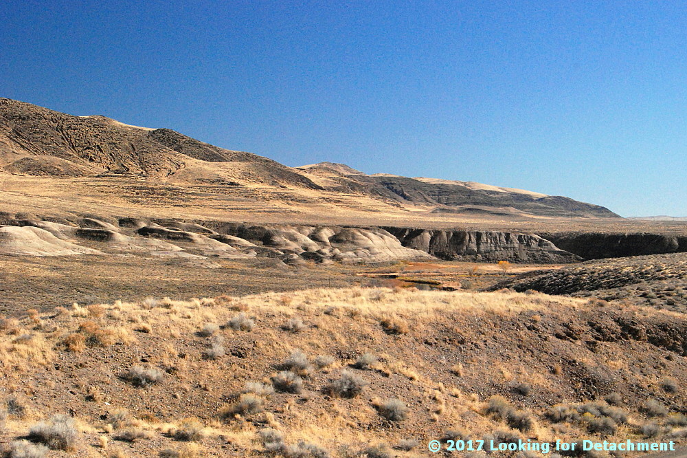
| Black Rock Desert |
Well, here we are again,
traveling from Winnemucca, NV, to Highway 395 north of Susanville, CA, and we’ve just made it to the west end of the Jungo Road where it intersects with NV S.R. 447 (formerly S.R. 34) just south of
Gerlach. You’ve probably noticed that I haven't been blogging much recently. I'm not really sure why. Sometimes the work I do takes the writing right out of me, partly because I do enough writing many days that I'm totally done with that by the end of the day; also, I don't really have much time after work before I have to do dinner, then get ready for bed—at least if I want to get enough sleep, which I do want (I don't always succeed). Another thing contributing to the recent spate of sparse blogging—besides taking care of personal things that have been taking a lot out of my energy during my days off—is that my writing effort during the fall and winter months has been going toward writing bits of fiction (a novel?), which I've been working on intermittently during the last two years.
Anyway, all of that—work, trying to get enough sleep, personal issues, and writing fictional to non-fictional stories—has placed blogging low on the list.
Now I'll upload the photos for this post, and we'll go from there. Just like a real journey, we’ll see how far we get!
 |
| Smoke Creek Desert |
At
the end of the last post, we'd driven quickly through Gerlach and had reached the northwest side of the
Smoke Creek Desert. I hadn't taken any photos while zipping through Gerlach, but I often stop, and I've even stayed overnight at least twice. So let's backtrack before moving on.
Gerlach is a small town that brags of several mottoes, including "Center of the Known Universe," "Where the Pavement Ends and the West Begins" and "The Time That Town Forgot." More can be seen on the town sign, above, or in
this nicely enlarged version of the sign by the
RGJ. As indicated by the sign, Gerlach is technically pronounced Grr-lack rather than the Grr-lock one hears so commonly these days. I shot these photos of Gerlach on a trip that FMOH and I took back in the spring of 2014. Like the June, 2018, trip that we—you and I—are reprising, he and I had just come into town from Winnemucca on the Jungo Road. We were bringing the motorcycle back from Nevada, mirroring
this trip taking it out to Nevada.
While in town, we did the usual thing of stopping to eat at Bruno's Country Club, probably getting
Bruno's Famous Homemade Ravioli. By 2014, Bruno was no longer making his ravs personally, so I don't think they were quite as authentic, nor were they quite as good.
Unlike many trips, this time we stopped at the bar for a couple beers; we weren't driving on that afternoon or evening, but were, rather, staying at Bruno's Motel. Bruno Selmi, the Basque owner of the cafe, bar, motel, and only gas station in town,
died in May of 2017—he can be seen in the photo above the bar (the older man on the right).

After checking in to our room at the motel—and after duly going back to the bar to get a second room when the first smelled either of gas or dead mouse—we wandered out onto the far western edge of the Black Rock Desert, where we had a view somewhat atypical of most views of the desert. This section of the Black Rock is a section you don’t want to drive into: it’s usually muddy, and it’s very possible that you’ll get stuck. The getting stuck part typically happens at night when an unsuspecting traveler, one who is already out on the desert somewhere to the east, decides to get off the desert—and instead of driving to the usual take-out spot north of town, sets their sights on the lights of Gerlach and makes a beeline for town. The next thing our unsuspecting—or willfully ignorant—traveler knows, they are stuck, possibly axle deep, in the mud at the west end of the main section of the Black Rock Desert. Fortunately for them, they aren’t far from Bruno’s gas station. Maybe someone will risk a vehicle to come and pull them out!

It’s possible one could wend their way through the merely salty white section of desert to the pavement on the east edge of Gerlach, at least in the drier years, but I don’t recommend trying it. I personally know at least one person who tried this one night back in the 1980s; the getting stuck was epic.
The next morning after breakfast, FMOH and I headed west.
Now let’s get back to my June 2018 trip, which I was taking all by myself (cue pint-sized pity party). I had just made it to
the northwest side of the Smoke Creek Desert and had taken the photo seen earlier and in my last post.
A ways farther down the west side of the Smoke Creek Desert, I pulled over for a quick examination of some tufa. There are many spots to see tufa domes, mounds, and hills along the west side of the Smoke Creek Desert; this mound, Hill 4081, was a new one to me.
I climbed up through the
cheatgrass and scattered tansy-mustard tumbleweed and looked around. Here we’re looking off to the northeast, more or less back toward the Junction of C.R. 447 and the Smoke Creek Desert Road. The
Granite Range, unsurprisingly underlain by granite, rises steeply beyond the distant Smoke Creek Desert playa. The foreground is green because...water. It’s a wet part of the basin, possibly because of the entry of perennial Smoke Creek into the desert just south of where we’re standing. It’s also more elevated than the playa, and covered with grass (at least cheat grass) and various scrub.
I love tufa mounds, so I stood looking around for a few minutes, taking lots of photos. This photo looks off more to the north. The distant bluish hills just right of the tufa dome are part of the
Buffalo Hills, which are underlain by a pile of volcanic rocks.
More tufa! More volcanic rocks! The hills in shadow between the tufa masses are some volcanic flows forming the eastern foothills of
Burro Mountain.
From this point on Hill 4081, I got back on the Smoke Creek Desert Road, went south a short distance, and then turned west on what Washoe County considers the continuation of the Smoke Creek Desert Road, and what Google Maps refers to as the Smoke Creek Road: a dirt road that heads west up Smoke Creek.
to be continued...
Google Maps location map.
Related Posts:
Winnemucca to Hwy 395 north of Susanville, Part 2
Winnemucca to Hwy 395 north of Susanville, Part 1
Things You Find in the Field: Sulfur at Sulphur
Blue Mountain (2012)
Pulpit Rock (2012)
Smoke in the Black Rock & Smoke Creek Deserts (2102)
Where in the West: Black Rock Desert (2008)
Where in the West - June: A Second Look (2008)
Where in the West - June (2008)
Name That Place (2008)