Friday, December 11, 2009

Friday from the Road: There & Back Again

I'm just going to throw out a few photos from my most recent road trip, which was to and from the NWMA convention last week. None of these pictures were taken on a Friday, but that doesn't matter to my way of thinking (which, admittedly, could be distorted by a slight fever).
On the way there, just after coming into Edwards Creek Valley, the guy ahead of me put on his breaks suddenly, so I slowed down, thinking I might get a glimpse of a coyote. Instead, off in the distance, I saw some smoke rising from a low spot in the Desatoya Mountains.
As I drove along, the wind was picking up in the valley. The smoke coming from a canyon to the south swirled a bit near the ground, then rose straight upward to spread out horizontally at an atmospheric layer not that far above ground level.
I eventually stopped and got this picture. The colors around the edges of the smoke fascinated me - and then my mind went on a tangent and I wished that the smoke could be from a little basalt flow erupting along a range front fault instead of a brush fire caused by who-knows-what. The canyon is probably the canyon of Edwards Creek. The truck ahead of me pulled over when they got cell service and called in the fire, which presumably stayed small, because I couldn't find anything about it online.
On the way back, I got this shot looking southwest down Big Smoky Valley toward Kingston Canyon, with the setting sun just about to go behind the Toiyabe Range.
A little farther to the east, the sagebrush bushes in Antelope Valley were a glowing golden orange, and the shadows were a deep greenish blue. The photo looks northeast toward the distant Roberts Mountains on the right and the closer Simpson Park Mountains on the left.

Wednesday, December 9, 2009

Twelve Months of Looking for Detachment (2009)

I'm doing the usual year-end meme - like I did last year - which is from Biochem Belle, DrugMonkey, Short Geologist, and Lockwood. The meme consists of posting the first sentence of the first blog post of each month of the year, with the link to that post. I've done that - with a couple minor modifications - along with the photo belonging to that post. I skipped two CotA links, which were the first posts of several months, I skipped one Two-Years-Ago post, and one Road Song post. As Lockwood pointed out, the geoblogosphere usually messes with the rules of any given meme, so I'm just being "normal" - for a geo-type. Unlike Lockwood, I didn't post any titles.

January: Here's a Happy 2009 to everyone, with a photo of the last sunset of last year, 2008.

February: The first ever Carnival of the Arid is up, hosted by Chris Clarke of Coyote Crossing.

March: For this month's Where in the West, we have the above [below] famous mountain, a mountain that has more than one name.

April: The third Carnival of the Arid (CotA#3) is up, over at Coyote Crossing.

May: aboutgeology: @sfoxx OK, why is the Eureka Qtzite such a familiar name? What's it signify? 7:02 PM

June: I haven't done a Where in the West since March, so no doubt everyone's forgotten all about it!

July: Once again, I have a few field photos from Great Basin National Park - this time of alluvial fans as seen looking down from about 12,000 feet on the shoulder of Wheeler Peak.

August: It's time for Where in the West again! For the August 2009 version of WITW, we have the above [below] unknown area located somewhere in the west - that would be somewhere in the western part of North America.

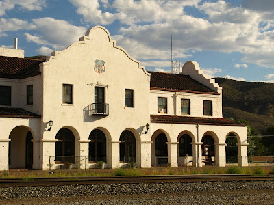
September: I just got back from a short trip to Caliente, Nevada. The weather was looking good when I headed down there, with temperatures predicted to be slightly lower than average, especially if clouds like these stayed around.
front
October: Just the other day, Monday to be precise, I was walking around above town thinking about the signs of fall that were all around: dry, straw-colored bunch grass (unknown variety), yellow blooms of rabbitbrush (right foreground), golden-brown blooms of sagebrush (left middleground), and yellow to bright red aspen on the distant mountain.

November: After making the unexpected turn onto Oregon Highway 62, I drove toward Crater Lake and stopped at the first pullout, the entrance to the Ponderosa picnic area (Google Maps location) - named, no doubt, for the magnificent Ponderosa pine trees that dominate the area.

December: I'll be at the Northwest Mining Association meeting in Reno for a few day (NWMA), which isn't to say I absolutely won't blog, but... in case I don't, I'm posting a few ways to find this blog.

[There hasn't been a first photo in December, yet, other than the one at the top of this post. It would be rather circular if I reposted it here, so I won't.]

Wednesday, December 2, 2009

How to Find Detachment: General Geology

I'll be at the Northwest Mining Association meeting in Reno for a few day (NWMA), which isn't to say I absolutely won't blog, but... in case I don't, I'm posting a few ways to find this blog. The category this time? General Geology. (And, yes, I'm the one defining the categories.)

Some searches leading to Looking for Detachment, in the general geology category:

  • Caliente caldera
  • columnar andesite
  • Dixie Valley earthquake fault
  • geological style
  • geologists walking stick
  • geosyncline
  • geothermal gradient
  • mauna kea types of rocks produced
  • mt st helens shock wave photo
  • photo detachment folds
  • places to see before you die geology
  • scales of maps
  • survivor geologist
And some searching questions:

  • Do you think that uniformitarianism is consistent with rare catastrophic events, like a great earthquake?
  • How can you teach 4th graders about faults and folds with earthquakes
  • How to become a geomorphologist
  • Is broken top volcano close to a plate?
  • What are some interesting things about Broken Top volcano
  • What kind of a geologist should I be
  • Who is responsible for outlining the principal now called uniformitarianism


If you want to see which posts these searches led to, I'll let you Google it yourself! (What a concept.)

P.S. I'm at a hotel that has outrageous wi-fi charges, so am connecting via Verizon. Comments will be published; my comment replies may be limited - unless I break down and buy some internet time!

Monday, November 30, 2009

Travel Day 4, Part #2 and Day 5: Northeastern Oregon

trees After leaving Multnomah Falls, I tootled eastward along I-84, minding my own business for about four hours, until I came upon a sight that made me realize I was coming in to the north country. Never mind that I was, by then, heading southeast. Traveling west to east along the Columbia River doesn't make me think "north" - though coming to the river from the south might indeed make me think that. The yellow-green to yellow-orange trees I saw on the hillside made me think north, and they always do. These trees are conifers, commonly known as western larch (Larix occidentalis), sometimes called deciduous because they lose their needles every year. They are like little flames on the hillsides in the fall, when their needles turn yellow-green, then yellow, and then orange.
inside After a long drive across paved roads leading to graveled roads leading finally - after dark - to a rocky "rough dirt track," I came to the home of Liz Enslin, who lives in a yurt and blogs at Yips and Howls. [Photo taken inside the guest teepee.]
heat I was treated to great hospitality by Liz and her partner Jerry. The hospitality included a salad from homegrown vegetables and a great local beer: Terminal Gravity IPA brewed by the Terminal Gravity Brewery in Enterprise, Oregon . After enjoying bloggish conversation, I was escorted to the guest teepee.
view In the morning, I awoke to this great view of the canyonlands of northeastern Oregon.
outside This is the teepee that was my overnight home. I was told by my hosts, after morning coffee, that the holes in the teepee canvas were put there by the slashing claws of a black bear. I didn't hear anything terribly suspicious in the dark of the night, but did hear coyotes in the early morning.
yurt
The yurt, as seen from the teepee. More about yurt living at Yips and Howls.
basalt The countryside is underlain by basalt flows, like these barely seen under cloudy skies. These flows are part of the same Grand Ronde Basalt (CRBG) that we saw at Multnomah Falls.
canyon Flows of the Grand Ronde Basalt are well exposed in Joseph Canyon at the Joseph Canyon Viewpoint on Highway 3. The basalt flows erupted from long fissure vents in this part of northeast Oregon and in southeast Washington; the resulting dike system is sometimes known as the Chief Joseph Dike Swarm. I took a few pictures in the pouring rain, did not see any dikes, and moved on.
larch1 Yes, the larch were turning yellow!
larch2 I first saw larch in west-central Idaho, probably not much farther north than these trees are located.
larch3 It was spring, and the new feathery needles were on the trees. I was amazed to "discover" such an unusual tree, and I'm still amazed every time I see them. Larches remind me of that first trip north of Boise a long time ago, and they remind me of every trip I've taken on the Alcan since then.

Some Links:
Liz Enslin has more about larch, as part of her Species of the Week series.

General Overview of the Columbia River Basalt Province (with photo of a dike in the Chief Joseph dike swarm).

Photo Tour of the Columbia River Basalt Province (with photos of the Grand Ronde Basalt and some cross-cutting dikes).

Saturday, November 28, 2009

Modified Gluten Free Banana Bread

I haven't been blogging that much recently, but will record here a gluten-free, wheat-free banana bread recipe I used recently, with the modifications I made. The original recipe is from the back of Bob's Red Mill Gluten Free All Purpose Baking Flour:

Ingredients

1/3 cup Canola Oil
2/3 cup Brown Sugar, packed
2 large Eggs
1 tsp. Vanilla Extract
1 3/4 cups Gluten Free All Purpose Baking Flour
2 tsp. Baking Powder
1 1/4 tsp. Cinnamon
1 tsp. Xanthan Gum
1/2 tsp. Salt
1 1/2 cups mashed ripe Bananas
1/2 cup finely chopped Pecans or Walnuts
1/2 cup Raisins

Directions

Preheat oven to 350°F. Grease 9x5-inch non-stick loaf pan. Cream together oil, sugar, eggs, and vanilla in large bowl with eletric mixer. Add flour, xanthan gum, salt, baking powder and cinnamon to egg mixture, alternating with bananas. Beat until smooth. Stir in nuts and raisins. Batter will be somewhat soft. Transfer to pan. Bake for 1 hour. Serves 10

Modifications

One, I used a whip and a plastic spatula (scraper) for stirring rather than an elecric mixer. An electric mixer is generally not recommended for banana breads, and extra beating is not recommended for high altitude cooking (which I was doing, although I didn't pay any attention to that fact before I started).

Two, I puréed the walnuts in a coffee grinder (we don't have a cuisinart or blender at our little house because of space considerations, but may shortly get a small blender). The addition of puréed walnuts rather than chopped walnuts was a little like adding 1/2 cups extra flour with a minor or trace amount of extra oil.

Three, I didn't use any raisins.

Four, after mixing everything together, I considered the high-altitude aspect of my baking situation. (It's usually better to consider this prior to beginning!) I looked up adjustments for cooking at 5000 feet (I'm at about 6500 feet), and, thinking that the batter was too thick and too dry, I made the following adjustments:
  1. I added two or three large dollops of applesause.
  2. I added one or two smaller dollops of sour cream.
  3. I then added a minor scattering of extra flour after wondering if the mixture was too moist.
  4. I added a little extra cinnamon for more flavor.
  5. I increased the cooking temperature by 25°F, and possibly could have decreased the cooking time but didn't.
  6. It would be normal to reduce the baking powder as part of the high-altitude cooking adjustment, but I didn't consider adjustments early enough to do that.
The resulting loaf seemed too dry to me when it first came out of the oven, but after placing in a plastic baggie overnight it didn't seem that way at all. Next time I will probably look for a recipe that uses applesauce to begin with, and modify it for wheat-free flour. I'm wondering if some combination of applesauce and sour cream could be substituted for a half or more of the oil.

Sorry, no pictures - it's already gone!