 This most recent time that I visited Caliente, I did some more looking around the long-ago campsite from 1978. I wanted to make sure that I'd found the right site, and I wanted to take more pictures.
The mostly paved Meadow Valley Wash road, Highway 317, isn’t in the same location as shown on old topo maps of the area, and Meadow Valley Wash may not be following the same channel it followed in 1978. The original Elgin, NE, Nev., 7.5 minute topo map, which covered our camp area no matter where it was located, was dated 1969; it was "photoinspected" in 1980 with no changes noted even though the road had moved prior to 1978. Consequently, I’m not entirely sure I found the right location, but after checking out two more possibilities, I’m almost sure. (This site has some downloadable zip files of pertinent USGS topo maps if you are interested.)
In order to more fully evaluate the area, I drove the old camp road - which is the only road shown on the old topo map - south of camp to an unnamed drainage. I then walked the area south of that drainage. Later, I drove south on the main road and checked out an area where Meadow Valley Wash may have washed out some land sometime in the last 30 years (or even before then). With all this additional exploration, I still may have missed the area, but I don't think so. Air-photo sets from 1978 or thereabouts would be helpful.
 This area, south of the unnamed drainage, has a good, wide ledge above the river, which we could have camped on - but the view seems wrong, the drainage has a road in it - and I don’t remember a side road that close to camp - and the area is overgrown with cottonwood trees, willows, and high brush. I decided against it.
 I then went farther south to an area where Google Earth shows three wash channels, including the active one - see the upper center part of the above GE image. The active channel is against the far east wall of the canyon, where there is a raised ledge above the river, and where the main road is shown on the old topo map.
 I crossed the creek here, after walking across two sandy, brushy, and tree-infested unused wash channels. I took off my socks, rolled up my pant legs, and walked through the creek (river?) in my field sandals. Later, having not put my socks back on, and having not rolled my pant legs back down, my legs were all scratched up from all the underbrush, and my feet felt a little misused. Boots or tennies would have been a better choice. I should have at least put my socks back on or rolled down the pant legs!
 This is what the canyon looks like, looking south from the ledge where the old road used to be, with the train tracks visible on the west side of the canyon. The ledge continues to the south towards the reddish cut behind the large, square boulder on the left. This ledge is not presently accessible by vehicle at all, has been covered by huge boulders that have rolled down from the cliffs above, and is higher above Meadow Valley Wash than our camp was. The cliffs behind the ledge are steeper than any camp cliffs I remember. It's possible, however, that I looked too far to the south and should have walked farther to the north, but I'm not going back anytime soon.
 Because of the relative inaccessibility of the east side of the canyon in this area, and because of the dense tree cover along the active channel in general, I saw and heard lots of wildlife, mostly deer and birds.
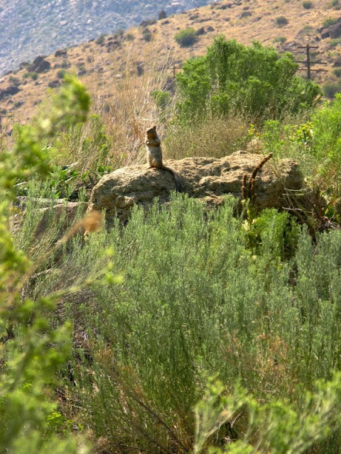
 Walking back to my truck, after crossing Meadow Valley Wash again, I spied this ground squirrel sitting on a boulder of ash-flow tuff.
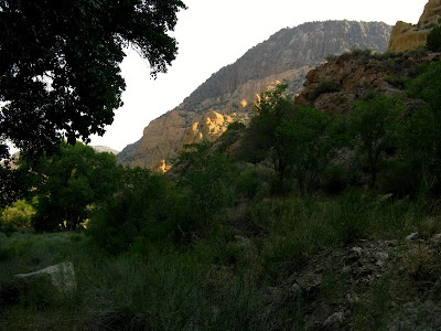
 So, back we go again to what I think is the most likely camp location. I arrived there fairly early in the morning, and this is what our view would have been near the north end of our camp area. Of course the cliffs of poorly to strongly welded ash-flow tuff look familiar - I have now been there twice in the last month!
 While the sun rose behind the cliffs, I putzed around here and there, walking back and forth and side to side in the wide area that was our camp, hoping that I might find some historical remains. I found signs of washouts and multiple realignments of the old road. Back in 1978, we had accessed the camp from the south end; the area I’ve homed in on is now accessed from the north end. The southern access route may have been in the location of that unnamed drainage mentioned earlier.
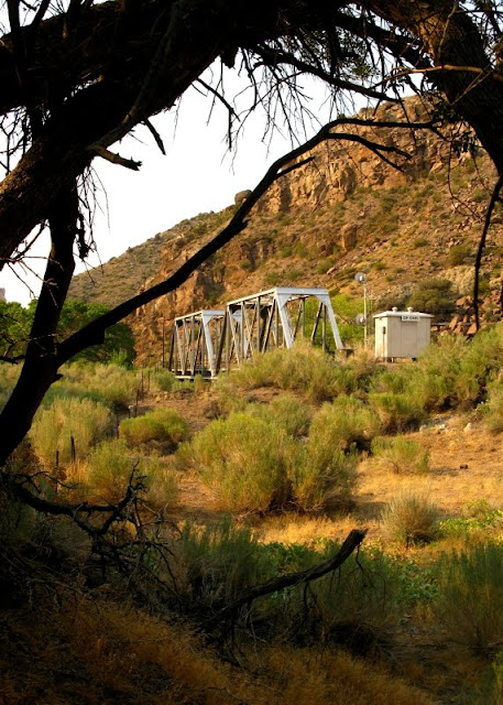
 The railroad tracks and railroad bridge are accessible from the north end of camp, so I walked over and took a few pictures.
 The view looking north along the tracks toward the reddish hills across the canyon from my first map area seemed vaguely familiar. Possibly I’ve been here before! If not, then I experienced a random feeling of déjà vu, rather than a meaningful one.
 Here's the railroad bridge from the north looking south, with our camp area on the left (east) side of the photo.
 After spending some time on the tracks, I turned and walked back toward camp...
...to be continued.
2 comments:
Do you have any photos from your 1978 camp? That might help figure out where you were. I presume not.
It's amazing how much can change in a relatively short period of time, and how those changes can mess with your memory. This summer I was on a field trip in central Alberta (prairie) to a location that I had visited in 1993. It was the same locality, but I was completely lost--the area did not match my memory at all. Later I learned that the road had been realigned by a few hundred metres, which was enough to throw everything out of whack in my head. The old road alignment had overgrown so much that it looked like (and I assumed it was) a remediated pipeline right-of-way. And that's only 16 years.
Cheers,
--Howard (Calgary, AB, Canada)
Howard, I have very few pre-1993 photos because of certain life events, and none from Caliente. It's one of the reasons I've been going back to these areas, but it also has been an interesting exercise in exploration and memory. I've picked out the area that overall matches my memory the best, but I could be off by a mile (at most).
Post a Comment