Elgin, NV is little more than a road junction and railroad siding, with a few nearby ranches. To get to Elgin, you drive south from Caliente on Highway 317 through Rainbow Canyon, then past the End of the Rainbow Canyon Ranch on the west side of the road, then east onto dirt at the Elgin turnoff. The paved Highway 317 continues south about a half mile past the Elgin turnoff, then it turns to dirt and becomes the Kane Springs Wash road. You can also come to Elgin from the south on the Meadow Valley Wash dirt road.
After driving north from the Cottonwood Canyon area, I made a short side trip a couple miles down the Kane Springs Wash road, but then blew off that portion of my explorations into the past in favor of Elgin and the more scenic Rainbow Canyon.
 At Elgin, I turned east into the hills, thinking I could get into Pennsylvania Canyon, the site of some old exploration shenanigans, from the west. The sign says, "Road Damaged Ahead." At a V in the road just past the sign, I took the left turn, which is shown on old maps as the main road into Pennsylvania Canyon. The road immediately steepened and went around a curve. When I peered around the curve, I could see two more curves ahead, on a road with more curves and switchbacks than can be counted on two hands.
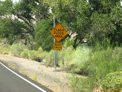
The road looked damaged to me - lumpy and sloping irregularly off to both sides. I would have had to walk every single bit of the part of the road I could see, and probably much of road that I couldn't see, before being sure that I wouldn't have to back down around one or more curves if the road was completely washed out with no turn-around spots. Backing around curves isn't an impossible task, but it is one best done with a spotter, especially if the road is lousy. I backed up, backing around the first curve, turned around near the V in the road, and drove back to Elgin. I then headed north on 317 toward Rainbow Canyon. Highway 317 is marked at its north and south ends by signs like this one. Essentially, the road is subject to flash floods for 21 miles of its 21.5-mile length.
 The flash flood sign was immediately followed by a closed sign. This closed sign is mimicked by a similar sign near the north end of the highway, near Caliente. The road wasn't closed by being blockaded, but in places it is practically wiped out, which happened during the 2005 flood. Locals say that the road hasn't been repaired since, though it looks like some dirt has been pushed around here and there.
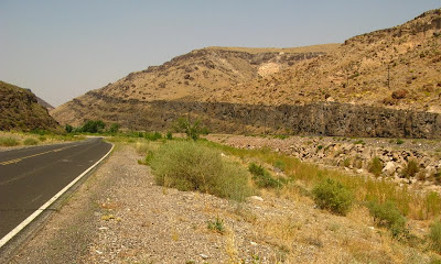
 Rainbow Canyon's south end begins at this narrowing of the Meadow Valley Wash canyon, where some dark volcanic flows dip slightly to the south or southeast.
 These are those same dark flows in the foreground cliffs on the left. They consist of fine-grained to vesicular basalt or basaltic andesite. I call this part of Rainbow Canyon "the narrows," although I find no reference to that name on any map - it's either a local name, our old field name, or a name that stuck in my mind from somewhere else. Ahead, beyond the dark cliffs on the side of the road, you can see some lighter, brownish rocks underneath three dark flows of this same basalt. We'll look at those lower cliffs later.
2 comments:
I'm enjoying your tours of rural Nevada! It takes me back to UNR days and field studies.
Glad you're enjoying these, Garry! This area is mostly farther south than we went when I was at UNR, except for Death Valley - way over to the west.
Post a Comment