 The 8th day started out cloudy, and gradually turned rainy. Here we're heading down to Homer, having already passed Clam Gulch, and having just passed Ninilchik. As we drove by, I was thinking maybe we'd stop at Ninilchik or the beach on the way back, though we hadn't gotten an early start, and I didn't know how rainy the day would turn.
 Not much farther on, we pulled over to look at the view across Cook Inlet (in the far distance in this wide angle shot) and to look at the lupines and cow parsnip, which were also blooming alongside fireweed.
 It is at about this spot that one might hope for a view of Augustine looking south down and across Cook Inlet. Augustine is an island volcano that last erupted in 2006. Check out these much better images (ha!) at AVO. Augustine (sometimes called St. Augustine or Mount St. Augustine but shown as Augustine Volcano on topo maps) is officially a stratovolcano, one with a central dome and flow complex or cluster; it's part of the Aleutian volcanic arc, and it's the most active volcano in the Cook Inlet area (location map at AVO).
 Ah, yes. We arrived at this famous sign, which doesn't mention Homer as a "quaint little drinking village with a small fishing problem," supposedly seen locally on bumper stickers.
 Despite the fall-like weather (even for an Alaskan summer), we manage to get this view of the Kenai Mountains across Kachemak Bay. The glacier in the upper left is a small glacier coming out near the Doroshin Glacier (not visible farther left or in the clouds). It probably has a name, but not on topo maps available to me (MSRMaps location).
 Before a late lunch, we stopped briefly at the Alaska Islands & Oceans Visitor Center, which has some interesting wildlife and ocean displays and a nice little gift shop, where I bought art notecards of two puffins and four ravens.
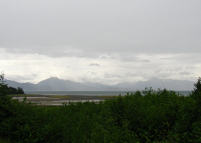 The Visitor Center parking lot overlooks a small mud flat just below Beluga Lake (MSRMaps location).
 That's Grace Ridge, tucked behind Sadie Cove and in front of Tutka Bay, across the flats and across Kachemak Bay.
 By the time we finally stopped for lunch, the rain had become a downpour. Sitting outside was out of the question, although at least one brave (or crazy?) soul was out in the weather.
 I had to take a picture of this "Local Organic Wi-Fi" sign, which I noticed when we were leaving the organic lunch joint.
A Couple Augustine References:
Power, J.A., Coombs, M.L., and Freymueller, J.T., eds., 2010, The 2006 eruption of Augustine Volcano, Alaska: U.S. Geological Survey Professional Paper 1769, 667 p., 1 plate, scale 1:20,000, and data files.
AND (part of above) Section 2: The Geology of the 2006 Eruption.
Related Posts:
Wordless Wednesday: I Love the Color of the Water
Record Reds
Down to the Kenai: AK2011 Day 4
At the Cabin: AK2011 Day 4
Fishing for Reds and Other Miscellany (including a Volcano): AK2011 Days 5-7
Wordless Wednesday: Seen at Homer
2 comments:
I SO want to visit Alaska! Will have to work a winter to take a summer off for that. Looks a little cool and damp there right now.
Our trip in July had variable weather, from sunny and warm (in the 70s) to two days of a downpour. Quite a range!
Post a Comment