Here are a few photoviews from Majuba Hill, while I get it together to take some rock photos:
 |
| Wooden structure (trestle and ore bin?) on the mine dump of the Middle adit. |
Mindat has
a photo showing what the above structure looked like in 1970, although the angle isn't great. At that time, the entrance to the adit was wooden (current view of the adit entrance at
my previous post). You can see a good side view of the structure
here (photo also from Mindat), as it looked in 1980. According to
one source, there may have been a 1000-foot-long tramway leading from this site to an ore bin. I have a couple ideas where this could have run; maybe I'll get a chance to post the ideas later.
 |
| View looking off toward the Humboldt Range. |
 |
| Looking across an upper part of Rye Patch Reservoir at the Humboldt Range. |
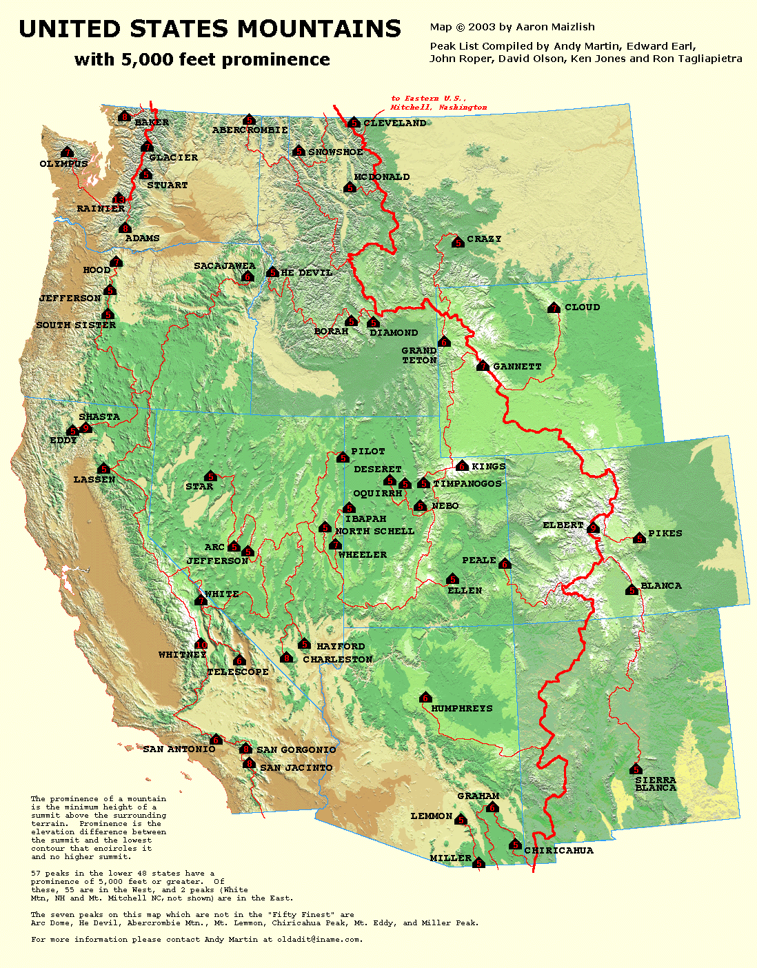
Star Peak, at 9836 ft (2998 m), is the tallest peak in this view. It's the pointy one on the left. Star Peak is one of the 57 peaks in the lower 48 with 5000 feet or more of prominence (prominence explained here with a map of peaks in the west), and it ranks #6 in prominence in Nevada. The round "hill" in the center is 8940 ft, and the seemingly lower hill a little right of center, which is a bit farther in the distance, is an unnamed peak at 9031 ft.


5 comments:
Thanks for sharing with us the sere beauty of Nevada. It is pretty here in tree country where I live now (western Washington state), but I miss seeing the bones and skin of the earth like we can in Nevada.
Sometimes being able to see the bones makes the geology a little clearer! Which I like.
This is so helpful! Do you know where the on and off ramps are from I80 between Fallon Rest area and Winnemucca that take you to the frontage roads or older hiway 40 that are paved?
From Trinity (rest stop at 395 and 80) to Toulon, old 40 is mostly dirt and partly inaccessible. At the Toulon exit, pavement runs from there into Lovelock, where it continues through town and north as Upper Valley Rd or S.R. 396 (unsigned I think). This section continues north, where it can be also accessed (on the west of I-80) by the Coal Canyon exit. Then north, the pavement eventually turns west away from the freeway; just before that, you can turn east and go under the freeway (a short stretch of dirt). Then on the east side of 80, it's paved into Oreana (also Oreana exit). From Oreana, head east toward the mountains and the old highway is the first left turn. Pavement runs north many miles, eventually turning to dirt and coming into the Florida Canyon mine from the south. You can turn off still on pavement before that and get back to 80 at the Rye Patch exit. Then at the Humboldt exit, 138, the pavement is accessible again going northeast toward Imlay. Pavement is then accessible on the northwest side of 80 all the way through the Mill City and Dun Glen exits ( 149 and 151). At Rose Creek (ex 168), old 40 runs back SW towards Cosgrave - much is dirt, some paved btwn Cosgrave and Rose Crekk - and NW into Winnemucca, becoming West Winnemucca Blvd (main street).
Also see the highway 40 tag - highway 40 - some of these show parts of old 40 or sights or geology near 40.
Post a Comment