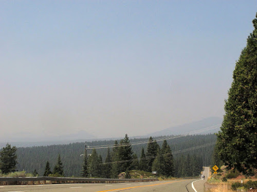
Yes, it's been very smoky in northern California this summer, as it has been in many places across the west. These particular photos were taken on August 21st, when I just happened to drive down the right roads in the right direction, i.e., westerly, so it was easy to notice that Lassen was essentially missing.
 |
| Mt. Harkness is on the far right; Kelly Mountain is a little left of center. |
Here, a little farther down the road, Mt. Harkness is on the horizon on the very far right, just above the highway; Kelly Mountain has disappeared below the the sloping, forested horizon. Lassen would normally be standing out just near the center of the photo (Google Street View location).
Kelly Mountain *might* be part of the far, outlying flanks of the older, larger volcano known as Mount Tehama, but *might* is a speculation on my part, one not based on much geologic research (or any mapping!).
The road took me by an overlook of the northwestern end of the hazy, smoky Lake Almanor. The lake is very low for this time of year; it has nevertheless been host to lots of pelicans, egrets, Canada geese, and many other waterbirds including occasional sightings of blue heron, and the often ubiquitous coots.
 |
| Six pelican swim away from me above the lower left blue patch; two egrets stand like symmetrical statues toward the right. |
 |
| I could see Lassen Peak clearly on August 24th; the photo location approximates that of photo #1. |
 |
| Lassen Peak looms above the darker, tree-covered Kelly Mountain, from a location close to photo #2. |
Where in the West: Lassen Peak — LFD
Remembering Lassen Peak’s Last Blast, 100 Years Later — Eruptions
The Volcano That Wasn't There, and Two That Were... — Geotripper
Interlude: "Lateral Blasts of Great Force" — Rosetta Stones


2 comments:
We've had no significant fires in Wyoming, yet day after day smoke from the PNW obscures mountains just 40 miles west!
Yes, the PNW has been really bad -- I have a few pictures from the air; I'll try to post them before the week is out.
Post a Comment