And I drive through it!
Snow squalls were cruising through
central Nevada last week when I was coming back from the lake. Snow in springtime is common in this high desert to steppe environment, and snow in summer - at least on the tops of mountains - was fairly common when I started field work out here in the late 1970's. The snow, the sun coming through the clouds, and the cloud shapes and shadows all make for interesting drives in the mostly wide-open countryside.
 Here, as I approach Middlegate (the place) from the west, the willow trees in Eastgate Wash are lit by sun shining beneath clouds behind me. Darkness and glowing mountains loom around the corner. (Also see "A little more about the geography" at the end of this post for more about the Middlegate region.)
 Highway 50 turns to head in a northerly direction after passing through Middlegate (the place), and heads for a moment or two right at this snowy part of the Desatoya Mountains. The bright reflection of sun from the snow creates mirage on the road ahead of me.
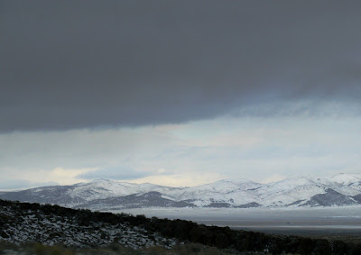
 Ooh, more glowing mountains, this time near Cold Springs, which is a small outpost that offers gas, food, lodging, and RV hookups. The slanting light-dark contact of foreground and background shows a typical slope at the foot of desert mountains, the kind of slope that is often composed of a combination of alluvial fan and pediment (also here and here).
 Yellowish sunlight peeps through from the west beneath dark clouds.
 Another view of the slanting slope at the western foot of the Desatoya Mountains, probably a pediment with alluvial fan cover.
 As I round the next corner and start heading east toward Austin, snow starts falling in waves or patches, and it nearly obliterates the view of this ranch just north of Highway 50 in Edwards Creek Valley.
 Now I'm heading in an easterly direction toward New Pass, a canyon running between the north end of the Desatoya Mountains and the south end of the New Pass Range, but I can't see the mountains!
 And here's why: it's snowing in New Pass, and visibility has dropped again.
 In fact, here visibility gets worse, although the snow on the road is minimal.
 Finally, I come through this particular snow squall and can see Reese River Valley and the Toiyabe Range beyond. The small town of Austin, Nevada, is just off the picture to the left (north) in the Toiyabe Range.
This post is a submission for the Third Carnival of the Arid at Coyote Crossing.
 Here, as I approach Middlegate (the place) from the west, the willow trees in Eastgate Wash are lit by sun shining beneath clouds behind me. Darkness and glowing mountains loom around the corner. (Also see "A little more about the geography" at the end of this post for more about the Middlegate region.)
 Highway 50 turns to head in a northerly direction after passing through Middlegate (the place), and heads for a moment or two right at this snowy part of the Desatoya Mountains. The bright reflection of sun from the snow creates mirage on the road ahead of me.


2 comments:
dramatic photos! nice.
Thanks, Leslie!
Post a Comment