 It all began - at least for me - on April 6, 2009, when MOH and I were driving toward Susanville on Highway 36. Note the shovel hiding behind the tree.
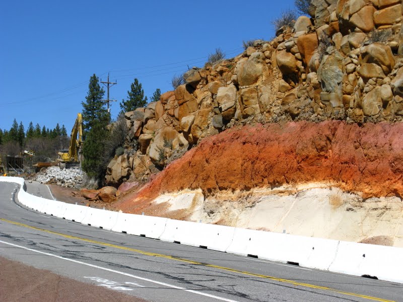 The entire roadcut was barricaded off, and fearing the worst, we pulled over so I could take some in-progress pictures.
 I climbed over the barricade...
 ...and quickly grabbed a few close-up photos, just in case they were planning to take out the entire exposure...
 ...and just in case all my other close-up photos of the roadcut might be non-digital, which is what I suspect.
 On May 18, 2009 - the 29th anniversary of the eruption of Mt. St. Helens - the destruction of this fine roadcut had continued, and it was clear that it would be wiped out.
 On July 29, 2009, we pulled over again. Roadwork had moved farther westward on Highway 36, and the roadcut with the excellent baked zone (among many other great geologic features) was in its now current form.
 There's really not that much to see anymore, especially when compared to what one could see before.
 I didn't even walk over to the other side of the road.
Does anyone knows what basalt this is - possibly the Miocene Lovejoy Basalt or the Pleistocene basalt of Susanville Peak?
Related Posts:
Susanville Roadcut Before and After
Baked... Lake Sediments?
4 comments:
I hate what they did.
Nasty nasty people.
I hope the road folks don't destroy the triple dike on State 139. Many years ago when I-80 was under construction the Californian Highway Department remove the best example I have ever seen of a chevron fold. I think it was near Vacaville. But not all road improvements are bad. If it wasn't for the highway system we probably wouldn't even know of the Goshen flora.
Triple dike photo is here. I hope it stays, too. And how could I forget about the Goshen flora?
Post a Comment