 I thought I'd post a trip report I wrote back in March, when the early mornings were very dark and I was riding the 4:45 bus in to work. Nowadays, I'm sleeping in just a little and taking a later ride whenever possible. Photos are from various times since mid-April.
Riding to work on the 4:45 bus: It's dark. Cars and trucks — some clearly heading out to the mines — pass us on the freeway.
 Many people on the bus are sleeping. Maybe they didn't have any morning coffee like I did, coffee that makes it possible for me to get ready for work and impossible to sleep on the bus. The light from the phone I'm writing this on, carefully picking out letters with my stylus, is the only light I see besides headlights on the road.
Button Point: Button Point is a promontory at the north end of the Sonoma Range, where I-80 takes a nearly 90-degree turn, and the Humboldt River goes from flowing northwest, makes a kind of large semi-circle, and then ends up flowing west-southwest before heading in more southerly directions toward the Humboldt Sink. Button Point is also a rest stop. We pass it by.

Volcanic rocks south of I-80 just east of Button Point.
Golconda: We get off the freeway here and drive slowly through the small berg of Golconda on the original Highway 40.

Sign on the eastbound exit for Golconda: In case you didn't know which way to go!
Other buses have stopped to pick up people at a large, jumbled parking lot near the center of town; we pass them by, and — leaving the old highway behind at a sharp, 25-mile-an-hour as-posted turn beyond the far end of town — go out the paved road through Emigrant Canyon, where the railroad tracks follow the Humboldt River. Picking up speed after making the turn, we wind through a canyon cut into green, brown, and orangey-purple phyllites of the Cambrian Preble Formation.
At the site of Preble, now a small agglomeration of dilapidated (or rustic) ranch out buildings and sheds, we stop at the railroad tracks before crossing. Up in the distance I see one red taillight.

Preble and the railroad crossing come in to view.
The data connection cuts out somewhere between Golconda and the railroad crossing, picks up again at 5:16 past the curves through the dusty, phyllitic hills, but my mobile device doesn't quite make a connection. I keep trying and finally get a solid connection in the windswept, sand-covered swath affected by last October's fire.

The Osgood Mountains, with the Pettit Ranch (the trees just barely in shadow) in the distance on the alluviual fan.
The road ahead of us is still paved. Vehicles going out to the mines — Hollister, Midas, Twin, TR, and Pinson — pass us. Our speed is regulated by a GPS-based system tied to actual speed limits. A few trucks — including two-trailer semis — go by us in the other direction, leaving the mines, ranches, and isolated outposts like Tuscarora and Midas to make their way back to Golconda, the freeway, and beyond.
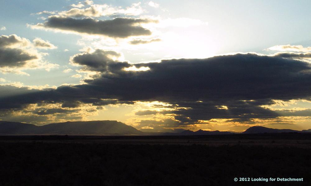 A view of the Midas Trough, not far from the turnoff to the Midas Road. Miners (and geologists) going out to the Midas and Hollister mines head out toward the broad low area beneath the rising sun.
The bus driver has a radio on, set to one mine frequency or another, and chatter picks up now and again, about the road and the traffic.
5:25: We come to the Midas turnoff. At the turnoff, a plethora of signs pop up on the right side of the road, pointing the way to various mines. Companies with signs: Atna, Barrick, Newmont, and Great Basin Gold. Mines mentioned on the signs: Pinson, Turquoise Ridge, Twin Creeks, Midas, and Hollister.

A plethora of signs.
We have now left S.R. 789, called the Getchell Mine Road by NDOT, and are on its extension, a well magged (treated with magnesium chloride), fairly smooth, wide dirt road that I've always known as...the Getchell Mine Road.
 This is (reportedly) a county road maintained by Newmont with monetary contribution from Barrick. Road access is still public: side dirt roads, if you know which ones to take, lead to canyons, mountain passes, ranches, and reservoirs.
I see the vague dark outline of the Osgood Mountains to the west, and the lights of Twin at one o'clock. We pass some lights on the left (probably the Pinson Mine), and come to the "No Passing Next 3 Miles" sign at 5:31, after crossing a cattle guard.
 The old tungsten mine [Pacific or Valley View mine] north of Atna's Pinson Mine, which we pass at about 5:30, just before crossing the cattle guard. In March, the outline of the Osgood Mountains was just an outline: black on a dark background.
The lights of Newmont's Twin Creeks Mine off in the distance to the right.
 5:34:The road splits, with one road heading off toward Twin, the other continuing straight toward TR-Getchell. Access on both roads is still public, at least for a short ways: the continuing Getchell Mine Road provides access to at least one side canyon; the Twin Creeks road provides access to the Chimney Reservoir.
Beyond this final juncture, the road becomes a little more curvy, maybe a little more corrugated or rutted. Lights from both mines are visible. After passing through the main gate at 5:39, the bus makes its way to at least one stop before arriving at my worksite at 5:53.
End of Trip. (E.O.T.)
3 comments:
As always, fantastic landscape pictures! What a beautiful area.
I liked this post so much I added it to my things I think are neato blog:
http://keaneato.net/2012/06/25/now-thats-a-bus-ride-to-work/
Glad you liked it! And thanks for linking - that's neat! ;)
Post a Comment