 Bowman Creek, on the eastern slope of the Toiyabe Range in central Nevada: where we will be going next.
For topo maps of the Bowman Creek area: TerraServer [now MSR Maps] seems to have a glitch between the small-scale map and a more detailed large-scale map, though their interface works fine at all scales if you look at the air-photo, and you can slowly page through the Bowman Creek area in detail from the large-scale map (that is, the intermediate-scale maps supposedly of that area show some other area in central Nevada).
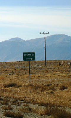
 As you drive south on old Highway 8A (S. R. 376), past Kingston Canyon, on your way to Tonopah, long before you come to Ophir Creek you'll see this little green sign marking the main road in to Bowman Creek.
 Don't turn there - actually, it's probably a good place to turn, and I'll have to try this road on the north side of the creek some day and see where it goes - instead keep driving a bit until you go past the first turn in one of the longest straight stretches of paved road in Nevada.
 Turn here! This is the old road in, the one that goes up the alluvial fan on the south side of the creek to a long-ago campsite.
 As I drove up the fan on the road we used back in the summer of 1978, I realized that I'd forgotten about the spring the road went by. If you click to enlarge, you can see that someone has actually built a house on top of the spring mound, a great spot with a great view of Big Smoky Valley. I was a bit surprised by this, and initially took a wrong turn. Stay right, not left, to bypass the house and private plot of land. Follow my tracks, if they are still there.
As you drive up the fan closer to Bowman Creek, the road will go to the base of the spring mound (an eroded fault scarp that forms part of the Toiyabe Range fault zone) and then will turn to the north to go around.
 Above, a Google Earth image showing the Toiyabe Range fault zone (yellow lines), the spring with house symbol, Bowman Creek with fish symbol (good trout), and old camp with helicopter symbol (click to enlarge). The old RO Ranch is in the lower right corner.
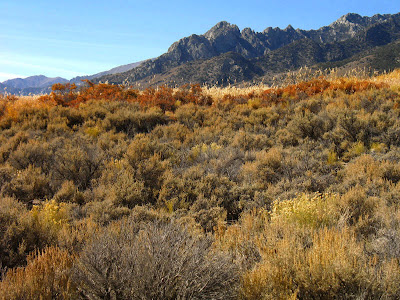
 Because it was fall when I visited, the colors of sagebrush still in bloom, faded rabbitbrush, willows and other water-loving plants were absolutely stunning - so naturally I spent some time taking a few photos. The photo above looks westerly, toward the range front.
 This photo looks southwest, and you can see some of the particularly craggy ridges of the Toiyabe Range, which is one of Nevada's highest mountain range.
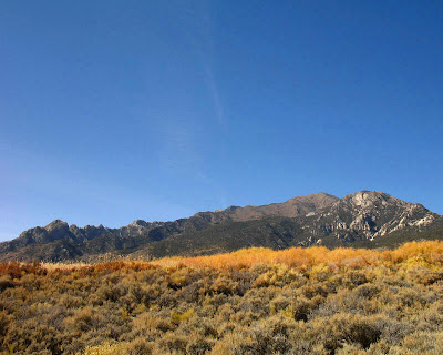
 The big picture, with the house on the spring hidden from view.
 After winding around a bit, the road goes past another house that wasn't there back then, and climbs up toward our old campsite. From the spring onward, this road was, in places, steep, rocky, and made of powdery dust that hid all the rocks. Rocks would jump out from beneath the dust and bash unsuspecting transfer cases and differentials. And even if you thought you memorized the locations of the rocks, the truck ahead of you - whoever had passed over the road last - was sure to have knocked a few rocks around or dug out a new one. The more we drove on the road, the worse it got. It's now much better, and maybe doesn't follow the exact same path as it did.
 Ah, the creek: cold, running water. You can catch grasshoppers in the tall rushes and grasses on the other side of the creek and bait your hook, if you want. Some of the pools are big enough at least to sit in, and briskly cold for cooling off in summer heat.
No comments:
Post a Comment