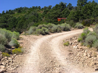
 On that first day, I made it past Tepee Rocks, to this sign: Ella Mountain Lookout, 10.
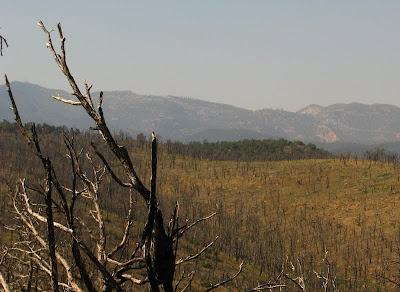
 And then I went beyond that to this burned area, where I realized the rest of the way would be too long for a late afternoon drive. Ella Mountain Lookout can be seen as a couple tiny-looking towers on the left edge of the photo, on the distant hill between the two charred branches.
The second day, I dedicated myself to getting into Pennsylvania Canyon by way of the Ella Mountain Lookout road. I made it to the Ella Mountain Lookout 10 sign at 9:30, to the burn at 9:40. The roads were long, and the way in was briefly obscured by faulty memory and a lack of good topo maps. About 6 miles in from the sign that said 10 miles, I came to a T in the road - a T I wasn't expecting, a T with no sign. I turned the right way, at first - to the west - but not believing the lookout road could deteriorate so rapidly, I turned around, went back to the T, and drove east.
 After going way too many miles the wrong way, going lower and lower in elevation and farther and farther away, I found a place to turn around - lo and behold, one where I could still see the lookout in the distance to the west, one where bands of sage sparrows were chip, chipping and flying from bush to bush.
I turned around at 10:10 am. I went back to the T junction, and kept going west, what had I been thinking!? At that point, the long road got steep and rocky.
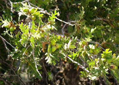
 I passed the Ella Mountain 3 sign at 10:30 (why hadn't there been a sign at the T, they were everywhere else!), and made it to this rocky turn with a view at 10:40. It was here that I discovered that the rock I’d been bumping my way slowly across was a poorly welded, well-indurated tuff, seen above in the right foreground. I was also reminded of two unexpected trees. See the one on the right, growing on the tuff? That's an oak. What about those tall trees behind it and across the road - aren't they a little tall for piñons?
 Yes, it's an oak. The acorns somehow brought back memories of my initial, long-ago surprise at seeing oak trees in Nevada. The tall trees I still didn't recognize.
 I’ve now come to a main fork in the road. Ella Mountain is 1 mile to the right, and Elgin - “Road Damaged Ahead" - is 10 miles to the left. The left road is the road into Pennsylvania Canyon. I arrived here at 10:50, and then got underway by 11:15 after taking pictures from the lookout.
Do I seem a little overly time conscious? Well, I was. I hadn't filled the gas tank in Caliente that morning, so I was watching mileage and time carefully so I wouldn't get too far down any one road.
To be continued…
No comments:
Post a Comment