No, I'm not going to add a picture here, although
The Lost Geologist did;
his picture details everything he carries when fully field ready. Maybe I'll add a photo of myself later, but right now my field gear is strewn all around my bedroom and all through the front and back of my truck. That's often what happens when I come in from the field. So I'll more or less follow checklists, which - for this impromptu geo-meme - can be found at
Geotripper and
Johannes Lochman. Update: I didn't see Kim's entry at
All of My Faults are Stress Related when I wrote this. And now,
Hypocentre has one up, also.
Hair: Mine is pulled back and up in a clip, and always completely hidden by a sunhat or baseball cap. I gave up on any kind of ponytail a long time ago.
Sunburned Peeling Nose: I generally avoid this one, with sunscreen rated 35 to 50, if at all possible. I already had way too much sun exposure when growing up in the baby-oil suntan lotion days.
Beard: Thankfully, none at all. It would look strange with my female body!
T-shirt and Logo: When wearing T-shirts instead of long-sleeve, sun-proof, breathable shirts (or winter gear and layers), my T-shirts are usually devoid of logos anymore and often have pockets. Pockets are so essential.
Vest: I wear a vest, often a
beige Filson (or a
bright orange one for hunting season), but more recently a larger, fluorescent orange safety vest, like
this one.
Things in the Vest: For me, the vest is designed to carry almost everything that I carry, because I try to avoid having a backpack (only if sampling big time). The back vest pocket (or two), can carry as many as four or five 5-pound rock samples. The back pocket is also a handy place to put hand samples, the rock hammer, and clothing taken off when de-layering in cool-cold-rainy-snowy weather. That's also where I put my water bottle and sometimes my lunch. A few sample bags belong inside the back pocket.
Front inside pockets hold my Brunton compass, any safety papers I need in a plastic baggie, toilet paper in another baggie, any
cheat sheets I think I need, extra map scales, my field book, GPS, sample book if needed, flagging,
topofil thread and
hip chain if needed, extra markers, extra GPS and digital camera batteries, and sunscreen.
Front outside pockets hold my acid bottle in its leather case, protein bars, and my digital camera (or does that go on the inside?). Because my acid bottle is in a pocket, my vest is sometimes adorned by duct tape where acid has eaten through the vest material. Acid bottle and sunscreen have to be kept away from any paper like maps and field book, and from batteries and food. Sunscreen and acid have to be kept away from GPS and digital camera, as does any water or other liquids.
Upper left pockets hold pens, pencils, a few colored pencils, a couple markers, and map scales. I'm currently putting my hand lens and magnet, which are on a nylon cord and are designed to hang from my neck, into the upper right pocket, but I may remove the velcro that closes that pocket - then I will be able to hang the lens and magnet from my neck, where they will rest in that de-velcroed pocket while hanging.
I've probably left a couple things out; one usually figures those things out after the first day or two.
Belt and Buckle: I wear a sturdy,
nylon webbing belt, and try to avoid carrying anything on the belt, including hammer, acid bottle, or Brunton. Instead, the hammer is in my hand or in the large back pocket of my vest; the acid bottle is in one particular front vest pocket; and the Brunton is in some other particular front pocket. The only thing I attach is my pocket knife, which is tied to a belt loop by an extra boot lace. It's attached to me that way because I've left it behind after lunch way too many times.
Pockets: Keys, ear plugs, sun-proof chapstick, maybe some lysine ointment in case I develop sun-caused fever blisters, maybe my data stick if I've been to the office - these all go in the two front pockets, the keys in a zipped pocket if I have one. Any motel keycard I happen to have will be in a zipped pocket or in my truck with my wallet, well hidden. Sometimes my camera will fit into a front pocket. My cell phone goes in a zipped pocket on the side, down above the knees - or in the field vest in a zipped or velcroed pocket.
With all the pockets available on pants and vest, I have managed to take and carry several samples after running out of sample bags (or once when I forgot them). One has to be careful when sampling this way to make sure there is no contamination already present in the pockets (ha!), to label the samples somehow, and to get a large enough sample size. This method of sampling is not recommended, and is usually only good for a few, small samples.
Rock Hammer: As Geotripper mentioned, a rock hammer is useful for things besides whaling away at rocks and outcrops. For one thing, hammers are good for hammer-throwing contests. Many kinds of contests have been devised, and new ones can be invented if the old standard ones get boring. Be sure not to hit the back of one's head when winding up for a good hammer throw (this happened in one particular throwing contest that took place the western Mojave north of Tehachapi).
Hammers are also good for defending oneself: from
rabid bobcats, for example, and from coyotes (I thought about it once when I looked up and three were staring at me from across a 20-foot-wide sand wash), and also from potentially bad-ass people, who are sometimes found in locations south of the Garlock Fault or anywhere in the
vicinity of the Panamint Range.
I sometimes carry a 2.5 pound sledge hammer with a long wooden handle that doubles as a walking stick on steep sidehills. It's also good for aiding with balance.
Hands: I will carry my rock hammer, map case or large map board, and GPS. A map case will fit in the back Filson or vest pocket; a hammer will fit there, also. I look at my GPS almost constantly when mapping.
Legs: I'm with
Johannes on this one. I have rarely worn shorts in the field - to avoid sun and scratchy or thorny bushes - so my legs are not tan, and they are hidden under pants. Are they muscular? Who knows?
Pants: These are the things that cover the legs, and which add pockets to the list of many pockets above. I wear loose cotton jeans with a carpenter or painter style for extra pockets - or, more recently, nylon pants with extra pockets. These are thin, light-colored pants which can double as exterior winter pants to keep out rain or snow when used with long johns for warmth. If it's too cold, overpants and lined pants are required, sometimes diminishing the number of available pockets. But winter is a special case where staying warm trumps number of pockets or how much one can carry.
Shoelaces: These are indeed sometimes knotted to preserve their useful life, and also because I can never remember what length to buy.
Socks: It's nice if one's socks match the rest of one's outfit, but if not wearing shorts, matching becomes non-critical. Sometimes thin under socks are required.
Boots: Recently, my best (most comfortable) pair of field boots has been an ugly black pair, a composite safety toe variety, with pseudo-Vibram soles.
Ironclad Bladders: "For 300 mile drives to geologic localities without stops," per
Geotripper. I have met a few geologists with "itty-bitty-bladders" who were always needing stops out in the middle of nowhere, where the largest cover is the truck. Thus developed a long-standing rule: men use the front of the truck, women use the back, and everyone has to get out of the truck or van and go to their places. That's so all men are in front of all truck mirrors. I have met a few men who would prefer that I walk miles to find cover rather than them get in front of the truck while I use the back of the truck as a potty - but these men have, thankfully, been rare, and I never listen to them. It can seem a little uncomfortable ordering one's boss to the front of the truck, but - hey, you do what you gotta do!
Another characteristic is required for one's bladder in desert or other non-cover areas: speed. Speed is needed when the only place to stop is the side of a straight stretch of dirt or paved road. Exceptional speed is needed when the road curves and you can't see around the curve.
Brunton Compass: Yes - see above. These can be used on rare occasions for signaling to wayward helicopters, but
don't expect them to see you. These can also be used for checking into mine adits to see how far into the hill they go.
Eyes: Sunglasses are often worn; ones that change from light to dark can be useful. Always be on the look out for - everything.
Brain: "Dehydrated, half-baked, freeze-dried, poisoned, but always plotting the next trip," also per
Geotripper. Indeed. And sometimes thermally altered by too much sun or too much beer.
Hat: Worn to protect said brain - see "Hair" above.
Backpack: When I carry a backpack, in addition to all of the above things, I will for sure have an emergency kit including snake-bite kit, more water, toilet paper, lunch stuff, lots of extra sample bags, moleskin, extra glasses, and waterproof matches wrapped in ziplock baggies.
My backpack often has other miscellany leftover from hiking trips; I don't always know what these things are or when I decided they were useful. For example, spare change for phones and dollars for cabs are rarely needed. Whereas I have seen pay phones in the middle of nowhere, these are getting
rarer and rarer: a phone booth once located near Cima Dome, CA, was taken out in 2000 because it became too popular in the 1990's. Another in-the-middle-of-nowhere pay phone still exists, as far as I know, to the east. I used this other pay phone as early as 1983, before Cima Dome became popular and inspired a
movie.
As far as cabs go (ha!), I have seen them deliver people down miles of terrible dirt roads to places as far away from a city as The Pyramid on the east side of
Pyramid Lake; however, if you need a cab when already out in the middle of nowhere because your truck broke down or because your field partner forgot to meet you at the end of the day, one will rarely drive by on whatever dirt road or sand wash you happen to be stuck in. In fact, I've never seen a random cab go by anywhere out there.
The Short Geologist at Accidental Remediation has
numerous posts relating to field gear of all kinds, including clothing and tools for your field vehicle.
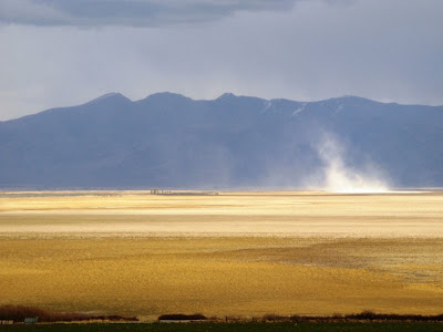 It was a dark and stormy day, and one particular dust storm arose, grew, whirled a bit, and dissipated while I watched. The photos of this storm were taken looking a little north of east from the rest area.
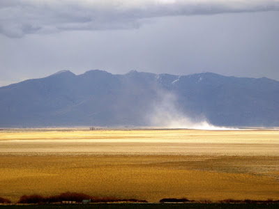 The Skeddadle and Amedee Mountains form the backdrop for this particular dust storm.
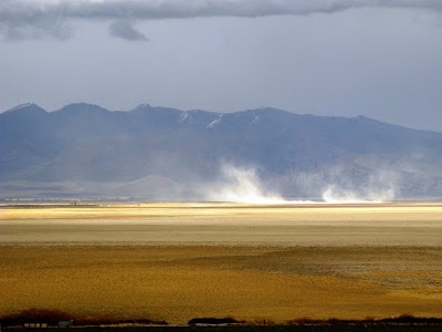 Here, the dust storm does a bit of whirling, forming a wide-diameter dust devil, prior to dissipating.
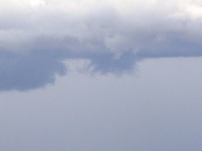
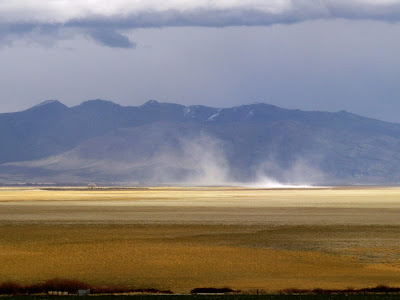 While the dust storm gets smaller, a vaguely funnel-shaped cloud forms above it. This cloud is probably not a funnel cloud, though I have seen small funnel clouds above large dust devils.
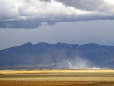 Now the dust storm is getting thinner and thinner, dwindling while I stand in the rain, getting wetter and wetter.
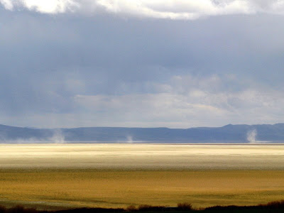 Meanwhile, a bit to the south, some classic dust devils arise in the desert mirage.
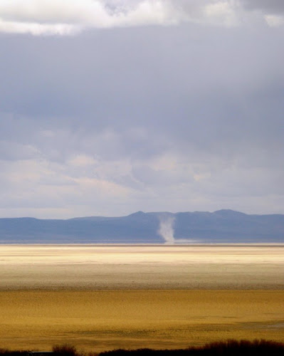 My favorite mirage-based dust devil of the day.
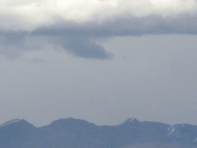 The clouds above the larger dust storm formed interesting shapes, especially as the dust storm was winding down. Here are a couple enlargements of the cloud shapes.
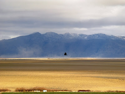 On the next day, the storm - wind and rain - was mostly gone, the playa was wetter, and vultures flew back and forth in front of me.
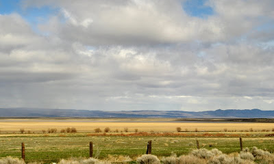 A little farther south, in the southwest arm of Honey Lake, I spotted some water in the lake (enlarge and look closely!).
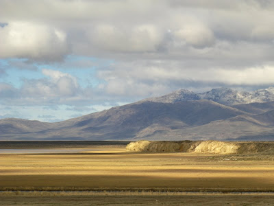 The water was south of The Island, almost lapping up against a landform I sometimes call "the bluff." I'm always a bit happier when I can spot some water in Honey Lake.


