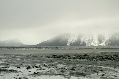
Going to Girdwood involves driving the Seward Highway (partly Alaska S.R. 1) south out of Anchorage. The highway follows the railroad along the north side of Turnagain Arm.
 We came into view of the Turnagain Arm mud flats near Potter Marsh (currently a snow-covered, frozen marsh), and spotted these oval, sub-rounded ice fragments sitting on mud covered by a thin sheet of water. The tide was clearly down - was it going out or coming in?
 A bit of mud flat shows itself between Potter Creek and McHugh Creek - mud, water, and mountains across the arm are all gray, making for a particularly wintry look.
 We made our usual stop at Beluga Point, a good place check the disposition of the tide. The wind was howling up the arm toward the east, enough to make for a penetratingly cold experience. In fact, I was the only one who chose to get out of the car (the Real Alaskans knew better), and after doing that once, I didn't do it again until we came to a heated and enclosed espresso place in Girdwood.
 The tide was going out, though you can't really tell from my photo; the water was moving downstream to the west, with surface waves from the wind breaking to the east. Mud flats near Indian Creek, looking up Turnagain Arm to the east.
 Mud flats between Bird Creek and Bird Point, looking across Turnagain Arm at the Kenai Mountains. We can see two relatively large stream incisions in the mountains on the left side of the photo beyond the low, tree-covered land, the tip of which is Bird Point. The valley just above Bird Point was carved by an unnamed drainage; the larger valley on the far left was carved by Sawmill and Slate Creeks. These drainages are U-shaped in their upper reaches, and V-shaped below about 500 feet.
 Partly frozen mud flats, with the lowland of Bird Point in the middle background, in front of the steep, glacially shaped northern front of the Kenai Mountains.
 Near shore, between Bird Point and Girdwood, angular to sub-rounded fragments of ice float on the muddy water of Turnagain Arm. Much of this thin ice originated as pancake ice.
 Snowy and partly frozen mud flats with piles of chaotic ice blocks, near Girdwood, looking across Turnagain Arm toward the large, U-shaped mouth of Seattle Creek.
 Snow-covered and frozen, nearshore mud flats with strange ice forms that look like mini-hoodoos. This photo was taken near Girdwood, and looks east across the below sea-level channel formed by Glacier Creek. Through the fog, you can vaguely see in-use power lines, along with dead trees left from the 1964 Good Friday earthquake, when the land sank and salt water flooded the area, killing the trees.
 |
| Turnagain Arm photo locations |
The same mud flats in summer.
4 comments:
Your trip brings back good memories. I drove to Girdwood from Anchorage last summer. Weather was much nicer.
Glad you had good weather. We sure didn't.
i'm probably one of the few people who know You shot this is color.
Sorry You had such bad weather.
Best!motsfo
Motsfo, as you know, that's color for sure - and I can see it because I know it's there, but the color really only shows distinctly in the second picture. The posts on our trip to the glacier shows the weather in even finer form!
Post a Comment