Monday, June 30, 2008

Find Detachment in This: Tunguska

Draw your own conclusions by reading the following links. At the time, the "blinding, deafening blast" was not a mystery. The "doom, doom, doom" scenario offered by many websites reminds me of dwarves in the The Mines of Moria per the Lord of the Rings.


Tunguska per Wikipedia.

Do you read Russian? [Cited by Wikipedia, original transcripts from 1908, supposedly.]

Leonid A. Kulik. Came on the scene in 1927.

Yeah, sure. I'm all for science fiction, but GMAB.

Sunday, June 29, 2008

Hiking in the Mountains

hikers
MOH and I have been fortunate enough recently to be taking our visitors from Alaska around here and there in the Basin and Range to see the sights. One thing we did was to drive up one of the local, Basin and Range mountains and take a little hike. As you can see, we saw some beautiful sights, and a little wildlife.

More on this particular mountain later!
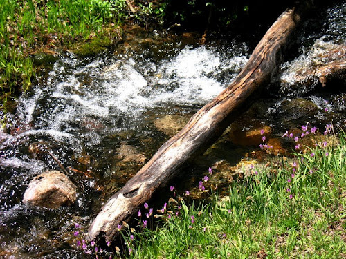
mountain A view of the mountain from the mountain's shoulder; you can see some layered rocks that form the highest part of the mountain. Are they sedimentary, metamorphic, or volcanic? mountain spire creek Some purple wildflowers growing along a rushing, snow-melt creek. mountain again view from mountain A view of distant mountains to the southeast from the shoulder of the mountain. squirrelWe found this little ground squirrel on the side of the road, apparently eating dirt - maybe it was going after road salt from the winter.

Saturday, June 28, 2008

The Principle of Uniformitariansim


The principle of uniformitarianism is one of the earliest formed principles of geology. It is a principle, not a theory.

The principle of uniformitarianism is stated simply as "the processes affecting Earth today are the same ones that affected it in the past" - as quoted from What Stories do Rocks Tell, at ClassZone. Besides describing the principle of uniformitarianism, the website goes on to outline the other principals of geology:

The principle of uniformitarianism is fundamental to understanding geology and working out what actually happened in the past, during the long history of the earth, during the eons of geologic time. This main principle is sometimes stated as "the present is the key to the past."

If geologists could not use what they see around them now, by studying geologic processes and relationships occurring and in place today, it would be difficult if not impossible to determine what had happened in the past. Any ideas, concepts, or hypotheses that a geologist might form about the past - anywhere or anywhen on earth - would be useless without the principle of uniformitarianism, simply because one could not go to the geologic record - which is also a record of events and processes that include the chemistry of the past, the physics of the past, the biology of the past, the hydrology of the past, the geochemistry of the past, the geophysics of the past, and the bio-geology of the past - and do any meaningful interpretation at all.

If, for example, sedimentary rock layers of the past were laid down sideways or vertical instead of in horizontal fashion as we see them being laid down today - say, because the gravity on earth worked very differently in the past - then any interpretation of what happened to older rock layers that are now folded, faulted, and otherwise deformed, would be incorrect. Another way of looking at this would be as described at MSN Encarta:

The principle of uniformitarianism depends on the 'uniformity of laws,' which assumes that the laws of physics and chemistry have remained constant. To test uniformity of laws, geologists can examine preserved one-billion-year-old ripples that look very much like ripples on the beach today. If gravity had changed, water and sand would have interacted differently in the past, and the ripple evidence would be different.

In other words, ripple marks today indicate that water has flowed or wind has blown1 (because we also see ripple marks created in areas of blowing sand), and therefore ripple marks in rock formations of the past also indicate the same thing. By measuring and comparing ripple marks formed today under different circumstances of water or wind formation, different speeds of water current or air movement, and different environments, a geologist can then apply the data collected today to the ripple marks of the past and hypothesize an environment in which those ancient ripple marks formed.

Geologists at first sometimes took the principle of uniformitarianism to such an extreme that catastrophic events of certain kinds were almost completely ruled out, perhaps because the principle was partly formulated as a tenet opposite to the then prevailing doctrine of catastrophism. The two major types of events somewhat ruled out by geologists of the past were huge, giant floods and huge, giant volcanic eruptions. The reason for these things being ruled out or overlooked while using the principle of uniformitariansim, is that these things - huge catastrophic floods, and huge catastrophic volcanic eruptions - are not seen happening on earth today. The discovery and recognition by J. Harlan Bretz of the very large series of floods that formed the Channeled Scablands of Washington state, eventually was accepted as something that 1) really happened and 2) could happen again if circumstances similar to those that caused the floods occurred again. It's interesting to note that it was in part the identification of huge ripple marks that clinched the acceptance of the way-larger-than-usual floods. In a way, then, the principle of uniformitarianism helped confirm Harlan Bretz's ideas - if you look at the size of ripples in rivers today and compare them to the size of the ripples formed by these past floods in the Channeled Scablands, you would have to conclude that an immense volume of water was required to form them.

Likewise, the recognition of the very large volcanic calderas of Tertiary age in central Nevada and of Quaternary age in Yellowstone Park, Wyoming made geologists realize that large, "catastrophic" volcanic eruptions are part of the earth's history and therefore could happen today/soon, or sometime in the near to far future. The relative size of the eruptions at Yellowstone (Yellowstone Park and environs actually contains several - at least three - calderas) compared to that of many volcanic eruptions that we, as people, think of as large or "catastrophic" is discussed at Yellowstone Caldera. It can be good to remember that events that are considered catastrophic are on the large end of a continuum of smaller to larger events, and that the large events are often considered catastrophic only because of the effect they could have on humans. We are the ones defining normal earth processes as catastrophic.

Anyone attempting to do geology without using the principle of uniformitarianism as described above, is really not doing geology at all.

1. I am reminded of the movie Little Big Man, in which Pawnee chief, Old Lodge Skins, says "...as long as grass grow, and wind blow, and the sky is blue." One of my favorite quotes, for some reason.

UPDATE 23Jun2010: Also see Rapid Canyon Formation and Uniformitarianism at Clastic Detritus and Of Catastrophic Floods and Canyons at 4.5 Billion Years of Wonder.

Thursday, June 26, 2008

Where is It?

A few quotes about how to find things: the geological art & science of exploration and discovery.

  • "Gold is where you find it." An old adage or saying with no specific source.

  • “Where oil is first found is in the minds of men.” - geologist Wallace Pratt, as quoted recently by the AAPG.

  • "It is the genius of a people that determines how much oil shall be reduced to possession; the presence of oil in the earth is not enough. Gold is where you find it, according to an old adage, but judging from the record of our experience, oil must be sought first of all in our minds." (Wallace Pratt, 1943.)

  • "We usually find oil in new places with new ideas. When we go to a new area we can find oil with an old idea. Sometimes also we find oil in an old place with a new idea, but we seldom find much oil in an old place with an old idea." (Parke Dickey, Tulsa Geological Society Digest of 1958, v. 26, p. 84.)
The last two quotes were quoted on this web page. I didn't find any exact publication location for the Pratt quote.

Tuesday, June 24, 2008

Days Off Are Here!

flower

It's been a long work week - that is, more than ten days, less than twenty. Yesterday was my last day at work for this shift, and now I'm on days off, and I'm lucky enough to be off for the 4th of July this year. MOH will be starting his days off soon, so our days will totally overlap this time.

cirrus1

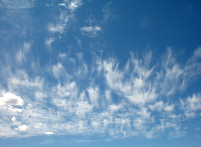
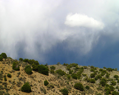
ACIt's early summer here, or at least it's acting like it with blue, cirrus-filled skies in the morning and mid-day, which sometimes give way in the afternoon to thunder-poppers. Winds will sometimes pick up a bit in the afternoon, but overall not that much. The monsoon has yet to move in on a regular basis. Temps in the valleys are reaching the mid to high 80's, and it has been difficult to really cool our little house down at night using our tiny window AC. If it's cool enough outside, I'll leave the bedroom window open a crack, but sometimes it's too warm for that.

cirrus2

Sounds of summer, so far this year, are a nearby church bell that chimes the quarter hours, and the local historical train giving touristy train rides. The train excursions increase during the summer.

Any visitors [link not currently available] from colder climates are encouraged to bring T-shirts, a couple long shirts, and a jacket or sweatshirt in case it suddenly goes cold on us. This is Nevada, after all.

cloud with hill

cupWhen I leave my little office for days off, I clean the dust and any loose rock chips off the desk, and put all my logging and geology tools in order. These tools include spray water bottles, an acid bottle, a coffee cup, a couple magnets, and various scratching devices for testing mineral hardness. Also, a streak plate is handy to have at hand.

Nearby, I have my rock color chart, a mineral percent estimating chart or two, a sand grain sizing gauge with pasted-on sand particles, and a pocket knife. All kinds of miscellaneous other things are lying around here or there, some buried in plastic boxes, others under piles of paper or journal articles: color pencils, marking pens of various sizes, extra flagging of a couple different colors, extra sunscreen in case I run out, a pocket stereo viewer that I rarely use, extra boots, extra vests, extra hats, extra field books, extra, extra, extra... And some old, stale Swisher Sweets, which I really should throw away: they're probably awful by now, and I haven't had any desire for a (good or bad) cigar in a couple years.

rocks in truck

The back of my truck, now, that's another story. It's organized and disorganized, depending on where or how deep you look. Where I should have the requisite 5 gallons of water per my own desert rules, I've got a bunch of rocks - can you imagine that? And that's in the back of the truck. I've also got rocks under both sides of the front seat, and one rock hammer under the driver's side, and another rock hammer under the passenger's side. The rock hammers belong in the back, unless I'm getting in and out of the truck a lot. The rocks belong outside the truck. Most of them are so old that I'm not sure I will be able to tell where they are from, although several have numbers on them, numbers that no longer mean a thing to me.

I used to be much better with organization, with labeling rocks and keeping them in places where I might actually look at them again. Oh, well.

Monday, June 23, 2008

Monday Photos from the Mountains

Loveland Pass
mountains
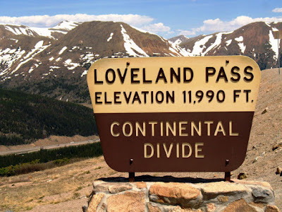
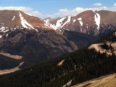
A Monday mountain photo or two for your enjoyment, from Loveland Pass, way up on the Continental Divide in Colorado.

flowers
These photos were taken in early June, 2006. It was barely spring, with snow still covering all the north facing slopes, and little wildflowers popping up here and there.

bluebird
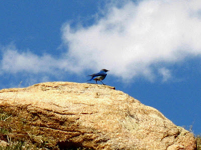
And a mountain bluebird, too!

Mining and Exploration News

Just a few summaries and links to mining and exploration stories out recently. Excuse some dorky titles. How can you tell which titles are dorky? Easy, the dorky ones are mine.


From Ron Schott's Geology Picks:
Not so Good Oil and Gas Exploration in Washington state

From Geology.com:
Surprise, surprise, there's a new gold rush in CA!
Internet Addiction - do YOU suffer from it? (Oops - not mining related unless you are reading this blog post over and over again!)

Also from Geology.com:
Geologists are needed in Australia

But in other reports (and comments), jobs aren't really available unless you KNOW SOMEONE.

Canada can't attract women into mining jobs according to this article - also from Geology News - although on my spring field trip, all the women geologists were Canadian, except for me.

I could find no reference in the above news release to open-pit mines - I guess we're on our own! Also, the news release mentioned driving the referenced new equipment through mineshafts. Mine shafts are vertical, and no underground trucks or truck drivers drive up and down through these things (shafts). The driving is done in mine tunnels or adits, and in declines or inclines. Declines are mine tunnels or adits that descend gradually as you walk into a mine (or drive - a geologist should be so lucky!); inclines are tunnels that go uphill at a very slight angle as you enter the mine, usually for drainage purposes. Also, the article speaks of the "roofs" of underground mines, a somewhat vague term that could refer to the rocks immediately overhead while underground, or possibly to surface rocks above the entire mine - I'm not really sure which, because if you are in an underground mine, the surface over your head is called the "back." And that's because when the old-timers made their tunnels, they were typically not very high, and the miners had to bend over to enter and walk through them, thus having their backs almost in contact with the "ceiling" of the mine adit.
Last but not least, lots of things have been happening in Arizona - as usual - see these articles and more at Arizona Geology:
Arizona Geology shows a neat, colorful table comparing commodity prices over the past decade, described somewhat more fully at Pitpundit Blog.


Sunday, June 22, 2008

1981 OCS Drilling Moratorium Links

Brian at Clastic Detritus has recently had an article about petroleum resources on the Outer Continental Shelf (OCS). I'm providing a few links for further reference, mostly in order to flesh out the history of the moratorium itself.

A brief history of the moratorium and bans on drilling: first, the initial moratoriums were passed as part of certain fiscal year (FY) budgets for the Department of Interior (DOI). The history and much more can be read here, and is summarized as follows:

  1. The 1981 moratorium only covered California.
  2. In 1983, a ban on "pre-leasing" was extended to the North Atlantic.
  3. In 1988 Congress enacted the first OCS drilling ban, as part of the FY 1989 DOI appropriations - this ban covered leases in the eastern Gulf of Mexico (GOM), south of 26 degrees North.
  4. Other extensions were passed in 1990 under the Outer Banks Protection Act, which included "moratorium language" for North Carolina offshore areas.

The Minerals Management Service (MMS) summarizes the history the OCS Lands Act and more, going back to the 1800's.

Marathon Oil sues the U.S. in 1997 over part of the OCS ban and certain leases it had been awarded in 1981 prior to the moratorium.

A 2000 update on OCS royalties, and more, by AGI.

A 2004 Geotimes article compares the way we manage OCS leasing and drilling with the way Norway does it, and goes into some of the root causes for our current ban (environmental, primarily).

MMS lists some U.S. Offshore Milestones as of 2006.

Environment: a couple links to 2006 arguments by the Sierra Club for keeping the ban, including 2005 testimony before the Senate Committee on Energy and Natural Resources.

A 2006 Power Point presentation by a coalition for maintaining the current OCS bans, has some history and definitions.

A 2006 letter from the County of Los Angeles opposes the ban.

A CSN News article from 2006, wherein Bush says yes to nuclear energy, quoted in part below:

More Nuclear Power, Bush Says; No Oil Drilling, Pelosi Insists
By Susan Jones
CNSNews.com Senior Editor
May 19, 2006
(CNSNews.com)

Politicians of all stripes agree that the United States would benefit from a reduced dependence on foreign oil. But that's where the agreement ends.

On Thursday, President George W. Bush said the nation "must start building nuclear power plants." He described them as a "key part of a clean, secure energy future."

Bush spoke on the same day that House Minority Leader Nancy Pelosi warned, "We cannot drill our way to energy independence."

June 18, 2008 news from Energy Daily.

June 18, 2008 news from Poynter Online.

The Congressional Record online only goes back to 1983, but some information possibly could be found there, if you know how to look for it. I found it a little cumbersome.

Saturday, June 21, 2008

North to Alaska

Following on with some of the recent musical endeavors in the geoblogosphere, I'm going to publish this mostly obscure song I wrote a number of years ago. It's called "North to Alaska" and is sung to the tune of (if you can sing the tune) "North to Alaska" by Johnny Horton. Also, this is in honor of certain parental-type Alaskans who will be visiting soon (although, that would be "South from Alaska" for them).

North to Alaska

Verse I:
Scott and Jon went to Juneau
In the year of eighty seven.
They looked around til they thought they found
A little bit of heaven.
They spent their time at the Red Dog,
Drinkin' down those Chinook beers.
But at the rate they're finding gold
They'll be there several years.
Jon said, "Scott, I think it's time,
We'd better head for the hills.
We've got to find some gold before
Dennis sees all these bills."
They drank a few more tall Chinooks,
Said goodbye to the old Red Dog.
They packed their bags and grabbed their gear
And headed up in the fog.

Where the rivers are winding,
Big nuggets they're finding,
North to Alaska, North the rush is on.


Verse II.
They hiked on up the river
Through forests of devils club.
They trudged through all the swamps,
Through all that muck and mud,
They marched and marched for miles and miles
Til they stopped on the riverbank.
They looked just like two refugees
From the forest dark and dank.

They looked down in the river,
And they didn't believe their eyes.
The salmon were thick from shore to shore;
They were two happy guys.
They ran back, got their rods and bait;
Their destiny was clear.
Scott said, "Jon, you know I'm glad
That we brought all our gear." fish

The rivers are winding,
Big Sockeyes they're finding.
North to Alaska,
North the rush is on.


Verse III.
Scott turned to Jon and said, "You know
We've caught us quite a pile.
My arms are tired, my feet are wet,
I think I'll rest a while."
Jon said, "Scott, I guess it's time
We packed these fish to town."
They didn't get far before they heard
A growl from a great big brown.

They quickly dropped the fish and ran
And pulled their 44's.
But by the time they tried to fire
The bear was on all fours.
It looked like they'd fight him hand to claw;
They knew that it was futile.
So they left their fish beneath that mountain
Just a little northwest of Juneau. bear

Where the rivers are winding,
Big brown bears they're finding.
North to Alaska,
North, the rush is on.


Verse IV.
They hiked on up the river
Looking for that gold.
They climbed up on the mountain
Trying to find the lode.
They tripped over all the rotten trees
And slipped on all that moss.
And each time that they tripped and fell
They were cussing out the boss.

They got out their machetes,
Hacked away at all those trees.
While trying to find the outcrops,
They were down on hand and knees.
Scott said, "Jon, I think I know
A better way to go.
We'll ride the ore buckets to the top,
And you know, we won't go slow." glacial silt

The rivers are winding.
Big nuggets they're finding.
North to Alaska,
North, the rush is on.


Verse V.
They called back in to Reno,
Said, "Get Dennis up here fast.
We finally found the Mother Lode,
You won't believe how vast."
Scott and Jon found all the gold
That was buried in the land.
Now they sit in the bar and tell
Of how they dug and panned.

They sat and drank at the Red Dog
Til all the ore was mined.
"Jon, you know that gold mine was
So hard to find.
We worked the Juneau gold belt,
Now we're finally heading home,
From that mountain one thousand two hundred
Miles southeast of Nome."

Where the rivers are winding,
Big nuggets they're finding.
North to Alaska,
North, the rush is on.

North to Alaska,
North, we're going back home.


Photo credit for bear picture to Alaska Al.

Friday, June 20, 2008

Fossil Friday #3

Standing on Fossils:


Yes, that's my hiking boot (barely) in both photos for scale. The fossils are from the same locality as the ones I showed a couple weeks ago.

And no, I'm not going to name them! Can you?

Have a good weekend!

Thursday, June 19, 2008

Tree Planting: You don't know what you got til it's gone.

Caption: Forests cover nearly a third of the Earth's landmass. Falling into three categories -- tropical, temperate and boreal -- the forest types each have differing influences on local, regional and global climate.
Credit: Nicolle Rager Fuller, National Science Foundation
Usage Restrictions: None
Related news release: If a Tree Falls in the Forest, and No One Is Around to Hear It, Does Climate Change?
Image from Eureka Alert
Press Release: see
Eureka Alert for one version.

Second Image from Wikipedia

I first read about this Science article at Olelog, who explains it all pretty well, I think, and provides a few more links.

According to the article - I, who live in the temperate zone, with our house at the lake in Sierra Nevada forest and our little house in the Nevada outback in upland steppe (sagebrush zone to pinon-juniper zone), should not plant trees, but rather should strip trees and bushes, possibly either to plant wheat (winter wheat? native wheatgrass?) or to plant cement or white river rock! [These are my extrapolations, not specific statements in any of the above links.]

I think not. I will go xeriscape in places like Reno. I will not, however, cut down temperate-zone trees in order to xeriscape or plant native grasses. The effect I've noticed of having a lawn with plants and trees in desert towns like Reno is the following: green grass (not native grass that turns brown by late spring) will cool your house in the summer considerably. Cement and white river rocks around your house will heat your house in the summer considerably (the winter heating effect can be desirable, but there are other ways to achieve that goal, such as windows in all the right places).

I won't do it. MOH and I have been growing spruce trees for the last several years; I'm not about to kill them now.

Just a rant or reaction, mostly. But my interpretation, although extreme, really does suggest that stripping and not replanting forests would stop, negate, or at least slow global warming. If that is the case, then global warming in and of itself could have the effect of counteracting global warming when the temperate tree line moves north, creating grasslands across the temperate zone. (Of course, in that case, we will still have to go cut down the boreal forests!)

On another minor issue, the Science abstract uses the following phrase: "...the low albedo of boreal forests is a positive climate forcing." Why the (fairly) recent jargony use of "forcing," which now permeates the climate change literature, or at least the online literature. One could simply say: "...the low albedo of boreal forests has a positive effect on climate." OR: "...the low albedo of boreal forests increases overall global temperatures." Forcing used to be a verb. Now it's used as a noun and an adjective. Yikes, is what I say! Oh, well. I'm not in that field. I'm not going to change that usage. But it sounds jargony to me, and it sounds non-specific, also. Is a "positive climate forcing" equal to something that raises temperature, or is it merely something that has a "definite" effect rather than a "positive" effect (the latter presumably being an increase in temperature)?

I guess my only real point here is that I'm not cutting trees in my area (or in Alaska, either, for that matter) for the sake of counteracting global warming based on this Science article. I guess Johnny Appleseed should have been shot for his efforts, although try telling that to the people of Paradise, CA (for some reason, there are persistent local legends that Johnny Appleseed made it that far west!).

They took all the trees
Put 'em in a tree museum
And they charged the people
A dollar and a half just to see 'em

Don't it always seem to go
That you don't know what you've got
Till it's gone
They paved paradise
And put up a parking lot

Big Yellow Taxi (as written and sung by Joni Mitchell)
© 1966-69 Siquomb Publishing Co. BMI

Wednesday, June 18, 2008

Accretionary Wedge #10: Up

Accretionary Wedge #10 is up over at Geological Musings in the Taconic Mountains. John VH has done a great job of summarizing the many posts for this Wedge: Geology in Art. Geology, as many of you already know, is both a science and an art, and in this month's Wedge, you can see how - check it out, if you haven't done so already!

Tuesday, June 17, 2008

One Year

Well, I have been working in this neck of the woods for about a year, now. It's the first time I've worked at a mine in my decades-long career, and now it's already been a year. My how the time flies. Prior to this, I've mostly been in exploration.

In the past 5 years, I have worked some around the peripheries of mines, I have worked in onsite facilities where active mining was about to begin, and I have worked in offsite facilities where active mining was in progress.

Prior to these last 5 years (and maybe about 50% of the last 5 years), I spent most of my time in the field, conducting raw (grass-roots) to district-based reconnaissance, choosing which areas to go look at, which areas to stake or acquire, and which properties once acquired and mapped to take to the first stage of drilling. I've been fortunate enough to see some properties go beyond round-one of drilling, and have seen two go into production. In doing so, I've worked in every state in the west except for Montana and Wyoming.

There is a difference between working in the exploration end of things - reconnaissance, property evaluation and acquisition, and early-stage property mapping and drilling - and working in the production end of things - pre-development drilling and evaluation, development drilling and evaluation, and what is sometimes called "production logging." For one thing, at least so far, there is a lot less actual field work involved. I'm "in the field" in the sense of being away from home, but much of my work is done in an office, coreshed, or warehouse-typesetting. The mine geologist at a mine - and his crew if he has one - usually does most or all of the mapping inside a mine, whether it be underground mapping or pit mapping. I am not a mine geologist, and I've never been a mine geologist.

One thing that I'm not sure that everyone fully appreciates is the extent to which companies in industry expect confidentiality. At most companies, whether working as a full-time company employee or as a consultant, one is required to sign a confidentiality agreement. Most agreements require that knowledge and information gained while working is to remain confidential for one year after leaving a company.

I was once half-heartedly accused of breaching a confidentiality agreement. Just before I left Northern Exploration Company (NEC) for Former Mining Company (FORMINCO), I had completed a list of volcanic-hosted recon targets for the Mojave Desert of California, and I hadn't had time to look at all of them. Another NEC employee also left for FORMINCO at the same time.

Within a year, while I was off doing recon in the Coast Ranges of California, the other geologist had come up with his own recon list for the Mojave - and lo-and-behold: by pure coincidence, one of the targets was the same as one I had chosen the year before. After all, how many volcanic-hosted gold recon targets can a person come up with in the Mojave? The list is potentially huge, but some districts will be more obvious and will rate higher, no matter who is doing the prioritizing.

The clincher was, the other geologist at Former Mining Company staked a large claim block, one that completely surrounded a small claim block that NEC had staked in one corner of that particular mining district. My former boss from NEC gave me a little hell the next time he saw me, but he finally understood that I had nothing to do with staking those particular claims or generating the area as a recon target, although I did end up helping to map the area.

Saturday, June 14, 2008

Accretionary Wedge #10: Geology and Art

The Prospector
by Newell Convers Wyeth
(1888-1945)


Click here for a larger image.
Thumbnail image is from The Mineralogical Record.
Oil painting on canvas (1906)


This post is a submittal to the June Accretionary Wedge, which is being hosted by John Van Hoesen at Geological Musings in the Taconic Mountains. Mine will be a bit short (for me, that is).

"The Prospector," by Newell Convers Wyeth, is a colorful rendition of the early western prospector. It was commissioned by McClure's Magazine to illustrate "The story of Montana: The treasure of Butte Hill and development of the great copper industry," which was published in the November, 1906 issue of that magazine, number 28, page 27.

Christopher Powell Connolly - who had a short career as a muckraker from 1906 until about 1914, when World War I began - wrote the story, an expose of some of the excesses of the copper mining industry in Montana in the early 20th century. The website, Montana: Big Sky Country, writes about Connolly as follows:

Connolly wrote the story he knew best, Montana's copper wars. His publisher, McClure's Magazine, advertised the Clark-Daly feud, spiced with the struggle between Standard Oil and Heinze as "the most thrilling fact story that has ever come out of the West" and illustrated it with rare photographs and N. C Wyeth's The Prospector...

Though [the story] was accused of bias, "The Story of Montana" launched Connolly's career, and he went on to write three more articles for McClure's detailing Heinze's court battles with Standard Oil's Amalgamated Copper Company and others.

"The story of Montana" is potentially for sale at Amazon.com, but is currently unavailable. Keep your eye out for a copy, if you are interested in American history.

I chose the painting "The Prospector" because 1) I wanted something related to mining and 2) I like the colors and shapes in the painting. I'm not usually a fan of early American western-style paintings, but this one appealed to me. I can't say much about artistic influences on N. C. Wyeth's work, but he studied under Howard Pyle in Chadds Ford, Pennsylvania. The National Museum of Illustration (NMAI) has an excellent biography of N. C. Wyeth. In it they state that Wyeth's instructor, Pyle

exhorted his students to “jump into their paintings to know the place” they were depicting. To go and experience the environments, and Wyeth took him literally, and went out West and lived with the Utes and Navahos. For three months he punched cattle, herded, was a mail-carrier, and documented his experiences in meticulous drawings. When he returned his incredible artwork was sought after and published at an astonishing rate.

Perhaps it's his dedication to place that strikes me in this particular painting. In any case, N. C. Wyeth put a lot of effort into gaining the experience he needed to paint what he wanted to paint. Most of his paintings aren't strictly geological in nature, but this one shows a backdrop that looks like Mt. Whitney in the southern Sierra Nevada of California. It could also be many places elsewhere in the west, including certain high peaks in Colorado, Idaho, and Montana, and probably other areas as well.

Accretionary Wedge #10: Geology in Art

A Few Rules of the Desert

I've been meaning to publish this one for awhile, but now's the time - it's summer, people are in the field or will be soon, and Tuff Cookie , MJC Rocks, and Hypocentre have both posted some good lists of things they have learned and things that can go wrong while in the field. Some of the rules below will apply to non-desert-type field areas. Use some judgement.

1) Always walk in the shade if possible, even if that means tracking back and forth a little - and try to have your head in the shade in which you are walking.

2) Likewise, always sit in the shade if possible, even if that means scrunching yourself under a small cliff. Have as much of your body in the shade as possible.

3) You can create shade by placing a shirt over a bush and putting your head underneath the shirt. If you are sitting around waiting for someone to pick you up in the desert (like a helicopter or field partner), that small amount of shade is better than nothing.

4) In a similar vein, always wear a hat, a light-colored one is best. The hat will keep the sun off the top of your head, which will help keep you cool, cooler at least than without a hat. A baseball hat will keep the sun out of your eyes. A hat with a brim all the way around will keep the sun off your neck and ears, helping with possible sunburn problems.

5) Unless you really like a tan and are not very fair skinned, always wear sunscreen. I prefer sunscreen with a SPF of 30 to 50. SPF-15 sunscreen does almost nothing for me if I'm out all day long. (And even if you "like a tan," consider wearing sunscreen, anyway.)

6) When you come to a mine adit (or other dark, cool, or enclosed area), always throw a rock in before getting too close or going in. Rattlesnakes like to hide out and stay cool in mine adits. And, as I've mentioned before, so do other wild animals like mountain lions.

7) Mine adits are great places to find shade. They are usually cooler than the heat of the mid-day desert sun, being at average, year-round ground temperature (that would be warmer than the outside air in the winter).

8) If you go into said mine adits, make sure with a light or the reflected light from your Brunton compass mirror that there aren't any shafts just inside the entrance. A shaft is a hole in the ground, into which you don't want to fall. If you have not had any training in underground workings and aren't with at least one other person (preferably two others), DO NOT GO IN AT ALL. Stay out, stay alive. (Going in old workings and active underground mines has a whole other set of rules - one rule is: two lights per person is minimum, and one light per person had better be a fully charged, REAL mine lamp, not a flashlight.)

9) If you have to walk out (from getting stuck or stranded in the desert), do so at night if at all possible. In fact, only walk out in daytime if you know exactly where you are going, what road or building or spring you are planning to get to, how long it will take to get there, and when you can expect a person to be coming along. Also, consider all of those things if you are walking out at night, while also considering how well and how safely you can traverse the ground in the dark.

10) Because deserts (and other countryside - anywhere) can also be cold, especially at night, and even in high summer - always carry waterproof matches.

11) Always know the countryside. Know where all the springs are, and know which ones have water this year. Know if any dry washes are likely to have water running in them. Know which so-called perennial streams or creeks might actually be dry.

12) In other words, always have a good topographic map with you. A GPS with a good, downloaded map might suffice, but batteries can die, and sometimes the satellites are unreachable (bottoms of some canyons) or their output might for some reason be inaccurate. A folded paper map will never run out of batteries and will never give you the wrong coordinates (unless you read it incorrectly).

13) If you are stuck or stranded and have a vehicle, stay with it. There are only a very few occasions when leaving your vehicle to walk out is a good idea. Of course, you will have to make that decision in the field, hopefully not after you've become muddle-headed from lack of water, from heatstroke or heat exhaustion, or from exposure to the cold.

14) Always have plenty of water. If you have a vehicle, have it loaded with water. Five gallons in a vehicle is an absolute minimum, even when traveling on paved roads. In fact, when on any dirt road, the USFS and BLM generally require you to have one axe, one shovel, and one gallon of water per vehicle. (And they may still be able to draft you for fire fighting, maybe.)

15) If you are out and about in the middle of nowhere (or maybe even somewhere), and you see a water trough or water tank - get in it. A great way to cool off. As mentioned in the comments, it's probably a good idea to check for snakes first, especially in some areas, though I've never seen any in cattle troughs or tanks in the western and southwestern U.S. deserts (also, see note below about other areas).

16) Remember, almost any water (for drinking) will do in a real pinch, although particular water sources are best left for absolute last resorts. Carry some water purification pills (for the water, not you), and have a water purification system in your truck. As Chuck notes below, NEVER drink radiator water that has antifreeze in it, which is most radiator water - that will kill you.

17) Don't ever, ever throw any water away, and use the absolute minimum necessary for things like washing dishes and hands, or brushing teeth. Absolute minimum. Absolute.

18) Don't drink beer while working in the desert (especially a hot desert, especially while camping out with possibly limited resources and a long walk out if your truck goes bad). Beer (etc.) is dehydrating. And don't whine (to me) about this rule. If you break this rule, go back to the rule about carrying lots of water, and triple the amount of water you need to carry in your truck.

19) If you are traveling about off-road in a vehicle, always have two spare tires. Head in as soon as the first one becomes flat. Don't wait for the second one to become flat! Carry some of that awful tire goo. Know how to change a tire, and have everything possible that you might need to use: cheater bar, WD40, handyman jack in case you are in a tight spot (do not use on rental car), and flares or orange triangles in case you are on the side of a major road. Have a tire pump in your truck - one that plugs into your cigarette lighter or attaches to your battery - in case you only have a relatively slow leak and don't want to use the awful tire goo.

20) Have any and all means necessary and possible for getting said vehicle unstuck. Always carry a full roll of duct tape.

21) Have a partner with you if at all possible, or at least be within walking distance of where people are or pass through routinely - routinely being at least 4 times per day. If you know or suspect that people - like ranchers, cowboys, sheepherders, or other geologists - pass through the area less than 4 times per day, then count that as zero people.

22) In other words, know the countryside you are working in and all the conditions.

23) Even before you become stranded, have a plan of what you are going to do, if. Where are you going to go? What will you do when you get there? Will there be someone there, or will someone come by in a vehicle? How long will you wait where you are after the helicopter pilot (or your field partner in a truck) hasn't come to pick you up?

24) If you find yourself walking in circles while mapping, or if you find yourself not being able to decide which way to go next or what to do next - it is time to stop, whatever you are doing. Sit down. Sit down in the shade! Do not sit down on a hot outcrop. Drink some water. If you have an ice chest with cold water from melting ice, put some on a scarf or hat or shirt, and put that on your head to cool yourself off. Maybe you are just walking in circles because it's late in the day and it's time to call it quits. Maybe you are walking in circles because you are in the very early stages of heat stroke or heat exhaustion. If you are young and sure of your condition, consider pouring some of the melted ice water over your head - that is a very fast way to cool off -- Disclaimer: this method may not be recommended by safety personnel because of potential shock or heart considerations.

25) Always carry a first-aid kit, even if only a small one. These days, a cell phone could be helpful, if you are in range. A satellite phone might be even better.

26) Always know the latest rules about what to do in case of a snakebite (the first-aid people change their minds about this one fairly often).

27) More about water - if you stop sweating, drink some water. Drink lots of water. Don't stop drinking water. Go into town and get a motel room with air conditioning. Your body will hardly cool you if the temperature is over 120 degrees F. Get on in to town!

28) Of course, some things might happen that you can't or haven't planned for - you will always have to improvise in those situations. Don't worry, there are a lot of resources out there, and you are a smart and resourceful person. And a little luck never hurts!

NOTE: in any desert (or field area) foreign to you, different rules might apply.

Friday, June 13, 2008

Blogging about GeoBlogging

Yes, the Geoblogosphere has been getting a lot of press recently, first in an article in AAPG's Explorer, then in the recent edition of Geotimes, which finally came to our little house in the Nevada outback.

Many geobloggers have blogged about this new phenomenon, which has made some of us famous, or at least handed out the 15 minutes of fame due to everyone according to Andy Warhol. Some of us are less famous than others, but Chris at Highly Allochthonous is doing his best to make sure we are all given our place on the geoblogic roster (or would that be geoblogical?) - see his list of the 45 geoblogs that make up his "allgeo" - and also see a few more geoblogs listed in the comments on his post. Which reminds me, I need to update my geo-links!

So, for all my non-geoblogospherian readers, those of you who might not yet be on to the whole of the GeoBlogosphere, please check it out. Chris's Allgeo feed can be read in the sidebar here at Looking for Detachment, and also in the sidebars of many other geobloggers' blogs.

Those of us who have recently meta-geoblogged include the following, listed in geologic order, with the oldest post at the bottom and the youngest at the top, just as we see things in the geologic record:

If I've left anyone out as far as posts go, sorry 'bout that! Some "layers" are listed more than once, because they geoblogged about geoblogging more than once!

Thursday, June 12, 2008

Views from Middlegate

Here we are, back at Middlegate Station, for a last look at a few more views. Did I forget to mention the Mini-Mart? Stop in anytime you're driving by to get a cold soda or other drink, ice cream sandwiches, snacks, and a few other sundries.
If you have a chance, sit out on the back deck - the one between the two identical motel buildings - and take a look at Fairview Peak, of "Earthquake Fault" fame, in the distance to the west.
The porch is a rustic affair, but from it you can see the little yellowish finch birds that come to the back of the motel to get water from swamp coolers.
While in the room, MOH and I could hear some chirping through the back "window," which is actually just an opening for the swamp cooler fan. At first I thought it was some funny noise the fan was making - but from the porch, we could see clearly that it was little birds, living in this little desert oasis of poplar trees and swamp-cooler water.
view Here's a view of a nearby ranch, just east of Middlegate Junction, with the south part of the eastern Clan Alpin Mountains in the background. If you look closely (click to enlarge), you can see that the well-exposed Tertiary volcanic rocks are dipping slightly to the east. A storm moved in, and we retreated to our motel room for a while, but outside the views were still great - of clouds and partly hidden mountains. storm clouds
Clouds hang over the Desatoya Mountains.

Below are three views of Middlegate, the geographic notch in the southern Clan Alpines, from Middlegate Station, the old station, motel, bar, cafe, etc at Middlegate Junction (too many Middlegates for you?). The tree in the notch is the famous Middlegate Shoe Tree, one of those places routinely visited by travelers of America's so-called Loneliest Road, Highway 50.

carBefore leaving, you might want to take a last look at some of the rustic old cars and buggies and things around the station.

phone


And you might want to make a last phone call, letting everyone know where you are.sign


Now, which way to go: south toward Gabbs...signs...or north towards Highway 50?


For this trip, turn right and go east on Highway 50 to the shoe tree...shoe tree


P.S. This used to be a good place for a "pit stop" - down in the wash that the shoe tree grows in. It's a little overused now, since the Highway 50 and the shoe tree became famous. I'd stop somewhere else, if I were you.

Tuesday, June 10, 2008

Happy Birthday!

Happy Birthday to any and all of my readers who might happen to have a birthday on June 10th. And here's to you: cheers! From MOH and I both, in case you haven't gotten a birthday card yet.

Yes, I know it isn't IPA or anything fancy. It's not even Sierra Nevada Pale Ale or Alaskan Amber - the latter formerly known as "Chinook" in Juneau, I think, because the Alaskan Pale Ale wasn't produced until 1988, and I drank Chinook beer in the Red Dog Saloon in 1987.

We're having a cake tonight!

[If you look closely you can see the Surgeon Generals warning - that's all the disclaimer I'm going to make!]

Monday, June 9, 2008

My Truck: Getting Gas

So, today I started out by getting gas in town prior to going to work. As you can see, the gas price is high. The $4.21 and 9 tenths shown is for 85 octane gas, which isn't even sold in most places. In most places, the lowest octane you can buy is 87 octane.

Although I have an old truck, as possibly you can tell from the picture, I go ahead and buy the 85 octane gas. The elevation in eastern Nevada is high; it's also high at the lake and everywhere in between. It's okay to assume that you can lower your octane rating by 1 for every 1000 feet in elevation gained over sea level, just don't immediately, then, cruise back to sea level.

My truck burns a little oil, and is almost at 190,000 miles. It's doing okay. It's a 1992 Chevy half ton with two spare tires in the back and a nice, though slightly rusty Caravan camper. Those are very good metal camper shells that are made in Reno. That's why blue sticker on the truck says, "Nevada's Best." Because it is.

As I maybe mentioned once before, it's really not a desert truck: it don't have no stinking AC. That's a bad paraphrase from - what, oh - Treasure of the Sierra Madre ("We don't need no stinking badges.") For some reason, I'm always thinking that quote is from "Fear and Loathing in Las Vegas." Badges remind me of the Test Site, and the Test Site reminds me of Vegas.

My non-desert truck has been up the Alcan 2 times (one of those times, it went part way up on the ferry from Prince Rupert to Skagway), and down the Alcan 2 times. I've been up the Alcan 3 times and down 2 times. The odd discrepancy was because I rode up the Alcan with my dad when he drove the U-Haul that was carrying all my stuff.

I highly recommend driving the Alcan to anyone who has at least two weeks to spare - and I highly recommend having at least one month to spare rather than two weeks. I'm looking forward to hearing about Wayfarer Scientista's journey down the Alcan this summer, and am looking forward to seeing her photos.

A bit about gasoline.

A bit more about the Alaska Highway.

Saturday, June 7, 2008

Where in the West: Black Rock Desert

Oh, all right - I won't keep you-all guessing any longer. June's Where in the West (WITW) is the rather large, dry lake bed or playa known as the Black Rock Desert - and, oops, I had my directions a little confused: the main axis of the Black Rock Desert runs southwest to northeast (not east-west as I often envision it when I'm out there without having looked at a map prior to going - not, btw, recommended - going without a map, that is).
Black Rock PointPhoto two from June 2 was taken near Cholona siding on the Western Pacific Railroad, looking almost due north at Black Rock Point, the formation of rock after which the Black Rock Desert is named.
desertPhoto one from June 2 was taken near Trego Hot Springs looking approximately northwest.
tracksPhoto one from June 5 was taken in the "center" of the desert north of Trego Hot Springs, looking northeast.
Calico MountainsPhoto two from June 5 was taken from the same location, looking approximately north, with the Calico Mountains in the background.

The Black Rock Desert, sometimes fondly called "the Black Rock," - as in, "I'll be up on the Black Rock this weekend," - is located between the two well-known Nevada towns of Gerlach and Winnemucca. Gerlach lies right at what appears to be the southwest edge of the desert - as it's locally called - as in, "Yep, go on and take the desert up to Soldier Meadow." Actually, as you can see the map from MSRMaps, a small portion of the desert continues southwest of Gerlach. That "small portion" is only 12 miles in length, as long as many Basin-and-Range valleys are wide! (Squares on the map are still about 6 miles across.)
mapWinnemucca lies many miles east of the desert proper. A wide, graveled, often washboardy (and sometimes horrendous) dirt road connects Gerlach and Winnemucca. The road is currently known in it's entirety as the Jungo Road, according to various county road maps available at Nevada DOT, but it's been shown by two route numbers in the past, with the 1941 state road map showing the entire route as S.R. 49, and with the 1976-77 road map showing S.R. 49 going from Highway 95 just north of Winnemucca to Sulphur, and S.R. 48 going from Sulphur to S.R. 34 (now 447) just south of Gerlach. If the desert is okay for travel, take the desert to Trego — Trego siding and Trego Hot Springs are within a mile or two of each other — and then get off the desert and on to the gravel road. It may be possible to drive farther on the desert toward Winnemucca, but don't do it on my account.

If you are out in the "middle" of the desert and head rambunctiously toward Gerlach - and forget to turn right to get on the pavement (which would be S.R. 34 heading north toward, well, nowhere) - you will run into mud. This operation is most often undertaken at night, when heading straight for the lights of Gerlach might seem like the shortest distance between two points. It's not. It takes a long time to get unstuck out there, and your buddies won't know where you are, because they most likely remembered to follow the main tracks.

When I say "middle," I'm really thinking of an area about half way between Black Rock Point and Gerlach, or maybe closer to Gerlach. If you drive too far to the northeast toward the sink of the Quinn River, you are very likely to get stuck, if not also lost. Take it easy out there!

And seriously, when traveling around in any of this country even on the paved S.R. 34 heading north - past the dirt turn-off to Soldier Meadow, past the old Hog Ranch gold mine, and eventually to Vya - be well prepared for either hot or cold weather extremes. The area north of Gerlach and somewhere east of Vya is where the Stolpa's got lost and almost died while crossing through the wrong part of the world to take a short cut. If you are in Gerlach, stop at Bruno's - either the restaurant or the gas station - and get the low-down on whether the desert is okay to drive on, and get some ravioli while you're at it. I don't know who you could check with in Winnemucca.

Trails:
  • John C. Fremont and Kit Carson passed through in 1843-1844.
  • The Applegate brothers in 1846 and then Peter Lassen in 1848 more-or-less created the Applegate-Lassen Trail - a cutoff from the established Orgeon Trail (not necessarily a better trail).
  • The Nobles Cutoff was established in in 1851 by William H. Nobles, that trail being essentially the present back road from Gerlach to Susanville. That is not a road to take during rains or wintertime or without two spare tires. It's a fairly well-traveled route, traveled by Gerlachians and local ranchers, but it can be quite rocky. Extremely.
You, my readers, will have to do the research necessary to find where all these historic routes actually pass through the desert.

The name: It's common knowledge that Black Rock Point, after which the Black Rock Desert is named, is made of black limestone. Maybe I've been there once. Maybe. I couldn't find any "reliable" resources about the limestone; there are, however, several miscellaneous references to this well-known fact. The link above states that the limestone is more than 300 million years old - I have no idea about that.

The desert is huge, it spans least three counties, no mean feat in Nevada, the land of large counties. The Washoe, Churchill, and Pershing county geologic maps and reports (NBMG Bulletin 70, Bulletin 83, and Bulletin 89) can be purchased here; all county maps can be downloaded here (a huge file). It's the Pershing County report that would answer questions about the limestone.

Playas and the desert: Andrew talks about dry lake beds and what you can do with them (on them?).

More history: and more about the Black Rock Desert in general.

Hot springs: Desert Woman on the Road has photos of Black Rock Hot Springs, which is at the western base of Black Rock Point. She also has some photos of other hot springs in the area.

The desert has numerous hot springs around it's edge and within driving distance (well, everything is within driving distance). Many of these springs are extremely hot, and people have been known to die in them. Always check a new spring out carefully, not by jumping in. Always keep your dogs in the truck or on a leash - and don't jump in after them. One woman has died doing that. Really, the dogs aren't worth it. Read these precautions.

Quinn River: not much info is available.

Lake Lahontan: View a very nice map of Pleistocene Lake Lahontan and other Pleistocene lakes in Nevada, by an old friend of mine, Marith Reheis. There are old lakeshores everywhere you look. (I'm presuming that you're on the desert by now!)
sign Sign near the west end of the dirt road from Gerlach to Winnemucca (the dirt road begins on S.R. 447 between Gerlach and Empire). Look behind the sign - are those old shorelines?