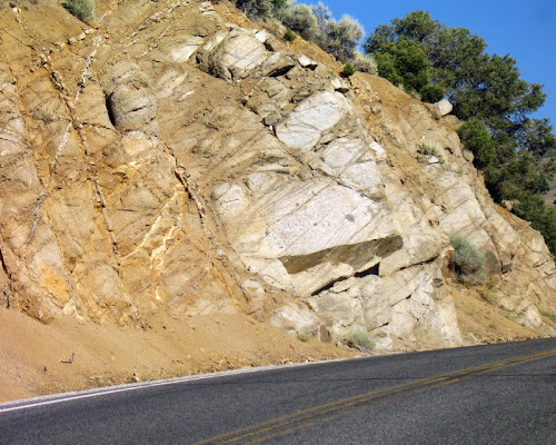
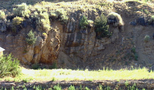
 At the very far west end of town, right about the time the speed limit is increasing on your way downhill out of town (or decreasing on your way uphill into town), you can see a small powder house in an adit dug into Jurassic quartz monzonite on the north side of the road by old-timer miners. The photo of the powder cache door looks more or less northwest and was taken while heading west out of town. If you are coming in from the west, you will probably have to pull out on the side of the road to even see this.
 Above, just uphill from the powder house, toward town and a little to the east: a nice exposure of the quartz monzonite, with its inclusions, pegmatite dikes, and a few small quartz veins. The old-timers reputedly dug on some fairly thin quartz veins for the silver they mined - I haven't knocked around in the hills much to see what the veins actually looked like.
 Above, a nice exposure right across the street (Highway 50 or Main Street) from the Pony Canyon Motel, looking north. This exposure shows several fine-grained mafic dikes in the center (dark colored and steeply dipping to the west) with some sub-parallel, light-colored, coarse-grained granitic to pegmatitic dikes. To the left of the dark-light dike zone you can see a brownish, Fe-oxide-stained zone, which is where you can find a narrow quartz vein or two with strike and dip sub-parallel to the dikes and fractures. The mafic dikes can be considered diabasic, and they look similar to Jurassic dikes at Yerington; the light-colored dike to the left of the Fe-oxide zone might be a quartz-eye porphyry.
These dikes, veins, and associated fractures all cut the highly weathered quartz monzonite that is exposed on the east and west sides of the exposure (right and left in the above photo, respectively). On the west side of this exposure, you can see that the weathered quartz monzonite is cut by numerous thin pegmatite dikelets that strike generally east-west and dip shallowly to moderately to the north, also cut by the dikes, veins, and fractures.
And, not being able to resist playing around, I've included a few One Geology overlays on Google Earth. The first one attempts to recreate the scale of the geologic map shown in an earlier post and reprinted below.

 The second just shows a nice view of Austin from the south, using a 2x vertical exaggeration as suggested by hypocentre at Hypo-Theses. The One Geology at this scale is simplified compared to the reality of chopped up, ever-widening Nevada (to quote Brian at Clastic Detritus).
 Several other geoblogospheric types have played around some with this - go to All of My Faults are Stress-Related and Sismordia - Seismology at Concordia to see a couple more examples of how to use One Geology.
Map from: NBMG Report 40 - Sediment-Hosted Precious-Metal Deposits of Northern Nevada - Road log/trip guide for SEG precious metals field trip, fall 1984, by J. V. Tingley, H. F. Bonham, Jr.
2 comments:
Those overlays on Google Earth look great! The ones I tried were really pixel-y. I guess this means that I just need to play some more!
Kim, thanks - it took a little fooling around, and although I was hoping for more detail, the overlays do look good.
At smaller scale, the U.S. geology looked pretty pixelated to me - on their website. It might be intereseting to try to make a smaller scale Nevada overlay.
Thanks for pointing out the site!
Post a Comment