 In continuing to clear out drafts and finish incomplete series or road trips, I'll take a leap back to October, 2009, when I was driving back from the annual GSA meeting in Portland. Last you knew, I was somewhere in northeastern Oregon, a mystery location replete with tipi, yurt, basalt, and larch.
From there, I took I-84 east to Twin Falls, Idaho, then went south on Highway 93 toward Jackpot, Nevada, with the full intention of making it in and out of Jarbidge, Nevada, in one day. With Jarbidge being a long way from everywhere, I didn't make it. Instead, I made it part way in, turned around, stayed in Jackpot (which I don't recommend unless you love stateline casinos, bring your own food, or both), then went in the next day. Both times, I turned off Highway 93 at Rogerson, Idaho, and went west toward the Jarbidge River across the east part of the Owyhee Plateau, south of the west-central Snake River Plain.
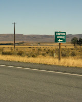
 On the way in—the first afternoon and then the next morning—I crossed over a narrow dam located here on the 3 Creek or Jarbidge Road. This is what the area looks like, from Rogerson to the drop-off into the East Fork of the Jarbidge River: generally flat with lots of basalt.
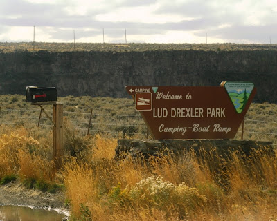
 After a slight turn in the road (previous photo), I came to the sign for Lud Drexler Park, which appears right before the one-lane passage across Salmon Falls Dam.
 This is a view to the south taken from the center of Salmon Falls Dam on Salmon Falls Creek. The dam was built across Salmon Falls Creek in 1908 to 1912 (history), creating Salmon Falls Creek Reservoir. Because of my convoluted way of approaching Jarbidge, I crossed over this dam three times. Had I known conditions in Jarbidge—they have year-round food, lodging, and gas, although calling ahead wouldn't hurt—I could have stayed there the first night.
 Looking north from the center of the dam, one sees this canyon wall made of basalt. The basalt is probably Pliocene, has been mapped as part of the Banbury Basalt, a name which is not in use everywhere. Extending units mapped in quads to the north near Twin Falls, we could be looking at either the Pliocene basalt of Hub Butte or the Pliocene basalt of Burger Butte—or some other basalt entirely.
 Unfortunately, the one-lane road over the dam is not a good place to stop and look at rocks!
 I got a good view of Salmon Falls Creek Reservoir, which can be seen south of the highway, after driving west of the dam.
 On the second day, I stopped just beyond the dam, parked, and took a closer look.
 This is the one-lane road as seen from the west side—one has to stop when crossing from either direction and carefully look for oncoming traffic.
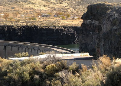
 The entire dam, as seen from the west on the second day.
 A close-up shot of water seeping out between basalt layers just below the dam.
 The shadows on the dam were great as I drove back towards Rogerson on the first day.
Some References: Digital Map of Twin Falls County, Idaho (click on Twin Falls): Digital Atlas of Idaho.
Kauffman, J. D, Othberg, K. L., Virginia S. Gillerman, and Garwood, D. L., 2005, Geologic Map of the Twin Falls 30 X 60 Minute Quadrangle, Idaho: Idaho Geological Survey, Map DWM-43, 1:100,000.
Lewis, R.E., and Young, H.W., 1989, The hydrothermal system in central Twin Falls County, Idaho: USGS Water-Resources Investigations Report 88-4152, 44p.
Othberg, K. L., Kauffman, J. D, and Virginia S. Gillerman, 2005, Geologic Map of the Twin Falls Quadrangle, Jerome and Twin Falls Counties, Idaho: Idaho Geological Survey, Map DWM-52, 1:24,000.


