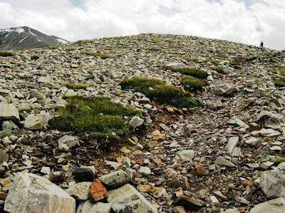
 On the last part of our Wheeler Peak trek, MOH and I had made it to about 11,600 feet, or about 300 feet below what we call "the shoulder." This section of trail, like most sections above tree line, is rocky, and when the snow is still melting, it's occasionally wet to barely muddy. Here, up ahead of me (as usual), MOH is about to crest this rise and saunter on to the shoulder.
 One great thing about the shoulder: it's the flattest thing around! I mean, it's barely uphill, and to each side, east and west, it's downhill! (Well, it's always downhill if you turn back around.) On this map, the shoulder is the distinctly flatter-than-everywhere-else ridge more or less north-northwest of the word "Foot." For a barely uphill section, however, it could be longer, in my opinion.
Views from the shoulder are generally nice to spectacular, starting with a great view of Wheeler Peak, seen in the photo above. One of the several wind shelters on this section of trail is barely in view on the left part of the photo. This is a particularly nice double shelter; we walked over and had lunch, a lunch of protein and carbohydrate bars with water, if I remember correctly.
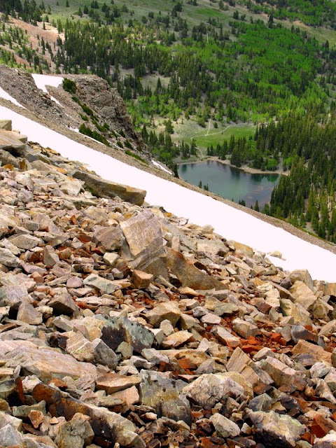
 Like I said, great views - this one looking north, with Stella Lake on the left, Teresa Lake on the right, and the northern Snake Range in the sun beyond the shaded forest. Both lakes are tarns.
 A closer view of Stella Lake.
 We arrived on the 11,900-foot shoulder at just about 2:00 pm. I dawdled around as much as possible, not sure if I was going onward. MOH was sure he was going to the summit, but I wasn't sure at all. One thing that was starting to concern both of us was the thunderstorm to the southeast. We had already experienced a little wind, but nothing like the wind for which the wind shelters were designed, which is is a wind strong enough to knock a small- to medium-sized person sideways. I say this from personal, though later than this post, experience.
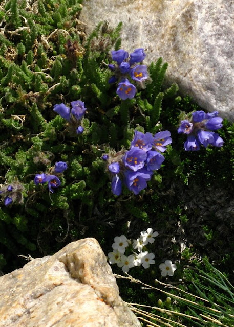
 Everywhere flowers! These are more of the skunky-scented polemonium, with some white phlox. I didn't take many flower photos at this point, figuring that I'd get them on the way down. Ha!
 By 2:25, I decided to go onward, despite the storm, which is clearly the same one darkening the skies over Wheeler Peak. MOH is just a dot beneath the storm cloud on the right. The cairn in the lower right is there to mark the trail in case of minimal to zero visibility. Many of the cairns also mark the wind shelters, which are off trail and downhill, left of the cairns when going uphill.
 MOH is about to leave the shoulder area for higher and steeper realms, and has entered the raven zone. I can't say that these ravens are here all the time, but they were out in full force on this day, using the updrafts for some great soaring. The backdrop for this picture is composed of those looming, dark and stormy clouds.
 At 2:30 pm: the trail goes upward, and varied green mats clump the ground between the quartzite rocks.
 The mats include large ones made mostly of the yellow-flowering plant (Geum rossii) we saw lower on the trail. Spring Valley and the Schell Creek Range south of Highway 50 are getting dumped on by our storm.
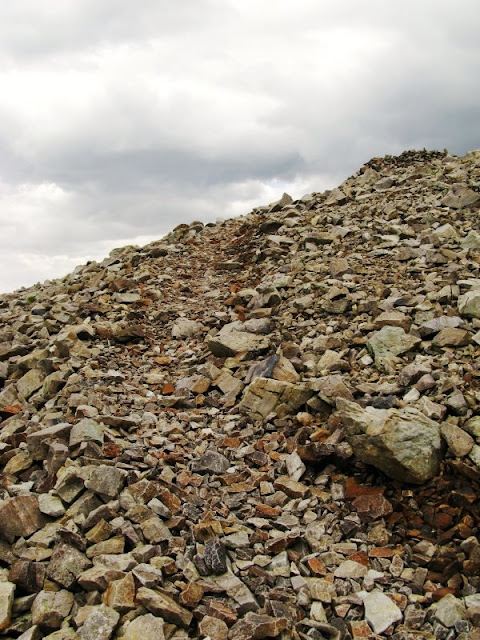
 I never said the trail wasn't steep at times, always rocky, winding to switchbacked.
 I've made it to another wind shelter. Here you can see the general build of these things: rather horseshoe shaped with the highest walls to the west to protect hikers and climbers from the wind. This one has a narrow entryway built opposite the highest part. The shelter is at about 12,000 feet.
 Rocks and rain.
 More rocks and more rain. This photo looks more or less to the southeast, into that same storm. Does it look at all threatening to you?
 At 2:35 pm and about 12,100 feet, the trail goes on. I'm still below the lower snowbank; MOH is just a dot above the right side of the lower snowbank. He's heading for the last wind shelter. The clouds are not dissipating in any way...
During this relatively short section of trail, my eyes were mostly focused on the rocky trail. More views next time!
4 comments:
oh I love the flowers in the high alpine zone! colours amongst all the rocks.
I took more flower photos on our second time up, a week after the trip this post is about. Not only were there more flowers, but it was sunnier!. It was also, somehow, windier.
Thank you for the continuing story of your adventure, and the mighty fine pictures!
Hmm... I'm trying to get to the next part of this journey, but absolutely have a few things to get done by Friday!
Post a Comment