 When we left off last time, I was at about 12,100 feet on the Wheeler Peak Summit Trail, still below the lower snow bank and the first black knob or hill. Now, about 10 minutes later at 12:45 pm, I've hiked above the lower snowbank and am climbing said black knob.
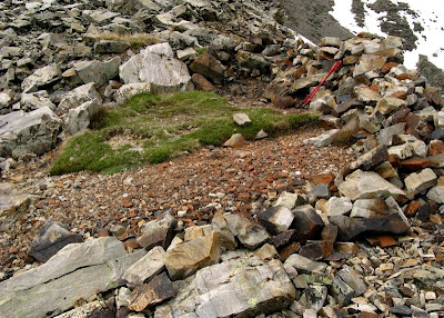
 I stop for a breather - I mean, to take some pictures of the view, including the one above with quartzite in the foreground and the northern Snake Range in the background to the northeast and in the left part of the photo. The Snake Range décollement or detachment fault, also seen here, is inconveniently in shadow.
 In fact, there are mostly shadows everywhere at this point. Looking to the northwest, I now have a clear view of that lower snowbank, along with two hikers who are ascending in shorts. (Brrr!) The rainy gap in the Schell Creek Range across Spring Valley, is Cleve Creek.
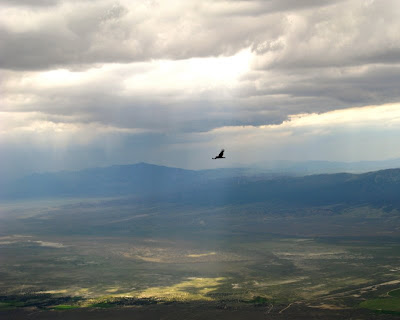
 Another raven, at 2:55 pm. See "raven zone" here.
 By this point in this little hike, elevations have become somewhat approximate - can you believe I didn't take a GPS? Well I didn't. It's now 3:00 pm, and I've climbed above part of the upper snowbank and am probably at about 12,320 feet or higher, at the top of the second black knob. [The "knobs" aren't really distinct knobs, but look that way when you are below them looking up.] By now, the two chilled hikers are above me reaching the very top of the middle snowbank, and MOH is just below the upper white rocks heading for the upper snowbank.
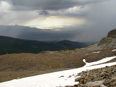
 It's really raining hard down on the alluvial fans to the northeast. That's Snake Valley beyond the rain.
 Closeup of the rain, which is pounding the hills just north of Lehman Caves.
 The view to the north at 3:05 pm, with a nice bright patch of sunlight shining on a green part of Spring Valley.
 Looking back down the trail to the west-northwest, it's now raining in the Copper Creek area of the Schell Creek Range, and also to the south where Highway 50 cuts through the mountains (far left of the photo).
 At 3:10 pm, I've made it to what I'm assured is the uppermost wind shelter, although I have no way of personally verifying that assertion. This shelter is at about 12,350 feet by my aerial photo - map - Google Earth reckoning, maybe as high as 12,365 feet.
By now it's definitely raining, though I no longer remember exactly when the rain started. I take off my daypack to get water and some protein-carb bars. And to rest.
 Here's Wheeler Peak from the upper wind shelter, looking southeast up the final part of the ridgeline.
 And Wheeler Peak again, this time looking more to the south, with the beginning of a large talus slope on the right.
 Talus slope.
 Talus slope with a storm in the background (gee, what a surprise).
 A little lower on the same talus slope.
 Here, I'm standing beyond the western edge of the wind shelter, looking down the talus slope, over a steep, rocky ledge.
 I look back up the slope. Far ahead of me, MOH is crossing the upper snowbank, headed for the summit.
 By 3:25 pm, MOH has gone beyond the upper snowbank, I have put on extra fleece along with my rain jacket and pants, and I have turned to go back down.
There are no pictures from the trip down, which was a trip of rain, wind, sideways rain, and sideways hail. Not long after starting back down, the top of the peak was socked in from clouds and rain, and visibility was rapidly deteriorating. The sideways hail stung my legs all the way to somewhere below the shoulder area, below 11,900 feet. At the shoulder area, I considered using the double wind shelter, even going so far as to walk over to it. I had to consider the cold and the real threat of hypothermia, though, and continued downward. Everytime the trail turned into the wind, I had to put a hand over my face to keep my face and eyes from being stung, even with glasses on. And I had to constantly wipe my glasses with wet wool gloves so I could see the rocks and slope in front of me. Fortunately, the wet rocks under my boots didn't seem slippery.
Amazingly, MOH made it to the top, took a verification photo, turned around, and caught up with me on the way down by the time I reached the waterfalls area at about 11,100 feet. The shorts guys made it to the top and passed us going down, not far above trail's end in the upper part of the Wheeler Peak campground. They said the sideways hail was painful, but were in good spirits.
MOH and I reached camp six to eight hours after setting out at 11:00 am.
3 comments:
What an awesome hike. And excellent captures. The hail sounds painful.
I more or less hurt one of my knees coming back down - am "resting" now! But it was a survival thing. Had to come down.
Just the opposite at the canyon. Down is optional, up is mandatory.
Got to take care of those knees.
Post a Comment