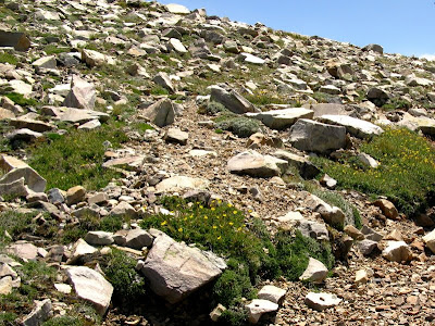
 The trail to Wheeler Peak, as it goes upward from 10,800 feet, gets into a rocky and variably tree-covered area, with intermixed Englemann spruce and limber pine that get smaller and smaller until they disappear entirely. In this area, we walked and slid over a few snow patches - snow patches that were almost completely gone one week later.
 Cones amid rocks and twigs.
 A comma butterfly poses for me on a piece of quartzite.
 In the last little bit of trees, the trail enters a long patch of running water - an ephemeral stream that disappears into the ground right in front of us. We call this entire stretch of trail "the waterfalls."
 Running water below the last stand of trees.
 Steps built into the trail become mini-waterfalls.
 The waterfall section continues upward, around the corner. It's long enough that it can't fit into any one or two photos from any angle.
 And being as how we live in the semi-arid to arid Great Basin, we are fascinated with this exhuberant display of waterflow. I take about a million and a half pictures.
 We follow the wet, running trail upward, until the stream turns off into the uppermost bushes and trees.
 Aha! Here we find the beginning of that long stream: a spring below patches of melting snow.
 We stand and stare at this phenomenon for some time, catching our breath in the thin air of this 11,100-foot elevation. One week later, all the running water at this spot was gone.
We've now gone less than half a mile and climbed about 300 feet in about a half an hour.
 From the trail just above the spring, just above the last trees, the view to the northwest and north shows a few clouds. That's Bald Mountain on the right, with Spring Valley and the Schell Creek Range in the distance.
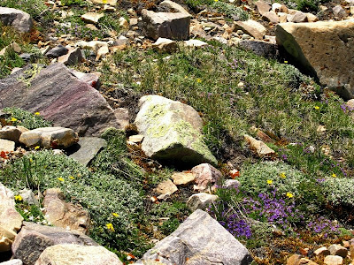
 The trail continues upwards, as trails sometimes do, and by 1:30 pm we come into large, green clumps with blooming, yellow flowers and low-growing mats of various kinds. Flower clumps and mats have been common since leaving the highest patch of trees; they seem to grow on us as we move ever upwards.
 These buttercup-like flowers are possibly Geum rossii, an alpine plant that grows to at least 12,500 feet in the Great Basin.
 Other flowers include the bluish purple Polemonium viscosum - sometimes called sticky or skunky polemonium - and mats of some kind of alpine phlox. The polemonium often makes its presence known before you see it: while walking, you will catch the distinct scent of skunk, the way we did last year on our hike to the rock glacier. If you look around, you will then find these bluish purples flowers.
 The trail goes ever upward and generally southward towards the peak.
 Finally, at about 1:45 we reach a point where we have a fairly good view of Mount Moriah and other peaks in the northern Snake Range.
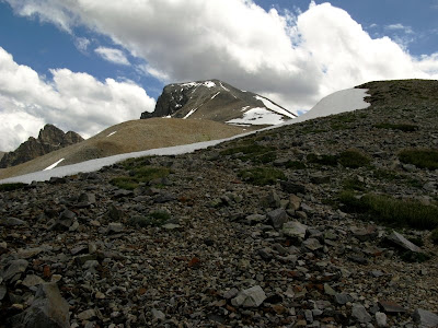
 The trail is now at about 11,600 feet, and has come to a snow bank. The trail goes into the snow, but we bypass to the right in large, non-trail rocks. We now have a view of what we call "the shoulder," that flat area in the sun, beyond the shaded foreground.
Why is the foreground in shadow? Clouds have been gathering, but so far they haven't looked very threatening.
Wheeler Peak is inside Great Basin National Park
4 comments:
Wonderful landscape and great photos (as usual)!
Thanks, HGG! Glad to hear from you.
Thank you for the grand tour. I love Great Basin NP for a lot of reasons, but I haven't had the opportunity to explore it as much as I have wanted to.
Glad you're enjoying it, Garry. I think, besides the post above this one, that I've got one more to go - although I have more photos than that, of course! :)
Post a Comment