Muncho Lake, a scanned postcard version.
Continue to the west and then north on the Alcan, beyond Folded Mountain. After stopping to view Stone Sheep (or Stone's sheep - Ovis dalli stonei) in the highway (a common site), you will come to Muncho Lake, about 36 km from the Folded Mountain turnout. Just so you remember where you started from and have some idea of where you're going, in this topo map, Folded Mountain is in the lower right, just to the left of the Nonda Creek label; Muncho Lake is prominent toward the upper left.Muncho Lake is pictured above in a scanned version of a postcard I bought somewhere, somewhen on one of my Alaska Highway travels. Again, as in one image in my last post, the postcard seems to have been taken from a hovercraft or airplane; it looks northward.
The light-colored mountainous area, seen to the right (east) of Muncho Lake, is the Sentinel Range, part of the northern Canadian Rocky Mountains. The range continues a little to the north, just out of the postcard picture. I think it ends to the south at the Toad River and the Alaska Highway, although the geology and structure making up the Sentinel Range continues southward beyond the ToadRiver-road line of demarcation.
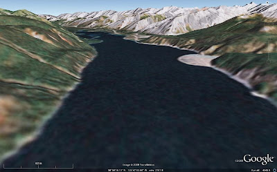
 Above, I've more or less duplicated the postcard view of Muncho Lake with an image from Google Earth. We will be zooming in on a portion of the range front below, in a Google Earth view looking north from a height of about 472 ft (144 m) above ground level (I forgot to switch to meters in my new Google Earth version 5 right away!). The closeup focuses in on the third of several triangular-shaped mountain faces above, and it shows most of the second face in the foreground and part of the fourth face (and beyond) in the background.
 These triangular-shaped range faces are dip slopes, with the carbonate beds dipping almost entirely parallel to the faces. These shapes could be called triangular facets, though they are not strictly fault-caused - nor are they the result of truncated spurs - and they are reminiscent of the flatirons along the Rocky Mountain range front in Boulder, CO, though bedding there dips eastward, and bedding above dips westward. Locally, these shapes in the Sentinel Range are called sawteeth. [If there is a better geomorphic or descriptive term for these triangular shapes than what I've used here, I wouldn't mind some input!]
 This photo, taken in 1996 from the north end of Muncho Lake, duplicates the Google Earth image above (or the other way around), and shows the beds dipping parallel to the range front slope. The drawing below highlights the bedding.
 So, from Folded Mountain, here, we've gone to this northern end of Muncho Lake, here, and are centered in on the triangular part of the range front at the very north end of the lake, here.
No comments:
Post a Comment