Tuesday, September 30, 2008

One Year Ago Today: Fall


These photos were taken last year in the Duck Creek Range and southern Schell Creek Range of eastern Nevada. This year, the trees seem to be changing color slowly, more slowly than last year. The aspens on Austin Summit, for example, were green just a few days ago. So I don't expect to find very good examples of our local Nevada color before my next days off, maybe some distant ones. For other inspiring autumn photos see Wayfarer Scientista (Colorado, I think) and Apparent Dip (Alaska).

Monday, September 29, 2008

Alaskan Turbidites

This post is mostly an excuse to show some turbidite photos, turbidtites obliquely mentioned much earlier. The best turbidite photos I've seen are Brian's at Clastic Detritus - like these.

The above photo shows the famous Alaska Turbidite Locality, located on Alaska Route 1 between Mileposts 104 and 105, about 23 miles southeast of Anchorage on the way to Girdwood and points beyond. The photo is taken from the Girdwood side of the roadcut, looking in a northwesterly direction, more or less towards Anchorage.

The location of the next two photos is the in the cliff area above the two dark vehicles that are in front of the red truck and past the leftward turn in the road. The location of the last four roadcut photos is in the cliff area above or to the right of the white vehicle that is between the closest turn and the far, righward turn (past the two dark vehicles).

Parking can be seen on the immediate right side of the road. Parking is tight; use caution. I walked on the outside of the guardrail to get to the roadcut, and then carefully ran across the road when no one was coming - you may have to wait awhile, especially on weekends. Also, there may be parking on the Anchorage side of the roadcut; I didn't, however, check that out.

Turbidites! The cliff above is about 50 to 60 feet high. It exposes turbites of the Cretaceous Valdez Formation or Valedez Group (somewhere between about 146 and 66 million years old).
Above, a somewhat closer view of the same cliff. In general, the dark gray layers are finer grained, composed of sandy to silty mudstone, and the light gray layers are coarser grained, composed of dirty, silty sandstone. The alternating patterns create a banded look typical of turbidites. These are not varves, so each light-dark couplet can't be counted as one year - it counts as one turbidite episode.

The rocks in the cliff show all kinds of sedimentary structures, including soft-sediment deformation, ripple cross-lamination, graded bedding, and rip-up clasts. Non-sedimentary structures include some faults and a pervasive high-angle metamorphic foliation.

Unfortunately, I haven't examined this roadcut in any detail for a number of years. Cars and trucks were whizzing past, and the lighting was poor - dark and cloudy. Some of the best examples of sedimentary structures require more time to find than I had time for (if you can believe that! - but we had dates with fish to keep, remember!). The roadcut is a fun place to stop, however, even if only for a moment or two.

A bit of geologic history: The turbidites in the Valdez Formation formed when submarine slumps and slides, set off by earthquakes along a paleo-subduction zone, flowed along the sea floor carrying sand and mud. Currently, the Alaska subduction zone is off to the east and southeast in the Gulf of Alaska.

The Valdez Group rocks were probably not anywhere near Alaska when they were forming. Some notes of mine from a 1997 field trip suggest they formed at about 40 degrees north latitude, and were moved north by strike-slip faulting along the coast of North America. They have since been uplifted along the Border Ranges fault, which runs along the western base of the Chugach Mountains, and which separates the Wrangellia terrane on the west from the Chugach terrane on the east.

The Google Earth - One Geology image above shows the Chugach terrane in green, with Girdwood smack dab in the middle. To the west of that, the Wrangellia terrane is shown in light yellow. Another terrane or group of rocks is shown to the east of the Chugach terrane in bright yellow. The present Alaska subduction zone is approximately located between the dark blue water and the deeper water shown in a funky purple. The terrane boundaries curve eastward, somewhat parallel to the curve of the Alaska subduction zone. Active volcanoes created by the subduction zone also curve crudely to the east (although to the north of the above image). The Border Ranges fault, an active fault with movement and an earthquake as recent as 1997, runs along the west side of the green Chugach Mountains terrane.

The Chugach terrane is an accretionary wedge, prism, or complex. South-central Alaska is made up largely of several accreted terranes with complex geologic history. I really can't pretend to be up on the details - I took a class at UAA in 1997 and went on a few field trips. Things have probably changed some since then, at least interpretationally speaking!

This Google Earth - One Geology image has been rotated to look straight down the Chugach terrane from northeast of Anchorage, toward Girdwood, and to the Homer spit and Kodiak Island beyond. The turbidite roadcut is just a little west, or right of, the yellow pin marking Girdwood.

Back to the roadcut:

The above photo was taken from the other side of the road, outside the guardrail. The cliff in this part of the roadcut is about 20 feet high, with its base just below road level - there's a dip between the road and the cliff that you can't see from this angle. This photo, and the photos below, show some of the features I was looking for, but the cliff is steep and hard to climb around on!
Above: metamorphic foliation cutting across the turbidite beds. The foliation has been interpreted as indicating top-to-the-right motion, which is more or less to the east or southeast, and the top-to-the-right motion has been taken up somewhat by little bedding plane slips, which are hard to see.These last two photos show me pointing to some beds just above the white flowers that were seen in the lower left of the previous photo.
Turbidite flow direction is to the right in these photos, perhaps best indicated by the upper part of the lower light-colored sand layer - the one that makes it all the way across the photo from the lower left corner to about a third of the way up on the right side. The finger, for scale, is pointing to a thin white layer that may show the same thing.

Comments are welcome - maybe you can spot some things in these photos that I haven't! For lots and lots about turbidites, go see these posts at Clastic Detritus.

Sunday, September 28, 2008

Putting in at Deep Creek: AK2008 Day 3

canal The day started out as a typical Kenai Peninsula day at the cabin, with clouds hanging over the access canal to the river, and the sun tyring to push through. The sun didn't make it, though: it sprinkled off and on, and temperatures stayed between 50 and 60 degrees F through the day.
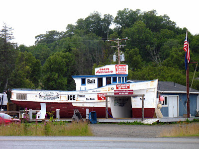
bait We made our way down the Sterling Highway, past Ninilchik, to Deep Creek, having some time to stop and look at typical Alaskan scenery.
sign
office We arrived at Deep Creek, the upper part where the offices are, went inside and paid for our soon-to-be halibut charter.
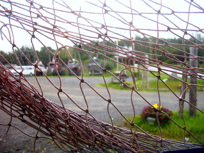
view Above: a view from inside looking out toward the Sterling highway, with various blurry halibut boats across the parking lot.
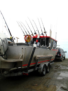
tilt Ah, and there's our halibut boat: Tilt II !
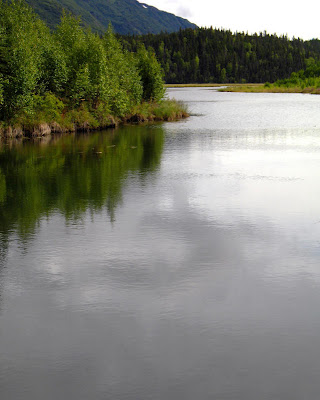
lighthouseAbove: a dark and cloudy view, looking north across Deep Creek to the sea-cliff and Cook Inlet beyond. The weather is such that you can hardly tell sky from water; in fact, I think that it's easier to see the horizon in the photo than it was in real life. The lighthouse on the cliff may be a residence rather than a lighthouse: I couldn't find any info about it in lighthouse listings.
shore Our halibut boat again, now down on the beach. And no, that truck or SUV isn't going to pull the boat into the water!
towed Instead, a John Deere tractor will, first pulling us towards shore, then turning around on the beach...
water ...in order to back us into the brackish waters of Cook Inlet.
inlet And hey, that's how we probably looked from the shore: a smallish halibut boat heading southwest toward deep water.

Saturday, September 27, 2008

Honey Lake Update and Other Water News


Photo taken September 24, 2008 looking east.

Photo taken September 22, 2007 looking east.

These photos were all taken from the same place: the Honey Lake Rest Area on Highway 395, betwen Milford and Janesville, two small towns southeast of Susanville, California, and north of Reno, Nevada. The lower two photos show nearly the same view, with the last photo taken almost exactly one year earlier than the upper two photos. Besides the slightly different weather, warm and sunny last week and slightly cooler with clouds a year ago, the upper photo shows no water in the lake while the lower photo shows water.

In the most recent photos, Honey Lake looks brown to dark brown and muddy. At the rest stop and while driving by, I could see water way out on the east side of the lake, in the eastern arm: the lake is by no means completely dry. I'm hoping, also, that water is being maintained in the wetlands in the Honey Lake Wildlife Area, though I haven't been out that-a-way for more than a year. It's a great place to spot birds, in case you are ever driving through the area.

As I mentioned in an earlier post, this lowering of the lake level might have something to do with Washoe County's water project to import water from the Honey Lake Valley. It might, however, just be a dry year - other lakes in northern California are at low levels, levels I haven't seen for about 5 years or more - and water from the Fish Springs Ranch probably didn't start flowing to Reno's north valleys until sometime in August.

ChrisM of Pools and Riffles, was concerned about how the Fish Springs Ranch project might affect the recently signed Truckee River Operating Agreement (TROA), which was finally signed by all parties on September 6, although the plan was already in place via an interim agreement signed several years ago. It's possible that the Fish Springs Ranch project may have helped with the TROA by relieving water demands on Reno area wells, thus making it easier to send water down the river to Pyramid Lake. That last bit, however, is just a speculation on my part.

The TROA still has to be approved in federal court. An excellent timeline showing the history of this agreement is presented here by RGJ.com.

Eric of The Dynamic Earth mentioned in the comments of my previous post that he thought Las Vegas had recently bought a desalination plant for Los Angeles. I looked into desalination a little bit, and found quite a number of interesting links.

Desalination for Las Vegas, with a plant being located somewhere on the coast of southern California, was mentioned by Nevada Governor Jim Gibbons in April, although I couldn't find any reference to Nevada actually getting very far with this idea.

Desalination is being seriously considered in southern California and northern California, and one plant located near Oceanside, California - Poseidon's plant in Carlsbad - received approval in early August to begin construction. Santa Barbara is considering re-opening their moth-balled desalination plant, a plant that has been non-operational since 1992.

Desalination can have some environmental problems; the Carlsbad plant will be required to create 55.4 acres of marine habitat to make up for marine habitat loss during operation. Somehow, that area seems small to me, but I'm not sure what the re-habitation project actually encompasses. Also, the Carlsbad plant will test a new pump that's designed to use less energy in pumping the huge amount of water needed. Energy use for desalination is one of the environmental problems; it's equally one of the economic problems.

A few desalination facts from UNESCO, as of May, 2008:
  • In 2002 there were about 12,500 desalination plants around the world in 120 countries. They produce some 14 million m²/day of freshwater, which is less than 1% of total world consumption.

  • The most important users of desalinated water are in the Middle East, (mainly Saudi Arabia, Kuwait, the United Arab Emirates, Qatar and Bahrain), which uses about 70% of worldwide capacity; and in North Africa (mainly Libya and Algeria), which uses about 6% of worldwide capacity.

  • Among industrialized countries, the United States is one of the most important users of desalinated water (6.5%), especially in California and parts of Florida [although other references implied that very little desalination is actually underway in California].

Friday, September 26, 2008

Friday Fault Photos #4

As you drive east on Highway 50 through central Nevada, between Fallon and Austin, you will eventually have to cross the Desatoya Mountains, and you will do so in a narrow canyon called New Pass, which leads up to New Pass Summit. A couple short miles after entering the canyon you will come upon this magnificent, hoodoo-like roadcut exposure of a fault. As you can see, it's located just a bit east of Churchill County Milepost 104.
Here's a view from just a little bit closer. The top of the hoodoo, from the ground up, is about 20-30 feet high. Don't be afraid! Just because it's hoodoo-like doesn't mean it will bite you! In the above photo you can see a fairly sharp fault plane, a white line that appears to bisect that lonely pinon tree.
The fault dips moderately steeply away from the road and toward the tree (northeasterly), and the fault plane strikes sub-parallel to the road (about northwesterly). The hangingwall - the side to the left above the fault plane - is composed of light-colored, almost white ash-flow tuff; the footwall - the side to the right below the fault plane - is composed of dark greenish or green-stained rock. The rock really is a kind of yucky green.
Now, just drive around until you find a place to park, and walk up to the fault, which is seen in the photo above from the other side.
The white hangingwall tuff, this time on the right side, has been fractured with joints parallel and perpendicular to the fault. The green footwall rock is brecciated, with the breccia composed of pieces of ash-flow tuff. All the ash-flow tuff in this canyon is supposed to be New Pass Tuff, which is about 22 million years old, or early Miocene.
Above, a close-up of the footwall breccia.
While you are standing there, you will be able to follow the fault down to ground level, as seen above, by following the color contrast between the light-colored hangingwall and the greenish footwall. As the fault approaches the roadside ground level, the footwall breccia becomes a little more chaotic and sheared looking.

References:
NBMG Report 40 - Sediment-Hosted Precious-Metal Deposits of Northern Nevada - Road log/trip guide for SEG precious metals field trip, fall 1984, by J. V. Tingley, H. F. Bonham, Jr.
NBMG Bulletin 88 - Geology and mineral deposits of Lander County, Nevada; Part I, Geology, by John H. Stewart and Edwin H. McKee, Part II, Mineral deposits, by Harold K. Stager, 1977.

Location:


View Larger Map

Translation Widget

Callan Bentley at NOVA Geoblog has just recently given a paper on the Rise of the GeoBlogoSphere (GBS), a paper based in large part on a recent survey he asked Geobloggers to take.

Much of the GBS is composed of English-speaking bloggers, or bloggers from other countries who are, nevertheless, blogging in English, like The Lost Geologist. I have noticed, however, that there are several Spanish geo-blogs, a number of German geo-blogs, and a few other geo-blogs in other languages. I have wanted on several occasions to read some of these blogs, and although I am somewhat familiar with Spanish, my Spanish is very rusty, and I especially have a hard time following anything written with scientific and geologic terminology.

Consequently, I have added a translation widget to my site, in order to help facilitate the reading of this blog in other languages. It seems to work alright; I don't know how good the translations are. I especially have no idea how good the translation into 'Russian beta' is. With this widget, after clicking on a flag of your choice, the translated page opens in another web-browser page (in IE7, anyway). It translates linked-to pages (sometimes slowly), translates comments, and translates most of what's in the sidebar of this blog.

For example, in Spanish, Christie at the Cape becomes Christie en el Cabo, Geology Happens becomes Geologia Pasa, Hindered Settling becomes Obstaculizado Resolución de Conflictos, and Looking for Detachment becomes Buscan Descatamento. Comments in the sidebar are not translated, and neither are the words in my label cloud or the titles and articles in the Allgeo feed. A couple sidebar widgets don't work in the translated web page, and the World Visitors Map and popular posts widgets show a very low number of hits for some reason.

I got the widget from this Blogger Accessories post, using the Java/html code in the upper part of the post, which I pasted into the widget part of my sidebar without any alteration of code. I had earlier tried some code from another help site first, but that code either didn't work or needed a lot of modification, which I didn't want to bother with, especially since the comments were indicating that it might not work. If anyone notices any problems, please let me know.

Now, if some Spanish, German, and other geoblog sites would add translation options to their sites, I'll have even more to read!

Thursday, September 25, 2008

Mining in the Asteroid Belt: Accretionary Wedge #13

Space: the next frontier (final?)

This month's Accretionary Wedge is all about "Geologeeeeee in Spaaaaaaaace," as Chris over at goodSchist pronounces it!

I got to thinking about mining in spaaaace, and found some interesting links that have to do with mining meteorites on earth, and some results of meteor impacts.

But first off, mining in space - in the asteroid belt or anywhere else - is not likely to happen anytime soon, IMO. Numerous people, however, have been looking into it, perhaps at least as long as we have been actively exploring space, beginning with our 1960's race to the moon.

Asteroids are small metallic to rocky bodies in our solar system that are too small to be considered planets. That definition is a little fuzzy, as we have found out recently with the de-classification of Pluto from a planet to, well, a dwarf planet, which is something between an asteroid and a planet in size.

The main grouping of asteroids occurs in the asteroid belt between Mars and Jupiter. These asteroids are thought to be what's left of primordial or proto-planetary matter that did not form a planet because of interference by the large gravitational field of nearby Jupiter. Asteroids also occur in Jupiter's Lagrange points; these asteroids are known as Trojans. Finally, there are asteroids that approach relatively close to Earth, and they are called Near Earth Asteroids (NEA's).

Asteroids can also be classified by composition. The classification of asteroids into C-type, S-type, and M-type, along with several other minor types, is based on the study of meteors that enter earth's orbit and then survive as on-the-ground meteorites. Chris at goodSchist describes in detail one of the C-type asteroids, Ivuna, and Geology Happens has some info about asteroid impacts and the craters they form.

Asteroid mining, as I mentioned, was the first type of mining that came to my mind when I thought of mining in space. The several different kinds of asteroids have potentially many different kinds of minerals or elements that a reasonable miner might want to go after in space. These elements include gold and platinum, aluminum, magnesium, nickel, cobalt, platinum, and titanium, aluminium, gold, silver, zinc and other base and precious metals, and a whole host of resources depending on asteroid type:
C, D, P: H2O, CO2, CH4
B, G, F: nickel and iron
Q, S, M: nickel, iron, silicates, and platinum group elements

Apparently - and probably not surprisingly - the Near Earth Asteroids have been voted "most likely to be mined" by those doing initial feasibility studies. C-type asteroids are favored by some, not only for their iron, aluminum, magnesium, nickel, cobalt, and platinum, but also for other commodities and mineral sources such as ice, hydrocarbons, graphite, silicates, sulfides and sulfates, nitrates, and carbonates. The current feasibility and accuracy of these plans and ideas is beyond the scope of this little blog article!

Meteorite impacts on earth have led to some interesting mining speculation, the foremost of which started after G. K. Gilbert, in the 1890's, decided that the Barringer Meteor Crater in Arizona was caused by an underground steam explosion - because he could find no meteor-impact evidence, such as an intact meteorite. In 1902, Daniel Moreau Barringer, an American mining engineer, decided that the crater, which he recognized as a meteorite impact crater, had great iron and nickel mining potential, if only the meteorite that had created the crater could be found. He drilled the area for twenty years without finding what he was looking for, at the same time finding geologic evidence that eventually led to the acceptance of the site as an impact crater.

Others have occasionally proposed exploring for impact sites as a way to find certain metals and commodities, such as gold, platinum, and diamonds. It's not clear to me whether these are viable exploration models, or whether they are, in large part, based on the fact that the Sudbury mining district in Canada, a large source of nickel, copper, cobalt, and platinum group elements, is the site of a huge meteorite impact that occurred 1.8 billion years ago. The metals in the 30 x 60 km Sudbury basin are not currently thought to have come from the meteorite, but from the earth itself. The story of the Sudbury impact and resulting melting of the earth's crust can be read about here, here, and here. From Naldrett, 2003:

...there is a growing body of isotopic evidence that the complex is an impact melt that incorporated Ni-, Cu-, and PGE–bearing mafic and/or ultramafic rocks that were already present in the target area (Keays and Lightfoot, 1999; Cohen et al., 2000).

In other space-mining news, mining on the moon may succeed sooner than asteroid mining, if NASA builds its moon base, and if mining Helium-3 for fusion-generated energy proves worthwhile. The most recent moon-base proposal, however, doesn't seem to require any off-world mining.

A Few References:

Cohen, A.S., Burnham, O.M., Hawkesworth, C.J., Lightfoot, P.C., 2000, Pre-emplacement Re-Os ages from ultramafic inclusions in the Sublayer of the Sudbury Igneous Complex, Ontario: Chemical Geology, v. 165, p. 37–46.

Keays, R.R., Lightfoot, P.C., 1999, The role of meteorite impact, source rocks, protores and mafic magmas in the genesis of the Sudbury Ni-Cu-PGE sulfide ore deposits, in Keays, R.R., et al., eds., Dynamic processes in magmatic ore deposits and their application in mineral exploration: Geological Association of Canada, Short Course Notes, v. 13, p. 329–366.

Naldrett, A. J., 2003, From Impact to Riches: Evolution of Geological Understanding as Seen at Sudbury, Canada: Geological Society of America, GSA Today, vol. 13, issue 2, p. 4-9.

Accretionary Wedge #13: Geology in Space

Tuesday, September 23, 2008

One Year Ago Today: Honey Lake

One year ago today (yesterday, actually, because my internet connection went down in the middle of this post), there was water in Honey Lake. See that light brown, barely reflective stuff way out there? That's water, not a playa.

A couple days ago, driving through the same valley, there appeared to be only minimal, if any, water. In fact, all I noticed was a dark brown area where the now-dry lake bed was damp or muddy. No pictures, though. Maybe there was some water way out on the east side of the lake. I'll have to check on this again - I can't find an online water level site for the lake.

Northern Nevada (Reno) is stealing importing some of northern California's water, although reports say this *shouldn't* affect the groundwater in the Honey Lake Valley. It's called the Fish Springs Ranch Water Project.

L.A. should desalinate, thus easing much southern pressure on northern water. I don't know what it would do for Reno, though. Maybe L.A. could sell water north, thereby making a little money for themselves!

Yeah, Sure!

How long could you survive in the vacuum of space?
Well, maybe...

This is not for the Accretionary Wedge on spaaaaaccee... hosted by Chris at Good Schist, unless I run out of tiiiiiimme...

Monday, September 22, 2008

And Even Another GeoBlog

Here's another geoblog, written by a self-described "geology person" - whose main interest, according to his profile, is rocks.

The blog is Outside The Interzone, by Lockwood. In one post, while speaking about Deep Time (geologic time), he says:
As a geology person, one learns, in a symbolic way at least, to contemplate the world from completely different time scales. Mostly longer and slower, but sometimes, as with volcanic explosions, meteorites and other fast, energetic events, you need to be able to consider the world on time scales shorter and faster than human experience can really register. It's a joy of the discipline, to look for consistency across scales of time and space, that most people never have the opportunity to perceive- to their great loss.
Check it out!

Sunday, September 21, 2008

Summit Lake and Beyond: AK2008 Day 2

lodge We arrived at Summit Lake Lodge, which is for sale in case you are interested, in time for a slightly late lunch.
paws A friendly bear greeted us...
tables...so we went on in, found a place, and sat down. Summit Lake Lodge has good food, good beer, a good atmosphere, and a good view.
view Sometimes it's worth stopping at the gift shop at the south end of the parking lot - to get milkshakes, espresso, T-shirts, or other gift-type items.
shakes

lakeAfter lunch, we headed south on Alaska Route 1 to Tern Lake, where the Seward Highway continues south to Seward as Route 9, and the Sterling Highway continues west towards Sterling, Soldotna, Kenai, and Homer as Route 1. Tern Lake is a great place to stop to see wildlife, to stretch your legs, and to get a good view of more mountains and another great U-shaped glacial valley, seen above looking southeast towards Moose Pass.
graywackeAs you drive away from Tern Lake, to the west and back toward the Sterling Highway, you'll have ample opportunities to stop and examine several metagrawacke roadcuts like the one above, which is cut by a network of quartz veins. In fact, you can't miss seeing the slaty graywacke, even if you don't stop at Tern Lake - there are several good collecting places here and there near the triangular junction of the Sterling and Seward highways.
creekSuddenly, the parental driver (my dad) took a sharp left turn, and we headed into the woods toward the Tern Lake campground. fishiesA short walk from a little pullout on the dirt road before the camp will take you to Dave's Creek, a good place to view spawned out red salmon.
fishThe red salmon, or sockeyes, are still hanging around, some going barely going upstream, most barely holding their own against the current.
creek Above, the photo looks back toward Tern Lake at the head of Dave's Creek. Downstream and to the west, Dave's Creek joins Quartz Creek and empties into Kenai Lake near Cooper Landing. It's amazing: all these lakes have creeks and rivers going into them and out of them, and all of them eventually empty into the ocean! (Well, maybe I've been in the Great Basin too long - actually thinking that lakes and oceanward drainage are amazing.)

road The road goes on, pointing more-or-less toward Redoubt Volcano, which can't be seen through the clouds on this particular day.
cabin Finally, then, we found the right turn-off from the Sterling Highway, and we made our way on pavement and the dirt to the cabin - seen above in an earlier rendition before it was lifted off the ground after the September 1995 flood, which occurred not long after the painting of this strange picture.
flood