Saturday, February 28, 2009

One Year Ago Today: Blogger-versary

Actually, it was one year ago on February 29th, during a leap year, that I started massively transferring all blog posts to this LFD site at Blogger. The mostly young site, with start-of-blogging-for-real anniversary noted earlier, had been located elsewhere, an elsewhere that hardly exists anymore.

shirtT-shirt seen on the back of a random (former) Oregonian.

For the record, Oregon is pronounced ORY-gun (or OR-ih-gun), not Ory-GONE - as in gone, bye bye - and not OR-gun, either, leaving out the 'ih' or 'ee' part of ORY. I say this as a non-random (former) Oregonian, the daughter of 2 Oregonians, the grandaughter of 4 Oregonians, back until the begining of the Oregon trail. I.e., I'm a westerner, if you hadn't noticed.

For that earlier anniversary, I was taken to task (just a bit) for showing a picture of an average to below average (read: latter) beer. Given that there will be several more blogiversaries in the geoblogosphere coming up during the next year (and a recent one at Dave Schumaker's Geology News - it was he who took me to task, by the way) - I'd like to recommend a Better Beer with which to celebrate. And it's a geological beer, to boot!
beerYes, it's Stone IPA, a decent to good India Pale Ale. Yay for IPA's! See this review by Geology Joe at SlingShot Thought for more details on the beer.

Wedge Up at Geotripper!

The Accretionary Wedge for February is up over at Geotripper! Go check it out - lots of geological places to see around the world, including your own backyard.

Check it out!

Friday, February 27, 2009

Friday from the Road: West Gate Windmill

It's been a few weeks since I left you on the road, arriving at West Gate, that notch in the mountains just a little bit west of Middlegate Station, so I thought I'd better get back to you, so you won't feel stranded.
part The main thing about West Gate, besides the notch cut conveniently through the Clan Alpine Mountains so Highway 50 could pass through, is the windmill.
all A full view of the windmill, as seen from behind a fence and gate, looking northwest.
top The top of the windmill, the part that spins round and round whenever the wind blows - which it does quite often.
pump The bottom part of the windmill: the center rod moves up and down, pumping water out of the ground.
ice A little water leaks around the bottom, freezing into ice in winter.
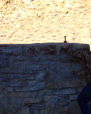
gate The water goes by metal pipe along the ground and then upward into this water tank built of rocks and concrete. The pipe can barely be seen behind the large fence post, near the top of the squarish water tank.
climb Now, being the good investigative sorts that we are, we'll climb the rock wall and peer into the tank.
water Water! In the desert! This windmill used to run most of the time, but it seems to have been off for a while in some recent years. In summer, a nice water tank full of water can be a great thing to find out in the middle of nowhere - especially after a hot day of field work - although I'd hesitate climbing in this one because it's right along the highway.

I crudely calculated that I've passed through West Gate at least 200 times during the past 3 decades. I'm wondering if it's more than that - the number seems low to me, but maybe not! There was some hope of me keeping track of the actual number had I tried counting sometime in the 1980's, but it's too late now for more than just a crude estimate.

And right about when this posts, I'll be passing through again, on the first leg of another journey to Alaska. We'll be at the Iditarod when it starts up (did I mention that yet?) - see countdown widget on the sidebar, right above an Anchorage temperature indicator. Posting may be light to non-existent, although I have some pre-posts ready to go.

Thursday, February 26, 2009

Before and After


Well, before, anyway. These photos show my truck with the red mine flag and green blinking light (on top of the cab) that I had while on my last consulting job. Now, the flag and blinkie light are gone, having been returned to the mine from whence they came.

It might be like when you carry an umbrella and then it doesn't rain? (In Nevada, you can almost always keep rain away by carrying an umbrella, because it routinely doesn't rain here.) Now that I've turned these things back in, the next thing you know they'll be calling me up to come back! It's always possible, though I'm not counting on it. Check out the current price of copper, though: holding steady at above $1.50. A good sign? Who knows?

Truck photos were shot at a good cell phone reception area in a sometimes muddy pullout near Salt Wells, Nevada - between Sand Mountain and Fallon - winter, 2008. "After" photos would look similar, but without red mine flag, green light, or orange parking sticker hanging from the rearview mirror.

Wednesday, February 25, 2009

Desert Shadows

For this month's Carnival of the Arid, hosted once again by Chris Clarke at Coyote Crossing, I thought I'd try to illustrate why I fell in love with Nevada and its so-called desert. Instead of explaining how it is I came to love this desert, I'm just going to show a few pictures. All but one of these photos were taken while driving Highway 50 through central Nevada; one was taken about 40 miles south of Highway 50.
chalk

Chalk Mountain from the south.


desatoya

West side of the Desatoya Mountains.


newark

Newark Valley, looking west.


northumberland

East Northumberland Canyon, looking east.


reese

Reese River Valley, looking west.


desatoya

West side of the Desatoya Mountains.


antelope

Antelope Valley and Antelope Range, looking south.


smoky

Big Smoky Valley looking north from Spencer's Hot Springs.


fairview

The west side of Fairview Peak, looking south.


chalk

Chalk Mountain from the south side, different lighting.


Some portions of the Basin and Range of Nevada are technically desert or arid, other portions are technically steppe or semi-arid -- although people argue about these definitions all the time, and I won't go into that right now.

Tuesday, February 24, 2009

Two Years Ago Today: Frozen Waterfall

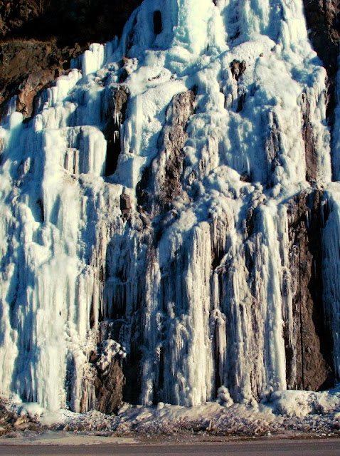
frozen Two years ago today, I was in a car with my parents and MOH, and we were driving down the Seward Highway toward the Kenai Peninsula. We drove by this frozen waterfall, which is located right on the highway, in Turnagain Arm, not very far west of Beluga Point, somewhere between Mile 117 and Mile 110 on Alaska 1. It's always frozen, this time of year.

We were heading down to the cabin, a place I like to go in winter, partly to see the frozen river, partly because it can be much colder on the peninsula than in Anchorage, and partly because it's just so different than it is during the summer.
cabin The cabin area in too much snow to drive to the front door.
temp Relatively decent temperatures for the middle of winter.
river A low but not very frozen river. Note the bald eagle in the highest tree straight across the river (click to enlarge); it's just a little dot near the top of the tree.

The pump was frozen so we didn't stay. This year we probably won't even go. The view is always stunning; and U-shaped, glacially carved valleys abound.

Monday, February 23, 2009

Places for a Geologist to Visit

In a continuation of a meme event that took place in the GeoBlogosphere late last year, Garry Hayes is hosting the current Accretionary Wedge - February, #16 - at his site, Geotripper:
What are the places and events that you think should all geologists should see and experience before they die? What are the places you know and love that best exemplify geological principles and processes?
Rather than create a new list of 100, or even 25, I thought I'd just mention a few places not on the original list, that I think should be considered.
SnakeR

Snake Range, Nevada: a place to collect mylonites.

1. See a metamorphic core complex - metamorphic core complexes are common in a belt in North America, from British Columbia south into Mexico, and also occur in other places in the world, including Slovakia, Greece, Turkey, Iran, Tibet, China, and New Zealand. One should see a metamorphic core complex, preferably as part of a tour or field trip, just so one can get involved in the lively discussions about how they form, but also in order to see and collect wonderful samples of mylonites!

2. While in Tibet, check out the Tibetan Plateau - just because it's there. It's the "largest, highest area in the world today" - and it was created by a magnificent convergence of two continental plates.

3. While in China, be sure to see the South China Karst, which is now a UNESCO World Heritage Site, and which contains some unusual rock formations formed by dissolution and re-precipitation of limestone: Guizhou Libo Karst, Yunnan Shilin Karst, and Chongqing Wulong Karst. I don't know of other similarly magnificent regions of karst that could replace this one.

Those are my three additions or suggestions. I have seen number one: several metamorphic core complexes in the western United States.

Accretionary Wedge #16: Is One Life Enough?

Sunday, February 22, 2009

TGIMT: Meme Time

Just when my content and photo posts were starting to drive me nuts - a new meme!! Yay! Seen at Outside the Interzone: Thanks, Lockwood. He states: "The origin of this list is here (with discussion and nice photos) via Swans On Tea." WARNING: This is another one of those 100% U.S.-centric memes. I personally have been to zero falls outside the U.S. and Canada.

You all know what to do: "Bold the ones you've visited, add comments as desired, and as a bonus, add a personal favorite that's not on the list, and that you think other waterfall enthusiasts would enjoy."

This meme counts backwards, from #10 to #1. If you make it to the end, Lockwood added a bonus falls, which I haven't been to. I should add some waterfall on the Alcan, let me think about it a minute... Oh, not to keep you waiting, or anything! (P.S. I'm just sure Callan Bentley has been to all but one or two of these!)

#10 Lower Calf Creek Falls, Escalante National Monument, Utah

#9 Lower Falls of the Yellowstone River, Yellowstone National Park, Wyoming

#8 Upper Whitewater Falls, in southwestern North Carolina

#7 Snoqualmie Falls, between Snoqualmie and Fall City, Washington - have I been there? Maybe. Do I remember it? No.

#6 Havasu Falls, Supai Village, Havasupai Indian Reservation, Grand Canyon, Arizona [Been to Lava Falls, however; I know, not the same!]

#5 Shoshone Falls, Twin Falls, Idaho [Ooh, a pretty one that I haven't been to, yet.]

#4 Multnomah Falls, Columbia River Gorge, Oregon [My absolute favorite falls in the whole world - I've been to the bottom millions of times, to the top once. It's a family falls, I think.]

#3 Bridalveil Falls, Yosemite National Park, California [What about Yosemite Falls, Vernal Falls, Staircase Falls, all the other ones in Yosemite?]

#2 McWay Falls in Julia Pfeiffer Burns State Park, Big Sur, California [Hmm... check this one out; it's only on the list because it supposedly is the only waterfalls in the U.S. falling directly into the ocean.]

#1 Niagara Falls, Niagara, New York

Bonus Waterfall: Salt Creek Falls, Oregon [via Lockwood]
Bonus Waterfall: Palouse Falls, eastern Washington [via me] - a remnant of the floods that created the Channeled Scablands. Picture and some info here.
[I don't think you have to keep adding to the list, here, like I did - just add a bonus one and pass it on.]

I have 4, including my bonus one.

Saturday, February 21, 2009

More Snowshoeing

Yes, we went snowshoeing again - rather than going to Hawaii - and taking some inspiration from Wayfarer Scientista, I'm just going to post a few pictures. Her recent photo was one of serenity and peacefulness, of snow, water, trees, and mountains; mine are of snow, ice, trees, and mountains. The common theme of these pictures is snow, which is nice and cold. Cold is good for chilling out, in case you ever need to do that.
tree shadowsAspen tree shadows on sparkly snow.
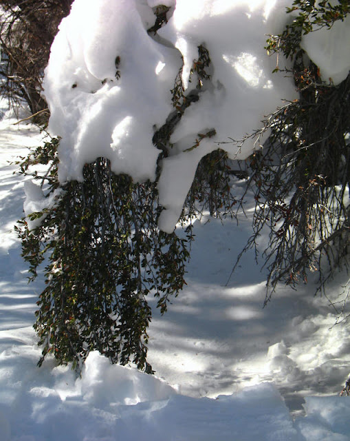
mahogony and snowMountain mahogany branches, weighed down by snow. When these snow masses are higher in the bushes and trees, we call them "tree clouds," a local term invented very recently. Be careful, tree clouds can fall on you!
mini iciclesTiny icicles, often seen dripping from tree clouds and other snow masses.
bushesA scenic view of sunlit bushes, evergreen trees, and a snowy mountainside as seen across shadowed snow.
mini aspensA small aspen grove beyond a bower formed of mostly of mountain mahogany branches.
trees in lightSunlit aspen trees hiding amongst the shadows. Note the small, bright tree cloud.
mountainThe mountain on one side of the canyon, with an avalanche chute towards the left and some wrinkled snow near the top.
snow texturesUnusual snow textures on the mountain. I wouldn't want to be up there; it all looks a little unstable.
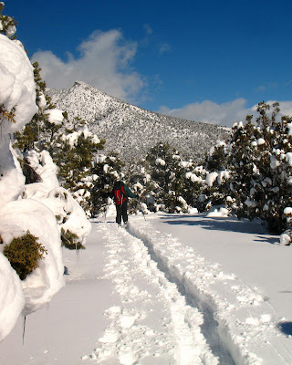
trail But not so, here on the ground, where we mush uphill, slowly onward. Snow drifts were deep; fortunately, someone I know - who was snowshoeing with me, there up ahead - had made a path about a week earlier.
Wednesday, February 18, 2009

Muncho Lake, B. C.

lake1

Muncho Lake, a scanned postcard version.

Continue to the west and then north on the Alcan, beyond Folded Mountain. After stopping to view Stone Sheep (or Stone's sheep - Ovis dalli stonei) in the highway (a common site), you will come to Muncho Lake, about 36 km from the Folded Mountain turnout. Just so you remember where you started from and have some idea of where you're going, in this topo map, Folded Mountain is in the lower right, just to the left of the Nonda Creek label; Muncho Lake is prominent toward the upper left.

Muncho Lake is pictured above in a scanned version of a postcard I bought somewhere, somewhen on one of my Alaska Highway travels. Again, as in one image in my last post, the postcard seems to have been taken from a hovercraft or airplane; it looks northward.

The light-colored mountainous area, seen to the right (east) of Muncho Lake, is the Sentinel Range, part of the northern Canadian Rocky Mountains. The range continues a little to the north, just out of the postcard picture. I think it ends to the south at the Toad River and the Alaska Highway, although the geology and structure making up the Sentinel Range continues southward beyond the ToadRiver-road line of demarcation.

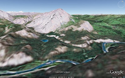
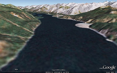
lake2 Above, I've more or less duplicated the postcard view of Muncho Lake with an image from Google Earth. We will be zooming in on a portion of the range front below, in a Google Earth view looking north from a height of about 472 ft (144 m) above ground level (I forgot to switch to meters in my new Google Earth version 5 right away!). The closeup focuses in on the third of several triangular-shaped mountain faces above, and it shows most of the second face in the foreground and part of the fourth face (and beyond) in the background.
range-img These triangular-shaped range faces are dip slopes, with the carbonate beds dipping almost entirely parallel to the faces. These shapes could be called triangular facets, though they are not strictly fault-caused - nor are they the result of truncated spurs - and they are reminiscent of the flatirons along the Rocky Mountain range front in Boulder, CO, though bedding there dips eastward, and bedding above dips westward. Locally, these shapes in the Sentinel Range are called sawteeth. [If there is a better geomorphic or descriptive term for these triangular shapes than what I've used here, I wouldn't mind some input!]
range-pic This photo, taken in 1996 from the north end of Muncho Lake, duplicates the Google Earth image above (or the other way around), and shows the beds dipping parallel to the range front slope. The drawing below highlights the bedding.
range-sketch So, from Folded Mountain, here, we've gone to this northern end of Muncho Lake, here, and are centered in on the triangular part of the range front at the very north end of the lake, here.

Tuesday, February 17, 2009

Folded Mountain, B. C. - A Reprise

Back to our semi-regularly scheduled program, as erratic in content as it sometimes is...
image1 Just pretend that you are still on the Alcan, in that in-between place between Toad River and Muncho Lake in northern British Columbia, Canada. You've just driven to the famed Folded Mountain turnout, pulled out to read the sign, and are now looking at Folded Mountain. If you look to the north, you'll see views like the two I've so cleverly created from Google Earth: the first one, above, looking north from about 450 m above the ground; the second one, below, looking north from just as close to ground level as I could get Google Earth to go, 60 m above the ground.
image2 I don't usually have a hovercraft with me while driving the Alcan, so I usually look at things from ground level, having never spent enough time on the highway to do any hiking around. A hovercraft could, however, be a useful thing to have on this supposedly paved highway: it always seems like major - I mean major - road construction is in progress somewhere along the way. Too bad I don't have photos of some of the boulder fields I've driven through on the supposedly paved highway.
folds Suprisingly, a 1993 photo taken from or near the Folded Mountain turnout looks very similar to the second Google Earth image, but in the photo you can actually see some of the folds. And someone has drawn on the photo, approximately outlining some of the folds. Please ignore the pen lines on the upper part of the mountain - that part is too obscure for drawing to be of any use whatsoever - without having the actual mountain handy (which it's not).

Soon, we'll move just a little farther along the road to Muncho Lake, but first I must take a break. Farther up the road, my drawings will become a little more sophisticated. (But not because of the break!)

Monday, February 16, 2009

A Snowshoe Trip

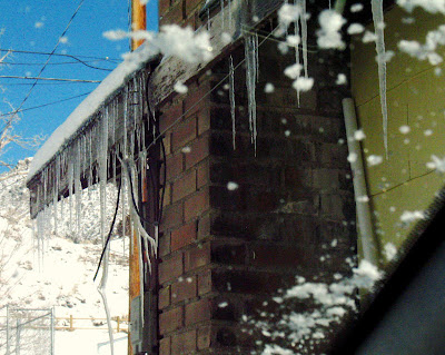
icicles When we started out on our snowshoeing escapade last week, we had fresh snow on the windshield, the sun was shining brightly, and long icicles were hanging from the roof of our little house.
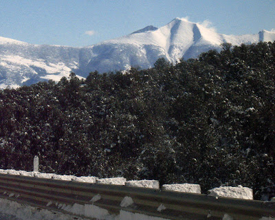
wind As Wheeler Peak came into view, we could see snow blowing from the top of the mountain.
clouds Or maybe those are just some clouds.
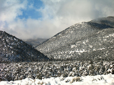
wheeler Or maybe it's both: wind blowing snow off the ridgeline and clouds hanging to the east of the crest.
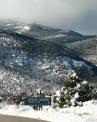
parkOur destination was on the east side of the peak, in the canyon below the clouds: the Upper Lehman Creek campground, the upper of two campsites that are regularly kept open in the winter - that is, at least the parking area is kept open.
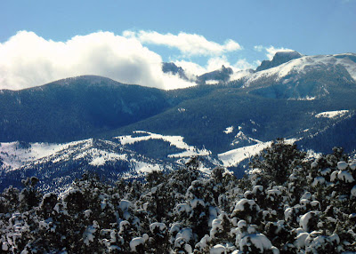
canyon That's our destination! That canyon, where sun and shade meet, and where clouds hover farther up the trail, maybe waiting for us.

Oh, but guess what. The road and campground parking lot were closed for snow removal! We turned around, drove around for a while, and looked for another place to start our 'shoeing. Not finding one we liked, we then left the mountain.
snow On the way back, we stopped in a large plowed pullout (Google Maps street view) at the top of Sacramento Pass, which is at an elevation of 7154 feet according to the road sign, but which may be a tad higher according to the topo map (MSR Maps).
trees From there, we plowed uphill in deep fluffy powder, our snowshoes sinking in to our knees in places - well, it seemed like we sunk in that deep, but most often it was more like mid-calf on me - until we had a view of Wheeler Peak, this time partly hidden by a snow-covered ridge.
trail And then we turned around. The distinctive peak in the photo above can be seen in the Google Maps street view linked-to earlier; just rotate the little man figure around until it looks more to the north (how come I can't choose a little woman figure?)